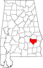
Bullock County, Alabama Basics:
Bullock County Alabama - Government Site
Population: 10,605
Area: 623 square miles
County seat: Union Springs
Area code(s) in use: 334
Time zone: CST
High school graduate or higher: 70.3%
Bachelor's degree or higher: 11.9%
Median household income: $34,500
Persons in poverty: 22.2%
Home ownership rate: 77.3%
Mean travel time to work: 26.3 minutes
Adjacent counties:
Barbour Macon Montgomery Pike Russell
Places in Bullock County, Alabama
Franklin Field Airport,
Sehoy Airport Almeria Fire Department,
Bullock Correctional Facility,
Bullock County Courthouse,
Bullock County Jail,
Bullock County Sheriff's Office,
Greenwood - Fitzpatrick Volunteer Fire Department,
Highway 51 Volunteer Fire Department,
Midway Volunteer Fire Department,
Thompson Cornerstone Volunteer Fire Department,
Union Springs Police Department,
Union Springs Volunteer Fire Department King Ditch Antioch Church Cemetery,
Barnette Cemetery,
Bethel Cemetery,
Cope Cemetery,
Cornerstone Cemetery,
Creek Stand Cemetery,
Dasinger Cemetery,
Edwards Cemetery,
Elizabeth Cemetery,
Fairview Cemetery,
Fellowship Cemetery,
Fitzpatrick Cemetery,
Glenford Cemetery,
Haines Chapel Cemetery,
High Ridge Cemetery,
Hubbard Cemetery,
Inverness Cemetery,
Jackson Cemetery,
Jericho Cemetery,
Johnston Cemetery,
Kendrick Cemetery,
Lewis Cemetery,
Liberty Cemetery,
Lydia Baptist Cemetery,
Mallard Chapel Cemetery,
Mason Cemetery,
McGrady Cemetery,
Midway Cemetery,
Moultrie Cemetery,
Mount Azure Cemetery,
Mount Calvary Cemetery,
Mount Carmel Cemetery,
Mount Harmon Cemetery,
Mount Zion Cemetery,
Oak Grove Cemetery,
Oak Hill Cemetery,
Old Sellers Cemetery,
Ox Level Cemetery,
Paulk Cemetery,
Peniel Cemetery,
Penile Cemetery,
Perote Cemetery,
Perpetual Care Cemetery,
Pickett Cemetery,
Powell Cemetery,
Provo Cemetery,
Ridge Cemetery,
Ridgeley Cemetery,
Rogers Cemetery,
Sardis Cemetery,
Seay Cemetery,
Shepherd Cemetery,
Stills Cemetery,
Thornton Cemetery,
Three Notch Cemetery,
Walter Cemetery,
Williams Cemetery Fitzpatrick Census Designated Place Allens Chapel,
Almeria Church,
Baldwin Chapel Church,
Bascom Chapel,
Bethel Presbyterian Church,
Bethlehem Church,
Beulah Church,
Brown Grove United Methodist Church,
Calvary Church,
Corinth Church,
Cornerstone Church,
County Line Church,
Eidson Grove Church (historical),
Elizabeth Baptist Church,
Enon Church,
Faith Tabernacle,
Fellowship Church,
First Baptist Church,
First Presbyterian Church,
First United Methodist Church,
Fitzpatrick Church,
Galilee Church (historical),
Great Hope African Methodist Epsicopal Church,
Greater Pleasant Grove Church,
Greenwood Baptist Church,
Hardaway African Methodist Episcopal Church,
Hawkins Chapel,
Hayes Hill Church,
High Ridge Church,
Hopewell Church,
Indian Creek Baptist Church,
Inverness Baptist Church,
Jones Chapel,
Kingdom Hall Church,
Liberty Baptist Church,
Line Creek Church (historical),
Little Sardis Church,
Low Field Church,
Macedonia Baptist Church,
Magnolia Church (historical),
Mallard Chapel,
Mount Asia Church,
Mount Azure Baptist Church,
Mount Calvary Church,
Mount Canaan Church,
Mount Carey Church,
Mount Carmel Baptist Church,
Mount Coney Church,
Mount Eland Church,
Mount Harmon Baptist Church,
Mount Hilliard Baptist Church,
Mount Hilliard Church,
Mount Hilliard Church,
Mount Mariah Church,
Mount Olive Church,
Mount Olive Church,
Mount Olive Church,
Mount Sinai Church,
Mount Zion Church,
Mount Zion Church,
Mount Zion Church,
Mount Zion Church,
Mount Zion Church,
Mountain View Church,
Mountain View Church (historical),
Neal Chapel African Methodist Episcopal Zion Church,
New Bethel Church,
New Bethel Church,
New Hope Church,
New Hope Church,
New Hope Church (historical),
New Mount Pleasant Church,
New Saint John Church,
Oak Grove Church,
Oak Grove Church,
Old Pine Grove Church,
Old Saint John Church,
Old Sardis Church,
Old Union Church,
Old Union Grove Church,
Panther Creek Church,
Penile Methodist Church,
Perote Church,
Pine Grove Baptist Church,
Piney Grove Church,
Pleasant Grove Church,
Pleasant Hill Church,
Powells Church (historical),
Rogers Chapel,
Rogers Chapel,
Saint James Christian Methodist Episcopal Church,
Saint John African Methodist Episcopal Church,
Saint Luke Baptist Church,
Saint Lukes Baptist Church,
Saint Mark Church,
Saint Marks Church,
Saint Marys Church (historical),
Salem Church,
Sand Hill Church,
Second Baptist Church,
Town Creek Church,
Trinity Church,
Trinity Episcopal Church,
Trinity Roman Catholic Church,
Union Grove Church,
Union Hill Church,
Walter Chapel,
Waymans African Methodist Episcopal Chapel,
Webster Church Barnett Pond Dam,
Bear Pond Dam,
C F Green Lake Dam,
Colley Pond Dam,
Enon Number 2 Dam,
Enon Pond Number 1 Dam,
Forrer Number 1 Dam,
Forrer Number 2 Dam,
Gibson Dam,
Green Dam,
Henderson Lake Dam,
Hobbie Lee Dam,
Hoff Pond Dam,
Lake Vann Dam,
Maytag Lake Number 1 Dam,
Maytag Number 2 Dam,
Mcclean Lake Dam,
Mcghee Pond,
Mitchell Lake Dam,
O H Williams Lake Dam,
Old Town Creek Watershed Dam Number 24,
Old Town Creek Watershed Dam Number 25,
Old Town Creek Watershed Dam Number 26,
Old Town Creek Watershed Dam Number 31,
Old Town Creek Watershed Dam Number 32,
Old Town Creek Watershed Dam Number 37,
Paulk Pond Dam,
Rutland Pond Dam,
Schorr Lake Dam,
Sehoy Dam,
Sehoy Plantation Lake Dam,
Smuteye Pond Dam,
Sorrell Dam,
Tompkins Dam,
Troy Rod and Gun Club,
Turnipseed Lake Dam,
Varner Dam,
Wehle Lake Dam,
White Oak Number One Dam,
White Oak Number Two Dam Bullock County Hospital Beckhams Lake,
Cypress Pond (historical),
Gibson Lake,
Woolforks Lake (historical) Auburn University Agricultural Experiment Station,
Boswell Gin (historical),
Bristol Store (historical),
Bucksnort (historical),
Carlisle Mill (historical),
Caylers Store (historical),
Chananagi (historical),
Coles Store (historical),
Copes Gin (historical),
Culvers (historical),
Fenn Gin (historical),
Graddy Gin (historical),
Greenwood Store (historical),
Heads Store (historical),
Heron (historical),
Hicks Gin (historical),
Highlog (historical),
Hubbards Store (historical),
Indian Creek (historical),
James (historical),
Jenks Store (historical),
Jinwrights Gin (historical),
Martins Store (historical),
Mascotte (historical),
Midway Station (historical),
Moseley Gin (historical),
Moseleys Gin (historical),
Moultries (historical),
Napiers Store (historical),
Picketts Gin (historical),
Pitts Gin (historical),
Rainers Gin (historical),
Reynolds Store (historical),
Riley Store (historical),
Rogers Gin (historical),
Roughtons Store (historical),
Rutland Store (historical),
Salters (historical),
Sedgefield Plantation,
Sellers Store (historical),
Smiths Store (historical),
Turnipseeds Store (historical),
Union Springs Country Club,
Worthington Store (historical) Bullock County Courthouse Historic District Aberfoil,
Almeria,
Beans Crossroads,
Blues Old Stand,
Bread Tray Hill,
Bruceville,
Chunnenuggee,
Corinth,
Cornerstone,
Enon,
Fitzpatrick,
Guerryton,
Hector,
High Ridge,
Hooks Crossroads,
Inverness,
Jamback,
Jenkins Crossroads,
McGowan,
Midway,
Mitchell,
Mount Hillard,
Omega,
Ox Level,
Peachburg,
Perote,
Pickett,
Pine Grove,
Postoak,
Sardis,
Scottland,
Sedgefield,
Sellers Crossroads,
Shopton,
Simsville,
Smuteye,
Stavo,
Suspension,
Tanyard,
Thompson,
Three Notch,
Tito,
Union Springs Aberfoil Post Office (historical), Algiers Post Office (historical), Almerian Post Office (historical), Arbor Vita Post Office (historical), Blue Post Office (historical), Boyd Post Office (historical), Bruceville Post Office (historical), Bughall Post Office (historical), Bullock Post Office (historical), Calhouns Store Post Office (historical), Chunnenuggee Post Office (historical), Cot Post Office (historical), Enon Post Office (historical), Eric Post Office (historical), Fitzpatrick Post Office (historical), Greenwood Post Office (historical), Guerryton Post Office (historical), Hector Post Office (historical), Heron Post Office (historical), High Ridge Post Office (historical), Highlog Post Office (historical),
Indian Creek Post Office (historical), Indian Post Office (historical), Inverness Post Office (historical), Jones Post Office (historical), Line Creek Post Office (historical), Mascotte Post Office (historical),
Midway Post Office (historical), Mitchell Station Post Office (historical), Mount Hilliard Post Office (historical), Mount Level Post Office (historical), Panther Post Office (historical), Peachburg Post Office (historical), Perote Post Office (historical), Pickett Post Office (historical), Pine Grove Post Office (historical), Postoak Post Office (historical), Reynolds Post Office (historical), Richland Post Office (historical), Shopton Post Office (historical), Simsville Post Office (historical), Suspension Post Office (historical), Thompson Post Office (historical), Three Notch Post Office (historical),
Union Springs Post Office Allen Lake,
Barnett Lake,
Bear Lake,
Bentons Lake,
C F Green Lake,
Cochrans Lake,
Colley Lake,
Enon Lake Number One,
Enon Lake Number Two,
Fishers Lake,
Goodman Lake,
Green Acres Lake,
Green Lakes,
Greens Pond,
Henderson Lake,
Hobbie Lee Lake,
Hoff Pond,
Lake Forrer Number One,
Lake Forrer Number Two,
Lake Louise,
Lake Vann,
Martin Lake,
Maytag Lake Number 1,
Maytag Lake Number Two,
Maytags Lake,
McCains Lake,
Mcclean Lake,
McGhee Lake Number Two,
Mitchell Lake,
O H Williams Lake,
Old Town Creek Watershed Lake Number 24,
Old Town Creek Watershed Lake Number 25,
Old Town Creek Watershed Lake Number 26,
Old Town Creek Watershed Lake Number Thirty-one,
Old Town Creek Watershed Lake Number Thirty-seven,
Old Town Creek Watershed Lake Number Thirty-two,
Paulk Lake,
Pinkston Lake,
Rutland Lake,
Schorr Lake,
Sehoy Lake,
Sehoy Lake,
Smuteye Lake,
Spains Lake,
Thad Greens Lake,
Tompkins Lake,
Turnipseed Lake,
Varner Lake,
Wehle Lake,
White Oak Lake Number One,
White Oak Lake Number Two,
White Oak Lakes Aberfoil Junior High School (historical),
Bethel School,
Bullock County Area Vocational Center,
Bullock County High School,
Bullock County Technical High School,
Chestnut Ridge School (historical),
Chunnenuggee Elementary School (historical), Chunnenuggee Female College (historical),
Cornerstone School (historical),
Deason School (historical),
Enon Junior High School (historical),
Fairview School,
Fitzpatrick Elementary School (historical),
Great Hope Junior High School (historical),
Guerryton Junior High School (historical),
Hector Elementary School (historical),
Indian Creek Elementary School (historical),
McClenny School,
McInnus School (historical),
Merritt High School,
Middle School,
Mount Canaan School,
Murray School (historical),
New Hope School (historical),
Oak Grove Number 4 Junior High School (historical),
Oliver Junior High School,
Perote High School,
Phillips School (historical),
Post Oak Junior High School (historical),
Sardis School (historical),
South Highland School,
Thompson Junior High School (historical),
Union Springs Elementary School,
Union Springs Public School (historical) Beaverdam Creek,
Big Sandy Creek,
Bluff Creek,
Bogue Chitta Creek,
Bowlin Creek,
Buck Creek,
Caney Branch,
Colman Creek,
Cowikee Creek,
Cox Creek,
Dicky Creek,
Dobbs Creek,
Double Branch,
Double Creek,
Dry Creek,
Dry Creek,
East Creek,
Johnson Creek,
Leatherbreeches Creek,
Little Conecuh River,
Little Creek,
Little Sandy Creek,
Lockhart Creek,
Mill Creek,
Mill Creek,
Moores Creek,
Morgan Branch,
Moseley Creek,
Mountain Creek,
Norton Creek,
Perote Creek,
Pinhook Creek,
Posey Creek,
Reeder Branch,
Shopton Branch,
Slaughter Creek,
Williams Creek Wolfpit Hill WSCA-FM (Union Springs),

