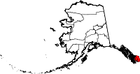
Ketchikan Gateway Borough, Alaska Basics:


No home page found
Population: 13,742
Area: 4858 square miles
Borough seat:
Area code(s) in use: 907
Time zone: PST-1
High school graduate or higher: 93.7%
Bachelor's degree or higher: 23.6%
Median household income: $59,736
Persons in poverty: 10.3%
Home ownership rate: 56.9%
Mean travel time to work: 14.0 minutes


Adjacent counties:

Find in Alaska

Map of the Ketchikan Gateway Borough area


Our detail map of Ketchikan Gateway Borough shows the Ketchikan Gateway Borough, Alaska boundary lines and other interesting items.

Places in Ketchikan Gateway Borough, Alaska

  Airports     show all on map

Bell Island Hot Springs Seaplane Base, Ketchikan (Temsco H) Heliport, Ketchikan Harbor Seaplane Base, Ketchikan International Airport, Loring Seaplane Base, Murphys Pullout Seaplane Base, Peninsula Point Pullout Seaplane Base, Yes Bay Lodge Seaplane Base

  Areas     show all on map

Bee Rocks, Club Rocks, Cutter Rocks, Gilanta Rocks, Point McCartey, Red River Research Natural Area, Tatoosh Rocks, Upper Nickeyville

  Bars     show all on map

Ajax Reef, Bittersweet Rock, Bolles Ledge, Bostwick Reef, California Rock, Craig Rock, East Bee Rock, Hassler Reef, Idaho Rock, Julius Reef, Kelp Rocks, Lewis Reef, Mastic Rock, Ohio Rock, Passage Rock, Pennock Reef, Phocena Rocks, Pond Reef, Potter Rock, Rosa Reef, Sealing Reef, Tamgas Reef, Tongass Reef, Washington Monument Rock, White Reef

  Basins     show all on map

Granite Basin

  Bays     show all on map

Alava Bay, Badger Bay, Bailey Bay, Bakewell Arm, Bald Headed Cove, Bell Arm, Black Sand Cove, Blank Inlet, Boat Harbor, Boca De Quadra, Bond Bay, Bostwick Inlet, Bullhead Cove, Burroughs Bay, Bushy Point Cove, Butlhead Cove, California Cove, Carroll Inlet, Checats Cove, Clam Cove, Coho Cove, Convenient Cove, Coon Cove, Customhouse Cove, Dall Bay, Dog Bay, Ella Bay, Fire Cove, Fitzgibbon Cove, Foggy Bay, Francis Cove, Gem Cove, George Inlet, Gnat Cove, Grace Cove, Grant Cove, Gwent Cove, Halibut Bay, Hall Cove, Harry Bay, Helm Bay, Herring Bay, Hidden Inlet, Hole In Wall Harbor, Judd Harbor, Kah Shakes Cove, Kah Shakes Lagoon, Kelp Island Anchorage, Klu Bay, Knudson Cove, Leask Cove, Long Arm, Lucky Cove, Manzanita Bay, Marten Arm, Marten Arm, Mary I Anchorage, Mink Bay, Morse Cove, Moser Bay, Moth Bay, Mud Bay, Naha Bay, Nakat Bay, Nakat Harbor, Nakat Inlet, Neets Bay, Neets Bay, Nehenta Bay, Nelson Cove, Niquette Harbor, Open Bay (not official), Phocana Bay, Phocena Bay, Pond Bay, Port Stewart, Portage Cove, Princess Bay, Punchbowl Cove, Radenbough Cove, Ray Anchorage, Raymond Cove, Reef Harbor, Refuge Cove, Regina Cove, Rockfish Cove, Rudyerd Bay, Ryus Bay, Saks Cove, Sandfly Bay, Sargent Bay, Seal Cove, Shelter Cove, Shoal Cast, Shoal Cove, Short Bay, Shrimp Bay, Smeaton Bay, Smugglers Cove, Spacious Bay, Sweaton Bay, Sykes Cove, Thorne Arm, Thorne Arm, Tombstone Bay, Totem Bight, Traitors Cove, Tsa Cove, Vallenar Bay, Very Inlet, Vixen Bay, Wadding Cove, Walker Cove, Ward Cove, Wasp Cove, Weasel Cove, Whisky Cove, Willard Inlet, Wilson Arm, Yes Bay

  Beaches     show all on map

Black Sand Beach

  Bends     show all on map

Tiderace

  Buildings     show all on map

Alaska State Troopers Ketchikan, Boat Rock Light, City of Ketchikan Fire Department, City of Ketchikan Fire Department Station 2, Fillmore (historical), Guardian Flight, Ketchikan Airport Police, Ketchikan Correctional Center, Ketchikan Fire Department Shoreline Station, Ketchikan Indian Community Tribal Health Clinic, Ketchikan International Airport Fire Department, Ketchikan Police Department, Ketchikan Public Health Center - Southeast Region, Ketchikan Regional Youth Facility, Ketchikan Volunteer Rescue Squad, Ketchikan Volunteer Rescue Squad, Ketchikan Women Infants and Children Clinic, Mary Island Lighthouse, North Tongass Volunteer Fire Department Station 6, North Tongass Volunteer Fire Department Station 8, PeaceHealth Ketchikan Clinic, PeaceHealth Ketchikan Clinic, Saxman City Fire Department, South Tongass Volunteer Fire Department, United States Customs and Border Protection Port of Entry Ketchikan, United States Forest Service Misty Fiords National Monument Ranger Station

  Canals     show all on map

Fillmore Inlet

  Capes     show all on map

Akeku Point, Angle Point, Ape Point, Astronomical Point, Bactrian Point, Bar Point, Bass Point, Bat Point, Betton Point, Blaine Point, Blank Point, Bluff Point, Blunt Point, Bostwick Point, Breezy Point, Brow Point, Brunn Point, Bushy Point, Caamano Point, Cactus Point, California Head, Camp Point, Cape Fox, Cape Fox, Cape Northumberland, Cape Northumberland, Carroll Point, Charcoal Point, Checats Point, Chin Point, Claude Point, Cliff Point, Cod Point, Cone Point, Curlew Point, Dall Head, Dark Point, Dew Point, Donnelly Point, Dress Point, Duke Point, Edge Point, Edith Point, Elf Point, Ella Point, Elsie Point, Escape Point, Eve Point, Fin Point, Fire Point, Fish Point, Flag Point, Foggy Point, Fools Point, Form Point, Fort Point, Fox Point, Garnet Point, Giant Point, Grassy Point, Grave Point, Gravina Point, Halibut Point, Harding Point, Harris Point, Harrison Point, Heckman Point, Helm Point, Hidden Point, High Point, Hose Point, Humpy Point, Hut Point, Indian Point, Indian Point, Island Point, Island Point, Kah Shakes Point, Katakwa Point, Kirk Point, Lakekta Point, Ledge Point, Ledge Point, Lewis Point, Male Point, Mike Point, Mop Point, Moth Point, Mountain Point, Niblack Point, Nigelius Point, Nose Point, Orca Point, Peninsula Point, Petrel Point, Point Alava, Point Eva, Point Fitzgibbon, Point Francis, Point Higgins, Point Lees, Point Louise, Point Mansfield, Point Nelson, Point Percy, Point Sykes, Point Trollop, Point Whaley, Point White, Point Winslow, Pop Point, Porpoise Point, Potter Point, Quadra Point, River Point, Rock Point, Rock Point, Rock Point, Roe Point, Sharp Point, Short Point, Simonton Point, Skirt Point, Slab Point, Slag Point, Snail Point, Snipe Point, South Vallenar Point, Spit Point, Steep Point, Surprise Point, Survey Point, Syble Point, Tatoosh Point, Tent Point, Tramp Point, Trap Point, Tree Point, Turn Point, Vallenar Point, Verdure Point, Wart Point, Wasp Point, Whale Point

  Cemeteries     show all on map

Bayview Cemetery

  Census     show all on map

Ketchikan Alaska Native Village Statistical Area, Loring Census Designated Place, Outer Ketchikan Census Subarea, Saxman Alaska Native Village Statistical Area

  Channels     show all on map

Anchor Pass, Behm Canal, Behm Narrows, Blind Pass, Cat Passage, Clover Passage, Danger Passage, Dixon Entrance, Edward Passage, Felice Strait, Gedney Pass, Hassler Pass, Inside Passage, Lincoln Channel, Narrow Pass, Nichols Passage, Pearse Canal, Port Tongass, Portland Canal, Revillagigedo Channel, Sealed Passage, Shoalwater Pass, Short Pass, Sitklan Passage, Sumner Strait, Tongass Narrow, Tongass Narrows, Tongass Narrows, Tongass Passage

  Churches     show all on map

Clover Pass Church

  Cliffs     show all on map

Getukti Cliff

  Dams     show all on map

Carlanna Lake Dam, Ketchikan Debris Control Dam, Ketchikan Diversion Dam, Ketchikan Lakes Dam, Lake Connell Dam, Lower Silvis Lake Dam, North Fawn Lake Dam, Saxman Dam, Saxman Lower Reservoir Dam, South Fawn Lake Dam, Upper Silvis Lake Dam, Whitman Lake Dam

  Falls     show all on map

Beaver Falls, Fish Ladder

  Forests     show all on map

Tongass/Ketchikan National Forest

  Glaciers     show all on map

Chickamin Glacier, Clara Smith Glacier, Gracey Creek Glacier, Greenpoint Glacier, Hummel Glacier, Through Glacier

  Guts     show all on map

Buccleugh Sound, Gedney Pass, Sawmill Slough, Sealed Passage

  Harbors     show all on map

Ketchikan Harbor, Thomas Basin

  Hospitals     show all on map

PeaceHealth Ketchikan Medical Center

  Islands     show all on map

Back Island, Barren Island, Bell Island, Betton Island, Bird Island, Black Island, Black Island, Black Rock, Blank Islands, Boat Rock, Bold Island, Bronaugh Islands, Bug Island, Bull Island, Cache Island, Candle Island, Carp Island, Cat Island, Cedar Island, Center Islets, Channel Island, Channel Islands, Clam Island, Clover Island, Cone Island, Coon Island, Cow Island, Cygnet Island, Cynthia Island, Cynthia Island, Danger Island, Danger Island, De Long Islands, Dog Island, Dogfish Island, Double Islands, Drug Island, Duck Islands, Duke Island, East Clump, East Island, East Island, Emmet Island, Entrance Island, Fillmore Island, Fish Islands, Fleece Rock, Forss Island, Fox Island, Fripo Island, Gannet Island, Gedney Island, Gibbs Rock, Goose Rock, Goose Tongue Island, Gosling Island, Granite Island, Grant Island, Gravina Island, Grouse Rock, Guard Islands, Harris Island, Hassler Island, Hassler Island, Helen Island, Hotspur Island, House Rock, Hume Island, Hump Island, Indian Rock, Joe Island, Just Island, Kanagunut Island, Kelp Island, Kestrel Island, Kite Island, Lane Island, Little Rock, Lord Islands, Lord Rock, Manzanita Island, Mary Island, Minx Islands, Moser Island, New Eddystone Islands, New Eddystone Rock, Observation Rock, Osten Island, Pennock Island, Percy Islands, Pup Island, Raven Island, Reef Island, Revillagigedo Island, Round Island, Roy Island, Rudyerd Island, Ruth Island, Seal Cove Rocks, Ship Island, Sister Islands, Sitklan Island, Slate Islands, Slim Island, Smeaton Island, Snail Rock, Snip Islands, Snipe Island, Square Island, Stack Island, Stag Island, Tatoosh Islands, Thistle Rock, Thomas Island, Tingberg Island, Track Rock, Trunk Island, Twin Islands, Vallenar Rock, Vancouver Island, Vegas Island, Vegas Islands, Village Island, Werlick Island, West Bee Rock, West Rock, Whale Rock, White Rock, Willow Islands, Winstanley Island, Yellow Rocks, Yelnu Islets

  Lakes     show all on map

Badger Lake, Bakewell Lake, Basin Lake, Beaver Lake, Bell Island Lakes, Big Goat Lake, Big Lake, Blue Lake, Blue Lake, Bluff Lake, Bostwick Lake, Bower Lake, Buckhorn Lake, Bugge Lake, Carlanna Lake, Cedar Lake, Cessnun Lakes, Chamberlain Lake, Claude Lake, Clay Lake, Downdraft Lake, Ella Lake, Emma Lake, Fawn Lake, Gilbert Lake, Gokachin Lakes, Granite Lake, Halfmoon Lake, Harriet Hunt Lake, Harrison Lakes, Heart Lake, Heckman Lake, Helm Lake, Hidden Inlet Lake, Hugh Smith Lake, Humpback Lake, January Lake, Jordan Lake, Kah Shakes Lake, Lake Bess, Lake Bluff, Lake Emery Tobin, Lake Grace, Lake Manzoni, Lake Maude, Lake McDonald, Lake Nellie, Lake Perseverance, Lake Rowena, Lake Shelokum, Leask Lake, Leduc Lake, Little Goat Lake, Little Humpback Lake, Long Lake, Loon Lake, Low Lake, Lower and Upper Ketchikan Lakes, Lower Checats Lake, Lower Ella Lake, Lower Ketchikan Lake, Lower Wolf Lake, Mahoney Lake, Manzanita Lake, Margaret Lake, Marten Arm Lake, Mesa Lake, Mirror Lake, Nakat Lake, Neets Lake, Nooya Lake, North Saddle Lake, Orchard Lake, Orchard Lake, Orton Lake, Patching Lake, Pine Lake, Punchbowl Lake, Quadra Lake, Quadra Lakes, Rainbow Lake, Reef Lake, Reef Point Lake, Reflection Lake, Roosevelt Lagoon, Saks Lake, Salt Lagoon, Scout Lake, Smith Lake, Smugglers Lake, Snow Lake, South Saddle Lake, Spur Mountain Lake, Star Lake, Swan Lake, Sykes Lake, Talbot Lake, Third Lake, Todd Lake, Trap Lake, Upper Checats Lake, Upper Ketchikan Lake, Upper Mahoney Lake, Upper Wolf Lake, Walker Lake, Ward Lake, Wilson Lake, Winstanley Lakes

  Locales     show all on map

Bailey Bay Hot Springs, Bakewell Lake Cabin, Beaver Camp Cabin, Beaver Falls Power House, Big Goat Lake Cabin, Bishop Ranch, Black Bear Observation Post, Boundary Peak 18, Cape Fox Village, Checats Cabin, Diary, Grassy Point Picnic Area, Helm Bay, Hugh Smith Lake Cabin, Humpback Lake Cabin, Ketchikan Rifle Range, Last Chance Campground, Lower Silvas Lake Picnic Area, Manzanita Bay Shelter, Manzanita Camp, Manzanita Camp Cabin, Mary Island, Matney Ranch, Misty Fiords Resort, New Eddystone Rock Geological Area, Orton Ranch, Rotary Beach Picnic Area, Sanya (historical), Settlers Cove Campground, Signal Creek Campground, Three C's Campground, Totem Lodge, Ward Lake Picnic Area, White River Boy Scout Camp (historical), Wilson View Cabin, Winstanley Island Cabin, Wolf Cabin

  Military     show all on map

United States Coast Guard Station Ketchikan

  Mines     show all on map

Alaska Gold Mountain Mines, Bert Lide Mine, Gold Standard Mine, Mahoney Mine, Sealevel Mine, Sleeping Beauty Mine, Steers Mine

  Parks     show all on map

Black Sands Beach State Marine Park, Dall Bay State Marine Park, Misty Fjords National Monument, Refuge Cove State Recreation Site, Totem Bight State Historical Park, Totem Park, Ward Lake National Recreation Area

  Populated Places     show all on map

Beaver Falls, Bell Island Hot Springs, Carlanna, Clover Pass, Dairy, Herring Cove, Herring Cove, Kah Shakes (historical), Ketchikan, Loring, Mountain Point, Mud Bay, Peninsula Point, Pennock Island, Port Higgins, Refuge Cove, Saxman, Shoreline Drive, Ward Cove, Yes Bay (historical)

  Post Offices     show all on map

Ketchikan Post Office, Ketchikan Post Office - Downtown Station Number 2, Ward Cove Post Office

  Ranges     show all on map

California Ridge, Halleck Range, Peabody Mountains, Rousseau Range, Seward Mountains

  Reserves     show all on map

Misty Fjords National Monument Wilderness, South Etolin Wilderness

  Reservoirs     show all on map

Connell Lake, Fawn Lake, Fawn Lake, Lower Silvis Lake, Saxman Reservoir, Upper Silvis Lake, Whitman Lake

  Ridges     show all on map

Alava Ridge, Albert Ridge, Dall Ridge, Dall Ridge, Green Ridge, Harbor Ridge, Loaf Ridge, Peninsula Ridge, Saw Ridge, Saw Ridge, Slide Ridge

  Schools     show all on map

Point Higgins Elementary School

  Streams     show all on map

Barrier Creek, Bartholomew Creek, Beaver Creek, Beaver Creek, Beaver Falls Creek, Billy Goat Creek, Blossom River, Blue River, Bostwick Creek, Buschmann Creek, Calamity Creek, Carlanna Creek, Carp Creek, Carroll Creek, Checats Creek, Chickamin River, Choca Creek, Clear Creek, Cobb Creek, Cow Creek, Davis River, East Fork Short Creek, Ella Creek, Emma Creek, Eulachon River, Falls Creek, Falls Creek, First Waterfall Creek, Fish Creek, Fromholtz Creek, Fromholz Creek, Gokachin Creek, Government Creek, Grace Creek, Gracey Creek, Granite Creek, Granite Creek, Grant Creek, Gunsight Creek, Harrison Creek, Hell Roaring Creek, Hoadley Creek, Humpback Creek, Humpy Creek, Indian Creek, Kah Shakes Creek, Keta River, Ketchikan Creek, King Creek, Klahini River, Klam Creek, Klu Creek, Lake Creek, Leask Creek, Leduc River, Licking Creek, Lunch Creek, Manzanita Creek, Marble Creek, Margaret Creek, Marten River, Naha River, Neets Creek, Niblack Hollow, North Fork Manzanita Creek, Orchard Creek, Perseverance Creek, Quadra Creek, Red Creek, Red River, Robinson Creek, Saks Creek, Sea Level Creek, Second Waterfall Creek, Shoal Creek, Short Creek, Signal Creek, Silver Creek, Skull Creek, Smugglers Creek, Sockeye Creek, South Fork Chickamin River, Spring Creek, Traitors Creek, Trollers Creek, Unuk River, Vallenar Creek, Walker Creek, Walker Creek, Walker Creek, Walsh Creek, Ward Creek, Wasta Creek, West Fork Blue River, Whipple Creek, White River, Whitman Creek, Wilson River, Winstanley Creek, Wolf Creek, Wolverine Creek

  Summits     show all on map

Achilles Mountain, Arm Mountain, Backbone Mountain, Bald Mountain, Banded Mountain, Behm Mountain, Betton Head, Black Mountain, Brown Mountain, Brush Hill, Buck Mountain, Chapin Peak, Cone Mountain, Cove Hill, Cove Mountain, Curve Mountain, Deer Mountains, Diana Mountain, Dickins Peak, Doe Mountain, Dome Mountain, Dome Peak, Dude Mountain, Duke Hill, Fawn Mountain, Fish Mountain, Flat Mountain, Fox Hill, Gap Mountain, Gold Mountain, Harry Saddle, High Mountain, High Mountain, House Mountain, Irvin Thompson Mountain, John Mountain, Judy Hill, Juno Mountain, Klan Hill, Level Mountain, Mahoney Mountain, Minerva Mountain, Mound Hill, Mount Blaine, Mount Hayford, Mount Jefferson Coolidge, Mount John Jay, Mount Lazaro, Mount Lewis Cass, Mount Marr, Mount Middleton, Mount Reid, Mount Stoeckl, Mount Upshur, Mount Willibert, Mount Wilson, Nakat Mountain, Nipple Mountain, North Quadra Mountain, Northbird, Notch Mountain, Painted Peak, Plain Mountain, Punch Hill, Round Hill, Roy Jones Mountain, Shed Mountain, Signal Mountain, Smooth Mountain, South Quadra Mountain, Spot Mountain, Spur Mountain, Stripe Mountain, Sullivan Mountain, Table Mountain, The Puppets, Thornton Mountain, Twin Peaks, Twin Rift, Ward Mountain

  Towers     show all on map

KGTW-FM (Ketchikan), KRBD-FM (Ketchikan)

  Trails     show all on map

Black Mountain Trail, Deer Mountain National Recreation Trail, John Mountain National Recreation Trail

  Valleys     show all on map

First Canyon,

Ketchikan Gateway Borough, Alaska Population By Race (2012 estimate)

RacePopulation
WhiteKetchikan Gateway Borough White population 9,3179,317  
American IndianKetchikan Gateway Borough American Indian population 1,9511,951
MixedKetchikan Gateway Borough Mixed population 1,2781,278
AsianKetchikan Gateway Borough Asian population 1,0441,044
BlackKetchikan Gateway Borough Black population 124123
Hawaiian & Pacific IslanderKetchikan Gateway Borough Hawaiian & Pacific Islander population 4141

Additional population tables :
State population table
Alaska population by county