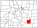
Otero County, Colorado Basics:


Otero County Colorado - Government Site

Population: 18,790
Area: 1262 square miles
County seat: La Junta
Area code(s) in use: 719
Time zone: MST
High school graduate or higher: 82.3%
Bachelor's degree or higher: 15.2%
Median household income: $31,860
Persons in poverty: 24.8%
Home ownership rate: 63.1%
Mean travel time to work: 17.1 minutes


Adjacent counties:
Bent  Crowley  Kiowa  Las Animas  Pueblo  

Find in Colorado

Map of the Otero County area


Our detail map of Otero County shows the Otero County, Colorado boundary lines and other interesting items.

Places in Otero County, Colorado

  Airports     show all on map

Arkansas Valley Regional Medical Center Heliport, Carrica Ranch Heliport, Cottonwood Field Airport, Fowler Airport, La Junta Municipal Airport, Melon Field Airport, Todd Airport

  Arroyos     show all on map

McMahon Arroyo

  Bridges     show all on map

Apishapa Bridge

  Buildings     show all on map

Carnegie Library, Fowler Volunteer Fire Department, Koshare Indian Museum, La Junta Fire Department, La Junta Municipal Building, Macdonald Hall, Manzanola Rural Fire Department, McBride Hall, McDivitt Center Gymnasium, McDivitt Hall, Otero County Courthouse, Otero County Jail, Otero Hall, Pioneer Health Care Center, Rocky Ford City Hall, Rocky Ford Fire Department, Southeastern Colorado Exposition Building, Wheeler Hall, Wheeler Library, Woodruff Memorial Library, Wunsch Hall

  Canals     show all on map

A J Anderson Ditch, Catlin Canal, Holbrook Outlet Ditch, Horse Creek Supply Canal, Jackson Lateral, Lake Canal, Lewis Lateral, Ninemile Canal, Old Otero Canal, Osborne Ditch, Otero Canal, Rocky Ford Canal, Rocky Ford Highline Canal, Two Buttes Canal, Wasson Lateral

  Cemeteries     show all on map

Calvary Cemetery, East Holbrook Mennonite Cemetery, Fairview Cemetery, Fowler Cemetery, Higbee Cemetery, Hillcrest Cemetery, Holbrook Cemetery, Martinez Cemetery, Mountain View Cemetery, Otero County Cemetery, Saint Paul's Lutheran Cemetery, San Jose Cemetery, Timpas Cemetery, Valley View Cemetery

  Census     show all on map

La Junta Gardens Census Designated Place, North La Junta Census Designated Place

  Churches     show all on map

Carson Avenue Baptist Church, Church of Christ, Church of Christ, Church of Our Lady of Guadalupe, Church of the Brethren, Community Presbyterian Church, Crossroads Church, East Holbrook Church, Emmanuel Mennonite Church, First Assembly of God Church, First Baptist Church, First Baptist Church, First Christian Church, First Christian Church, First Church of Christ Scientist, First Church of God, First Church of God, First Church of the Nazarene, First Methodist Church, First Methodist Episcopal Church (historical), First Presbyterian Church, First United Methodist Church, Free Methodist Church, Full Gospel Church, Hubbard Chapel African Methodist Episcopal Church, Immanuel Missionary Chapel, La Junta Baptist Tabernacle, Mount Zion Baptist Church, Penitenta Church, Pilgrim Holiness Church, Saint Andrew's Episcopal Church, Saint Patrick's Roman Catholic Church, Saint Peter's Catholic Church, Saint Peters Evangelical Lutheran Church, Spanish Bible Tabernacle, Trinity Lutheran Church, Worship Center of Rocky Ford

  Cliffs     show all on map

Apishapa Bluff, Dixie Bluffs, Jack Point

  Crossings     show all on map

Rocky Ford

  Dams     show all on map

Browning and Reese Number 1 Dam, Browning and Reese Number 2 Dam, Crooked Arroyo Detention CA-1 Dam, Crooked Arroyo Detention CA-3 Dam, Crooked Arroyo Detention CA-4 Dam, Crooked Arroyo Retention CA-2 Dam, Dye Dam, Holbrook Dam, Horse Creek and Black Draw Dam, Horse Creek Dam, Prairie Land and Irrigation Number 1 Dam, Rocky Ford Diversion Dam

  Gaps     show all on map

Packers Gap

  Hospitals     show all on map

Arkansas Valley Regional Medical Center, Atchinson, Topeka and Santa Fe Railroad Hospital (historical), Physicians Hospital (historical)

  Lakes     show all on map

Cheraw Lake, Manby Lake, May Water, Taylor Lake

  Locales     show all on map

Baski Windmill, Black Tank Windmill, Bloom Hill Windmill, Bull Pasture Windmill, Burmingham Windmill, Carrica Ranch, Cedar Pond Windmill, Cochran Windmill, Cottonwood Links Golf Course, Dry Creek Camp, Girard Windmill, Harbeck Windmill, Hedgecock Windmill, Hoffman Windmill, Honeys Windmill, Inge Ranch, Krammes, Lees Windmill, Lewis Ranch, Little Windmill, Lower Sheep Canyon Windmill, Mullins Windmill, Nemo Windmill, Newdale, Reed Windmill, River Windmill, Rocky Ford Country Club, Rocky Ford Feedyard, Rocky Ford Water Works, Smith Ranch, South Windmill, Swisher Windmill, Texico Windmill, Timpas Feedyard, Upper Hoffman Windmill, Wenzel Windmill, West Mesa North Windmill, West Mesa South Windmill, Wilson Windmill

  Military     show all on map

La Junta Army Air Field (historical)

  Mines     show all on map

Hancock Pit

  Parks     show all on map

Bent's Old Fort National Historic Site, Blaine Park, Potter Park, Rattler Football Field, Tippy Martinez Softball Field

  Populated Places     show all on map

Ayer, Benton, Bloom, Casa, Castiel, Cheraw, Elder, Fayette, Fowler, Hadley, Hawley, Hays, Higbee, La Junta, La Junta Gardens, La Junta Village, Manzanola, Mindeman, North La Junta, Old Fort Bent (historical), Ormega, Orr, Randall, Roberta, Rocky Ford, Shelton, Swink, Timpas, Vroman

  Post Offices     show all on map

Cheraw Post Office, Fowler Post Office, La Junta Post Office, Manzanola Post Office, Rocky Ford Post Office, Swink Post Office

  Ranges     show all on map

Bloom Hills, Iron Springs Hills, Shale Hills

  Reservoirs     show all on map

Anderson Reservoir, Bear Springs Reservoir, Browing and Reese Number 1 Reservoir, Brown Reservoir, Browning and Reese Number 2 Reservoir, Browning and Reese Reservoir Number 1, Cochran Reservoir, Crooked Arroyo CA-1 Detention Reservoir, Crooked Arroyo CA-3 Detention Reservoir, Crooked Arroyo CA-4 Detention Reservoir, Crooked Arroyo Retention CA-2 Reservoir, Daniher Reservoir, Dominick Reservoir, Dye Reservoir, Finki Reservoir, Freddy Reservoir, Fultz Reservoir, Government Pond, Government Reservoir, Haight Reservoir, Hixon Reservoir, Holbrook Reservoir, Horse Creek and Black Draw Reservoir, Horse Creek Reservoir, Kennedy Ponds, Lambing Camp Reservoir, Larson Reservoir, Lemley Pond, Newby Reservoir, Prairie Land Reservoir Number 1, Prink Reservoir, Richardson Pit, School Section Reservoir, Smith Reservoir, Snowden Lake, Swink Reservoir Number 1, Swink Reservoir Number 2, Swink Reservoir Number 5, Swink Reservoir Number 6, Swisher Reservoir, Two Buttes Pond

  Schools     show all on map

Columbian School, District Number 8 School, East School, Fort Bent School, Grand Valley School, Higbee Valley School, Jefferson Middle School, La Junta High School, La Junta Middle School, Liberty Elementary School, Lincoln School, Lincoln School, Newdale School, Otero Junior College, Park School, Rocky Ford High School, Saint Patrick Roman Catholic School, South School, Swink School, Washington Primary School, West School

  Springs     show all on map

Antone Spring, Arnold Springs, Circle I Waters Spring, Good Pasture Spring, Iron Springs, Kitch Spring, Rock Waterhole

  Streams     show all on map

Alkali Arroyo, Anderson Arroyo, Apishapa River, Bear Springs Arroyo, Benton Arroyo, Crooked Arroyo, Dry Creek, East Bear Springs Arroyo, East Branch Crooked Arroyo, East Fork Hoe Ranch Arroyo, East Fork King Arroyo, Harbordale Arroyo, Hoe Ranch Arroyo, Horse Creek, Iron Springs Arroyo, Jack Treese Arroyo, King Arroyo, Lone Tree Arroyo, McMahon Arroyo, Poitrey Arroyo, Robinson Arroyo, Rock Arroyo, Salt Arroyo, Sheep Canyon Arroyo, South Dry Creek, Thompson Arroyo, Timpas Creek, Vandiver Arroyo, West Bear Springs Arroyo, West Branch Crooked Arroyo, West Dry Creek, West Dry Creek

  Summits     show all on map

Meredith Hill, Merker Hills, Miller Mesa

  Towers     show all on map

KAVI-AM (Rocky Ford), KAVI-FM (Rocky Ford), KBLJ-FM (La Junta), KBZZ-AM (La Junta)

  Trails     show all on map

Old Santa Fe Trail

  Valleys     show all on map

Anderson Canyon, Breslin Draw, Corbin Canyon, Devils Canyon, Eightmile Canyon, Gaum Canyon, Gaussion Canyon, Godwin Canyon, Hardy Canyon, Horse Canyon, Hungerford Hollow, Jack Canyon, Last Chance Canyon, Minnie Canyon, Mixon Canyon, Ninemile Valley, North Fork Jack Canyon, Patterson Hollow, Penitenta Canyon, Plum Canyon, Purgatoire Canyon, Riley Canyon, School Section Canyon, Sheep Canyon, Smith Canyon, Smith Hollow, South Fork Jack Canyon, Stevens Draw, Terrel Canyon, Vogel Canyon, Vose Canyon, Withers Canyon

  Wells     show all on map

Big Well, Electric Well, Good Well, Haight Wells, House Water Well, Mills Well, North Well,

Otero County, Colorado Population By Race (2012 estimate)

RacePopulation
WhiteOtero County White population 17,30617,305  
American IndianOtero County American Indian population 601601
MixedOtero County Mixed population 489488
BlackOtero County Black population 207206
AsianOtero County Asian population 169169
Hawaiian & Pacific IslanderOtero County Hawaiian & Pacific Islander population 1918

Additional population tables :
State population table
Colorado population by county