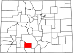
Rio Grande County, Colorado Basics:


Rio Grande County Colorado - Government Site

Population: 11,939
Area: 912 square miles
County seat: Del Norte
Area code(s) in use: 719
Time zone: MST
High school graduate or higher: 84.5%
Bachelor's degree or higher: 19.0%
Median household income: $38,329
Persons in poverty: 17.9%
Home ownership rate: 68.3%
Mean travel time to work: 18.7 minutes


Adjacent counties:
Alamosa  Archuleta  Conejos  Mineral  Saguache  

Find in Colorado

Map of the Rio Grande County area


Our detail map of Rio Grande County shows the Rio Grande County, Colorado boundary lines and other interesting items.

Places in Rio Grande County, Colorado

  Airports     show all on map

Astronaut Kent Rominger Airport, Chapman Field Airport, Mc Cullough Airport, Monte Vista Municipal Airport, Morning Shadows Ranch Airport, Movie Manor Landing Area

  Basins     show all on map

Piceance Creek Basin

  Bridges     show all on map

Granger Bridge

  Buildings     show all on map

Center Emergency Medical Services, Center Fire Department, City of Monte Vista Facilities Building, Colorado State Veterans Center at Homelake, Del Norte Community Ambulance, Del Norte Emergency Medical Services, Del Norte Fire Protection District - Del Norte Fire Department, Del Norte Fire Protection District - South Fork Fire Department, Del Norte Police Department, Monte Vista Emergency Medical Services, Monte Vista Fire Department, Monte Vista Police Department, Rio Grande Sheriff's Office, South Fork Emergency Medical Services, South Fork Police Department

  Canals     show all on map

Anaconda Ditch, Anderson Ditch, Atencio Ditch 2, Berry Lateral, Billings Ditch, Bowen Drain, Brownlow Lateral, Butler Irrigation Ditch, Centennial Ditch, Church Ditch, Del Norte Town Ditch, Empire Canal, Excelsior Ditch, Fish Ditch, Getz Ditch, Hiline Lateral, Independent Ditch 2, Leyden Lateral, Loveland Lateral, Lower Centennial Ditch, McDonald Ditch, McIntosh Arroyo Ditch, McLean Drain, Meadow Ditch, Meadow Ditch, Midland Canal, Minor Ditch, Monte Vista Canal, Monte Vista Lateral, Montoya-Mexican Ditch, Park Green Ditch, Parma Drain, Prairie Ditch, Raber Ditch, Raney Ditch, Resettlement Ditch, Rio Grande and Lariat Canal, Rio Grande and Piedra Valley Canal, Rio Grande and San Luis Canal, Rio Grande Ditch 2, Rio Grande Drain, Rio Grande Lateral Number 1, Rio Grande Number 1, Robison Seepage Ditch, Robran Ditch, San Luis Valley Canal, Sanderson Ditch, Sheridan North Ditch, Sheridan South Ditch, Silva Ditch, South Farm Meadow Ditch, South Fork Highline Ditch, Spruce Lawn Ditch, Star Ditch, Vano Ditch, Yarnell Ditch

  Cemeteries     show all on map

Del Norte Cemetery, Lariat Cemetery, Monte Vista Cemetery, Rock Creek Cemetery, San Luis Valley Cemetery, Valdeses Cemetery

  Census     show all on map

Alpine Census Designated Place, Gerrard Census Designated Place

  Channels     show all on map

North Channel Rio Grande

  Churches     show all on map

Bowen Community United Church, Catholic Church, Cavalry Baptist Church, Chapel of the South Fork, Church of Christ, Church of Jesus Christ of Latter - day Saints, Church of Jesus Christ of Latter - day Saints, Church of Jesus Christ of Latter - day Saints, Del Norte Baptist Fellowship, Emmanuel Christian Academy, First Baptist Church of Monte Vista, First Christian Church, Gateway Baptist Church, Holy Family Mission, Kingdom Hall of Jehovah's Witnesses, Lariat Community Baptist Church, New Hope Community Church, New Life Fellowship, Pioneer United Church, Presbyterian Church - First of Monte Vista, Saint Joseph Catholic Church Monte Vista, Saint Peters Lutheran Church, Saint Stephen the Martyr Episcopal Church, Sargent Community Church, Seventh Day Adventist Church, South Fork Church of Christ, The Feed Store Church, United Methodist Church, Valley Church of the Nazarene

  Dams     show all on map

Beaver Park Dam, Elk Creek Number 1 Dam, Fuchs Dam, Mill Creek Dam, Poage Dam, Summitville Tailings Dam

  Flats     show all on map

Big Park, Cat Creek Park, Coal Mine Park, Corral Park, Divide Park, Double Cabins Park, Dry Lake Flats, Dyers Park, Fish Park, Fivemile Park, Horse Park, Horseshoe Park, Kelly Park, Middle Park, Model T Park, Pond Park, Raton Park, Rock Creek Park, Round Park, Ruston Park, Trail Park, Upper Beaver Meadow, Viers Park, Willow Park

  Forests     show all on map

Rio Grande National Forest

  Gaps     show all on map

Blowout Pass, Bonito Pass, Elwood Pass, Meadow Pass, Summit Pass

  Hospitals     show all on map

Rio Grande Hospital

  Lakes     show all on map

Kreps Lake, Lost Lake, Poage Lake, Rudifor Lake, San Francisco Lakes, Swale Lake

  Locales     show all on map

Agua Ramon, Alder Guard Station, Beaver Creek Campground, Beaver Creek Youth Camp, Camp Val Verde, Cathedral Campground, Comstock Campground, Cross Creek Campground, Dry Creek Corral, Elwood Guard Station, Fitton Guard Station, Highway Spring Campground, Hutchison Corral, Lee Wood Picnic Area, Lost Cabin Ranch, Masonic Park, McCormick Cabin, Minesite Cabin, Rio Grande Forest Supervisors Office, Rock Creek Campground, South Fork Campgrounds, South Fork Guard Station, Upper Beaver Creek Campground

  Mines     show all on map

Annie Mine, Aztec Tunnel Mine, Beverly Shaft Mine, Bobcat Mine, Bowen Placer, Chandler Tunnel, French Tunnel, Golconda Group Mine, Guadalupe Claims Group Mine, Ida Tunnel Mine, Iowa Tunnel, Jasper Mine, Little Annie Mine, Narrow Gauge Shaft Mine, Perry Mine, Reynolds Mine, Rio Granite Granite Quarry, Saint Christopher Perlite Mine, Spiegel Mine, Summitville Mine

  Parks     show all on map

Monte Vista National Wildlife Refuge

  Pillars     show all on map

Cornwalls Nose

  Populated Places     show all on map

Alpine, Ansel, Baxterville, Del Norte, Dunul, Evansville, Gerrard, Hanna, Homelake, Jasper, Maxeyville, Monte Vista, Sevenmile Plaza, South Fork, Sugar Junction, Summitville (historical), Torres, Vastine, Zinzer

  Post Offices     show all on map

Elwood Post Office (historical), Monte Vista Post Office

  Reservoirs     show all on map

Beaver Creek Reservoir, Beaver Park Reservoir, Crystal Lakes, Elk Creek Number 1 Reservoir, Fuchs Reservoir, Mill Creek Reservoir, Million Reservoir, Poage Reservoir, Sherman Lake, Summitville Tailings Pond

  Ridges     show all on map

Green Ridge

  Schools     show all on map

Central School, Marsh Elementary School, Monte Vista High School, Saint Joseph School, Sargent Elementary School, Sargent Junior-Senior High School

  Slopes     show all on map

Rio Grande County Sanitary Landfill

  Springs     show all on map

Bowen Spring, Cedar Spring, Goat Ranch Spring, Sanderson Spring

  Streams     show all on map

Agua Ramon Creek, Alder Creek, Aqua Ramon Creek, Aspen Creek, Bear Creek, Bear Creek, Beaver Creek, Bennett Creek, Bowen Creek, Burnt Creek, Burro Creek, Castle Rock Creek, Cherry Creek, Church Creek, Consolidated Slough, Cropsy Creek, Cross Creek, Deer Creek, Dry Creek, Dry Pole Creek, Dyers Creek, East Alder Creek, East Branch Pinos Creek, East Fork Alder Creek, East Fork Pinos Creek, East Fork San Francisco Creek, Elwood Creek, Fern Creek, Fir Creek, Jasper Creek, Limekiln Creek, Little Beaver Creek, Little Bennett Creek, Middle Alder Creek, Middle Fork Park Creek, Middle Fork San Francisco Creek, Milk Creek, Mill Creek, North Fork Cat Creek, North Fork Raton Creek, North Fork Rock Creek, Park Creek, Pinos Creek, Prospect Creek, Race Creek, Raton Creek, Rock Creek, San Francisco Creek, Sawmill Creek, Schrader Creek, Shady Creek, Shaw Creek, Shearing Creek, Short Creek, Sierra Creek, Silver Creek, South Fork Raton Creek, South Fork Rio Grande, South Fork Rock Creek, South Mountain Creek, Spring Branch, Spring Creek, Spring Creek, Stowe Creek, Tewksberry Creek, Toll Gate Creek, Viers Creek, West Bear Creek, West Branch Pinos Creek, West Fork Park Creek, West Fork Pinos Creek, West Fork San Francisco Creek, West Fork Shaw Creek, Wightman Fork, Willow Creek, Wolf Creek

  Summits     show all on map

Agua Ramon Mountain, Beaver Mountain, Bennett Peak, Bishop Rock, Bonito Mountain, Burro Mountain, Cattle Mountain, Cropsy Mountain, Del Norte Peak, Demijohn Peak, Dog Mountain, East Butte, Elephant Mountain, Grayback Mountain, Greenie Mountain, Grouse Mountain, Handkerchief Mesa, Hogback Mesa, Horseshoe Mountain, Indian Head, Lion Point, Lookout Mountain, Marble Mountain, North Mountain, Pe�ascito, Pintada Mountain, Poison Mountain, Pup Peak, Ribbon Mesa, Sentinel Peak, Shaw Mesa, Sheep Mountain, Silver Mountain, South Mountain, South Mountain, Windy Mountain

  Towers     show all on map

KGCA-AM (Del Norte), KSLV-AM (Monte Vista), KSLV-FM (Monte Vista)

  Trails     show all on map

Dry Creek Stock Driveway, North Fork Dry Creek Trail, Wolf Creek Stock Driveway

  Valleys     show all on map

American Gulch, Barriclause Canyon, Big Hollow, Bonafacio Gulch, Burnt Gulch, Comstock Gulch, Deadmans Cave Gulch, Deer Gulch, Gerrard Gulch, Goat Ranch Gulch, Gopher Gulch, Horse Canyon, Horse Canyon, Log Canyon, Lower Log Canyon, Munger Canyon, Nicomodes Gulch, Palmer Gulch, Pole Canyon, Pole Gulch, Scherer Gulch, Smallpox Gulch, Soldier Gulch, Spring Gulch, Sunday Gulch, Walker Draw, Warr Canyon, Witney Gulch,

Rio Grande County, Colorado Population By Race (2012 estimate)

RacePopulation
WhiteRio Grande County White population 11,22311,222  
American IndianRio Grande County American Indian population 346346
MixedRio Grande County Mixed population 239238
BlackRio Grande County Black population 7271
AsianRio Grande County Asian population 6059
Hawaiian & Pacific IslanderRio Grande County Hawaiian & Pacific Islander population 00

Additional population tables :
State population table
Colorado population by county