Bradford County, Florida Basics:


Bradford County Florida - Government Site

Population: 27,097
Area: 294 square miles
County seat: Starke
Area code(s) in use: 352 904
Time zone: EST
High school graduate or higher: 74.9%
Bachelor's degree or higher: 8.6%
Median household income: $39,082
Persons in poverty: 20.1%
Home ownership rate: 76.7%
Mean travel time to work: 26.2 minutes

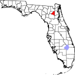
Adjacent counties:
Alachua  Baker  Clay  Duval  Putnam  Union  

Find in Florida

Map of the Bradford County area


Our detail map of Bradford County shows the Bradford County, Florida boundary lines and other interesting items.

Places in Bradford County, Florida

  Airports     show all on map

State Prison Field Airport

  Buildings     show all on map

Bradford County Emergency Medical Services Station 6, Bradford County Library, Bradford County Sheriff's Office, Brooker Electric Substation, Brooker Volunteer Fire Department Station 8, Florida State Prison Main Unit, Hampton Volunteer Fire Department Station 7, Heilbronn Springs Volunteer Fire Department Station 4, Lawtey Correctional Institution, Lawtey Police Department, Lawtey Volunteer Fire Department Station 5, New River Correctional Institution East, New River Correctional Institution West, New River Volunteer Fire Department Station 3, Sampson City Volunteer Fire Department Station 9, Starke Fire Department Station 1 Headquarters, Starke Police Department, Theressa Community Center, Theressa Volunteer Fire Department Station 2

  Cemeteries     show all on map

Brown Cemetery, Conner Cemetery, Crosby Lake Cemetery, Dedan Cemetery, Dyal Cemetery, Evergreen Cemetery, Hampton Cemetery, Hope Baptist Cemetery, Lawtey Cemetery, Mount Sinai Cemetery, New River Cemetery, Old Bradford Cemetery, Prescott Cemetery, Prevatt Cemetery, Sparkman Cemetery

  Churches     show all on map

Air Park Baptist Church, Bayless Hiway Church, Bethel Church, Bethleham Freewill Baptist Church, Bible Baptist Church, Boat Drain Church, Brooker Baptist Church, Christ Evangelical Lutheran Church, Church of Christ, Church of God by Faith, Church of God in Starke, Dedan Baptist Church, Evergreen Baptist Church, Evergreen Church, Faith Baptist Church, Faith Baptist Church of Lawtey, Faith Presbyterian Church, First Baptist Church, Full Gospel Assembly, Graham Baptist Church, Hampton Baptist Church, Hampton Christian Church, Holy Mission of Jesus Christ Church, Holy Temple of God Church, Hope Baptist Church, Keystone Christian Church, Keystone Presbyterian Church, Laura Church, Long Bridge Community Church (historical), Macedonia Baptist Church, Madison Street Baptist Church, McKinney Church, Mount Moriah United Methodist Church, Mount Vernon Church (historical), New Congressional Church, New Hope Church, New River Baptist Church, Northside Church, Philadelphia Missionary Baptist Church, Pine Level Church, Pine Street Church of God in Christ, Pleasant Grove Church, Pleasant Grove Methodist Church, Rock Baptist Church, Saint Edwards Catholic Church, Saint Marks Episcopal Church, Sampson City Baptist Church, Seventh Day Adventist Church, Souls Outreach Mission, The Church of Jesus Christ of Latter Day Saints, Trinity Baptist Church, Victory Baptist Church

  Hospitals     show all on map

Shands Hospital Starke

  Lakes     show all on map

Bolt Lake, Hampton Lake, Indian Lake, Lake Bedford, Lake Crosby, Lake Rowell, Lake Sampson, Paradise Lake, Silver Lake

  Locales     show all on map

Bradford Square, City of Starke Wastewater Treatment Plant, Hunters Run Golf Course, Montgomery Presbyterian Camp, Salvation Army Camp Keystone, Starke Plaza

  Military     show all on map

Keystone Army Air Field (historical)

  Parks     show all on map

Hampton Park, Lake Butler Wildlife Management Area Raiford Tract

  Populated Places     show all on map

Brooker, Clayno, Graham, Hampton, Hampton Beach, Heilbronn, Lawtey, New River, Olin's Mobile Home Park, Pleasant Grove, Sampson, Saxton, Starke, Theressa

  Post Offices     show all on map

Brooker Florida Post Office, Brooker Post Office, Graham Post Office, Hampton Post Office, Saxton Post Office (historical)

  Ridges     show all on map

Trail Ridge

  Schools     show all on map

Anderson School, Bradford High School, Bradford Middle School, Bradford Union Vocational-Technical, Brooker Elementary School, Brooklyn School (historical), Hampton Elementary School, Hope Christian Academy, Lawtey Elementary School, Rising School, Saint Marks Early Learning Center, Santa Fe Community College Watson Center, Southside Elementary School, Starke Elementary School, Starke Seventh-Day Adventist Christian Academy, Water Oak School

  Springs     show all on map

Heilbronn Spring

  Streams     show all on map

Alligator Creek, Alligator Creek, Braggs Branch, Double Run Creek, Gum Creek, Lake Butler Creek, McKinney Branch, Olustee Creek, Prevatt Creek, Rocky Creek, Sampson River, Water Oak Creek

  Swamps     show all on map

Cattail Swamp, Santa Fe Swamp

  Towers     show all on map

Bradford-Union Fire Control Headquarters, Brooker Water Tower, Division of Forestry Santa Fe Tower, Florida Gas Transmission Company Radio Tower, Hill Lookout Tower, Louis Hill Lookout Tower, WEAG-AM (Starke), WEAG-FM (Starke), WTLG-FM (Starke), WYFB-FM (Gainesville),

Bradford County, Florida Population By Race (2012 estimate)

RacePopulation
WhiteBradford County White population 21,16321,162  
BlackBradford County Black population 5,2575,256
MixedBradford County Mixed population 434433
AsianBradford County Asian population 135135
American IndianBradford County American Indian population 8181
Hawaiian & Pacific IslanderBradford County Hawaiian & Pacific Islander population 2727

Additional population tables :
State population table
Florida population by county