Dixie County, Florida Basics:


Dixie County Florida - Government Site

Population: 16,073
Area: 705 square miles
County seat: Cross City
Area code(s) in use: 352
Time zone: EST
High school graduate or higher: 76.4%
Bachelor's degree or higher: 8.1%
Median household income: $35,476
Persons in poverty: 16.3%
Home ownership rate: 76.6%
Mean travel time to work: 24.8 minutes

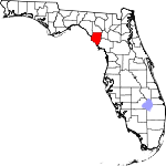
Adjacent counties:
Gilchrist  Lafayette  Levy  Suwannee  Taylor  

Find in Florida

Map of the Dixie County area


Our detail map of Dixie County shows the Dixie County, Florida boundary lines and other interesting items.

Places in Dixie County, Florida

  Airports     show all on map

Cross City Airport, Landing Field, Manatee Springs Airport

  Bars     show all on map

Seven Brothers, Seven Sisters

  Basins     show all on map

Lime Sink

  Bays     show all on map

Bull Cove, Deadman Bay, Horseshoe Cove

  Bridges     show all on map

Fanning Springs Bridge

  Buildings     show all on map

Cross City Correctional Institution Library, Cross City Police Department, Dixie County Emergency Medical Services Station 1, Dixie County Emergency Medical Services Station 2, Dixie County Emergency Medical Services Station 3, Dixie County Fire and Rescue Station 21, Dixie County Fire and Rescue Station 22, Dixie County Fire and Rescue Station 31, Dixie County Fire and Rescue Station 41, Dixie County Fire and Rescue Station 51, Dixie County Fire and Rescue Station 61, Dixie County Fire and Rescue Station 71, Dixie County Sheriff's Office

  Canals     show all on map

Airport Canal

  Capes     show all on map

Bowlegs Point, Drum Point, Halfway Point, Hardy Point, Horseshoe Point, Sand Point, Stuart Point

  Cemeteries     show all on map

Butler Cemetery, Fayetteville Cemetery, Keen Cemetery, Long Pond Cemetery, McCrabb Cemetery, Mingo Cemetery, Mount Olive Cemetery, Old Town Cemetery, Pleasant Grove Cemetery, Sandhill Cemetery, Shady Grove Cemetery, Wards Cemetery

  Channels     show all on map

Northern Pass, Wadley Pass, West Gap, West Pass

  Churches     show all on map

Faith Tabernacle, Lydia Church, Macedonia Church, McCrabb Church, Prospect Church, Rock Sink Church, Saint Christophers Church, Salt Creek Church, Scrub Creek Church, Suwannee River Church, United Church

  Cliffs     show all on map

McMillan Bluff

  Flats     show all on map

Beason Prairie, Delaney Prairie, Fish Prairie, Tenmile Prairie, Tomlinson Prairie

  Guts     show all on map

Days Creek, Sink Creek

  Islands     show all on map

Barbree Island, Big Grassy Island, Big Pine Island, Bird Island, Bird Island, Bradford Island, Bumblebee Island, Butler Island, Cat Island, Coon Island, Cotton Island, Crutchman Island, Davis Island, Goodson Island, Grassy Island, Harris Island, Lazy Island, Little Bird Island, Little Bumblebee Island, Little Grassy Island, Little Pine Island, Odulund Island, Old Town Hammock, Palm Island, Pepperfish Keys, Pine Log Island, Tater Island

  Lakes     show all on map

Adams Lake, Alligator Lake, Barpost Lake, Boat Lake, Bodiford Pond, Bonnel Lake, Booth Lake, Buck Pond, California Lake, Careless Prairie, Cemetery Lake, Clearwater Pond, Cove Lake, Cow Pond, Cow Ponds, Dixon Lake, Fish Pond, Governor Hill Lake, Hammock Lake, Jennings Lake, Long Pond, Long Pond, Lord Lake, Matthis Lake, Mill Pond, Mound Lake, Ocean Pond, Sand Pond, Station Lake, Thompson Lake, Union Lake, Ward Lake, Water Pond, Williams Lake

  Locales     show all on map

Brunco Railroad Station, Cow Camp, Dixie County Fire Control Headquarters, Dixie Plaza, Fishbone Beach, McCrabb Landing, Monden Camp, New Pine Landing, Otter Sink Camp, Pine Landing, Sunnyvale Fish Camp, Week Landing

  Military     show all on map

Cross City Air Force Station (historical), Cross City Army Air Field (historical)

  Parks     show all on map

Jena Wildlife Management Area, Lower Suwannee National Wildlife Refuge, Nature Coast Trail State Park, Perpetual Wildlife Management Area, Steinhatchee Wildlife Management Area, Steinhatchee Wildlife Management Area

  Populated Places     show all on map

Broscan, Cross City, Dixietown, Eugene, Fletcher, Hines, Horseshoe, Horseshoe Beach, Jena, Jonesboro, Old Town, Shamrock, Shired Island, Steward City, Suwanee Old Town (historical), Suwannee, Yellow Jacket

  Schools     show all on map

Dixie County Adult Center, Dixie County High School, James M Anderson Elementary School, Jena School, Old Town School, Seventh-Day Adventist Church School

  Springs     show all on map

Guaranto Spring

  Streams     show all on map

Amason Creek, Boat Creek, Boggy Creek, Brushy Creek, Buck Creek, Bumblebee Creek, Butler Creek, California Creek, Cow Creek, Demory Creek, Eightmile Creek, Fishbone Creek, Fishbone Creek, Flag Creek, Harris Creek, Howard Creek, Jim Lee Creek, Johnson Creek, Lilly Creek, Little Rocky Creek, Lock Creek, Lolly Creek, Monden Creek, North Double Barrel Creek, Pine Log Creek, Porpoise Creek, Ridgeway Creek, Rocky Creek, Salt Creek, Sand Hill Creek, Sanders Creek, Shingle Creek, Shired Creek, South Double Barrel Creek, Suwannee River, Tripod Creek, Turkey Creek, Week Creek, Whackup Creek, Wisher Creek

  Swamps     show all on map

Bear Bay Swamp, Blue Lake Swamp, Board Pile Bay, California Swamp, Cedar Swamp, Little Rock Swamp, Long Prairie, Pine Log Swamp, Pocoson Swamp, Pumpkin Swamp, Rocky Creek Swamp, Tiger Bay

  Towers     show all on map

Hines Lookout Tower, Holly Hill Lookout Tower, Horseshoe Lookout Tower, Putnam Lookout Tower, WDFL-AM (Cross City), WDFL-FM (Cross City),

Dixie County, Florida Population By Race (2012 estimate)

RacePopulation
WhiteDixie County White population 14,28914,288  
BlackDixie County Black population 1,4301,430
MixedDixie County Mixed population 225225
American IndianDixie County American Indian population 6464
Hawaiian & Pacific IslanderDixie County Hawaiian & Pacific Islander population 00

Additional population tables :
State population table
Florida population by county