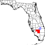
Hendry County, Florida Basics:


Hendry County Florida - Government Site

Population: 37,469
Area: 1153 square miles
County seat: La Belle
Area code(s) in use: 863
Time zone: EST
High school graduate or higher: 64.3%
Bachelor's degree or higher: 9.7%
Median household income: $35,736
Persons in poverty: 28.7%
Home ownership rate: 69.5%
Mean travel time to work: 25.3 minutes


Adjacent counties:
Broward  Charlotte  Collier  Glades  Lee  Palm Beach  

Find in Florida

Map of the Hendry County area


Our detail map of Hendry County shows the Hendry County, Florida boundary lines and other interesting items.

Places in Hendry County, Florida

  Airports     show all on map

Airglades Airport, Alico Airport, Alico-Felda Grove Airport, Berry Grove Airport, Big Cypress Airfield, Bob Paul Airport, Charlton Strip Airport, Clewiston Airport (historical), Colony Heliport, Cotton Strip Airport, Devils Garden Strip Airport, Duda Airstrip, Harper's Fly-In Ranch Airport, Hendry Correctional Institute Airport, La Belle Municipal Airport, Mc Daniel Ranch Inc. Airport, South Point Airport, Southern Ranch Airport, Southwest Citrus Airport, William's Sky Manor Airport

  Bays     show all on map

Coot Bay

  Bridges     show all on map

Banana Branch Bridge, Fort Denaud Bridge, La Belle Bridge, Negro Jim Hammock Bridge

  Buildings     show all on map

Big Cypress Fire and Emergency Medical Services, Clewiston Museum, Clewiston Police Department, Clewiston Public Library, Clewiston Volunteer Fire Department, Felda Volunteer Fire Department, Firehouse Cultural Center, Harlem Community Library, Hendry Correctional Institution, Hendry County Emergency Medical Services Station 119, Hendry County Emergency Medical Services Station 219, Hendry County Sheriff's Office East District, Hendry County Sheriff's Office West District, La Belle Fire Department, Montura Flaghole Volunteer Fire Department, Pioneer Plantation Volunteer Fire Department, Seminole Tribe Police

  Canals     show all on map

Deer Fence Canal, L-1 Canal, L-2 Canal, North Feeder Canal, Roberts Canal, Townsend Canal, West Feeder Canal

  Cemeteries     show all on map

Fort Denaud Cemetery, Ridgelawn Cemetery

  Census     show all on map

Fort Denaud Census Designated Place, Harlem Census Designated Place, Montura Census Designated Place, Pioneer Census Designated Place, Port LaBelle Census Designated Place

  Churches     show all on map

Big Cypress Church, Caloosa Baptist Church, Central Church of Christ, Christ the King Lutheran Church, Church of God of Labelle, Church of Peace, Community Presbyterian Church, Faith Chapel Pentecostal Church of God, Faith Lutheran Church, Felda Church, First Apostolic Church of Clewiston, First Baptist Church of Labelle, High Haven Church, Highlands Grace Reformed Church, Mount Calvary Missionary Church, Mount Zion Church, New Life Bible Learning Center, New Testament Church, Pioneer First Baptist Church, Saint Margarets Catholic Church, Saint Martins Episcopal Church, Truevine Church, Turning Point Church of God

  Guts     show all on map

Collins Slough, Devils Garden Slough, Fussel Slough, Hooper Slough, Lime Slough, Okaloacoochee Branch

  Harbors     show all on map

Anglers Marina, Belle Hatchee Marina, Roland Martin Marina

  Hospitals     show all on map

Hendry Hospital, Hendry Regional Medical Center

  Islands     show all on map

Beautiful Hammock, Butterfly Island, Cow Bone Island, Cowbone Hammock, Crows Nest Hammock, Dinner Island, Doctors Hammock, Dog Island, Dozier Hammock, Grasshopper Island, Roney Island, Tom Still Hammock, Wild Cow Island, Woodyard Hammock

  Lakes     show all on map

Cattail Lake, Fye Pond, Okaloacoochee Slough, Rocky Lake

  Levees     show all on map

Levee 3

  Locales     show all on map

Browns Indian Trading Post, Camp Everglades, Carolina Golf Club, City of Clewiston Wastewater Treatment Facility, Devils Garden, Felda, Fort Denaud (historical), LaBelle Plaza, Point of Cypress, United Methodist Camp

  Military     show all on map

Riddle Field (historical)

  Parks     show all on map

Sugarland Park

  Populated Places     show all on map

Belchers Mobile Home Park, Clewiston, Clewiston Trailer Park, County Line Trailer Park, Denaud, Elizondos Trailer Park, Everglades Mobile Home Park, Fairgrounds Mobile Home Park, Felda, Foxbriar Mobile Home Park, Harlem, Hooker Point, Kellys Trailer Park Number 1, Kellys Trailer Park Number 3, Keri, Kites Nest Mobile Home Park, LaBelle, Marion Mobile Home Park, Oaklane Mobile Home Park, Port LaBelle, Royal Palm Trailer Park, Sears, South Clewiston, Sugar Junction, Sugarland Mobile Home Park, Sugarton, Tropical Mobile Home Village, Twin Lakes Mobile Home Estates, Ventura Mobile Home Park, Whidden Corner

  Post Offices     show all on map

Clewiston Post Office, Labelle Post Office

  Schools     show all on map

Alsachkee Day School, Clewiston Community School, Clewiston High School, Clewiston Intermediate School, Clewiston Middle School, Clewiston Primary School, Community Christian School of LaBelle, Edison State College - Hendry Glades Center, LaBelle Community School, LaBelle Elementary School, LaBelle High School, LaBelle Intermediate School, LaBelle Middle School

  Streams     show all on map

Banana Branch, Fort Simmons Branch, Jacks Branch

  Summits     show all on map

Maple Mound, Tonys Mound

  Swamps     show all on map

Boggy Slough, Cow Slough, Crows Nest Slough, Gator Slough, Graham Marsh, Grassy Marsh, Gum Swamp, Hog Cypress, Lard Can Slough, Little Cypress Swamp, Little Lard Can Slough, Rocky Lake Strand, Tony Strand, Twelvemile Slough

  Towers     show all on map

Keri Lookout Tower, WAFC-AM (Clewiston), WAFC-FM (Clewiston), WKZY-FM (La Belle), WKZY-FM (La Belle), WWCL-AM (Lehigh Acres),

Hendry County, Florida Population By Race (2012 estimate)

RacePopulation
WhiteHendry County White population 30,72530,724  
BlackHendry County Black population 5,0965,095
American IndianHendry County American Indian population 824824
MixedHendry County Mixed population 412412
AsianHendry County Asian population 375374
Hawaiian & Pacific IslanderHendry County Hawaiian & Pacific Islander population 7574

Additional population tables :
State population table
Florida population by county