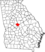
Bibb County, Georgia Basics:


Bibb County Georgia - Government Site

Population: 156,162
Area: 250 square miles
County seat: Macon
Area code(s) in use: 478
Time zone: EST
High school graduate or higher: 82.4%
Bachelor's degree or higher: 22.8%
Median household income: $37,920
Persons in poverty: 23.5%
Home ownership rate: 55.5%
Mean travel time to work: 20.9 minutes


Adjacent counties:
Crawford  Houston  Jones  Monroe  Peach  Twiggs  

Find in Georgia

Map of the Bibb County area


Our detail map of Bibb County shows the Bibb County, Georgia boundary lines and other interesting items.

Places in Bibb County, Georgia

  Airports     show all on map

Macon Downtown Airport, Middle Georgia Regional Airport

  Bridges     show all on map

Bridgewood Golf Course, Carl Vinson Bridge, Hartley Bridges, William L Stribling Bridge

  Buildings     show all on map

Bibb County Courthouse, Bibb County Sheriff's Office, Bureau of Alcohol Tobacco Firearms and Explosives Macon I Field Office, Central State Prison, Columbus Roberts Hall, Fire Station Number 4, Georgia Forestry Commission, Georgia Industrial Home, Hardman Library, Hay House, Macon - Bibb County Fire Department Administration, Macon - Bibb County Fire Department Station 1, Macon - Bibb County Fire Department Station 10 Headquarters, Macon - Bibb County Fire Department Station 101, Macon - Bibb County Fire Department Station 102, Macon - Bibb County Fire Department Station 103, Macon - Bibb County Fire Department Station 104, Macon - Bibb County Fire Department Station 105, Macon - Bibb County Fire Department Station 106, Macon - Bibb County Fire Department Station 107, Macon - Bibb County Fire Department Station 108, Macon - Bibb County Fire Department Station 11, Macon - Bibb County Fire Department Station 12, Macon - Bibb County Fire Department Station 2, Macon - Bibb County Fire Department Station 3, Macon - Bibb County Fire Department Station 5, Macon - Bibb County Fire Department Station 6, Macon - Bibb County Fire Department Station 7, Macon - Bibb County Fire Department Station 8, Macon - Bibb County Fire Department Station 9, Macon Behavioral Health Treatment Center, Macon City Hall, Macon Health Center, Macon Little Theater, Macon Police Department, Macon Police Department Precinct 1, Macon Police Department Precinct 2, Macon Police Department Precinct 3, Macon Police Department Precinct 4 Macon Mall, Macon Police Training Academy, Macon Transitional Center, Mary Erin Porter Hall, Mercer University Administration Building, Penfield Hall, Porter Hall, Price Library, Sherwood Hall, Shorter Hall, United States Marshals Service Middle District of Georgia, Washington Library, Wesleyan College Police Department, Wiggs Memorial Science Hall

  Cemeteries     show all on map

Andrews Cemetery, Davis Cemetery, Evergreen Cemetery, Fort Hill Cemetery, Glen Haven Memorial Garden, Jones Chapel Cemetery, Linwood Cemetery, Macon Memorial Park, Oakridge Cemetery, Riverside Cemetery, Rose Hill Cemetery, Saint Dennis Cemetery, Saints Rest Cemetery, Stone Creek Cemetery, Tucker Cemetery, Waldron Cemetery

  Census     show all on map

Macon Division, Swift Creek Division

  Churches     show all on map

Aberlina Baptist Church, Antioch Church, Avondale Church, Avondale Church (historical), Bass Church, Bethel Church, Bloomfield Church, Bloomfield Gardens Church, Bowman Church, Bryant Tabernacle, Bryant Tabernacle Baptist Church, Centenary United Methodist Church, Central Assembly of God Church, Central Church of Christ, Christ Episcopal Church, Church of God in Christ, Church of the Lord Jesus Christ of the Apostolic Faith, Commandment Keeping Church, Community Church, Congregation Sherah Israel, Congregational Holiness Church, Damascus Church, Doles Church, Duresville Church (historical), Eagle Cane Chapel (historical), Ebenezer Baptist Church, Ebenezer Church, Elizabeth Church, Evergreen Church, Faith Church, Faith Temple, Fambro Chapel, First Baptist Church, First Baptist Church, First Church of Christ Scientist, First Congregational Church, First Presbyterian Church, First Street United Methodist Church, Fountain Temple African Methodist Episcopal Church, Fulton Baptist Church, Glenwood Hills Church, Greater Friendship Baptist Church, Green Street Church, Hazzard Church, High Point Church, Highland Hills Church, Hillcrest Church, Holsey Temple Christian Methodist Episcopal Church, Holy Grove Church, Houston Heights Church, Howard Chapel, Ingleside Church, Ingleside Church, Lakeview Chapel, Lanier Heights Church, Lizella Church, Lundies Chapel (historical), Lundy Chapel, Lynmore Church, Macedonia Baptist Church, Macedonia Church (historical), Midway Church, Mikado Church, Mount Olive Baptist Church, Mount Pleasant Church, Mount Pleasant Church, Mount Zion Church, Mulberry Street United Methodist Church, New Elim Church, New Hope Church, New Piney Grove Church (historical), Northside Church, Ocmulgee Church, Park Memorial United Methodist Church, Pine Forest Church, Piney Grove Church (historical), Pleasant Grove Church, Ross Temple Baptist Church, Saint Dennis Church (historical), Saint James Church, Saint James Church, Saint John Church, Saint Josephs Cathedral, Saint Lukes Church, Saint Marys Church (historical), Saint Matthews Church, Saint Pauls Episcopal Church, Sardis Church, Second Baptist Church, Shiloh Church, Stewart Chapel African Methodist Episcopal Church, Stinsonville Church, Swift Creek Baptist Church, Tabernacle Baptist Church, Tattnall Square Baptist Church, Tattnall Square Presbyterian Church, Temple Beth Israel, Thomaston Road Church, Tremont Temple Baptist Church, Turners Tabernacle African Methodist Episcopal Church, Union Chapel, Union Church (historical), United Church, Washington Avenue Presbyterian Church, West Lawn Church, White Spring Church, Willingham Chapel, Wolf Creek Church

  Crossings     show all on map

Exit 2, Exit 3, Exit 3, Exit 4, Exit 54, Exit 55, Exit 55A, Exit 56, Interchange 1, Interchange 1, Interchange 2, Interchange 47, Interchange 48, Interchange 49, Interchange 5, Interchange 50, Interchange 51, Interchange 52, Interchange 53

  Dams     show all on map

Airport Lake Dam, Attaway Lake Dam, Bankston Lake Dam, Clay Lake North Dam, Clay South Dam, Dougherty Lake Dam, Edwards Lake Dam, Fenley Ryther Dam, Gibson Lake Dam, Gibson-Cary Development Corporation Dam, Kenelworth Manor Lake Dam, Lake Wildwood Dam, Lakeside Dam, Lamon Lake Dam, Newberry Lake Dam, Rivoli Lake Dam, Rowell Lake Dam, Sawyer Lake Dam, Sikes Lake Dam, Stokes Lake Dam, Stone Lake Dam, Vfw Lake Dam, Wesleyan College Lake Dam

  Hospitals     show all on map

Central Georgia Rehabilitation Hospital, Charter Lake Hospital, Charter Lake Hospital, Coliseum Medical Center, Coliseum Northside Hospital, Coliseum Psychiatric Center, Heritage Park Hospital, Macon-Bibb County Health Center, Medical Center of Central Georgia, Medical Center of Central Georgia Children's Hospital, Parkview Private Hospital (historical), Regency Hospital of Central Georgia, Riverside Clinic, Saint Luke Hospital (historical)

  Lakes     show all on map

Black Lake

  Locales     show all on map

Baconsfield Shopping Center, Bloomfield Village Shopping Center, Bowden Golf Course, Cherokee Shopping Center, Georgia Farm Bureau Shopping Center, Georgia State Farmers Market, Idle Hour Country Club, Ingleside Village Shopping Center, Macon Mall Shopping Center, Macon Waterworks, Marshalls Mill (historical), Northeast Plaza Shopping Center, Northgate Village Shopping Center, Northwoods Shopping Center, Pio Nono Plaza Shopping Center, Riverside Shopping Center, Rivoli Crossing Shopping Center, South Plaza Shopping Center, Summit Shopping Center, Town and Country Shopping Center, Vineville North Shopping Center, Vineville Shopping Center, Westgate Mall Shopping Center, Zayres-Eisenhower Shopping Center

  Military     show all on map

Cochran Field (historical), Fort Hawkins (historical)

  Parks     show all on map

Addison Tinsley Park, Anderson Park, Arrowhead Park, Ayers Park, Bloomfield Community Park, Claystone Park, Conner Park, Dempsey Park, Dunlap Park, Flintrock Park, Freedom Park, Georgia State Fairgrounds, Hardeman Park, Henderson Memorial Stadium, Hill Park, Hollingsworth Park, Lakeside Park, Lamar Park, Lanier Park, Macon Historic District, Macon Railroad Industrial Historic District, Messenburg Park, Nisbet Park, Ocmulgee National Monument, Pleasant Hill Historic District, Porter Field, Prince Park, Proudeit Park, Rose Park, Sandy Beach Park, Sparks Park, Tattnall Square, Turpin Park, Vineville Historic District, Washington Park, Whittle Park

  Pillars     show all on map

Ocmulgee National Monument

  Populated Places     show all on map

Angels Acres, Anthony Terrace, Arkwright, Arlington Park, Aultman Pines, Avondale, Azalea Park, Beaveroaks, Bedingfield, Bellevue, Bevinwood, Billingwood, Blanton Acres, Bloomfield Estates, Bloomfield Farms, Bloomfield Gardens, Bloomfield Heights, Bloomfield Park, Bon Ayer, Briarwood, Briarwood Hill, Bridgeman, Bristol Forest, Brookhaven, Brookwood, Brookwood Hills, Camelot, Castlegate, Cherokee, Christian Rest, Christophers Cove, Clarkview, Coal Neck Settlement (historical), College Estates, Country Club Estates, Crestfield, Crestwell Heights, Cross Keys, Crystal Springs, Dixie, Dogwood Plantation, Duresville, East Macon, Echeconnee Acres, Fairystone, Forest Lake, Franklinton, Glen Cove, Glenhaven, Glenwood Forest, Goodall Estates, Green Lawn Acres, Green Meadows, Greenbriar, Groveland, Groveland Park, Heritage Acres, Highland Circle, Highland Hills, Hillcrest Heights, Hillview, Idle Hour Estates, Idlewood, Ingleside, Jackson Heights, Jarrell Heights, Jefferson Hills, Jones Road Subdivision, Kings Cove, Kings Park, Lake Arrowhead, Lake Sardis Estates, Lakeside, Lakeside Hill, Lakeview, Lakewood, Lanier Heights, Liberty View, Lindsey Park, Lizella, Log Cabin Heights, Lokchapee, Lorane, Lumberhill, Lymore Estates, Macon, McKibben Lane, Meadowbrook, Meadows, Mogul, Montpelier (historical), Morningside, North Forest Hills, North Highlands, Northwoods, O'Reily Estates, Oglethorpe Homes, Payne, Phelps Estates, Pine Forest, Pineworth by the Lake, Richardson Estates, Riverside Hills, Riverside Park, Riverview, Rivoli (historical), Rivoli Plantation, Rockmill (historical), Rogers Acres, Rutland, Sanders, Sardis Estates, Shadowood, Sherwood Forest, Sherwood Forest, Shirley Hills, Shirlington, Silver Pines, Skipperton, Smithsonia, Sofkee, Sofkee Estates, South Highlands, Storeyland, Stratford Oaks, Stratford Oaks, Stratton, Sunnydale Acres, Tanglewood, Tara, Terra Cotta, Terrell, Tharpe Heights, Thornton Heights, Thornwood, Three Oaks, Trails End, Unionville, Villa Crest, Village Green, Vineville, Vinson Village, Vonreg Subdivision, Walden, Waverly Place, Weaver Heights, Wesleyan, Wesleyan Estates, Wesleyan Hills, Wesleyan Woods, West Oak, West Point, Westfield, Westgate Estates, Westminister, Westview, Wheeler Heights, Whispering Pines, Whispering Pines, Whitehouse Plantation, Wimbish Hills, Wimbish Wood, Wimbledon Woods, Wood Valley, Woodcrest

  Post Offices     show all on map

Macon Post Office

  Reservoirs     show all on map

Airport Lake, Attaway Lake, Bankston Lake, Clay Lake, Clay Lake North, Clay South Lake, Dougherty Lake, Edwards Lake, Forest Lake, Gibson Lake, Gibson-Cary Development Corporation Pond, Kenelworth Manor Lake, Lake Arrowhead, Lake Tobesofkee, Lake Wildwood, Lakeside Reservoir, Lamon Lake, Newberry Lake, Rivoli Lake, Rivoli Lakes, Rowell Lake, Sawyer Lake, Sikes Lake, Stokes Lake, Stone Lake, Tobesofkee Creek Structure Number One L, Vfw Lake, Walker Lakes, Wesleyan College Lake

  Schools     show all on map

Alexander School, Alexander School Number 2, Alexander School Number 4, Appling High School, Ballard-Hudson High School, Banks School, Barden School, Bellevue School, Bernd School, Bessie Chapel School (historical), Bruce School, Burdell School, Burghard School, Burke School, Carver School, Central Fellowship Academy, Central Georgia Technical College - Macon Campus, Chapel Hill Academy, Clisby School, Cochran Field Academy, Cross Keys Christian Academy, Danforth School, Duresville School, Fort Hawkins School, Georgia Academy for the Blind, Gilead Christian Academy, Goodwin School (historical), Gresham High School, Hall School, Hamilton School, Heard School, Howard School (historical), Hughes Vocational School, Hunt School, Ingram School, Ingram-Pye Elementary School, Jessie Rice Elementary School, Lanier High School, Lanier Junior High School, Macedonia School, Macon Junior College, Matilda Hartley Elementary School, McCrory School (historical), McEvoy Middle School, McKibben Lane School, Mercer University, Miller Middle School, Minnie Butler School, Mount De Sales Academy, Neal School, Newcastle School (historical), Northeast High School, Planters School (historical), Pleasant Grove School (historical), Porter School, Powers School, Redding School, Riley School, Rosa Taylor School, Saint Joseph School, Saint Peter Claver School, Southwest High School, Springdale School, Stephens School, Stratford Academy, Summerfield School (historical), Swift Creek School, Tattnal Square Academy, Tinsley School, Union School, Unionville School, W T Morgan Elementary School, Walter F George School of Law, Walter P Jones Elementary School, Werr School, Wesleyan College, White Spring School (historical), Whittle School, Williams School, Windsor Academy, Winship School

  Streams     show all on map

Amason Branch, Beaverdam Creek, Blue Branch, Boggy Branch, Bowman Branch, Coppas Branch, Donnan Branch, Dry Bone Creek, Gum Branch, Hall Branch, Johns Branch, Lamar Branch, Rocky Creek, Sabbath Creek, Savage Branch, Swift Creek, Tobesofkee Creek, Trinity Creek, Vineville Branch, Walnut Creek, Wolf Creek

  Summits     show all on map

Andrews Hill, Lamar Mounds

  Swamps     show all on map

Bond Swamp

  Towers     show all on map

WBML-AM (Macon), WDDO-AM (Macon), WDEN-AM (Macon), WIBB-AM (Macon), WMAZ-AM (Macon), WMGT-TV (Macon), WNEX-AM (Macon), WPEZ-FM (Macon), WQBZ-FM (Fort Valley),

Bibb County, Georgia Population By Race (2012 estimate)

RacePopulation
BlackBibb County Black population 82,76682,765  
WhiteBibb County White population 67,93067,930
AsianBibb County Asian population 2,8112,810
MixedBibb County Mixed population 2,0302,030
American IndianBibb County American Indian population 468468
Hawaiian & Pacific IslanderBibb County Hawaiian & Pacific Islander population 156156

Additional population tables :
State population table
Georgia population by county