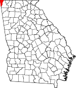
Dade County, Georgia Basics:


Dade County Georgia - Government Site

Population: 16,523
Area: 174 square miles
County seat: Trenton
Area code(s) in use: 706
Time zone: EST
High school graduate or higher: 81.5%
Bachelor's degree or higher: 16.9%
Median household income: $41,677
Persons in poverty: 16.4%
Home ownership rate: 78.4%
Mean travel time to work: 28.2 minutes


Adjacent counties:
Chattooga  Dekalb (AL)  Hamilton (TN)  Jackson (AL)  Marion (TN)  Walker  

Find in Georgia

Map of the Dade County area


Our detail map of Dade County shows the Dade County, Georgia boundary lines and other interesting items.

Places in Dade County, Georgia

  Airports     show all on map

Lookout Mountain Airport, Warren Field Airport

  Bays     show all on map

Castle Rock Gulf, Newman Gulf, Sulphur Springs Gulf, Tatum Gulf, Washer Gulf, Wolfpen Gulf

  Bends     show all on map

Johnson Crook

  Buildings     show all on map

Dade County Courthouse, Dade County Emergency Medical Station 5, Dade County Jail, Dade County Sheriff's Office, Davis Volunteer Fire Department Station 7, New Home Fire Department, New Salem Volunteer Fire Department, North Dade Volunteer Fire Department, South Dade Fire Department, Trenton Fire Department, Trenton Police Department, West Brow Fire Department

  Capes     show all on map

Dugan Point

  Cemeteries     show all on map

Bates Cemetery, Bethlehem Cemetery, Bible Cemetery, Brock Cemetery, Brown Gap Cemetery, Company Cemetery, Daniel Cemetery, Deakins Cemetery, Easley Cemetery, Forester Cemetery, Hanna Cemetery, Haswell Cemetery, Hawkins Cemetery, Jackson Cemetery, Kennedy Cemetery, Lake Hills Memorial Gardens, Long Cemetery, McKaig Cemetery, Miller Cemetery, Murphy Cemetery, Newman Cemetery, Payne Cemetery, Ray Cemetery, Reeves Cemetery, Stephens Cemetery, Summit Cemetery, Trenton Cemetery, Wells Cemetery, Whit Cemetery

  Census     show all on map

Trenton Division (historical)

  Churches     show all on map

Avans Church, Bethlehem Church, Brown Gap Church, Byrds Chapel, Calvary Baptist Church, Calvary Church, Cave Springs Church, Church of Christ, Church of Christ, Cloverdale Baptist Church, Edgewood Missionary Baptist Church, First Baptist Church of Trenton, Friendship Baptist Church, General Church, Griffin Church, Harris Chapel, Head River Baptist Church, Morganville United Methodist Church, Mount Olive Church, Mount Zion Church, New England Baptist Church, New Home Church, New Salem Church, New Unity Church, North Dade Church, Open Door Church, Piney Grove Baptist Church, Pleasant Grove Church, Rising Fawn Baptist Church, Rising Fawn Church, Rising Fawn Church of God, Saint Pauls Church (historical), Sand Mountain Church, Scenic Land Church, Slygo Missionary Baptist Church, Trenton United Methodist Church, United Church of Christ, West Brow Chapel, West Brow Church, Whiteoak Baptist Church, Wildwood Church, Wildwood Church, Woodlawn Baptist Church

  Cliffs     show all on map

Range Point, Seward Point, Street Point

  Crossings     show all on map

Exit One, Exit Two

  Dams     show all on map

Carver Lake Dam, Dyer Lake Dam, Gross Lake Dam, Johnson Lake Dam, Lake Hills Estates Dam, Lookout Lake Dam, McGee Lake Dam, Miller Lake Dam, Smythe Lake Dam, Tucker Branch Lake Dam, Vaught Lake Dam, West Brow Lake Dam, Young Lake Dam

  Gaps     show all on map

Bee Gap, Bradford Gap, Brown Gap, Burkhalter Gap, Easley Gap, Hale Gap, Hall Gap, Magby Gap, Newsome Gap, Payne Gap, Range Gap, Stidmon Gap, Sulphur Springs Gap, Tarkiln Gap, Whiteoak Gap, Windy Gap

  Hospitals     show all on map

Wildwood Lifestyle Center and Hospital

  Locales     show all on map

New Home, New Home Community Center, Sandmont Bible Camp

  Military     show all on map

Flintstone Air Force Station (historical)

  Mines     show all on map

Bailey Mine, Castle Rock Mine, Cole City Mine, Dade Mine, Davis-Wells Mine, Ferndale Mine, Green Mine, Holland Mine, Mars Mine, Murphy Mine, New England Mine, New South Mine, Parker Mine, Pat Obrien Mine, Racoon Mine, Rattlesnake Mine, Tatum Gulf Mine, White Oak Mine

  Parks     show all on map

Cloudland Canyon State Park

  Populated Places     show all on map

Amos Mill, Avans, Cedar Hill, Cloverdale, Cole City, Gass, Head River, Hooker, Lookout Mountain Town (historical), Morganville, New England, Plum Nelly, Rising Fawn, Stewart Town, Sulphur Springs Station, Tatum (historical), Trenton, Union, West Brow, Wildwood

  Post Offices     show all on map

Avans Post Office (historical), Cloverdale Post Office (historical), Cole City Post Office (historical), Head River Post Office (historical), Morganville Post Office (historical), New England City Post Office (historical), Rising Fawn Post Office, Sulphur Springs Post Office (historical), Trenton Post Office, Wildwood Post Office

  Ranges     show all on map

Sand Mountain

  Reservoirs     show all on map

Brown Lake, Carver Lake, Dyer Lake, Getter Lake, Green Pond, Gross Lake, Johnson Lake, Lake Edna, Lake Edna, Lookout Lake, McGee Lake, Miller Lake, Moore Lake, Smythe Lake, Tucker Branch Lake, Vaught Lake, West Brow Lake, Young Lake

  Ridges     show all on map

McCollum Ridge, Pudding Ridge, Slygo Ridge, Tennessee Valley Divide

  Schools     show all on map

Brown Gap School (historical), Covenant College, Dade County High School, Dade Elementary School, Dade Middle School, Dade Primary School, Davis Elementary School, Head River School (historical), Lookout Mountain Junior High School, Murphy Hollow School (historical), New Salem School (historical), North Dade School, Northwest Georgia High School, Scealf School (historical), West Brow School (historical)

  Springs     show all on map

Cole Spring, Forester Spring, Gunn Spring, Jackson Spring, Jones Spring, Murphy Spring, Pope Spring, Poplar Spring, Sims Spring, Skyuka Spring, Taylor Spring, Whiteoak Gap Spring, Whiteoak Spring

  Streams     show all on map

Allison Creek, Back Valley, Bear Creek, Big Spring Branch, Boatman Creek, Bullard Branch, Daniel Creek, Dove Creek, Dry Creek, Dry Wash Branch, Ferndale Branch, Flatrock Creek, Gray Creek, Gulf Creek, Harris Creek, Hurricane Branch, Hurricane Creek, Jack Branch, Long Branch, McBriar Branch, McClain Branch, McCollum Branch, Morrison Branch, Murray Branch, Pope Creek, Price Branch, Rattlesnake Creek, Sims Spring Branch, Sitton Gulch Creek, Squirrel Town Creek, Stephens Branch, Stewart Town Creek, Tadpole Branch, Tatum Gulf Creek, Town Creek, Turner Branch, Warren Creek, Waterfall Branch, Wauhatchie Branch, West Fork Little River

  Summits     show all on map

Castle Rock, Fox Mountain, Lawson Mountain, Tatum Mountain, Windy Mountain

  Towers     show all on map

WADX-AM (Trenton), WBDX-FM (Trenton)

  Trails     show all on map

Skyuka Trail

  Valleys     show all on map

Bible Gulf, Dean Gulf, Forester Gulch, Little Mans Gulch, McKaig Gulf, Paris Hollow, Pyburn Gulf, Rattlesnake Gulf, Richmond Gulf, Sitton Gulf, Slygo Valley, Squirrel Tail Gulf, Stewart Gulch, Sugar Camp Gulf, Tatum Gulf, Tatum Gulf,

Dade County, Georgia Population By Race (2012 estimate)

RacePopulation
WhiteDade County White population 15,86215,862  
MixedDade County Mixed population 215214
AsianDade County Asian population 149148
American IndianDade County American Indian population 8382
Hawaiian & Pacific IslanderDade County Hawaiian & Pacific Islander population 1716

Additional population tables :
State population table
Georgia population by county