Tift County, Georgia Basics:


Tift County Georgia - Government Site

Population: 41,010
Area: 259 square miles
County seat: Tifton
Area code(s) in use: 229
Time zone: EST
High school graduate or higher: 76.5%
Bachelor's degree or higher: 17.1%
Median household income: $37,033
Persons in poverty: 22.9%
Home ownership rate: 63.7%
Mean travel time to work: 18.2 minutes

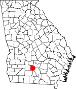
Adjacent counties:
Berrien  Colquitt  Cook  Irwin  Turner  Worth  

Find in Georgia

Map of the Tift County area


Our detail map of Tift County shows the Tift County, Georgia boundary lines and other interesting items.

Places in Tift County, Georgia

  Airports     show all on map

Henry Tift Myers Airport

  Buildings     show all on map

Excelsior Volunteer Fire Department, Georgia Agrirama, Georgia State Patrol Troop H Post 13 Tifton, Omega Police Department, Omega Volunteer Fire Department, Tift County Courthouse, Tift County Fire Department Station 6, Tift County Fire Department Station 8, Tift County Jail, Tift County Library, Tift County Sheriff's Department, Tift County Volunteer Fire Department Station 5, Tift County Volunteer Fire Department Station 7, Tift Volunteer Fire Department, Tifton City Hall, Tifton Fire Department, Tifton Police Department, Ty Ty Volunteer Fire Department Station 4, Woodlawn Community Center

  Cemeteries     show all on map

Fletcher Cemetery, Greenwood Cemetery, Harding Cemetery, Hickory Springs Cemetery, Lawrence Cemetery, Mount Vernon Cemetery, Oak Ridge Cemetery, Rutland Cemetery, Salem Cemetery, Smith Cemetery, Tift Memorial Gardens, Ty Ty Cemetery

  Census     show all on map

Phillipsburg Census Designated Place, Unionville Census Designated Place

  Churches     show all on map

Bessie Tift Chapel Baptist Church, Beulah Hill Baptist Church, Brighton Church, Brookfield Baptist Church, Brookfield Methodist Church, Calvary Church, Cherry Grove Church, Chula Baptist Church, Chula Methodist Church, Church of God, Church of the Nazarene, Congregational Christian Church, Corinth Church, Cycloneta Church (historical), Eastside Church, Eldorado Church, Everett Temple Christian Methodist Episcopal Church, First Assembly of God Church, First Baptist Church, First Defiance Church, First Methodist Church, First Presbyterian Church, Friendship Church, Friendship Holiness Church, Harding Church, Herring Memorial Church (historical), Hickory Springs Church, Mount Calvary Church, Mount Olive Church, Mount Olive Church, Mount Zion Church, Mount Zion Missionary Baptist Church, New Bethel Church, New River Church, Oak Grove Baptist Church, Oak Ridge Church, Old Ty Ty Church, Our Divine Savior Roman Catholic Church, Pineview Church, Saint Annes Episcopal Church, Saint Johns Church, Saint Mark Church, Saint Pauls Church, Salem Baptist Church, Second Baptist Church, Shiloh Missionary Baptist Church, Spring Hill Church, Trinity Methodist Church, Turner Church, Ty Ty Baptist Church, Union Grove Church, Union Grove Church (historical), Unity Tabernacle, Vanceville Church, Wayside Church, Wesleyan Methodist Church, Zion Hill Church (historical), Zion Hope Church

  Crossings     show all on map

Exit 14, Exit 15, Exit 16, Exit 17, Exit 18, Exit 19, Exit 20, Exit 21, Exit 22, Exit 23, Exit 24

  Dams     show all on map

Adcock-Morris Lake Dam, Adcock-Morris Lake North Dam, Adcock-Morris Lake Number One Dam, Agrirama Lake Dam, Bakers Pond Dam, Baldwin Lake Dam, Bany Lake Dam, Bowen Lake Dam, Branch Lake Dam, Brownlee Lake Dam, Bryan Lake Dam, Derris Lake Dam Number 1, Dillard Lake Dam, Fulwood Dam, Garrison Lake Dam, Hawes Lake Dam, Jones Lake Dam, Jones Lake Dam Number Three, Jones Lake Dam Number Two, Keen Lake Dam, Lake Larry Dam, Mar-Jan Lake Dam, Marchant Lake Dam, Marys Pond Dam, McAllister Lake Dam, McCrain Lake Dam, Moorman Lake Dam, Morris Lake Dam, Patrick Lake Dam, Ponder Lake Dam, Rankin Lake Dam, Ross Lake Dam, Rutland Lake Dam, Rutland Lake South Dam, Spradley Lake Dam, Stevens Lake Dam, Stone Lake Dam, Thornbill Lake Dam, Whiddons Millpond Dam, Willington Lake Dam, Wilson Lake Dam, Wiltons Lake Dam, Winfreds Lake Dam

  Hospitals     show all on map

Tift County Hospital (historical), Tift Regional Medical Center

  Lakes     show all on map

Bluff Lake, Ferry Lake, Goodman Lake, Hurricane Lake, Little Mud Lake, Moss Lake, Mullis Ponds

  Locales     show all on map

Magnolia Industrial Park, Pine Hill Shopping Center, Springhill Country Club, Tift-Town Shopping Center, Tifton-Tift County Industrial Park, Town and Country Shopping Center, Westgate Shopping Center

  Military     show all on map

Tifton Army Air Field (historical)

  Parks     show all on map

Fulwood Park, Tifton Commercial Historic District

  Populated Places     show all on map

Brighton, Brookfield, Chula, Eldorado, Excelsior, Ferry Lake, Harding, Hillsdale, Hoganville (historical), Iniss (historical), Kelltown, Linder, Omega, Pebblebrook, Phillipsburg, Sunsweet, Tifton, Ty Ty, Unionville, Vanceville

  Post Offices     show all on map

Fender Post Office (historical), Tifton Post Office

  Reservoirs     show all on map

Adcock-Morris Lake, Adcock-Morris Lake North, Adcock-Morris Lake Number One, Agrirama Lake, Allen Lake, Bakers Pond, Baldwin Lake, Bany Lake, Bowen Lake, Branch Lake, Brownlee Lake, Bryan Lake, Derris Lake Number 1, Dillard Lake, Fullwood Lake, Garrison Lake, Hawes Lake, Jones Lake, Jones Lake Number Three, Jones Lake Number Two, Keen Lake, Lake Larry, Mar-Jan Lake, Marchant Lake, Marys Pond, McAllister Lake, McCrain Lake, Moorman Lake, Morris Lake, Patrick Lake, Ponder Lake, Rankin Lake, Ross Lake, Rutland Lake, Rutland Lake South, Spradley Lake, Stevens Lake, Stone Lake, Thornbill Lake, Whiddons Millpond, Willington Lake, Wilson Lake, Wiltons Lake, Winfreds Lake

  Schools     show all on map

Bailey School, Baldwin College, Clark School, Eldorado Consolidated School (historical), Excelsior Consolidated School (historical), Harding Consolidated School (historical), J T Reddick Elementary School, Lastinger School, Northside School, Omega Elementary School, Southside School, Tift County High School, Tift County Junior High School, Tift School, Tifton Grammar School (historical), Tifton High School (historical), University of Georgia Research Labs, Wilson School

  Streams     show all on map

Arnold Creek, Big Branch, Cow House Branch, Foxhead Branch, Gator Branch, Gum Creek, Heard Creek, Little Branch, Little Creek, Mill Creek, Old Field Creek, Reedy Creek, Thick Creek, Whiddons Mill Creek, Wiregrass Branch

  Towers     show all on map

Ty Ty Lookout Tower, WABR-FM (Tifton), WPLH-FM (Tifton), WSGY-FM (Tifton), WTIF-AM (Tifton), WWGS-AM (Tifton), WXJF-FM (Omega),

Tift County, Georgia Population By Race (2012 estimate)

RacePopulation
WhiteTift County White population 26,98526,984  
BlackTift County Black population 12,79512,795
AsianTift County Asian population 574574
MixedTift County Mixed population 492492
American IndianTift County American Indian population 164164
Hawaiian & Pacific IslanderTift County Hawaiian & Pacific Islander population 4141

Additional population tables :
State population table
Georgia population by county