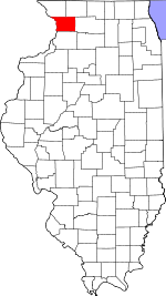
Carroll County, Illinois Basics:
Carroll County Illinois - Government Site
Population: 15,047
Area: 445 square miles
County seat: Mount Carroll
Area code(s) in use: 815
Time zone: CST
High school graduate or higher: 89.6%
Bachelor's degree or higher: 15.8%
Median household income: $48,456
Persons in poverty: 12.5%
Home ownership rate: 76.1%
Mean travel time to work: 24.6 minutes
Adjacent counties:
Clinton (IA) Jackson (IA) Jo Daviess Ogle Stephenson Whiteside
Places in Carroll County, Illinois
Block Airport,
Foxfield Aerodrome,
Kenneth Moll Airport,
Savanna City Hospital Heliport,
Swan Valley Farm Airport,
Tautz Airport,
Tri-Township Airport,
Williard Nycum RLA Airport Kennedy Bar Savanna Bay Santa Fe Beach Johnson Bridge,
Olin Bridge,
Savanna-Sabula Bridge,
Weidenhamer Bridge Chadwick Fire Protection District,
Lanark Fire Protection District,
Milledgeville Fire Protection District,
Mount Carroll Ambulance,
Mount Carroll Fire Protection District,
Savanna Army Depot Activity Fire Station,
Savanna Community Ambulance Association,
Savanna Fire Department,
Savanna Township Public Library,
Shannon Ambulance Service,
Shannon City Hall,
Shannon Fire Protection District,
Thomson Correctional Center,
Thomson Fire Protection District Adams-Daggert Cemetery, Apple River Cemetery,
Argo Cemetery,
Arnolds Grove Cemetery,
Arnolds Grove Dunkard Cemetery, Bashaw Family, Bayles Cemetery, Beryer Cemetery,
Bethel Cemetery,
Black Oak Lutheran Cemetery,
Brethren Cemetery, Brethren in Christ Cemetery, Brick Church Cemetery,
Brookville Lutheran Cemetery, Catholic Cemetery, Cemetery Hill Cemetery,
Center Hill Cemetery,
Chadwick Methodist Cemetery, Chamber Cemetery,
Cherry Grove Brethern Cemetery, Dunshee Cemetery,
Dutchtown Brethern Cemetery, Eagle Point Cemetery,
Fairhaven Cemetery, Free Family Cemetery, Georgetown Cemetery, Hardin Cemetery, Hazel Green Cemetery, Henderson Family Cemetery,
Hope Brethern Cemetery Cemetery, Jacobstown Cemetery,
Lanark City Cemetery,
Lower York Cemetery, Luthern Cemetery,
Mosquito Hill Cemetery, Mount Carroll Cemetery,
Oak Hill Cemetery,
Oakville Cemetery, Page Family Cemetery, Protestant Cemetery,
Renner Cemetery, Rock Creek Cemetery,
Saint Johns Cemetery,
Saint Wendelin Cemetery,
Savanna Cemetery,
Schriner Cemetery,
Shell Cemetery,
South Elkhorn Methodist Cemetery,
Spring Valley Cemetery, Stein Family Cemetery, Thomson Cemetery,
Trinity Evangelical Lutheran Cemetery,
Union Cemetery,
Wacker Cemetery,
Wolf Cemetery,
Woodland Brethren Cemetery, York Cemetery,
Zion Cemetery Assembly of God Church,
Bethel United Methodist Church,
Black Oak Church,
Calvary Baptist Church,
Cherry Grove Church of the Brethren,
Church of the Brethren,
Community United Church of Christ,
Dutchtown Church,
Faith Reformed Church,
First Baptist Church,
First Lutheran Church,
First Presbyterian Church,
First United Methodist Church,
Hope United Methodist Church,
Lanark United Methodist Church,
Middle Creek Church (historical),
Milledgeville Brethren Church,
Mount Carroll United Methodist Church,
New Unity Church,
Oak Park Bible Church,
Reorganized Church of Jesus Christ of Latter Day Saints,
Saint John the Baptist Catholic Church,
Saint Mathews Church,
Saint Pauls Episcopal Church,
Saint Peters Evangelical Lutheran Church,
Saint Wendelins Catholic Church,
Shannon Baptist Church,
Trinity Lutheran Church,
Trinity Lutheran Church,
Trinity Lutheran Church,
Union Church (historical),
Woodland Church,
York Church Lake Carroll Dam,
Timber Lake Dam Brickhouse Slough Apple River Island,
Dixie Islands,
Island 266,
Island Number 256,
Mound Island,
Santa Fe Island,
Savanna Islands,
Sweeney Islands,
Woodruffs Island Bowens Lake,
Buffalo Lake,
Cheek Slough,
Dysons Lake (historical),
Edick Lake,
Horseshoe Lake,
Lundy Lake,
Misquakee Lake,
Spring Lake Arnold Landing,
Carroll County Farm (historical),
Clifton School (historical),
Milledgeville Farmers Elevator,
NYA Camp,
Palisades Country Club Brookville Quarry,
Eller Quarry,
Haas Quarry,
Lawrence Quarry,
Mount Carroll Quarry,
Sturtz Quarry Ayers Sand Prairie State Nature Preserve,
Brookville Lutheran Cemetery Prairie Nature Preserve,
Maquette Park,
Mississippi Palisades State Park,
Mount Carroll Historic District,
Old Mill Park,
Sentinel Nature Preserve Argo Fay,
Arnold,
Ashdale Junction,
Ayers,
Blackhawk,
Burke,
Center Hill,
Chadwick,
Daggett (historical),
Ebner,
Elkhorn Grove,
Fair Haven,
Georgetown,
Hazelhurst,
Hickory Grove,
Hitt,
Ideal,
Kittredge,
Lanark,
Marcus,
Milledgeville,
Mount Carroll,
Polsgrove,
Savanna,
Shannon,
South Elkhorn,
Thomson,
Wacker,
Zier Cors Johnsons Creek Post Office (historical),
Lanark Post Office,
Milledgeville Post Office,
Mount Carroll Post Office,
Rock Creek Post Office (historical),
Thomson Post Office Lake Carroll,
Timber Lake Arnold Grove School (historical),
Arnold School (historical),
Avenue School (historical),
Center School (historical),
Chadwick Junior High School,
Chambers Grove School (historical),
Chambers School (historical),
Chestnut Park School (historical),
Cloverdale School (historical),
Cowen School (historical),
Daggett School (historical),
Dimon School (historical),
Dyslin Valley School,
Eastland High School,
Eastland Junior High School,
Eastwood School (historical),
Emerson School (historical),
Evergreen School (historical),
Excelsior School (historical),
Fair Haven Center School (historical),
Fairground School (historical),
Fairview School (historical),
Ferrin School (historical),
Fox School (historical),
Freedom School (historical),
Gillispie School (historical),
Good School (historical),
Grissinger School (historical),
Hartman School (historical),
Hazel Green School (historical),
Hickory Grove School (historical),
Hitt School (historical),
Honberger School (historical),
Jackson School (historical),
Jefferson School (historical),
Kingery School (historical),
Libertyville School (historical),
Lincoln Elementary School,
Locust Grove School (historical),
Lost Creek School (historical),
Maple Grove School (historical),
Milledgeville Elementary School,
Miller School (historical),
Mission Ridge School (historical),
Mosquito Hill School (historical),
Mount Carroll High School,
Mount Union School (historical),
North Otter Creek School (historical),
Oak Grove School (historical),
Oak Grove School (historical),
Oakton School (historical),
Oakville School (historical),
Olive School (historical),
Otter Creek School (historical),
Paynter School (historical),
Pleasant Hill School (historical),
Pleasant Hill School (historical),
Pleasant View School (historical),
Plum Grove School (historical),
Preston Prairie School (historical),
Reede School (historical),
Renner School (historical),
Rogers School (historical),
Rowland School (historical),
Sage School (historical),
Sandridge School (historical),
Savanna High School,
Shriner School (historical),
Slick School (historical),
Spring Valley School (historical),
Star School (historical),
Stewart School (historical),
Straw School (historical),
Thomson High School,
Union School (historical),
Vinegar Hill School (historical),
Walker School (historical),
Washington School (historical),
Wood School (historical),
Woodland School (historical),
York School (historical),
Zion School (historical) Apple River,
Camp Creek,
Carroll Creek,
Eagle Creek,
East Fork Creek,
East Johnson Creek,
East Plum River,
Goose Creek,
Hickory Slough,
Middle Creek,
Otter Creek,
Plum River,
Rush Creek,
Sand Creek,
Savanna Slough,
Straddle Creek WCCI-FM (Savanna) Dyslin Valley,
Skunk Hollow,

