Lee County, Illinois Basics:


Lee County Illinois - Government Site

Population: 35,132
Area: 725 square miles
County seat: Dixon
Area code(s) in use: 815
Time zone: CST
High school graduate or higher: 86.2%
Bachelor's degree or higher: 14.9%
Median household income: $50,342
Persons in poverty: 10.0%
Home ownership rate: 74.5%
Mean travel time to work: 22.7 minutes

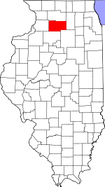
Adjacent counties:
Bureau  Dekalb  La Salle  Ogle  Whiteside  

Find in Illinois

Map of the Lee County area


Our detail map of Lee County shows the Lee County, Illinois boundary lines and other interesting items.

Places in Lee County, Illinois

  Airports     show all on map

Albrecht Airport, Bally's Strip Airport, Bernardin Heliport, Bernardin Landing Strip, Bresson Airport, Butler Hill RLA Airport, Collins Airstrip, Delhotal Airport, Dixon Municipal Airport-Charles R. Walgreen Field, Dunn Airport, Earl Barnickel Airport, Gearhart-Hollow Heliport, Gehant Airport, Gittleson Farms Airport, Hep Cats Airport, Home Free Airport, Illinois Copter Service Heliport, Ioder Landing Strip, J and W Ultralight Airport, Katherine Shaw Bethea Hospital Heliport, Leffelman Airport, Miller Airport, Ranken Airport, Rapp Landing Strip, Rasmussen Landing Strip, Rogers Brothers Landing Strip, Staton Airport, Swords Heliport, Taylor Airport, Thompson Landing Strip, W Davis Airport, Walders Farm Airport, Winterton Airport

  Bridges     show all on map

Mondays Bridge, Sundays Bridge

  Buildings     show all on map

Advance Emergency Medical Services of Dixon, Amboy City Hall, Amboy Fire Protection District, Ashton Fire Protection District, Compton Fire Department, Dixon City Fire Department, Dixon City Hall, Dixon Correctional Center, Dixon Public Library, Dixon Rural Fire Protection District Station 1, Dixon Rural Fire Protection District Station 2 Nachusa, Franklin Grove Fire Department, Franklin Grove Public Library, Harmon Fire Department, Lee County Courthouse, Loveland Community House, Mabley Developmental Center, Ogle - Lee Fire Protection District Steward Fire Department, Pankhurst Memorial Library, Paw Paw Fire Protection District, Sublette Fire Department, West Brooklyn Fire Department

  Canals     show all on map

Coon Creek Ditch, Five Mile Branch Ditch, Main Ditch, Red Oak Ditch

  Cemeteries     show all on map

Ashton Cemetery, Baird-Pumphrey Cemetery, Binghampton Cemetery, Bradford Cemetery, Brooklyn Cemetery, Brooklyn Lutheran Cemetery, Burket Cemetery, Centenary Cemetery, Chapel Hill Cemetery, Cottage Hill Cemetery, Degner Farm Cemetery, Dewolf Cemetery, Dixon State School Cemetery, Ellsworth Cemetery, Emanuel Cemetery, Emmert Cemetery, Fisk Cemetery, Franklin Grove Cemetery, Gap Grove Cemetery, Gehant Farm Cemetery, German Cemetery, Girton Cemetery, Greenwood Cemetery, Harding Cemetery, Holy Cross Catholic Cemetery, Inlet Cemetery, Lee County Poor Farm Cemetery, Mormon Cemetery, Mount Union Cemetery, Nelson Cemetery, Norwegian Lutheran Cemetery, Oakwood Cemetery, Peterson Cemetery, Pine Grove Cemetery, Prairie Repose Cemetery, Prairieville Cemetery, Reynolds Cemetery, Rock Ridge Cemetery, Saint Mary's Cemetery, Saint Mary's Cemetery, Saint Mary's Cemetery, Saint Marys Cemetery, Saint Patrick's Cemetery, Saint Patrick's Cemetery, Samuel Cobb Cemetery, Sandy Hill Cemetery, South Paw Paw Cemetery, Stevens Cemetery, Steward Cemetery, Sugar Grove Cemetery, Temperance Hill Cemetery, Theiss Cemetery, Twin Grove Cemetery, Union Cemetery, Union Cemetery, West Burying Ground, Williams Cemetery, Woodside Cemetery, Wyoming Cemetery

  Churches     show all on map

Ashton Bible Church, Ashton Church, Church of God Abrahamic Faith, Church of the Brethren, Church of the Nazarene, Community Church, Compton United Methodist Church, First Baptist Church, First Baptist Church, First Baptist Church, First Christian Church, First Church of the Open Bible, First Presbyterian Church, First Presbyterian Church, First Presbyterian Church, First United Methodist Church, Foursquare Gospel Church, Harmon United Methodist Church, Immanuel Lutheran Church, Immanuel Lutheran Church, Northside Church, Our Lady of Perpetual Help Church, Paw Paw Bible Church, Paw Paw United Methodist Church, Reynolds Church, Saint Flannen Catholic Church, Saint James Church, Saint Johns Lutheran Church, Saint Lukes Episcopal Church, Saint Mary's Church, Saint Marys Church (historical), Saint Patricks Catholic Church, Saint Patricks Church, Saint Paul Lutheran Church, Saint Pauls Lutheran Church, Second Baptist Church, Sublette Union Church, Sugar Grove Church, Theiss Church, Union Church, United First Church

  Crossings     show all on map

Interchange 82, Interchange 87, Interchange 93

  Dams     show all on map

Bass Lake Dam, Rock River Dam, Stroyan Lake Dam, Woodhaven Lake Dam

  Hospitals     show all on map

Katherine Shaw Bethea Hospital

  Lakes     show all on map

Lake Sunset, Leake Lake, Lyon Lakes, Mallard Pond

  Locales     show all on map

Ackland Farm, B and B Farms, Bonanza Creek Farm, Bonnell Farms, Borell Farms, Camp H C Warner, Camp Joy Bible Camp, Carnahan Station (historical), Colwell Farms, Connell Farm, Dixon Airport Industrial Park, Dixon Country Club, Gilmore Farms, Harrison Hog Farms, Hart Farms, Heng Farm, Jonesville School (historical), Journeysend Farm, Kessel Farms, Lee County 4-H Center, Lee County Farm (historical), Lee County Landfill, M and R Farms, Meusel Farms, Midway Drive-In, Olson Farms, Plaza North Shopping Center, Plum Hollow Golf Course (historical), Red Brick Road Farm, Rhodenbaugh Farm, Rock River Bible Camp, Sandy Knoll Farms, Schaver Farms, Setchell Farms, Sundial Farms, Svela Farms, Zimmerman Farms

  Military     show all on map

Green River Ordnance Plant (historical)

  Mines     show all on map

Amboy Quarry, Dixon Quarry, Gerdes Quarry, Inlet Quarry, Propheter Quarry, Stoneridge Quarry

  Parks     show all on map

Atlasta Park, Ballou Park, Bartlett Woods Nature Preserve, Borden Field, Dement Park, E C Smith Park, Foley Sand Prairie Nature Preserve, Franklin Creek Nature Preserve, Franklin Creek State Park, Grace K Johnson Park, Green River State Wildlife Management Area, Haymarket Square, Hennepin Canal Parkway State Park, Howell Park, John C Roe Park, John Dixon Park, Kiwanis Park, Lowell Park, Mathesius Park, Meadows Park, Memorial Pool, Mill Springs Day Use Area, Page Park, Reagan Boyhood Home, Reynolds Field, Ronald Reagan Boyhood Home National Historic Site, Temperance Hill Cemetery Prairie Nature Preserve, Vaile Park, Washington Field

  Populated Places     show all on map

Amboy, Ashton, Binghampton, Compton, Dixon, East Paw Paw, Eldena, Franklin Grove, Harmon, Henkel, Inlet, Kingdom, Lee, Lee Center, Lincoln Heights, Maytown, Melugin Grove (historical), Nachusa, Nelson, Palmyra, Paw Paw, Prairieville, Radley, Roxbury, Scarboro, Shaws, Shelburn (historical), South Paw Paw, Steward, Sublette, The Burg, Twelvemile Corner, Van Petten, Walton, Welland, West Brooklyn, Woodland Shores

  Post Offices     show all on map

Amboy Post Office, Dixon Post Office, Franklin Grove Post Office, Lee Center Post Office, Shaw Post Office (historical), Winooski Post Office (historical)

  Reservoirs     show all on map

Bass Lake, Black Oak Lake, Rock River, Stroyan Lake, Woodhaven Lake

  Schools     show all on map

Amboy Central Elementary School, Amboy High School, Amboy Junior High School, Armstrong School (historical), Ashton Elementary School, Ashton High School, Bend School (historical), Briton School (historical), Burket School (historical), Carbough School (historical), Chapel School (historical), Collins Dysant School (historical), Cook School (historical), Cottage Hill School (historical), Cyclone School (historical), Daven School (historical), Dixon High School, Downey School (historical), Duis School (historical), Eldena School (historical), Emmert School (historical), Franklin Center Elementary School, Franklin Center High School, Garrison School (historical), Graves School (historical), Green School (historical), Grimes School (historical), Harck School (historical), Hart School (historical), Hausen School (historical), Hazelwood School (historical), Hillhouse School (historical), Hillson School (historical), Hollister School (historical), Howlett School (historical), Jefferson Elementary School, Kelley School (historical), Kimbal School (historical), Kings School (historical), Lake School (historical), Lee County Special Education School, Lievan School (historical), Lincoln Elementary School, Lyon School (historical), Manion School (historical), Meckell School (historical), Merchant School (historical), Moffett School (historical), Mong School (historical), Morrissey School (historical), Mound School (historical), Nelson Elementary School, O'Neill School (historical), Oak Forest School (historical), Palmer School (historical), Paw Paw Elementary School, Paw Paw Junior-Senior High School, Peterson School (historical), Pope School (historical), Prestegard School (historical), Preston School (historical), Red Birch School (historical), Ronald W Reagan Middle School, Saint Anne School, Saint Marys Elementary School, Samuel Dysant School (historical), Sanders School (historical), Sauk Valley Community College, South Central School (historical), Spencer School (historical), Steward Elementary School, Stott School (historical), Sunday School (historical), Temperance Hill School (historical), Thorpe School (historical), Union School (historical), Vallem School (historical), Van Campen School (historical), Wagner School (historical), Walker School (historical), Washington Elementary School, Webber School (historical), Weiner School (historical), White Temple School (historical), Whiteoak School (historical), Wildcat School (historical), Will School (historical), Wolverine School (historical)

  Streams     show all on map

Chamberlain Creek, Dry Run, Fivemile Branch, Franklin Creek, Grubin Ditch, Johns Creek, Johns Creek South, Johns Creek Tributary, Plum Creek, Reid Creek, Sevenmile Branch, Steward Creek, Sullivan Lateral, Willow Creek, Willow Creek

  Towers     show all on map

WIXN-AM (Dixon), WIXN-FM (Dixon), WLLT-FM (Polo)

  Woods     show all on map

Gap Grove (historical), Inlet Grove, Knoxe Grove, Little Malugin Grove, Malugin Grove, Twin Grove,

Lee County, Illinois Population By Race (2012 estimate)

RacePopulation
WhiteLee County White population 32,46232,461  
BlackLee County Black population 1,8271,826
MixedLee County Mixed population 422421
AsianLee County Asian population 316316
American IndianLee County American Indian population 105105
Hawaiian & Pacific IslanderLee County Hawaiian & Pacific Islander population 00

Additional population tables :
State population table
Illinois population by county