Stark County, Illinois Basics:


Stark County Illinois - Government Site

Population: 5,948
Area: 288 square miles
County seat: Toulon
Area code(s) in use: 309
Time zone: CST
High school graduate or higher: 88.6%
Bachelor's degree or higher: 15.8%
Median household income: $51,392
Persons in poverty: 12.1%
Home ownership rate: 80.4%
Mean travel time to work: 26.9 minutes

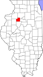
Adjacent counties:
Bureau  Henry  Knox  Marshall  Peoria  

Find in Illinois

Map of the Stark County area


Our detail map of Stark County shows the Stark County, Illinois boundary lines and other interesting items.

Places in Stark County, Illinois

  Airports     show all on map

Breezy Point Landing Strip, Hausmann Airport, Jackson Field Airport, Nelson Airport, Phils Airstrip (historical), Webster Heliport, Wyoming Airport

  Bridges     show all on map

Slackwater Bridge

  Buildings     show all on map

Bradford Community Fire Protection District, Bradford Rescue Squad, Lafayette Fire Department, Speer Volunteer Fire Department, Stark County Ambulance Service, Stark County Courthouse, Toulon Fire Protection District, Toulon Public Library, Wyoming Ambulance Service, Wyoming Community Fire Protection District

  Cemeteries     show all on map

Bradford Cemetery, Champion-Drawyer Cemetery, County Farm Cemetery, Eagleston Cemetery, Elmira Cemetery, Fox Cemetery, Glendale Cemetery, Grant Cemetery, Hall Cemetery, Himes Cemetery, LaFayette Cemetery, Mawbey Cemetery, McClenahan Cemetery, Osceola Cemetery, Osceola Grove Cemetery, Pleasant Valley Cemetery, Saint Dominic Cemetery, Saint John Cemetery, Schiebel Cemetery, Sheets Cemetery, Shockley Cemetery, Smith Cemetery, Snareville Cemetery, Starwano Cemetery, Stringtown Cemetery, Toulon Cemetery, West Jersey Methodist Churchyard, Wyoming Cemetery

  Churches     show all on map

Apostolic Christian Church, Elmira United Presbyterian Church, Faith Baptist Church, First Baptist Church, First Baptist Church, First Congregational Church, First Congregational United Church of Christ, Saint Dominic Church, Saint John the Baptist Church, Saint Timothy Lutheran Church, Toulon United Methodist Church, Wyoming First Baptist Church, Wyoming Methodist Church

  Dams     show all on map

Allendale Conservation Club Lake Dam, Kepler Lake Dam, Marsh Lake Dam

  Locales     show all on map

Morgan - Richey Jersey Farm, Osceola Center, Tanner's Orchard

  Parks     show all on map

Hodges Park

  Populated Places     show all on map

Bradford, Castleton, Duncan, Elmira, Lafayette, Lombardville, Modena, Morse, Osceola, Slackwater (historical), Speer, Stark, Toulon, Waldron (historical), West Jersey, Wyoming

  Post Offices     show all on map

Castleton Post Office, Pleasant Green Post Office (historical), Speer Post Office, Wyoming Post Office

  Reservoirs     show all on map

Allendale Conservation Club Lake, Kepler Lake, Marsh Lake

  Schools     show all on map

Baughn School (historical), Bradford Grade School, Bradford High School, Bumble Bee School (historical), Centennial School (historical), Colgan School (historical), Cox School (historical), Dewey School (historical), Emerson School (historical), Essex Grove School (historical), Foxx School (historical), Fredonia School (historical), Goshen School (historical), Grant School (historical), Hamilton School (historical), Harty School (historical), Hickory Grove School (historical), Himes School (historical), Holmes School (historical), Jack Creek School (historical), Jefferson School (historical), Jug Run School (historical), Lawndale School (historical), Liberty School (historical), Lincoln School (historical), Locust Grove School (historical), Logan School (historical), Longfellow School (historical), Lowell School (historical), Maxfield School (historical), Mound School (historical), Nicholson School (historical), North Star School (historical), Ogle School (historical), Osceola Grove School (historical), Pleasant Drink School (historical), Pleasant Hill School (historical), Pleasant Mound School (historical), Pleasant View School (historical), Quinn School (historical), Rist School (historical), Schiebel School (historical), Sheridan School (historical), Snareville School (historical), Stark County High School, Stark County Junior High School, Stark School (historical), Stringtown School (historical), Toulon Public School (historical), Toulon-Lafayette Grade School, Valley Center School (historical), Valley Grove School (historical), Valley School, Vinegar Hill School (historical), Winans School (historical), Winn School (historical), Wyoming Grade School

  Streams     show all on map

Camp Creek, Camp Run, Coopers Defeat Creek, East Fork Spoon River, Fox Creek, Indian Creek, Jack Creek, Jug Run, Mason Creek, Mud Run, Prince Run, Walnut Creek,

Stark County, Illinois Population By Race (2012 estimate)

RacePopulation
WhiteStark County White population 5,8175,817  
MixedStark County Mixed population 5453
AsianStark County Asian population 3029
American IndianStark County American Indian population 1211
Hawaiian & Pacific IslanderStark County Hawaiian & Pacific Islander population 00

Additional population tables :
State population table
Illinois population by county