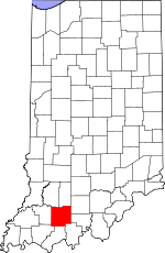
Dubois County, Indiana Basics:


Dubois County Indiana - Government Site

Population: 42,137
Area: 427 square miles
County seat: Jasper
Area code(s) in use: 812
Time zone: EST
High school graduate or higher: 86.2%
Bachelor's degree or higher: 19.5%
Median household income: $54,168
Persons in poverty: 7.9%
Home ownership rate: 77.6%
Mean travel time to work: 19.4 minutes


Adjacent counties:
Crawford  Daviess  Martin  Orange  Perry  Pike  Spencer  Warrick  

Find in Indiana

Map of the Dubois County area


Our detail map of Dubois County shows the Dubois County, Indiana boundary lines and other interesting items.

Places in Dubois County, Indiana

  Airports     show all on map

Buchta Airport, Huntingburg Airport

  Bars     show all on map

Buck Shoals

  Bends     show all on map

Duck Pond Bottom

  Bridges     show all on map

Coon Seitz Bridge, Crystal Station Bridge, John Seitz Bridge, Kessner Bridge

  Buildings     show all on map

Birdseye Fire Station, Celestine Volunteer Fire Department, Dubois Volunteer Fire Department, Ferdinand Volunteer Fire Department Station 1, Ferdinand Volunteer Fire Department Station 2, Haysville Volunteer Fire Department, Holland Volunteer Fire Department, Huntingburg Fire Department, Huntingburg Fire Department Station 2, Jasper Volunteer Fire Department Station 1, Jasper Volunteer Fire Department Station 2, Jasper Volunteer Fire Department Station 3, Madison Township Volunteer Fire Department, Saint Anthony Fire Department, Saint Henry Volunteer Fire Department, Schnellville Volunteer Fire Department

  Canals     show all on map

County Ditch, High Ditch, Long Ditch, Whetten Ditch

  Cemeteries     show all on map

Adkins Cemetery, Alexander Cemetery, Armstrong Cemetery, Augustana Cemetery, Bailey Cemetery, Bethel Cemetery, Bretzville Cemetery, Burton Cemetery, Cavender Cemetery, Central Cemetery, Chattin Cemetery, Cooper Cemetery, Cox Cemetery, Dillin Cemetery, Dungan Cemetery, Evans Cemetery, Ewing Cemetery, Fairmount Cemetery, Garland Cemetery, Gwin Cemetery, Hagen Cemetery, Harbison Cemetery, Hardin Cemetery, Hobbs Cemetery, Hope Cemetery, Main Cemetery, Mayo Cemetery, McKee Ditch, Mount Vernon Cemetery, Mount Zion Cemetery, Mount Zion Cemetery, Mount Zion Cemetery, Payne Cemetery, Reed Cemetery, Robinson Cemetery, Saint James Cemetery, Saint Paul United Church of Christ Cemetery, Sherritt Cemetery, Spencer Cemetery, Taylor Cemetery, Waddle Cemetery, Wilhoit Cemetery, Wininger Cemetery

  Census     show all on map

Dubois Census Designated Place

  Churches     show all on map

Anderson Valley Church, Birdseye Christian Church, Hickory Grove Church, Lemmon Church, Maple Grove Church, Nicholson Valley Church, Saint Joe Church, Saint Johns Church, Saint Johns Church, Saint Peters Church, Saint Raphaels Church, Shiloh Church

  Dams     show all on map

Beaver Creek Lake Dam, Birk Lake Dam, Briedenbaugh Lake Dam, Calumet Lake Dam, Carmichael Lake Dam, Celestine Community Club Lake Dam, Deerwood Lake Dam, Felmont Oil Company Dam, Ferdinand Forest Dam, Ferdinand Old Lake Dam, Ferdinand Water Supply Reservoir Dam, Habig Lake Dam, Holland Old Water Supply Dam Number 1, Huntingburg City Lake Dam, Huntingburg Conservation Club Dam, Idle Hour Lake Dam, Izaak Walton Lakes Dam, Jasper Lake Dam, Larry Hopf Lake Dam, Lottes Lake Dam, Olinger Lake Dam, Patoka Lake Dam, Ruxer Lake Dam, Saint Anthony Conservation Club Dam, Saint Anthony School Lake Dam, Schnellville Conservation Lake Dam

  Flats     show all on map

Buffalo Flat

  Hospitals     show all on map

Memorial Hospital and Health Care Center, Saint Josephs Hospital

  Lakes     show all on map

Camp Ground Lake, Knebel Lake

  Locales     show all on map

Duff Conservation Club

  Mines     show all on map

Huntingburg Pit

  Parks     show all on map

Armory Park, Camp Carnes, Lick Fork State Recreation Area, Maple Grove Camp

  Populated Places     show all on map

Birdseye, Bretzville, Celestine, Crystal, Cuzco, Dubois, Dubois Crossroads, Duff, Ellsworth, Ferdinand, Haysville, Hillham, Holland, Huntingburg, Ireland, Jasper, Johnsburg, Kellerville, Kyana, Maltersville, Mentor, Millersport, Portersville, Saint Anthony, Saint Henry, Saint Marks, Schnellville, Thales

  Post Offices     show all on map

Birdseye Post Office, Ditney Hill Post Office (historical), Ludlow Post Office (historical)

  Ranges     show all on map

Harbison Hills

  Reservoirs     show all on map

Beaver Creek Lake, Birk Lake, Briedenbaugh Lake, Calumet Lake, Carmichael Lake, Celestine Community Club Lake, Deerwood Lake, Dubois Community Club Lake, Felmont Oil Company Reservoir, Ferdinand Old Lake, Ferdinand State Forest Lake, Ferdinand Water Supply Reservoir, Habig Lake, Holiday Lake, Holland Lake, Huntingburg Conservation Club Lake, Huntingburg Lake, Idle Hour Lake, Ireland Lake, Izaak Walton Lake, Izaak Walton Lakes, Jasper Lake, Lake William, Larry Hopf Lake, Lottes Lake, McMurtrie Lake, Olinger Lake, Ruxer Lake, Saint Anthony Conservation Club Lake, Saint Anthony Conservation Lake, Saint Anthony School Lake, Schnellville Lake

  Ridges     show all on map

Coal Mine Ridge, Devils Backbone, Lost Ridge, Persimmon Ridge

  Schools     show all on map

Bender School, Celestine Elementary School, Convent of the Immaculate Conception, Crestview Elementary School, Ferdinand Consolidated School, Forest Park High School, Haysville Elementary School, Holland Elementary School, Huntingburg Middle School, Ireland Elementary School, Maple Park Elementary School, Northeast Dubois High School, Sacred Heart School, Saint Anthony School, Saint Joseph School, Southern Indiana Purdue Agriculture Center, Southridge High School

  Streams     show all on map

Ackerman Branch, Alexander Run, Altar Creek, Bailey Creek, Bauer Creek, Beaver Creek, Birch Creek, Bison Branch, Buffalo Stream, Calf Branch, Calumet Run, Cavender Run, Cline Brook, Coon Run, Cooper Run, Crooked Creek, Cross Drain, Dick Creek, Ditch Branch, East Fork Mill Creek, Ell Creek, Evans Brook, Fish Run, Flat Creek, Friday Branch, Grassy Fork, Green Creek, Grist Run, Hall Creek, Haysville Run, Hole Run, Holey Run, Hope Drain, Indian Creek, Ire Run, Ireland Brook, Jahn Creek, Jasper Brook, Jasper Drain, Lick Fork, Little Creek, Little Flat Creek, Mill Creek, Mud Branch, Mudhole Branch, Near Brook, Pale Run, Part Brook, Pat Run, Pinnick Creek, Plain Drain, Polson Creek, Portersville Drain, Riceville Creek, Richland Creek, Ritter Creek, Riz Run, Rizzley Creek, Sherritt Drain, Shiloh Drain, Shoal Run, Short Creek, Straight River, Sugar Creek, Taylor Hollow, Teder Creek, Waddle Brook, Water Drain, Water Run, Wolfe Creek

  Summits     show all on map

Goss Hill

  Swamps     show all on map

Big Bottom

  Towers     show all on map

WITZ-AM (Jasper), WITZ-FM (Jasper), WNAS-FM (New Albany)

  Valleys     show all on map

White Hollow,

Dubois County, Indiana Population By Race (2012 estimate)

RacePopulation
WhiteDubois County White population 41,29441,294  
MixedDubois County Mixed population 253252
AsianDubois County Asian population 211210
American IndianDubois County American Indian population 126126
Hawaiian & Pacific IslanderDubois County Hawaiian & Pacific Islander population 4242

Additional population tables :
State population table
Indiana population by county