Huntington County, Indiana Basics:


Huntington County Indiana - Government Site

Population: 36,977
Area: 383 square miles
County seat: Huntington
Area code(s) in use: 260
Time zone: EST
High school graduate or higher: 88.2%
Bachelor's degree or higher: 15.9%
Median household income: $46,538
Persons in poverty: 11.4%
Home ownership rate: 76.9%
Mean travel time to work: 21.0 minutes

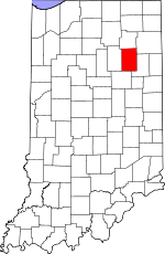
Adjacent counties:
Allen  Grant  Wabash  Wells  Whitley  

Find in Indiana

Map of the Huntington County area


Our detail map of Huntington County shows the Huntington County, Indiana boundary lines and other interesting items.

Places in Huntington County, Indiana

  Airports     show all on map

Beck Private Airport, Bowlin Airport, Fisher Farm Airport, Huntington Municipal Airport, Johnson Airport, Kilsoquah Farm Airport, The Wolf Den Airport

  Bends     show all on map

Heineys Bend

  Buildings     show all on map

Andrews - Dallas Township Volunteer Fire Department, Bippus Fire Department, Dallas Township Volunteer Fire Department, Huntington City Fire Department, Huntington City Fire Department Station 1, Huntington City Fire Department Station 2, Huntington City Fire Department Station 3, Huntington County Rescue, Markle Volunteer Fire and Rescue, Mount Etna Volunteer Fire Department Station 1, Mount Etna Volunteer Fire Department Station 2, Norwood Health and Rehabilitation Center, Parkview Hospital Emergency Medical Services, Roanoke Volunteer Fire Department, Warren Salamonie Township Volunteer Fire Department, Wells County Emergency Medical Services - Markle Station

  Canals     show all on map

Beaty Ditch, Beck Ditch, Brown Ditch, Carroll Ditch, Deemer Ditch, Detamore Ditch, Dolby Ditch, Elkenberry Ditch, Ellis Ditch, Fahl Ditch, Hoover Ditch, Lucky Ditch, McPherren Ditch, Myers Ditch, North Beck Ditch, Palmer Ditch, Smith Limer Ditch, Stevens Ditch, Verdrick Ditch, Wearley Ditch

  Cemeteries     show all on map

Barnes Cemetery, Feighner Cemetery, France Cemetery, Funk Cemetery, Gardens of Memory, German Settlement Cemetery, Loon Creek Cemetery, Maple Grove Cemetery, Monument City Memorial Cemetery, Mount Calvary Cemetery, Mount Hope Cemetery, Pilgrims Rest Cemetery, Pleasant Grove Cemetery, Purviance Cemetery, Redmen Cemetery, Rees Cemetery, Riverside Cemetery, Saint Johns Cemetery, Star of Hope Cemetery, Taylor Cemetery, Thompson Cemetery, Union Cemetery, West Union Cemetery, Woodlawn Cemetery, Yankeetown Cemetery

  Churches     show all on map

Bethesda Church, Buckeye Church, Clear Creek Church, Clear Creek Church, College Park Church, Jefferson Center Church, Jennings Chapel, Mount Etna Church, Pilcher Chapel, Pleasant Chapel, Pleasant Grove Church, Plummer Church, Saint Felix Friary, Saint Pauls Church, Saint Peters Church, Salamonie Church, Salem Church, Union Church, Wabash Church, Wesleyan Church, Zion Church

  Dams     show all on map

Huntington College Lake Dam, Huntington Lake Dam, Timber Lake Dam

  Hospitals     show all on map

Parkview Huntington Hospital

  Islands     show all on map

Monument Island

  Lakes     show all on map

Big Blue Lake, Clair Lake

  Locales     show all on map

Huntington Drive-In, Worster Farms

  Mines     show all on map

H and W Sand and Gravel Pit, Huntington Quarry

  Parks     show all on map

Arrowhead Fishing Site, Hier Park, Kil-So-Quah State Recreation Area, Kriegbaum Field, Laurie Park, Little Turtle State Recreation Area, Markle State Recreation Area, Memorial Park, Mount Etna State Recreation Area, Tower Park

  Populated Places     show all on map

Andrews, Banquo, Bippus, Bowerstown, Bracken, Browns Corner, Buckeye, Goblesville, Harlansburg, Huntington, Lancaster, Mahon, Majenica, Makin, Mardenis, Markle, Milo, Mount Etna, Pleasant Plain, Plum Tree, River, Roanoke, Roanoke Station, Rock Creek Center, Simpson, Warren

  Reservoirs     show all on map

Huntington College Lake, Huntington Lake, Salamonie Lake, Timber Lake

  Schools     show all on map

Andrews Elementary School, Crestview Junior High School, Horace Mann Elementary School, Huntington College, Huntington North High School, Lincoln Elementary School, Northwest Elementary School, Riley School, Roanoke Elementary School, Saint Mary School, Saint Peter Lutheran School, Salamonie School, The Village School, Victory Training Institute

  Streams     show all on map

Aboite Creek, Brook Creek, Bull Creek, Cow Creek, Flint Creek, Little Majenica Creek, Loon Creek, Majenica Creek, Mud Creek, Nieman Creek, Pond Creek, Prairie Creek, Rabbit Run, Richland Creek, Tah Kum Wah Creek, Weasel Creek

  Towers     show all on map

WHLT-AM (Huntington), WVSH-FM (Huntington),

Huntington County, Indiana Population By Race (2012 estimate)

RacePopulation
WhiteHuntington County White population 36,09036,089  
MixedHuntington County Mixed population 370369
American IndianHuntington County American Indian population 185184
BlackHuntington County Black population 148147
Hawaiian & Pacific IslanderHuntington County Hawaiian & Pacific Islander population 3736

Additional population tables :
State population table
Indiana population by county