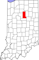
Miami County, Indiana Basics:


Miami County Indiana - Government Site

Population: 36,480
Area: 374 square miles
County seat: Peru
Area code(s) in use: 765 574
Time zone: EST
High school graduate or higher: 82.9%
Bachelor's degree or higher: 9.9%
Median household income: $39,816
Persons in poverty: 18.2%
Home ownership rate: 75.3%
Mean travel time to work: 23.0 minutes


Adjacent counties:
Cass  Fulton  Grant  Howard  Kosciusko  Wabash  

Find in Indiana

Map of the Miami County area


Our detail map of Miami County shows the Miami County, Indiana boundary lines and other interesting items.

Places in Miami County, Indiana

  Airports     show all on map

Benner Field, Caldwell Field Airport, Converse Airport, Goodenough Airport, Grissom Air Reserve Base, Miller Strip Airport, Peru Municipal Airport, Robison Airport, Rush Strip Airport, Shinn Bone Lane Airport

  Buildings     show all on map

Amboy Volunteer Fire Company, Amboy Volunteer Fire Department, Converse Volunteer Ambulance - Substation, Converse Volunteer Ambulance Headquarters, Converse Volunteer Fire Company, Converse Volunteer Fire Department, Denver Volunteer Fire Department, Grissom Air Reserve Base Fire Department, Macy Allen Township Volunteer Fire Department, Mexico Community Fire Association, Miami County Emergency Management Agency, Peru Fire Department Station 1, Peru Fire Department Station 2, Pipe Creek Township Volunteer Fire Department

  Canals     show all on map

Aberger Ditch, Berger Ditch, Breece Ditch, Brower Ditch, Clemans Smith Ditch, Coucher Ditch, Craig Ditch, Dale Powell Ditch, Dielman Ditch, E V Robbins Ditch, Fenters Ditch, Foor Ditch, Government Ditch, Graff Ditch, Grinslade Ditch, H P Berger Ditch, J M Robbins Ditch, Jenkins Ditch, Klise Ditch, Leedy Ditch, Lesher Ditch, Losher Ditch, Lowe Ditch, Miller Ditch, Miller Ditch, Mills Ditch, Mills Tributary Number Two, Overman Ditch, Peabody Ditch, Potter Ditch, Prairie Ditch, Regan Ditch, Robbins Ditch, Robbins Taylor Ditch, Runkle Ditch, Russell Ditch, Salem Ditch, Schoolman Ditch, Shrock Ditch, Taylor Ditch, Whitmore Ditch, Wildermuth Strebe Ditch, Wilson Rhodes Ditch, Wise Ditch, Zegafuse Ditch

  Cemeteries     show all on map

Barnhart Cemetery, Bond Cemetery, Bowman Cemetery, Cassville Cemetery, Chitick Cemetery, Clayton Cemetery, Clymer Cemetery, Courter Cemetery, Crider Cemetery, Deer Creek Cemetery, Eel River Chapel Cemetery, Enterprise Cemetery, Fegley Cemetery, Finley Cemetery, Five Corners Cemetery, Francis Godfroy Cemetery, Friends Cemetery, Gaerte Cemetery, Garnand Cemetery, Gerber Cemetery, Green Lawn Cemetery, Herchberger Cemetery, Hershberger Cemetery, Independent Order of Odd Fellows Cemetery, Kendall Cemetery, Keyes Cemetery, Koontz Cemetery, Leonda Cemetery, Macedonia Cemetery, Metzger Cemetery, Mount Hope Cemetery, Mount Zion Cemetery, Musselman Cemetery, New Hope Cemetery, North Grove Cemetery, Park Lawn Cemetery, Pipe Creek Cemetery, Plainview Cemetery, Ramer Cemetery, Rankin Cemetery, Salem Cemetery, Schrock Cemetery, Sharpee Cemetery, Shoemaker Cemetery, Springdale Cemetery, Tilden Cemetery, Westlawn Cemetery, Yike Cemetery

  Census     show all on map

Grissom Air Force Base Census Designated Place, Mexico Census Designated Place

  Churches     show all on map

Center Chapel, Ebenezer Church, Emmanuel Church, Emmanuel Church, Howard Miami Church, Midway Church, Mount Zion Church, Old Order Church, Olive Branch Church, Paw Paw Church, Pipe Creek Church, Pleasant Hill Church, Salem Church, The Little Church, Weasaw Church, Woodlawn Church

  Cliffs     show all on map

Cliffs of the Seven Double Pillars

  Dams     show all on map

Mississinewa Lake Dam

  Forests     show all on map

Frances Slocum State Forest

  Hospitals     show all on map

Dukes Memorial Hospital

  Lakes     show all on map

Fox Lake, Gaerte Lake

  Locales     show all on map

Mississinewa Country Club

  Military     show all on map

Grissom Air Force Base, Naval Air Station Bunker Hill (historical)

  Mines     show all on map

Kickapoo Stone Quarry, Milner Quarry

  Parks     show all on map

Maconaquah Park, West City Park

  Populated Places     show all on map

Amboy, Bennetts Switch, Birmingham, Bunker Hill, Chili, Converse, Courter, Deedsville, Denver, Doyle, Erie, Flora, Gilead, Loree, Macy, McGrawsville, Mexico, Miami, Missisinewa (historical), Nead, New Santa Fe, North Grove, Oakdale, Oakley, Park View Heights, Peoria, Perrysburg, Peru, Pettysville, Ridgeview, Santa Fe, South Peru, Wagoner (historical), Wawpecong, Wells

  Reservoirs     show all on map

Plothrow Pond

  Schools     show all on map

Bunker Hill Elementary School, Central Elementary School, Converse Elementary School, Elmwood Elementary School, Holman Elementary School, Liberty School, Lincoln Elementary School, Maconaquah Elementary School, Maconaquah High School, Maconaquah Middle School, Nead Elementary School, North Miami Consolidated Elementary School, North Miami High School, Oak Hill High School, Oak Hill Junior High School, Peru High School, Randall Elementary School, Richland School, Ridgeview School, Saint Charles School, Saint John Lutheran School, Victory Elementary School

  Streams     show all on map

Copper Creek, Daniel Creek, East Branch Twelve Mile Creek, Flowers Creek, Goose Run, Honey Creek, Little Pipe Creek, Little Pipe Creek, Little Weesau Creek, Mississinewa River, Negro Creek, Pipe Creek, Rife Creek, Schrom Creek, Shrock Creek, Silver Creek, South Fork Deer Creek, Sugar Creek, Turkey Creek, Walnut Creek, Washonis Creek, Weesau Creek

  Towers     show all on map

WARU-AM (Peru), WARU-FM (Peru),

Miami County, Indiana Population By Race (2012 estimate)

RacePopulation
WhiteMiami County White population 33,63533,634  
BlackMiami County Black population 1,6781,678
MixedMiami County Mixed population 657656
American IndianMiami County American Indian population 328328
AsianMiami County Asian population 146145
Hawaiian & Pacific IslanderMiami County Hawaiian & Pacific Islander population 00

Additional population tables :
State population table
Indiana population by county