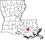
St. James Parish, Louisiana Basics:


St. James Parish Louisiana - Government Site

Population: 21,717
Area: 242 square miles
Parish seat: Convent
Area code(s) in use: 225 985
Time zone: CST
High school graduate or higher: 82.2%
Bachelor's degree or higher: 12.7%
Median household income: $53,728
Persons in poverty: 16.0%
Home ownership rate: 82.7%
Mean travel time to work: 25.0 minutes


Adjacent counties:
Ascension  Assumption  Lafourche  St. John Baptist  

Find in Louisiana

Map of the St. James Parish area


Our detail map of St. James Parish shows the St. James Parish, Louisiana boundary lines and other interesting items.

Places in St. James Parish, Louisiana

  Areas     show all on map

Coteau Chevreuil, Grand Point

  Basins     show all on map

Belmont Crevasse, Nita Crevasse

  Bends     show all on map

Rich Bend

  Buildings     show all on map

Convent Courthouse, Gramercy Police Department, Gramercy Volunteer Fire Department Station 1, Gramercy Volunteer Fire Department Station 2, Gramercy Volunteer Fire Department Station 3, Lutcher Fire Department, Lutcher Police Department, Lutcher Volunteer Fire Department, Lutcher Volunteer Fire Department, North Vacherie Fire Department Saint James Station, North Vacherie Fire Department Welcome Station, Oak Alley Foundation, Paulina - Grand Point - Belmont Fire Department Grand Point Station, Paulina - Grand Point - Belmont Fire Department Paulina Station, Paulina Grand Point Belmont Volunteer Fire Department Hester Station, Riverlands Health Care Center, Saint James Culture and Heritage Center, Saint James Parish Library, Saint James Parish Library Vacherie Branch, Saint James Parish Sheriff's Office, Saint James Parish Sheriff's Office, Saint James Parish Sheriff's Office - Juvenile Division, Saint James Parish Sheriff's Office - Records, South Vacherie Volunteer Fire Department Station 1, South Vacherie Volunteer Fire Department Station 2, Union - Convent Fire Department Convent Station, Union - Convent Fire Department Union Station, Union Convent Volunteer Fire Department, Vacherie Day Developmental Training Center, Vacherie Volunteer Fire Department Station 1

  Canals     show all on map

Batree Community Drainage Canal, Bourgeois Canal, Colonial Canal, Gramercy Town Canal, Number Twelve Canal, Saint James Canal, Saint James Parish Canal, Tennessee Williams Canal

  Capes     show all on map

Brilliant Point, College Point

  Cemeteries     show all on map

Antioch Cemetery, Celestin Cemetery, Highway Cemetery, Mount Calvary Cemetery, Philippian Cemetery, Saint James Cemetery, Saint Joseph Cemetery, Saint Michael Cemetery, Saint Phillips Cemetery, Western Cemetery

  Census     show all on map

Convent Census Designated Place, Grand Point Census Designated Place, Hester Census Designated Place, Moonshine Census Designated Place, North Vacherie Census Designated Place, Paulina Census Designated Place, Romeville Census Designated Place, Saint James Census Designated Place, South Vacherie Census Designated Place, Union Census Designated Place, Welcome Census Designated Place

  Channels     show all on map

Cantrelle Reach, Grandview Reach

  Churches     show all on map

Baptist Church, Buena Vista Baptist Church, Burton Lane Church, First Baptist Church of Vacherie, First Community Antioch Baptist Church, Greater Evergreen Baptist Church, Greater Golden Grove Baptist Church, Greater King Triumph Church, Greater Second Baptist Church, Highway Baptist Church, Highway Church, Israelite Baptist Church, King David Baptist Church, Kingdom Hall of Jehovahs Witnesses, Lady of Mercy Church, Lutcher Chapel United Methodist Church, Lutcher Methodist Church, Mount Calvary Church, Mount Olive Baptist Church, Mount Olive Church, New Creation Life Changing Ministry, New Hope International Ministries, New Horizon Missionary Baptist Church, New Zion Baptist Church, Philippian Baptist Church, Pilgrim Church, Prevailing Faith Ministries, Sacred Heart Church, Sacred Heart Convent (historical), Saint James Church, Saint James Community Church, Saint James United Methodist Church, Saint Joe Missionary Baptist Church, Saint Joseph Church, Saint Luke Baptist Church, Saint Matthew Baptist Church, Saint Michaels Church, Saint Paul Church, Saint Philip Catholic Church, Sweet View Church, Victory Assembly of God Church

  Crossings     show all on map

Lutcher-Cresent Ferry

  Hospitals     show all on map

Saint James Behavioral Health Hospital, Saint James Parish Hospital

  Islands     show all on map

Willow Island

  Levees     show all on map

Belmont Revetment, Rich Bend Revetment, Romeville Revetment, Saint Alice Revetment, Vacherie Revetment

  Locales     show all on map

Acadia Plantation (historical), Alta Vela Plantation (historical), Arcadia Landing, Armant Landing, Armant Plantation (historical), Bagatelle Plantation (historical), Bay Tree Plantation (historical), Beauvais Plantation (historical), Bellevue Plantation (historical), Bon Esperance Plantation (historical), Bourbon Plantation (historical), Bourgeoise Plantation (historical), Buena Vista Plantation (historical), Cabanocey Plantation (historical), Caribo Landing, Caribu Landing, Celestine Plantation (historical), Central Station (historical), Chapman Plantation (historical), College Point Landing, College Point Landing, Columbia Plantation (historical), Convent Landing, Convent Landing, Convent Station (historical), Crescent Landing, Crescent Landing, Crescent Plantation (historical), Curtis Plantation (historical), De Lobel Plantation (historical), Dubon Spur, Dupare Plantation (historical), Duprac Landing, Duprac Landing, Elevation Plantation (historical), Elina Plantation (historical), Gramercy Wastewater Treatment Facility, Helvetial Landing, Hester Plantation, Hester Station (historical), Home Place Plantation (historical), Jamestown Landing, Jolly Plantation (historical), La Blank Plantation (historical), Leche Plantation (historical), Legendre Plantation (historical), Lilly Plantation (historical), Lily Landing, Lily Landing, Longue Plantation (historical), Magnolia Landing, Magnolia Landing, Magnolia Plantation (historical), Malarcher Plantation, Manresa House of Retreats, May Plantation (historical), Minnie Plantation, Moonshine (historical), Mount Airy Landing, New Hope Plantation (historical), Oak Alley Landing, Oak Alley Plantation, Olga Landing, Olga Landing, Rapidan Plantation (historical), Regina Plantation (historical), Saint Alice Plantation (historical), Saint Cecil Landing, Saint Cecile Plantation (historical), Saint Clair Landing, Saint Clair Landing, Saint Claire Plantation (historical), Saint Emma Plantation (historical), Saint James Landing, Saint James Landing, Saint James Plantation (historical), Saint Joseph Plantation, Saint Joseph Plantation (historical), Saint Joseph Plantation (historical), Saint Mary Plantation, Saint Michael Plantation (historical), Saint Trisca Plantation (historical), Saint Victoire Plantation (historical), Salbury Landing, Salsburg Landing, Sport Plantation (historical), Theriot Plantation (historical), Tippecanoe Plantation (historical), Uncle Sam Landing, Uncle Sam Landing, Uncle Sam Plantation, Union Landing, Union Landing, Union Plantation, Valcour Aime Plantation (historical), Welham Landing, Welham Plantation, Wilton Landing, Wilton Landing, Wilton Plantation (historical), Wilton Station (historical)

  Oilfields     show all on map

Burton Gas Field, Citamon Bayou Gas Field, Cutgrass Coulee Oil Field, Hester Gas Field, Hestor Oil and Gas Field, Lapice Oil Field, Lower Vacherie Gas Field, Romeville Gas Field, Saint Amelia Gas Field, Saint James-College Point Gas and Oil Field, Vacherie Oil and Gas Field, West Burton Gas Field

  Parks     show all on map

Miles Memorial Park, Saint Michaels Church Historic District

  Populated Places     show all on map

Armant, Batree, Belmont, Bend, Bessie K, Bon Secours Plantation, Burton (historical), Burton Lane, Caire, Central, Chatman Town, Chopin (historical), Colomb Park (historical), Convent, Cress (historical), Feitel, Forstall (historical), Free Town, Gramercy, Grand Point, Grand View (historical), Helvetia, Hymel, Lagan, Lauderdale, Laurel Ridge Plantation, Lower Vacherie, Lutcher, Malarcher (historical), Miles, Minnie (historical), Nicholle (historical), North Vacherie, Oak Alley, Oneida, Oubre, Paulina, Pikes Peak, Rapidan, Remy, Romeville, Saint Elmo, Saint James, Saint James Plantation, Salsburg, South Vacherie, Southdown Plantation, Sport, Timberton (historical), Uncle Sam (historical), Union, Vacherie, Webre Steib Plantation, Welcome, White Hall

  Post Offices     show all on map

Burton Post Office (historical), Central Post Office (historical), Convent Post Office, Feitel Post Office (historical), Gramercy Post Office, Hester Post Office, Hymel Post Office (historical), Lagan Post Office, Lauderdale Post Office (historical), Lutcher Post Office, Oubre Post Office (historical), Paulina Post Office, Remy Post Office (historical), Romeville Post Office, Saint James Post Office, Saint James Post Office (historical), Timberton Post Office (historical), Union Post Office, Vacherie Post Office, Welcome Post Office

  Reservoirs     show all on map

Sportsman Pond

  Schools     show all on map

Burton Lane School, Fifth Ward Elementary School, Gramercy Elementary School, Highway Baptist Church Day Care Center, Jefferson College (historical), Lutcher Elementary School, Lutcher Head Start Center I School, Lutcher Head Start Center II School, Lutcher High School, Lutcher Junior High School, Magnolia School, Paulina Elementary School, Romeville Elementary School, Romeville Head Start School, Saint James High School, Saint James Parish Science and Math Academy School, Saint James Parish Youth Center Alternative School, Saint James School (historical), Saint Louis School, Saint Martinville School, Saint Michael School, Saint Peter Chanel Interparochial School, Sixth Ward Elementary School, Vacherie Elementary School, Vacherie Head Start Center Number 1 School, Vacherie Head Start Center Number 2 School, Vacherie Primary School, Welcome Head Start Center School

  Streams     show all on map

Bayou Andre David, Bayou Citamon, Bayou des Acadiens, Bayou Des Jones, Bayou Fusil, Bayou La Trainasse, Bayou Piquant, Bayou Pirogue, Bayou Secret, Bayou Shepherd, Bayou Traverse, Bayou Verret, Coulee Michel, Cutgrass Coulee, Old New River, Old New River, Tchackehou Bayou

  Towers     show all on map

KHOM-FM (Houma), WCKW-FM (Laplace),

St. James Parish, Louisiana Population By Race (2012 estimate)

RacePopulation
BlackSt. James Parish Black population 10,85910,858  
WhiteSt. James Parish White population 10,62010,619
MixedSt. James Parish Mixed population 130130
AsianSt. James Parish Asian population 6565
American IndianSt. James Parish American Indian population 4343
Hawaiian & Pacific IslanderSt. James Parish Hawaiian & Pacific Islander population 00

Additional population tables :
State population table
Louisiana population by county