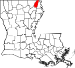
West Carroll Parish, Louisiana Basics:


West Carroll Parish Louisiana - Government Site

Population: 11,500
Area: 360 square miles
Parish seat: Oak Grove
Area code(s) in use: 318
Time zone: CST
High school graduate or higher: 73.7%
Bachelor's degree or higher: 9.7%
Median household income: $33,665
Persons in poverty: 22.6%
Home ownership rate: 70.8%
Mean travel time to work: 22.5 minutes


Adjacent counties:
Chicot (AR)  East Carroll  Morehouse  Richland  
Find in Louisiana

Map of the West Carroll Parish area


Our detail map of West Carroll Parish shows the West Carroll Parish, Louisiana boundary lines and other interesting items.

Places in West Carroll Parish, Louisiana

  Airports     show all on map

Bayou Meadows Airport, Berry Airport, Costello Airport, Kelly Airport

  Buildings     show all on map

Concord Volunteer Fire Department Central Station, Concord Volunteer Fire Department Macedonia Station, Concord Volunteer Fire Department Oak Grove Station, Fiske Union Volunteer Fire Department Central Station, Fiske Union Volunteer Fire Department North Station, Fiske Union Volunteer Fire Department South Station, Forest Volunteer Fire Department Central Station, Forest Volunteer Fire Department Substation, Goodwill Volunteer Fire Department, Kilbourne Volunteer Fire Department, Oak Grove Volunteer Fire Department, Ward 1 Volunteer Fire Department, Ward 2 Volunteer Fire Department, West Carroll Parish Library

  Capes     show all on map

Poverty Point

  Cemeteries     show all on map

Bethany Cemetery, Forest Cemetery, New Forest Cemetery, Wilson Cemetery

  Churches     show all on map

Assembly of God Church, Assembly of God Church, Bayou Macon Church, Bethlehem Church, Beulah Church, Bloomshade Church, Campbell Church, Church of Christ, Church of God, Clear Lake Church, Colewa Church, Concord Church, Green Chapel, Green Church, Green Cove Church, Harmony Church, Hill Church, Hixon Church, Lakeside Church, Locust Grove Church, Macedonia Church, Magnolia Church, Midway Church, Mount Moriah Church, Mount Pleasant Church, Mount Zion Church, New Bethany Church, New Prospect Church, New Zion Church, Plum Grove Church, Redwing Church, Rock of Mount Zion Church, Saint Clemith Church, Saint Paul Church, Sardis Church, Shady Grove Church, The Bible Missionary Church, Walnut Grove Church

  Dams     show all on map

Dam 67, Dam 68, Dam 69, Dam 76, Dam 78, Dam 80, Epps Lodge Lake Dam

  Guts     show all on map

Alligator Bayou

  Hospitals     show all on map

West Carroll Memorial Hospital

  Lakes     show all on map

Big Black Slough, Blackman Lake, Cockspur Lake

  Locales     show all on map

Epps Landing, Head of Navigation, Jackson Lodge

  Oilfields     show all on map

Epps Gas Field, South Epps Gas Field

  Parks     show all on map

Poverty Point National Monument, Poverty Point State Historic Site

  Populated Places     show all on map

Bear Skin, Chickasaw, Concord, Darnell, Epps, Fiske, Floyd, Floyd Landing, Forest, Goodwill, Gowen, Green, Kilbourne, Newhope, Oak Grove, Pioneer, Redwing, Terry, Twin Bridges

  Post Offices     show all on map

Caledonia Post Office (historical), Darnell Post Office, Epps Post Office, Floyd Post Office (historical), Forest Post Office, Kilbourne Post Office, Linkton Post Office (historical), Macon Post Office (historical), Oak Grove Post Office, Pioneer Post Office, Terry Post Office, Vista Ridge Post Office (historical), Wilcoxon Post Office (historical)

  Schools     show all on map

Cordley School (historical), Epps High School, Fiske Union School (historical), Forest School, Goodwill Elementary School, Hill School (historical), Kilbourne High School, Magnolia School, Oak Grove Elementary School, Oak Grove High School, Pioneer Elementary School (historical), Redwing School (historical)

  Streams     show all on map

Bear Skin Bayou, Bell Bayou, Big Venson Bayou, Boggy Bayou, Bogzack Creek, Cane Bayou, Caney Glade Bayou, Coleman Bayou, Colewa Bayou, Deer Creek, Fivemile Slough, Hill Bayou, Hill Bayou, Hurricane Creek, Indian Bayou, Little Colewa Bayou, Little Creek, Little Hurricane Creek, Lyon Bayou, Mill Bayou, Morgan River, Pine Bayou, Rising Slough, Threemile Slough, Tiger Bayou

  Towers     show all on map

KWCL-AM (Oak Grove), KWCL-FM (Oak Grove),

West Carroll Parish, Louisiana Population By Race (2012 estimate)

RacePopulation
WhiteWest Carroll Parish White population 9,4079,407  
BlackWest Carroll Parish Black population 1,8631,863
MixedWest Carroll Parish Mixed population 127126
American IndianWest Carroll Parish American Indian population 5857
AsianWest Carroll Parish Asian population 3534
Hawaiian & Pacific IslanderWest Carroll Parish Hawaiian & Pacific Islander population 00

Additional population tables :
State population table
Louisiana population by county