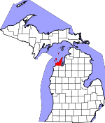
Leelanau County, Michigan Basics:


Leelanau County Michigan - Government Site

Population: 21,620
Area: 347 square miles
County seat: Leland
Area code(s) in use: 231
Time zone: EST
High school graduate or higher: 94.3%
Bachelor's degree or higher: 39.0%
Median household income: $53,982
Persons in poverty: 11.1%
Home ownership rate: 85.3%
Mean travel time to work: 21.7 minutes


Adjacent counties:
Benzie  Grand Traverse  

Find in Michigan

Map of the Leelanau County area


Our detail map of Leelanau County shows the Leelanau County, Michigan boundary lines and other interesting items.

Places in Leelanau County, Michigan

  Airports     show all on map

Empire Airport, Miller-Herrold Airport, South Fox Island Airport, Sugar Loaf Resort Airport, Woolsey Memorial Airport

  Bars     show all on map

North Manitou Shoals, North Manitou Shoals, Pyramid Point Shoal, Sleeping Bear Shoal, South Fox Island Shoals

  Basins     show all on map

Devils Hole

  Bays     show all on map

Cat Head Bay, Christmas Cove, Good Harbor Bay, Hall Bay, Ingalls Bay, Northport Bay, Omena Bay, Sleeping Bear Bay, Suttons Bay

  Buildings     show all on map

Cedar Fire Department, Cleveland Township Hall, Elmwood Township Fire and Rescue Department, Empire Area Museum, Empire Volunteer Fire Department, Glen Arbor Township Fire Department, Glen Lake Community Library, Grand Traverse Band Fire and Rescue, Grand Traverse Band Tribal Police Department, Great Lakes Children's Museum, Kasson Townhall, Leelanau - Northport Emergency Services, Leelanau County Sheriff's Office, Leelanau Historical Museum, Leelanau Township Library, Leland Township Fire and Rescue Department, Leland Township Fire and Rescue Department, Leland Township Library, Suttons Bay - Bingham Fire and Rescue Authority Bingham Station, Suttons Bay - Bingham Fire and Rescue Authority Main Station, Suttons Bay Library, Suttons Bay Police Department, Suttons Bay Village Hall

  Capes     show all on map

Birch Point, Brady Point, Carp River Point, Cat Head Point, Cemetery Point, Dimmicks Point, Donner Point, Gull Point, Lee Point, Leelanau Peninsula, Lighthouse Point, Northport Point, Omena Point, Paradesia Point, Pyramid Point, Sandy Point, Sleeping Bear Point, Stony Point, Vessel Point, Wardens Point

  Cemeteries     show all on map

Beck Graves, Beechwood Cemetery, Bingham Cemetery, Bland Cemetery, Burdickville Cemetery, Cleveland Cemetery, East Kasson Cemetery, East Leland Cemetery, Empire Catholic Cemetery, Fairview Cemetery, Fouch Cemetery, Glen Arbor Cemetery, Grindstuen Cemetery, Haas Graves, Heimforth Cemetery, Hutzler Grave, Immaculate Conception Catholic Cemetery, Kasson Cemetery, Kelderhouse Cemetery, Kilwy Cemetery, Leelanau School Road Cemetery, Leelanau Township Number One and Two Cemetery, Leland Catholic Cemetery, Maple Grove Cemetery, Maple Grove Cemetery, Miller Cemetery, Mongoo Cemetery, Mount Calvary Cemetery, Nash-Pettengill Cemetery, North Manitou Island Cemetery, Northport Point Columbarium Cemetery, Norwegian Lutheran Cemetery, Old Indian Cemetery, Omena Cemetery, Omena Presbyterian Cemetery, Onominese Cemetery, Onomonese Indian Cemetery, Price Graves, Rose Hill Cemetery, Round Top Cemetery, Sailors Graves, Saint Joseph Cemetery, Saint Marys Cemetery, Saint Michael Cemetery, Saint Paul Lutheran Cemetery, Saint Rita Cemetery, Saint Wenceslaus Cemetery, Shoemaker Grave, Solon Cemetery, South Fox Island Cemetery, South Manitou Island Cemetery, Sutton Township Cemetery, Swedish Mission Cemetery, Tobin Cemetery, Tucker Lake Cemetery, Werner-Erickson Cemetery, Wilson Cemetery

  Census     show all on map

Cedar Census Designated Place, Glen Arbor Census Designated Place, Greilickville Census Designated Place, Lake Leelanau Census Designated Place, Leland Census Designated Place, Maple City Census Designated Place, Omena Census Designated Place

  Channels     show all on map

Manitou Passage

  Churches     show all on map

Bethany Lutheran Church, Bethlehem Lutheran Church, Blessed Kateri Tekakwitha Church, Community Church, Community Church, Empire United Methodist Church, First Church, First Church of Christ Scientist, First Lutheran Church, Glen Lake Church, Holy Rosary Church, Immaneul Lutheran Church, Immanuel Lutheran Church, Indian Church, Keswick United Methodist Church, Kingdom Hall, Leelanau Community Church, Maple City Community Church, Northland Church of the United Brethren in Christ, Northport Evangelical Covenant Church, Omena Presbyterian Church, Saint Gertrude Church, Saint Joseph Church, Saint Mary's Catholic Church, Saint Michael's Church, Saint Pauls Church, Saint Philip Neri Church, Saint Rita's Church, Saint Wenceslaus Church, Suttons Bay Bible Church, Suttons Bay Congregational Church, Trinity Church, West Side Community Church

  Cliffs     show all on map

Empire Bluffs

  Forests     show all on map

Fife Lake State Forest

  Hospitals     show all on map

Grand Traverse Health Clinic, Leelanau Family Care, Leelanau Memorial Health Center, Manitou Medical Center, Northport Medical Clinic, Suttons Bay Medical Clinic, Suttons Bay Urgent Care Clinic, Tendercare Health Center Leelanau

  Islands     show all on map

Bellow Island, North Fox Island, North Manitou Island, South Fox Island, South Manitou Island

  Lakes     show all on map

Armstrong Lake, Bass Lake, Bass Lake, Bow Lake, Bright Lake, Brooks Lake, Cedar Lake, Cook Lake, Davis Lake, Duck Lake, Fisher Lake, Florence Lake, Garthes Pond, Gilbert Lake, Glen Lake, Hart Lake, Hatt Pond, Hidden Lake, Lake Leelanau, Lake Manitou, Lawrence Lake, Leg Lake, Lime Lake, Little Traverse Lake, Mougeys Lake, Mud Lake, Narada Lake, North Bar Lake, Omena Lake, Polack Lake, Provemont Pond, School Lake, Shell Lake, Shisler Lake, South Bar Lake, Tamarack Lake, Taylor Lake, Tucker Lake, Wells Lake

  Locales     show all on map

Bay Campground, Bingham Station (historical), Camp Kohahna, Cherry Bay Orchards, Cherry Beach Orchards, Cherry Home Orchard, Craker Boat Yard (historical), Dunes Golf Club, Empire Station (historical), Empire Township Campground, Fouch Station (historical), G Marsten Dame Marina, Gills Pier, Grand Traverse Light, Grand Traverse Yacht Club, Greilickville City Coal Dock, Greilickville Station (historical), Harbor West Marine, Homewood Cabins and Campground, Innestree Camp, Keswick Station (historical), Kings Challenge Golf Club, Lake Leelanau RV Park, Lautner School, Leelanau Narrows Access Site, Leelanau Pines Campground, Leelanau Station (historical), Leland Country Club, Leland Yacht Harbor, Lime Lake Campground, Links of Leelanau, Manitou Island Ferry, Manitou Mail Boat Deck, Miller Hill Lookout, Mountain Flowers Golf Course, North Manitou Island School, North Manitou Shoal Light, North University, Northport Bay Boat Yard, Northport Point Golf Club, Northport Station (historical), Omena Marina, Omena Station (historical), Pierce Stocking Visitor Center, Schomberg Station (historical), Shady Trails Camp, Shaldas Corner, Sleeping Bear Golf Club, Sleepy Bear Campground, Solem Orchard, Solon Station (historical), South Fox Island Lighthouse, South Manitou Island Light, South Manitou Island School, Suttons Bay Station (historical), Timber Shores Resort, Timberlee Ski Area, Traverse City Harbor, USDH Day Campground, Vacation Valley Camp, Veronica Valley Golf Course, Weather Station Campground, West Bay Boat Works Scuba North Incorporated, West Bay Shopping Center, Wild Cherry Campground

  Parks     show all on map

Bartholomew Park, Bay Front Park, Bingham District Number Five Schoolhouse Historical Marker, Bingham Township Park, Centerville Park, Cherry Bend Park, D H Day State Park, Early State Parks Historical Marker, Elmwood Township Park, Elmwood Township Park, Empire Lumber County Historical Marker, Fulton Park, Great Lakes Sport Fishery Historical Marker, Greene Park, Greilickville Historical Marker, Hancock Recreation Area, Haserot Park, Hendryx Park, James R Johnson Park, Leelanau State Park, Leland Historic District (Fishtown) Historical Marker, Leland Township Park, Myles Kimmerly Park, North Empire Park, Northport Park, Old Settlers Park Historical Marker, Omena Presbyterian Church Historical Marker, Peterson Park, Saint Wenceslaus Church and Cemetery Historical Marker, Sleeping Bear Dunes National Lakeshore, Sutton Bay Township Park, Sutton Park, Village Park, Vlack Memorial Park

  Populated Places     show all on map

Ahgosatown, Bingham, Bodus, Burdickville, Cedar, Cherry Bend, Crystal Spring, Empire, First Point Mobile Home Park, Fouch, Fountain Point, Glen Arbor, Glen Haven, Glen Lake Trailer Park, Greilickville, Hatchs, Heimforth, Isadore, Keswick, Lake Leelanau, Leelanau Schools, Leelanau Shores, Leland, Maple City, North Manitou, Northport, Omena, Peshawbestown, Port Oneida, Schomberg, Solon, Suttons Bay

  Post Offices     show all on map

Bingham Post Office (historical), Burdickville Post Office (historical), Cedar Post Office (historical), Cherry Home Post Office (historical), Crescent Post Office (historical), Elm Rock Post Office (historical), Empire Post Office, Fouch Post Office (historical), Fox Islands Post Office (historical), Fox Islands Post Office (historical), Gills Pier Post Office (historical), Glen Arbor Post Office (historical), Glen Haven Post Office (historical), Glenmere Post Office (historical), Good Harbor Post Office (historical), Isadore Post Office (historical), Kasson Post Office (historical), Keswick Post Office (historical), Lake Leelanau Post Office, Leelanau Post Office (historical), Leland Post Office, Maple City Post Office, Micham Post Office (historical), Miller Hill Post Office (historical), Norrisville Post Office (historical), North Manitou Island Post Office (historical), North Unity Post Office (historical), Northport Point Post Office (historical), Northport Post Office, Omena Post Office, Port Oneida Post Office (historical), Schomberg Post Office (historical), Shetland Post Office (historical), Solon Post Office (historical), South Manitou Post Office (historical), Suttons Bay Post Office

  Reservoirs     show all on map

Cherry Bend Lake

  Schools     show all on map

Glen Lake High School, Holy Rosary School, Kasson Center School, Leland Public School, Norris Elementary School, North University School, Northport Public School, Saint Mary's School, Sollar School, Suttons Bay High School, Suttons Bay Middle School

  Springs     show all on map

Dodge Spring

  Streams     show all on map

Belangers Creek, Belnap Creek, Cedar Creek, Cedar Run, Clearbrook Creek, Crystal River, Ennis Creek, Gills Creek, Good Harbor Creek, Houdek Creek, Lee Creek, Leland River, Leo Creek, Lime Creek, Mann Creek, Merbert Creek, Northport Creek, Northport Creek, Rice Creek, Rice Creek, Roaring Brook, Shalda Creek, Shetland Creek, Victoria Creek, Weaver Creek, Weisler Creek

  Summits     show all on map

Bramen Hill, Fouch Hill, Old Baldy Dune, Old Baldy Hill, Prospect Hill, Shauger Hill, Sleeping Bear Dunes, Sugarloaf Mountain, The Sleeping Bear

  Swamps     show all on map

Cedar Swamp, Solon Swamp

  Towers     show all on map

WBKP-FM (Leland), WLJN-AM (Elmwood Township), WLJN-FM (Traverse City), WMLB-FM (Glen Arbor), WTHM-FM (Glen Arbor),

Leelanau County, Michigan Population By Race (2012 estimate)

RacePopulation
WhiteLeelanau County White population 20,25820,257  
American IndianLeelanau County American Indian population 800799
MixedLeelanau County Mixed population 368367
AsianLeelanau County Asian population 108108
BlackLeelanau County Black population 8686
Hawaiian & Pacific IslanderLeelanau County Hawaiian & Pacific Islander population 00

Additional population tables :
State population table
Michigan population by county