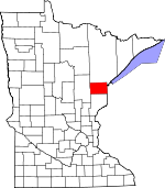
Carlton County, Minnesota Basics:


Carlton County Minnesota - Government Site

Population: 35,371
Area: 861 square miles
County seat: Carlton
Area code(s) in use: 218
Time zone: CST
High school graduate or higher: 91.3%
Bachelor's degree or higher: 21.9%
Median household income: $52,943
Persons in poverty: 11.9%
Home ownership rate: 78.5%
Mean travel time to work: 21.6 minutes


Adjacent counties:
Aitkin  Douglas (WI)  Pine  St. Louis  

Find in Minnesota

Map of the Carlton County area


Our detail map of Carlton County shows the Carlton County, Minnesota boundary lines and other interesting items.

Places in Carlton County, Minnesota

  Airports     show all on map

Cloquet/Carlton County Airport, Country Haven Airport, Moose Lake Carlton County Airport

  Buildings     show all on map

Barnum Volunteer Fire Department, Blackhoof Fire Department, Carlton County Courthouse, Carlton County Sheriff's Department, Carlton Fire and Ambulance, Cloquet County History and Heritage Center, Cloquet Fire Department, Cloquet Police Department, Cloquet Public Library, Cromwell Fire and Ambulance, Esko - Thomson Township Volunteer Fire Department, Fond du Lac Tribal and Community Center, Kettle River City Hall, Kettle River Fire Department, Mahtowa Fire Department, Moose Lake Depot Museum, Moose Lake Police Department, Moose Lake Public Library, Moose Lake Volunteer Fire Department, Perch Lake Volunteer Fire Department, Pine Valley Ski Chalet, Scanlon Volunteer Fire Department, Wrenshall Fire Department, Wrenshall Police Department, Wright Volunteer Fire Department

  Canals     show all on map

County Ditch Number Two

  Cemeteries     show all on map

Bethel Cemetery, Big Lake Indian Catholic Cemetery, Birch Lake Cemetery, Calvary Cemetery, Co-op Cemetery, Eagle Lake Cemetery, Elim Lutheran Cemetery, Finnish Apostolic Cemetery, Forest Hill Cemetery, Hillcrest Cemetery, Hillside Cemetery, Holy Family Cemeteries, Holy Trinity Cemetery, Lakeside Cemetery, Lakeview Cemetery, Leonard Cemetery, MacCabee Cemetery, Maple Grove Cemetery, Methodist Indian Cemetery, New Calvary Cemetery, Red Clover Cemetery, Riverside Cemetery, Riverside Cemetery, Saint Francis Cemetery, Saint John's Lutheran Cemetery, Saint Joseph's Cemetery, Saint Matthew's Cemetery, Salem Cemetery, Sandy Lake Cemetery, Sawyer Cemetery, Sunset Memorial Cemetery, Thomson Cemetery, Violet Cemetery, West Branch Cemetery, Wright Catholic Cemetery, Wright Community Cemetery

  Census     show all on map

Big Lake Census Designated Place, Esko Census Designated Place, Mahtowa Census Designated Place

  Churches     show all on map

Apostolic Church, Automba Church, Barnum United Methodist Church, Bethany Covenant Church, Bethany Lutheran Church, Bethel Lutheran Church, Bethesda Evangelical Church, Bethlehem Lutheran Church, Breath of Life Christian Church, Brethren Church, Cloquet Assembly of God Church, Cloquet Gospel Tabernacle Church, Cromwell Wright Evangelical Church, Duluth Apostolic Lutheran Church, Elim Church, Emmanuel Lutheran Church, Evangelical Covenant Church, Family Worship Center, Finnish Church, Finnish Church, First Presbyterian Church, Grace Baptist Church, Holy Angels Catholic Church, Holy Family Catholic Church, Holy Family Church, Holy Trinity Lutheran Church, Hope Lutheran Church, Immaculate Conception Church, J M Paine Presbyterian Church, Jehovah's Witnesses, Jehovah's Witnesses Congregation, Jehovah's Witnesses Congregation, Jesus Center Church, Kettle River Apostolic Lutheran Church, Mahtowa Covenant Church, Mary and Joseph Church, Moose Lake Methodist Church, Moose Lake Seventh Day Adventist Church, New Life Community Church, New Life Tabernacle Church, Northwood United Methodist Church, Our Redeemer Lutheran Church, Our Saviour's Lutheran Church, Pentecost Church, Polish National Church, Presbyterian Church of Cloquet, Queen of Peace Parish, River of Life Church, Saint Andrew's Episcopal Church, Saint Francis Parish, Saint John's Lutheran Church, Saint John's Lutheran Church, Saint Josephs Church, Saint Mathews Church, Saint Matthew's Lutheran Church, Saint Paul's Lutheran Church, Saint Peter's Evangelical Lutheran Church, Saint Peters Church, Salem Lutheran Church, Sandy Lake Church, Son of Life Community Church, The Church of Jesus Christ of Latter Day Saints, West Side Church, Zion Church, Zion Lutheran Church

  Cliffs     show all on map

Oldenburg Point

  Crossings     show all on map

Interchange 214, Interchange 220, Interchange 227, Interchange 235, Interchange 237, Interchange 239, Interchange 242, Interchanged 216

  Dams     show all on map

Cloquet Dam, Fond du Lac Dam, G-2 Pond Dam, Hanson Dam, Herman Mader Pond Dam, Knife Falls Dam, Langhorst Dam, Moehrke SCS Dam, Ninefeldt Pool Dam, Park Lake Dam, Rice Portage Lake Dam, Scanlon Dam, Thomson Dam, Walter Hackensmith Fishpond Dam

  Forests     show all on map

Fond du Lac State Forest

  Hospitals     show all on map

Community Memorial Hospital, Eppard Hospital, Fond du Lac Hospital, Gateway Family Health Clinic, Gateway Family Health Clinic, Interfaith Care Center, Mercy Hospital, Raiter Clinic, Villa Vista Nursing Home

  Islands     show all on map

Dunlap Island, Skunk Island

  Lakes     show all on map

Bang Lake, Bear Lake, Bear Lake, Benfield Lake, Big Lake, Black Lake, Black Lake, Blackhoof Lake, Bob Lake, Cedar Lake, Chub Lake, Coffee Lake, Cole Lake, Corona Lake, Cranberry Lake, Cross Lake, Crystal Lake, Dead Fish Lake, Eagle Lake, Echo Lake, Eddy Lake, Ellstrom Lake, First Lake, Flodin Lake, Flower Lake, Graham Lake, Hanging Horn Lake, Hardwood Lake, Hay Lake, Hizer Lake, Island Lake, Jaskari Lake, Kahring Lake, Kettle Lake, Kettle Lake, Lac La Belle, Lac Lake, Lake Twentynine, Little Hanging Horn Lake, Little Kettle Lake, Long Lake, Lost Lake, Lost Lake, Mattlia Lake, Merwin Lake, Miller Lake, Moose Lake, Moosehead Lake, Mud Lake, Mud Lake, Munson Lake, Park Lake, Perch Lake, Rice Portage Lake, Rogers Lake, Sandy Lake, School Lake, Second Lake, Section One Lake, Sofie Lake, Soper Lake, Spring Lake, Spring Lake, Spring Lake, Springer Lake, Spruce Lake, Tamarack Lake, Third Lake, Torchlight Lake, Venoah Lake, Walli Lake, Wild Rice Lake, Woodbury Lake

  Locales     show all on map

Arrowhead Camp, Atkinson (historical), Barker (historical), Barnum (historical), Barnum City Park Campground, Bear Lake Park Campground, Bent Trout Lake Campground, Big Lake Golf Course, Birch Bay Campground, Blackhoof (historical), Camp Lawrie, Camp Wanakiwin, Carlton, Cloquet, Cloquet - Duluth KOA Campground, Cloquet Forest Experiment Station, Cloquet Golf Club, Cloquet Waterworks, Corona, Cromwell, Culkin North Bound Rest Area, Duesler (historical), Hanging Horn Public Access Campground, Harney, Holyoke, Island Lake Campgrounds, Iverson, Kettle River (historical), Knife Island Campground, Mahtowa (historical), Moose Lake, Moose Lake Camp, Moose Lake City Campground, Nemadji, Oak Lake Orchard, Pine Hill Golf Club, Pine Tree Plaza, Red Fox RV Park, Sawyer, Scanlon, Spafford Park Campground, State Line, Thomson (historical), Twentynine Pines Country Club, Wicklunds Campground, Wrenshall, Wright

  Parks     show all on map

Athletic Park, Barnum City Park, Bear Lake County Park, Braun Park, Dye State Wildlife Management Area, Ervid T Clemons Memorial Park, Evergreen Memorial Drive Historical Marker, Fauley Park, Geology of the Saint Louis River Geological Marker, Graham Lake Wayside Park, Henry C Hornby Historical Marker, Henry Oldenburg Historical Marker, Hilltop Park, Iron Range Historical Marker, Island Lake Park, J Rodney Paine Historical Marker, Jay Cooke State Park, Jay Cooke State Park Geological Marker, Joshiah B Scovell Historical Marker, Kettle Lake State Wildlife Management Area, Mervin State Wildlife Management Area, Moose Lake City Park, Moose Lake Region Geological Marker, Moose Lake State Monument, Moose Lake State Recreation Area, Pine Valley Park, Pinehurst Park, Sather Park, Sawyer State Wildlife Management Area, Spafford Park, Sunnyside Park, Veterans Park, Wentworth Park, Wrenshall Scenic Overlook

  Populated Places     show all on map

Alford, Atkinson, Automba, Bandle's Mobile Home Park, Barnum, Barnum Mobile Home Park, Bergstrom's Mobile Home Park, Big Lake Chapel, Blackhoof, Brownell, Carlton, Cloquet, Corona, Cromwell, Duesler, Esko, Frogner, Harney, Hillside Terrace Homes, Holyoke, Iverson, J's Trailer Park, Kettle River, Mahtowa, Moose Lake, Nemadji, Otter Creek, Pine Tree Mobile Home Park, Pioneer Park Mobile Home Park, Pleasant Valley, Sawyer, Scanlon, Scotts Corner, Sunnyside Estates Mobile Home Park, Thomson, Woodbury, Wrenshall, Wright

  Post Offices     show all on map

Atkinson Post Office (historical), Automba Post Office (historical), Barker Post Office (historical), Barnum Post Office, Blackhoof Post Office (historical), Carlton Post Office, Cloquet Post Office, Corona Post Office (historical), Cromwell Post Office, Duesler Post Office (historical), Esko Post Office, Harney Post Office, Holyoke Post Office, Iverson Post Office, Kalavala Post Office, Kettle River Post Office, Mahtowa Post Office, Moose Lake Post Office, Nemadji Post Office, Salo Post Office, Sawyer Post Office, Scanlon Post Office, Suomi Post Office, Thomson Post Office (historical), Twin Lakes Post Office (historical), Wrenshall Post Office, Wright Post Office

  Reservoirs     show all on map

Forbay Lake, G-2 Pond, Langhorst Dam, Moehrke Pond, Ninefeldt Pool, Rice Portage Lake, Thomson Reservoir, Thomson Reservoir

  Schools     show all on map

Barnum Elementary School, Barnum High School, Blackhoof Valley School, Carlton High School, Central School, Churchill Elementary School, Cloquet Middle School, Cloquet Senior High School, Cromwell-Wright Public School, Eagle Lake School, Esko Schools, Fond du Lac Community College, Fond du Lac Ojibway School, Garfield School, Hope Lutheran Elementary School, Jefferson School, Kalevala School, Leach School, Moose Lake Community Schools, Queen of Peace School, Saint Paul's Academy, South Terrace Elementary School, Washington Elementary School, Washington School, Wrenshall High School

  Streams     show all on map

Anderson Creek, Annamahasung Creek, Blackhoof River, Clear Creek, Clear Creek, Crystal Creek, Dead Moose River, Deer Creek, Fond du Lac Creek, Gill Creek, Gillespie Brook, Hay Creek, Heikkila Creek, Hunters Creek, King Creek, Little Net River, Little Otter Creek, Little River, Midway River, Moose Horn River, Mud Creek, Nemadji Creek, Net River, Otter Creek, Park Lake Creek, Portage River, Rock Creek, Section Thirty-six Creek, Silver Creek, Silver Creek, Silver Creek, South Fork Nemadji River, Split Rock River, State Line Creek, Stony Brook, West Branch Kettle River, West Fork Moose Horn River

  Towers     show all on map

Cromwell Lookout Tower, Moose Lake Lookout Tower, WKLK-AM (Cloquet), WSCN-FM (Cloquet)

  Trails     show all on map

Willard Munger State Trail,

Carlton County, Minnesota Population By Race (2012 estimate)

RacePopulation
WhiteCarlton County White population 31,76331,763  
American IndianCarlton County American Indian population 2,0872,086
MixedCarlton County Mixed population 814813
BlackCarlton County Black population 531530
AsianCarlton County Asian population 177176
Hawaiian & Pacific IslanderCarlton County Hawaiian & Pacific Islander population 00

Additional population tables :
State population table
Minnesota population by county