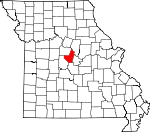
Moniteau County, Missouri Basics:
Moniteau County Missouri - Government Site
Population: 15,674
Area: 415 square miles
County seat: California
Area code(s) in use: 573 660
Time zone: CST
High school graduate or higher: 81.4%
Bachelor's degree or higher: 17.7%
Median household income: $49,394
Persons in poverty: 11.2%
Home ownership rate: 74.5%
Mean travel time to work: 25.7 minutes
Adjacent counties:
Boone Cole Cooper Miller Morgan
Places in Moniteau County, Missouri
Phillips Field Airport Lupus Bend,
Providence Bend,
Searcys Bend Burris Fork Bridge,
McDowell Bridge California City Fire Department,
California Police Department,
California Rural Fire Protection District High Point Fire Station,
California Rural Fire Protection District Kliever Fire Station,
California Rural Fire Protection District Main Station,
California Rural Fire Protection District McGirk Fire Station,
Clarksburg Volunteer Fire Department,
Department of Conservation California Central Field Fire Office,
Fortuna Fire Protection District Fortuna Station,
Fortuna Fire Protection District Latham,
Jamestown Rural Fire Protection District,
Jamestown Rural Fire Protection District,
Moniteau County Sheriff's Office,
Tipton Correctional Center,
Tipton Fire Department,
Tipton Police Department Bethel Cemetery,
Block Cemetery,
Boeckhaus Cemetery,
Bowlin Cemetery,
California City Cemetery,
Chapel Cemetery,
Clarksburg Cemetery,
Cofer Cemetery,
Cook Cemetery,
Defore Cemetery,
Enloe Cemetery,
Gallagher Cemetery,
Gamble Cemetery,
Garman Cemetery,
Gray Cemetery,
Hickam Cemetery,
High Point Cemetery,
Highland Cemetery,
Howard Cemetery,
Latham Cemetery,
Lebanon Cemetery,
Liberty Cemetery,
Masonic Cemetery,
Moreau Cemetery,
Newkirk Cemetery,
Old Salem Cemetery,
Pettigrew Cemetery,
Rohrback Cemetery,
Sappington Cemetery,
Schmutz Cemetery,
Snorgrass Cemetery,
Sweetwater Cemetery,
Van Pool Cemetery,
Walker Cemetery,
Williams Cemetery,
Yarnold Cemetery Bethel Church,
Chapel Church (historical),
Community Chapel,
Copp Chapel,
Corticelli Church,
Flag Spring Church,
Friendship Church,
Green Grove Church,
Hills Chapel (historical),
Moniteau Church,
Mount Moriah Church,
Mount Zion Church,
New Salem Church,
Old Salem Church,
Pilot Grove Church,
Rock Enon Church,
Salem Church,
Shiloh Church,
Union Church,
Union Church Bond Lake Dam,
Crews Lake Dam,
Elliott Lake Dam,
Jenkins Lake Dam,
Keane Lake Dam,
Knipp Lake Dam,
Longan Lake Dam,
Mayhugh Lake Dam,
McMenamy Lake Dam,
Number 576 Dam,
Number 577 Dam,
Porter Lake Dam,
Proctor Park Lake Dam,
Richward W Cook Junior Dam,
Veulemans Lake Dam,
Washburn Lake Dam,
Zimmerman Lake Dam Tadpole Island Blank Ford,
Brant,
Coal Bank Ford, Felix (historical), Lancaster (historical), Magnolia (historical),
North Carolina School, Oak Point (historical), Renfros Mill (historical),
Scott Ford,
Shock Ford,
Union Ford,
Whist Landing, Wind Mill (historical),
Wingate Ford Simpson Mine,
Tiff Mine Bacon,
California,
Cedron,
Clarksburg,
Corticelli,
Enon,
Fortuna,
High Point,
Jamestown,
Kliever,
Latham,
Lupus,
McGirk, Mount Vernon (historical),
Renfro,
Sandy Hook,
Tipton Derbey Lake,
R Elliott Lake,
Railroad Lake Aurora High School (historical),
Becker School (historical),
Bethel School (historical),
Brick School (historical),
Bruce School (historical), Bueker School (historical),
California Elementary School,
California High School,
California Middle School,
Carlos School (historical),
Cedron School (historical),
Clark School (historical),
Clarksburg Elementary School,
Cross Lane School (historical),
Donley School (historical),
Eldorado School (historical),
Elliott School (historical),
Enon School (historical),
Excelsior School (historical),
Fairview School (historical),
Felder School (historical),
Grant School (historical),
Green Grove School (historical),
Hale School (historical),
Harlan School (historical),
Harmony School (historical),
Hazel Dell School (historical),
Hickory Flat School (historical),
Hickory Grove School (historical),
High Point Elementary School, High Point School (historical),
High Prairie School (historical),
Highland School (historical), Hook School (historical),
Independence School (historical),
Jamestown C-1 Elementary School,
Jamestown C-1 High School,
Johnson School (historical),
Kraemer School (historical),
Latham Elementary School,
Lincoln School (historical),
Lone Elm School (historical),
Lone Oak School (historical),
Lone Star School (historical), Lupus School (historical),
Martin School (historical),
Mason School (historical), McGirk School (historical),
Mulberry School (historical),
Norman School (historical),
North Carolina School (historical),
North Mount Vernon School (historical),
Oak Dale School (historical),
Oak Grove School (historical),
Oak Hill School (historical),
Oakland School (historical),
Parkes School (historical), Pilot Grove School (historical),
Pilot School (historical),
Pleasant Hill School (historical),
Pleasant Ridge School (historical),
Pleasant Valley School (historical),
Pleasant View School (historical),
Pluck School (historical),
Prairie Grove School (historical),
Prairie Hill School (historical),
Prairie Home School (historical),
Prairie Union School (historical),
Red Brush School (historical),
Rock Island School (historical), Sandy School (historical),
Sappington School (historical),
Sherman School (historical),
Sherwood School (historical),
Shiloh School (historical),
South Carolina School (historical),
South Mount Vernon School (historical),
Splice Creek School (historical),
Sunnyside School (historical),
Surprise School (historical),
Tipton Elementary School,
Tipton High School,
Union School (historical),
Van Pool School (historical),
Walnut Grove School (historical),
West View School (historical),
Willow Fork School (historical) Cave Springs, Clifty Springs
Bear Branch,
Blythes Creek,
Burger Creek,
Burris Fork,
Cliffty Branch,
Colburn Branch,
Dry Fork,
East Brush Creek,
Factory Creek, Haines Creek,
Haldiman Branch,
Hauck Branch,
Howard Creek,
Howe Branch,
Kelley Branch, Landers Creek,
Lick Creek,
Little Moniteau Creek,
Little Splice Creek,
Long Branch,
Marney Branch,
Marshall Creek,
Maupin Branch,
Medlen Creek,
Mineral Branch,
Petite Saline Creek,
Pilot Branch,
Rock Enon Creek,
Rocky Branch,
Schaaf Creek,
Scott Branch,
Short Fork,
Smith Branch,
Smith Creek,
Splice Creek,
Steinhauer Branch, Stillhouse Branch,
Straight Fork,
String Creek, Tanyard Creek,
Thompson Branch,
Turkey Trot Creek,
Turtle Spring Branch,
Van Pool Branch,
Westing Branch,
Wieneke Branch,
Willow Branch,
Willow Fork KMIZ-TV (Columbia),
KTXY-FM (Jefferson City),
KZMO-AM (California),
KZMO-FM (California) Gooseberry Hollow,

