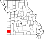
Newton County, Missouri Basics:


Newton County Missouri - Government Site

Population: 59,040
Area: 625 square miles
County seat: Neosho
Area code(s) in use: 417
Time zone: CST
High school graduate or higher: 84.1%
Bachelor's degree or higher: 18.2%
Median household income: $42,644
Persons in poverty: 14.9%
Home ownership rate: 75.0%
Mean travel time to work: 20.0 minutes


Adjacent counties:
Barry  Cherokee (KS)  Jasper  Lawrence  McDonald  Ottawa (OK)  

Find in Missouri

Map of the Newton County area


Our detail map of Newton County shows the Newton County, Missouri boundary lines and other interesting items.

Places in Newton County, Missouri

  Airports     show all on map

Cal Acres Airport, Dalbom Airport, Five Mile Airport, Lynch Field Airport, Neosho Hugh Robinson Airport, Shepherd Airport

  Areas     show all on map

Brock Prairie, Burkhart Prairie, Cedar Prairie, Diamond Grove Prairie, Hewitts Prairie, Jackson Prairie, Joys Prairie, Mud Prairie, Olivers Prairie, Pools Prairie, Sarcoxie Prairie, Silver Creek Prairie, Sparlings Prairie, Spurgeon Prairie, Swars Prairie

  Bridges     show all on map

Fillmore Bridge

  Buildings     show all on map

City of Fairview Police Department, Diamond Area Fire Protection District Station 1, Diamond Area Fire Protection District Station 2, Diamond Police Department, East Newton Fire Protection District, Eighteen Eighty-One Moses Carver House, Fairview Volunteer Fire Department, Fairview Volunteer Fire Protection Association, Gates, Granby Fire Department, Granby Police Department, Joplin Fire Department Station 5, Kent, Lodi, Missouri Department of Conservation Forestry Southwest Regional Field Fire Office Joplin, Missouri Department of Conservation Forestry Southwest Regional Field Fire Office Neosho, Neosho Fire Department, Neosho Fire Department Station 2, Neosho Police Department, Newton County Sheriff's Office, Prairie View, Redings Mill Fire Protection District Station 1 Headquarters, Redings Mill Fire Protection District Station 2, Redings Mill Fire Protection District Station 3, Redings Mill Fire Protection District Station 4, Redings Mill Fire Protection District Station 5, Redings Mill Fire Protection District Station 6, Seneca Area Fire Protection District Station 1 Racine Headquarters, Seneca Area Fire Protection District Station 2 Dessa, Seneca Fire Department, Seneca Police Department, Stark City Volunteer Fire Department, Stella Rural Volunteer Fire Department Station 3 Stella

  Cemeteries     show all on map

Barker Cemetery, Boyd Cemetery, Brown Cemetery, Burkhart Cemetery, Burson Cemetery, Buzzard Cemetery, Carver Cemetery, Cedar Creek Cemetery, Civil War Cemetery, Cole Cemetery, Diamond Cemetery, Dice Cemetery, Elm Spring Cemetery, Farney Cemetery, Gibson Cemetery, Gibson Cemetery, Granby Memorial Cemetery, Graves Cemetery, Greenwood Cemetery, Hazelgreen Cemetery, Hazelwood Cemetery, Hornet Cemetery, Ivie Cemetery, Kenney Memorial Cemetery, King Cemetery, Macedonia Cemetery, Maness Cemetery, Moser Cemetery, Mount Olive Cemetery, Mount Zion Cemetery, New Salem Cemetery, Nimmo Cemetery, Osborne Cemetery, Parkway Cemetery, Pleasant Hill Cemetery, Powers Cemetery, Regan Cemetery, Robertson Cemetery, Saginaw Cemetery, Seneca Cemetery, Shannon Cemetery, Sparling Cemetery, Thrasher Cemetery, Wanda Cemetery, Weems Cemetery, Wilson Cemetery, Wright Cemetery

  Churches     show all on map

Beef Branch Church, Belfast Church, Berwick Church, Bethel Church, Burch Church, Burkhart Church, Cave Spring Church, Cedar Creek Church, Church of God, Clear Creek Church, Greenwood Church, Hilldale Church, Hollow Springs Church, Jones Chapel, Liberty Church, Lone Star Church, Monark Church, Mormon Church, Mound Chapel, Mount Olive Church, Mountain Grove Church, New Fairview Church, New Hope Church, New Salem Church, Oak Grove Chapel, Oak Grove Church, Oakwood Church, Saint Agnes Church, Silver Moon Church, Spring Valley Church, Swars Prairie Baptist Church, Swars Prairie Church of Christ, Van Buren Church, Van Buren Church, Wesley Chapel, West Union Church, Wildwood Church

  Dams     show all on map

Austin Harrison Dam, Grand Falls Dam, Lake Mintahama Dam, Lost Creek Watershed Structure D-1 Dam, Newton County Structure E-1 Dam, Newton County Structure F-1 Dam, Newton County Structure F-2 Dam, Newton County Structure F-3 Dam, Number 40 Dam, Pepper Lake Dam, Stuffle Dam

  Falls     show all on map

Shoal Creek Falls

  Hospitals     show all on map

Freeman Health System, Freeman Health System, Freeman Neosho Hospital, Landmark Hospital of Joplin

  Lakes     show all on map

Williams Pond

  Locales     show all on map

Alcora, Art (historical), Birthplace Site, Browns, Croutchs Spur (historical), Ergo (historical), Fair Banks, Fontella, Freedom Community Center, Grand Falls, Harmony Shopping Center, Iron Switch, Kiddo Spur (historical), Liberty Community Hall, Log, Neosho Station (historical), Niles Station (historical), Sagmount Bible Camp, Seneca Mill, Wall

  Military     show all on map

Camp Crowder

  Parks     show all on map

Big Spring Park, Carver Bust, George Washington Carver National Monument, McClelland Park, Morse Park, Neosho Memorial Park, Spiva Park

  Populated Places     show all on map

Aroma, Belfast, Berwick, Boulder City, Cartmell (historical), Cave Springs, Center Point, Chester (historical), Christopher, Cliff Village, Dennis Acres, Dessa, Diamond, Diamond Mill, Fairview, Fredville, Gateway Drive, Gibbonsville, Granby, Granby City, Grand Falls Plaza, Grangeville (historical), Gregg, Hornet, Huber Center, Jollification, Jolly, June, Leawood, Loma Linda, McElhany, Midway, Monark Springs, Neosho, Newstead (historical), Newtonia, Nobleton, Park, Pepsin, Racine, Redings Mill, Richey, Ritchey, Saginaw, Seneca, Seneca Quapaw Agency (historical), Shoal Creek Drive, Shoal Creek Estates, Silver Creek, Spring City, Spurgeon, Stark City, Stella, Sunnyvale, Sweetwater, Talmage City, Tipton Ford, Tripoli, Virvins, Wadell, Wanda, Wela Park, Wentworth, Westview

  Post Offices     show all on map

Jones Creek Post Office (historical)

  Reservoirs     show all on map

Austin Harrison Reservoir, Bleuins Lake, Joplin Water Supply Lake, Structure E-1 Reservoir, Structure F-1 Reservoir, Structure F-2 Reservoir, Structure F-3 Reservoir

  Schools     show all on map

Belfast School (historical), Benton School (historical), Big Spring School (historical), Black Jack School (historical), Brown School (historical), Brown School (historical), Burch School (historical), Caddoo School, Cave Spring School (historical), Cawyer School (historical), Cedar Bluff School (historical), Cedar Creek School (historical), Central Elementary School, Christopher School (historical), Cloverdale School (historical), Cloverleaf School (historical), Crowder College, Diamond Elementary School, Diamond Hall School (historical), East Newton High School, East Union School (historical), East View School (historical), Elm Springs School, Fairview School (historical), Fairview School (historical), Fairview School (historical), Field Early Childhood and Kindergarten Center, Five Mile School (historical), Five Points School (historical), Frog Pond School (historical), Gallemore School (historical), Granby Elementary and Junior High School, Green Valley School (historical), Greenwood School (historical), Greenwood School (historical), Gregg School (historical), Hammers School (historical), Hazel Green School (historical), Hickory Grove School (historical), Hill Dale School (historical), Huber Center School (historical), Independence School (historical), Jay Bird School (historical), Jolly School (historical), Kiddo School (historical), Lake Hill School (historical), Liberty School (historical), Liberty School (historical), Lone Star School (historical), Mammers School, McClelland School (historical), McElhaney School, Meeks School (historical), Midway School (historical), Modern School (historical), Monark School (historical), Newtonia School, Norwood School (historical), Number Four School (historical), Number One School (historical), Number Two School (historical), Oak Dale School (historical), Oak Grove School (historical), Oshkosh School (historical), Pleasant Valley School (historical), Prairie View School (historical), Racine School (historical), Redding School (historical), Redings Mill School, Regan School (historical), Rheinmiller School (historical), Richey School, Ross School (historical), Round Prairie School (historical), Saginaw School (historical), Schoenborn School (historical), School Number 126 (historical), School Number 93 (historical), Seneca School, Silver Creek School (historical), Silver Moon School (historical), South Middle School, Spring School (historical), Spring Valley School (historical), Spring Valley School (historical), Spurgeon School, Stapleton Elementary School, Star School, Thompson Grove School (historical), Triway Elementary and Junior High School, Union College School (historical), Union School (historical), VanBuren School (historical), Wanda School (historical), Warren Branch School (historical), Wentworth School, West Benton School (historical), West Union School (historical), Westview Elementary School, Willow Springs School (historical), Woodvine School (historical)

  Springs     show all on map

Big Spring, Button Spring, Cave Spring, Elm Spring, Haddock Spring, Hearrell Spring, Lentz Spring, Linn Spring, Macedonia Spring, McMahan Spring, Monark Springs, Shannon Spring, Weatherspoon Spring, Williams Spring

  Streams     show all on map

Baynham Branch, Beef Branch, Buffalo Creek, Capps Creek, Carver Branch, Cedar Creek, Clear Creek, Cochran Creek, Douthit Branch, Dry Branch, Dry Valley Branch, Elm Spring Branch, Fivemile Creek, Grants Creek, Harrison Branch, Hickory Creek, Huffman Branch, Humphreys Branch, Hutchison Branch, Indian Creek, Jacobs Branch, Jones Creek, Kenny Branch, Little Lost Creek, MacDougal Branch, Middle Indian Creek, Newtonia Branch, North Indian Creek, Pryor Branch, Richey Creek, Silver Creek, South Indian Creek, Spencer Branch, Spring Creek, Stedman Branch, Sweetwater Branch, Thurman Creek, Weatherspoon Branch, Williams Branch, Willow Branch, Wurmington Branch

  Towers     show all on map

Goodman Lookout Tower, KBTN-AM (Neosho), KNEO-FM (Neosho)

  Valleys     show all on map

Edmondson Hollow, Gordon Hollow, Roaring Spring Hollow, Shannon Hollow, Tanyard Hollow,

Newton County, Missouri Population By Race (2012 estimate)

RacePopulation
WhiteNewton County White population 53,96353,962  
MixedNewton County Mixed population 1,7121,712
American IndianNewton County American Indian population 1,4171,416
AsianNewton County Asian population 886885
BlackNewton County Black population 531531
Hawaiian & Pacific IslanderNewton County Hawaiian & Pacific Islander population 472472

Additional population tables :
State population table
Missouri population by county