Carson City County, Nevada Basics:


Carson City County Nevada - Government Site

Population: 54,616
Area: 145 square miles
County seat: Carson City
Area code(s) in use: 775
Time zone: PST
High school graduate or higher: 86.3%
Bachelor's degree or higher: 20.9%
Median household income: $53,987
Persons in poverty: 15.0%
Home ownership rate: 60.5%
Mean travel time to work: 17.0 minutes

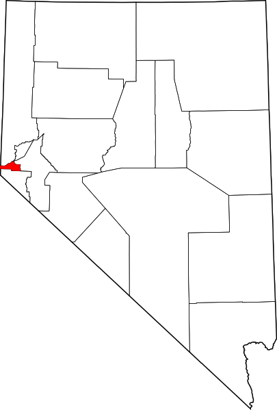
Adjacent counties:
Douglas  Lyon  Storey  Washoe  

Find in Nevada

Map of the Carson City County area


Our detail map of Carson City County shows the Carson City County, Nevada boundary lines and other interesting items.

Places in Carson City County, Nevada

  Airports     show all on map

Carson Airport, Carson-Tahoe Hospital Heliport, Parker Airport, Parker Carson Airport, Parker Carson Airport

  Areas     show all on map

Eastern Slope

  Basins     show all on map

Eagle Valley, Onion Valley

  Bays     show all on map

Secret Harbor, Skunk Harbor

  Buildings     show all on map

Carson City Fire Department Station 1, Carson City Fire Department Station 2, Carson City Fire Department Station 3, Carson City Sheriff's Office, Clear Creek Youth Center, Nevada Division of Forestry Western Area Station, Nevada Emergency Operations Center, Nevada Governor Mansion, Nevada Highway Patrol Headquarters, Nevada Highway Patrol Northern Command West Carson City, Nevada State Capitol, Nevada State Maximum Security Prison, Northern Nevada Correctional Center, Warm Springs Correctional Center, Washoe Tribal Police Department

  Canals     show all on map

Mexican Ditch

  Cemeteries     show all on map

Empire Cemetery, Lone Mountain Cemetery

  Dams     show all on map

Mexican Dam, Quilici Dam (historical)

  Flats     show all on map

Lower Prey Meadows, Taylor Flat

  Gaps     show all on map

Lakeview Summit

  Hospitals     show all on map

Carson Convalescent Center, Carson Tahoe Regional Medical Center, Evergreen Carson City Hospital, Evergreen Mountain View Health Center, Sierra Surgery Hospital

  Lakes     show all on map

Blackwells Pond, Dry Lake

  Locales     show all on map

Anderson Ranch, Anderson Ranch, Ash Sawmill, Ashs Sawmill (historical), Baldwin and Company Mill (historical), Blue Canyon Mill (historical), Browns Ranch (historical), Brunswick Mill, Brunswick Substation, Camp Nye (historical), Carson City Golf Course, Carson City Square, Carson City Station (historical), Carson Mall, Carson Ranger Station, Carson Recreation Area, Carson Rest Area (historical), Carson Shopping Center, Chartz Ranch, Clear Creek Campground (historical), Clear Creek Station (historical), Copper Canyon Mill (historical), Eagle Station Shopping Center, Eagle Valley Ranch Childrens Foundation, Frontier Plaza, Goni Ranch, Gregorys Mill (historical), Hereford Ranch, Landmark Letter, Landmark Letter, Lookout (historical), Market Spot Shopping Center, McRaeys (historical), McTarnahan Bridge, Meads Quartz Mill (historical), Merrimac (historical), Merrimac Mill (historical), Mexican (historical), Morgan Mill (historical), New Eureka Mill (historical), Old Mexican Mill, Ormsby County Farm, Perrin Brothers Ranch (historical), Saints Rest (historical), Santiago Mill (historical), Silver City Mall, Silver Saddle Ranch, Springmeyer Ranch (historical), Stewart Smoke Stack (historical), Sunny Acres Childrens Home, Swifts Station (historical), The Mallard Center, Toll (historical), Vivian Mill (historical), Warehouse Market, Woods Ranch, Yerington Smelter (historical)

  Mines     show all on map

Alex Eske Mine, Athens Mine, Bessemer Mine, Bidwell Mine, Bunker Hill Mine, Capitol Mine, Carson Black Lead Mine, Carson Mine, Cinderlite Mine, Comstock Extension Mine, Comstock Extension Mine, Dixon Mine, Golden Eagle Mine, June Ellen Mine, Lucky Strike Mine, Montreal Mine, Ohio Mine, Panama Canal Mine, Premier Mine, Prison Hill Mine, Prison Stone Quarry, Smith Brothers Mine, United Mine, United Mining Company Mine, Utopian Mine, Valley View Mine, Voltaire Mine, Yerington Mine

  Parks     show all on map

Camp Carson Park, Centennial Park, Fuji Park, Governors Field, Mills Park, Ross Gold Park, Snyder Meadows State Park, Tahoe-Carson Speedway, Terrace Park

  Populated Places     show all on map

Brunswick (historical), Carson City, Carson Hot Springs, Eagle Station (historical), Empire, Fiddlers Green, Lakeview, Mill Creek Settlement (historical), New Empire, Pinyon Hills, Stewart

  Post Offices     show all on map

Airport Station Branch Post Office, Carson City Post Office, Empire Post Office (historical), Lake View Post Office (historical), Stewart Branch Post Office (historical)

  Reservoirs     show all on map

The Tanks

  Ridges     show all on map

Lone Mountain, Prison Hill

  Schools     show all on map

Al Seeliger Elementary School, Bernadette Murphy Juvenile Detention, Bethlehem Lutheran School, Bordewich-Bray Elementary School, Capital Christian School, Carson City Seventh Day Adventist School, Carson High School, Carson Middle School, Carson Montessori School, Eagle Valley Middle School, Educare Academy, Empire Elementary School, Fremont Elementary School, Fritsch Elementary School, Mark Twain Elementary School, Martha Gleason Elementary School, Opportunity High School, Pioneer High School, Saint Teresa of Avila Catholic School, Silver State High School, Stewart Indian School (historical), Team A School, Western Nevada Community College

  Springs     show all on map

Badger Spring, Bull Run Spring, Carson Hot Springs, Currys Warm Springs, Devil Springs, Erastra Spring, Taylor Spring

  Streams     show all on map

Ash Canyon Creek, Bliss Creek, Clear Creek, Kings Canyon Creek, Marlette Creek, Secret Harbor Creek

  Summits     show all on map

Bismark Peak, C Hill, Indian Mountain, McTarnahan Hill, Nine Hill, Snow Valley Peak, Sugarloaf

  Towers     show all on map

KPTL-AM (Carson City)

  Valleys     show all on map

Ash Canyon, Brunswick Canyon, Carson Valley, Clear Creek Canyon, Combs Canyon, Kings Canyon, North Kings Canyon, Rose Canyon, Sand Canyon, Snow Valley, Sullivan Canyon, Vicee Canyon, Voltaire Canyon,

Carson City County, Nevada Population By Race (2012 estimate)

RacePopulation
WhiteCarson City County White population 49,10049,099  
American IndianCarson City County American Indian population 1,4751,474
MixedCarson City County Mixed population 1,4201,420
BlackCarson City County Black population 1,3111,310
AsianCarson City County Asian population 1,2561,256
Hawaiian & Pacific IslanderCarson City County Hawaiian & Pacific Islander population 164163

Additional population tables :
State population table
Nevada population by county