Schuyler County, New York Basics:


Schuyler County New York - Government Site

Population: 18,518
Area: 328 square miles
County seat: Watkins Glen
Area code(s) in use: 607
Time zone: EST
High school graduate or higher: 88.0%
Bachelor's degree or higher: 16.4%
Median household income: $47,869
Persons in poverty: 9.4%
Home ownership rate: 81.1%
Mean travel time to work: 25.6 minutes
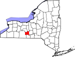
Adjacent counties:
Chemung  Seneca  Steuben  Tompkins  Yates  

Find in New York

Map of the Schuyler County area


Our detail map of Schuyler County shows the Schuyler County, New York boundary lines and other interesting items.

Places in Schuyler County, New York

  Airports     show all on map

Culver Airfield, Eagle Ridge Airport, Four Seasons Airport, Hemlock Run Airport, Kayutah Lake Airport, Re-Dun Field Airport, Schuyler Airport, Tilden Airport, Ultralight Flight Farm

  Bays     show all on map

Fleet Cove

  Bridges     show all on map

Lhommedieu Street Bridge, Mill Street Bridge, White Hollow Road Bridge

  Buildings     show all on map

Beaver Dams Volunteer Fire Department, Burdett Fire Department, Cascata Winery, Castel Grisch Winery, Catharine Town Hall, Dix Town Hall, Dutton S Peterson Memorial Library, Grange Hall, Hector Town Hall, Mecklenburg Volunteer Fire Department, Monterey Volunteer Fire Company, Montour Falls Fire Department, Montour Falls Memorial Library, Montour Falls Memorial Library, Odessa Fire Department, Schuyler County Court House, Schuyler County Jail, Schuyler County Volunteer Ambulance, The Falls Home for Adults, Tyrone Volunteer Fire Department Company, Valois - Logan - Hector Volunteer Fire Company, Watkins Glen Fire Department, Watkins Glen Municipal Hall

  Capes     show all on map

Barnards Point, Buttonwood Point, Coal Point, Corbett Point, Glen Eldridge Point, Hector Falls Point, Inwood Point, McGrath Point, Peach Orchard Point, Pitchers Point, Salt Point, Scout Point, Starkey Point, Swarthout Point, Valois Point

  Cemeteries     show all on map

Altay Baptist Church Cemetery, Beach Cemetery, Beaver Dams Cemetery, Belmont Cemetery, Bennetsburg Cemetery, Burdett Presbyterian Cemetery, Carman Road Quaker Cemetery, Christ Johns Cemetery, Coe Cemetery, Cook Cemetery, Cooley Cemetery, County Line Cemetery, County Line Cemetery, Cronk Cemetery, Greenwood Cemetery, Hector Presbyterian Church Cemetery, Highland Cemetery, Jones Cemetery, Laurel Hill Cemetery, Lawrence Cemetery, Maltby Cemetery, McIntyre Settlement Cemetery, Mecklenburg Cemetery, Monterey Cemetery, North Settlement Cemetery, Old Reading Cemetery, Old Sugar Hill Cemetery, Pleasant View Cemetery, Reynoldsville Cemetery, Saint Marys Cemetery, Schuyler Cemetery, Sugar Hill Cemetery, Townsend Cemetery, Tyrone Union Cemetery, Union Cemetery, Valois Cemetery

  Channels     show all on map

Diversion Channel

  Churches     show all on map

Altay Baptist Church, Bethel Fellowship Church, Bible Baptist Fellowship, Burdett Presbyterian Church, Burdett United Methodist Church, Catharine United Methodist Church, First Baptist Church, First Baptist Church, First Methodist Church, First Presbyterian Church, Glen Baptist Church, Grace Gospel Assembly of God, Hector Presbyterian Church, Kingdom Hall of Jehovahs Witnesses, Lawrence Memorial Chapel, Logan Methodist Church, Mecklenburg United Methodist Church, Montour Falls United Methodist Church, Mount Calvary Lutheran Church, Odessa Baptist Church, Odessa United Methodist Church, Saint Benedict's Church, Saint James Episcopal Church, Saint Mary of the Lake Roman Catholic Church, Tyrone United Methodist Church, Valois Community Church, Waneta Lake Chapel, Wayne Baptist Church, Wayne Baptist Church Cemetery, Wesleyan Church, Weston Presbyterian Church

  Falls     show all on map

Aunt Sarahs Falls, Hector Falls, Shequaga Falls

  Forests     show all on map

Cliffside State Forest, Finger Lakes National Forest, Green Mountain National Forest-Hector Ranger District

  Hospitals     show all on map

Schuyler Hospital

  Islands     show all on map

Poplar Island, Red Bank, Stingers Island

  Lakes     show all on map

Cayuta Lake, Cinnamon Lake, Lamoka Lake

  Locales     show all on map

Allen Farms, Arcadian Estate Vineyards, Atwater Estate Vineyards, Backbone Trailhead, Bear Farm, Bergen Farms, Blueberry Patch Recreation Site, Bumpus Corners, Camp Gorton, Chapman Corners, Coles Corners, Cool Lea Campground, Dalrymple Farms, Ervay's Marina, Fox Run Golf Course, Gingerbread Corners, Glen Harbor Marina, Glendale Farm, Halls Corners, Hector P O, Hidden Valley Camp, Lakewood Vineyards, Leidenfrost Vineyards, Lembeck's Marina, Mangus Vineyards, Montour Falls Marina, Montour Falls Village Sewage Treatment Plant, Montour Falls Yacht Club, Potomac Group Campground, Rasta Ranch Vineyards And Nursery, Reading Center Station, Rose Hill Farm, Village Marina, Watkins Glen Golf Course, Watkins Glen International, Watkins Glen Station, Watkins Glen Yacht Club, Wickham Farms

  Mines     show all on map

Arcangeli Pit

  Parks     show all on map

Catharine Creek Wildlife Management Area, Connecticut Hill State Game Management Area, Hector Land Use Area, Lakeside Park, Marina Park, Watkins Glen State Park

  Populated Places     show all on map

Alpine, Alpine Junction, Altay, Beaver Dams, Bennettsburg, Burdett, Catharine, Cayuta, Cayutaville, Cherry Lane, Deckertown, East Steamburg, Gabriels Junction, Havana Glen Mobile Home Park, Hector, Irelandville, Logan, Mecklenburg, Monterey, Montour Falls, Moreland, North Reading, Odessa, Perry City, Pine Creek, Reading Center, Reynoldsville, Searsburg, Shorewood, Smith Valley, Spaulding Corner, Townsend, Tyrone, Valois, Watkins Glen, Wedgewood, Weston, Wildwood Mobile Home Park

  Post Offices     show all on map

Beaver Dams Post Office, Burdett Post Office, Cayuta Post Office, Montour Falls Post Office, Odessa Post Office, Reading Center Post Office, Tyrone Post Office, Watkins Glen Post Office

  Reservoirs     show all on map

Mill Pond, Waneta Lake

  Ridges     show all on map

Hector Backbone, Sebring Hill

  Schools     show all on map

B C Cate Elementary School, District Number 1 School (historical), District Number 3 School (historical), Dolphburgh School (historical), Dunmon School (historical), Hickory Knoll School, Howard A Hanlon Elementary School, Lower Moreland School (historical), North Beaver Dams School (historical), Odessa - Montour Middle - High School, Padua High School (historical), Round School (historical), Saint Johns Seminary, School Number 1 (historical), School Number 19 (historical), School Number 24 (historical), Star District School (historical), Sugar Hill School (historical), Upper Moreland School (historical), Watkins Glen Elementary School, Watkins Glen High School, Watkins Glen Middle School

  Streams     show all on map

Banfield Creek, Big Hollow Run, Bolter Creek, Breakneck Creek, Bullhorn Creek, Buttonwood Brook, Catharine Creek, Catlin Mill Creek, Cayuta Inlet, Cranberry Creek, Curry Creek, Glen Creek, Hamilton Creek, Hector Falls Creek, Hemlock Run, Hencoop Creek, Jackson Creek, Johns Creek, L'Hommedieu Creek, Little Tobehanna Creek, McCorn Creek, Pine Creek, Quarter Mile Creek, Sawmill Creek, Seneca Lake Inlet, Shequaga Creek, Spring Brook, Tobehanna Creek, Townsend Creek

  Summits     show all on map

Baker Hill, Burnt Hill, Foots Hill, House Hill, Huey Hill, Irish Hill, Mount Pleasant, North Hill, Oak Hill, Rogers Hill, Satterly Hill, Six Nations Hill, South Hill, Stocking Hill, Sugar Hill, Swan Hill, VanLone Hill, Varney Hill, Watkins Hill

  Swamps     show all on map

Bad Indian Swamp, Hinman Swamp

  Towers     show all on map

Sugar Hill Fire Tower, WGMF-AM (Watkins Glen), WPIE-AM (Trumansburg)

  Trails     show all on map

Burnt Hill Trail, Finger Lakes Trail, Gorge Trail, Interloken Trail, Potomac Trail, Ravine Trail, South Slope Trail

  Valleys     show all on map

Beardsley Hollow, Catharine Valley, Cornish Hollow, Excelsior Glen, Glen Eldridge Tug Hollow, Havana Glen, Hendershot Gulf, Mitchell Hollow, Texas Hollow, The Gulf, Van Zandt Hollow, Watkins Glen,

Schuyler County, New York Population By Race (2012 estimate)

RacePopulation
WhiteSchuyler County White population 17,94417,943  
MixedSchuyler County Mixed population 241240
BlackSchuyler County Black population 204203
AsianSchuyler County Asian population 7474
American IndianSchuyler County American Indian population 5655
Hawaiian & Pacific IslanderSchuyler County Hawaiian & Pacific Islander population 00

Additional population tables :
State population table
New York population by county