Coos County, Oregon Basics:


Coos County Oregon - Government Site

Population: 62,637
Area: 1596 square miles
County seat: Coquille
Area code(s) in use: 541
Time zone: PST
High school graduate or higher: 87.8%
Bachelor's degree or higher: 17.8%
Median household income: $37,853
Persons in poverty: 17.3%
Home ownership rate: 66.5%
Mean travel time to work: 19.3 minutes

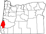
Adjacent counties:
Curry  Douglas  

Find in Oregon

Map of the Coos County area


Our detail map of Coos County shows the Coos County, Oregon boundary lines and other interesting items.

Places in Coos County, Oregon

  Airports     show all on map

Bandon State Airport, Barkers Field, Bay Area Hospital Heliport, Bay Area Hospital Heliport, Benham Airport, Lakeside State Airport, Norway Airstrip, Powers Airport, Roseburg Lumber Chip Facility Airstrip, Southwest Oregon Regional Airport, Sunnyhill Airport, Westlog Airstrip

  Areas     show all on map

Bills Prairie, Enchanted Prairie, Hall Prairie, High Prairie, Jenkins Prairie, Rowland Prairie, Taft Prairie, Wilson Prairie

  Bars     show all on map

Mussel Reef, North Spit, Simpson Reef

  Bays     show all on map

Big Creek Arm, Blacks Arm, Browns Cove, Carlson Arm, Coleman Arm, Coos Bay, Day Inlet, Devore Arm, Haynes Inlet, Haywood Inlet, Hungryman Cove, Jordan Cove, Kentuck Inlet, Libby Arm, Lindros Arm, Middle Cove, North Cove, School Land Bay, Shutter Arm, South Cove, Sunset Bay, Tarheel Arm, Templeton Arm, Willanch Inlet

  Beaches     show all on map

Agate Beach, Bandon Beach, Bastendorff Beach, Lighthouse Beach, Merchants Beach, North Beach, Sacchi Beach, Whisky Run Beach

  Bends     show all on map

Contrary Bend

  Bridges     show all on map

Bullards Bridge, Chandler Bridge, Cooper Bridge, Coos City Bridge, Crosby Bridge, Fairview Bridge, Fox Bridge, Hervey Bridge, Landrith Bridge, Lone Pine Bridge, Lone Tree Bridge, McCullough Memorial Bridge, Remote Bridge

  Buildings     show all on map

Bandon City Hall, Bandon Historical Society Museum, Bandon Municipal Court, Bandon Police Department, Bandon Public Library, Bandon Public Works, Bandon Rural Fire Protection District Kehl Station, Bandon Rural Fire Protection District Main Station, Bandon Rural Fire Protection District Randolph Station, Bridge Rural Fire, Broadbent Post Office, Bureau of Land Management Coos Bay District Office, Cape Arago Lighthouse, Charleston Rural Fire Protection District Charleston Station, Charleston Rural Fire Protection District Crown Point Station, Charleston Rural Fire Protection District Station 1, City of Coquille Police Department, Coos Art Museum, Coos Bay City Hall, Coos Bay Fire Department Central Station 1, Coos Bay Fire Department Eastside Station, Coos Bay Fire Department Empire Station, Coos Bay Municipal Court, Coos Bay Police Department, Coos Bay Post Office, Coos Bay Public Library, Coos Bay Public Works, Coos County Courthouse, Coos County Fairgrounds Museum, Coos County Jail, Coos County Logging Museum, Coos County Public Health Department, Coos County Public Works, Coos County Sheriff's Office, Coos Forest Protective Association, Coos Historical and Maritime Museum, Coos Watershed Association, Coquile Museum, Coquille City Hall, Coquille Fire and Rescue, Coquille Fire Department Station 2, Coquille Fire Department Station 3, Coquille Fire Department Station 4, Coquille Indian Tribal Police Department, Coquille Municipal Court, Coquille Public Library, Coquille Public Works, Coquille River Lighthouse, Coquille Watershed Association, Department of Motor Vehicles Coos Bay, Department of Motor Vehicles Coquille, Dora - Sitkum Rural Fire Protection District, Dora Public Library, Egyptian Theatre, Fairview Rural Fire Protection District, Flora M Laird Memorial Library, Greenacres Rural Fire Protection District, Hauser Rural Fire Protection District, Hazel M Lewis Memorial Library, KYNG - AM, Lakeside City Hall, Lakeside Public Library, Lakeside Public Works, Lakeside Rural Fire Protection District, Little Theatre on the Bay, Marshfield Sun Printing Museum, McKinley Grange Hall, Menasha Pad, Millington Rural Fire Protection District 5 Station 1, Millington Rural Fire Protection District 5 Station 2, Myrtle Point City Hall, Myrtle Point Fire Department Station 1, Myrtle Point Fire Department Station 2, Myrtle Point Fire Department Station 3, Myrtle Point Municipal Court, Myrtle Point Police Department, Myrtle Point Post Office, Myrtle Point Public Works, North Bay Rural Fire Protection District, North Bend Annex of the Coos County Courthouse, North Bend City Hall, North Bend Fire Department Station 2, North Bend Fire Station 1, North Bend Fire Station 3, North Bend Library, North Bend Police Department, North Bend Public Works, On Broadway Thespians Dinner Theatre, Oregon Coast Historical Railways, Oregon State Police Department Coos Bay Area Command, Pony Village Mall Children's Theatre, Powers City Hall, Powers Municipal Court, Powers Police Department, Powers Public Works, Powers Ranger Station, Powers Volunteer Fire and Ambulance, Red Cross Blood Services Bay Area Hospital, Red Cross Coos Bay Satellite Office, Sawdust Theatre, Shutter Creek Correctional Institution, Shutter Creek Correctional Institution Fire Department, Southwestern Oregon Community College Hales Center for the Performing Arts, Southwestern Oregon Community College Library, Sprague Community Theatre, Sumner Grange, Sumner Rural Fire Protection District Station 1, Tenmile Lakes Basin Partnership, United States Coast Guard Cutter Orcas Station, United States Coast Guard Group Air Station North Bend, United States Coast Guard Lifeboat Station Coos Bay, United States Customs and Border Protection Port of Entry Coos Bay

  Capes     show all on map

Cape Arago, Collver Point, Coos Head, Coquille Point, Crawford Point, Devils Elbow, Drake Point, Fivemile Point, Fossil Point, Glasgow Point, Gravel Point, Graveyard Point, Gregory Point, Jordan Point, Long Island Point, North Point, Pierce Point, Pigeon Point, Pony Point, Rocky Point, Rocky Point, Russell Point, White Point, Willow Point, Yoakam Point, Younker Point

  Cemeteries     show all on map

Allegany Cemetery, Archer Cemetery, Bear Creek Cemetery, Brack Cemetery, Brewer Cemetery, Bullards Cemetery, Catching Creek Cemetery, Dement Cemetery, Empire Cemetery, Enchanted Prairie Cemetery, Fairview Cemetery, Fetter Cemetery, Fishtrap Cemetery, Fox Bridge Cemetery, Garrett Cemetery, Gravelford Cemetery, Hayes Cemetery, Haynes Cemetery, Hermann Cemetery, Hultin Cemetery, Independent Order of Odd Fellows Cemetery, Independent Order of Odd Fellows Cemetery, Knights of Pythias Cemetery, Kronenberg Cemetery, Lakeside Cemetery, Lampa Creek Cemetery, Masonic Cemetery, McKinley Cemetery, Morris - Baker Cemetery, Myrtle Creek Cemetery, Myrtle Crest Memorial Gardens, Neal Cemetery, Norris Family Cemetery, Norway Cemetery, Ocean View Memorial Gardens, Old Myrtle Point Cemetery, Powers Cemetery, Randolph Cemetery, Russell Cemetery, South Fork Cemetery, South Slough Cemetery, Sumner Pioneer Cemetery, Sunset Memorial Park, Templeton Cemetery, Upper Fishtrap Cemetery, Warner Cemetery, Warner Grave, Waterman Cemetery, Wise Cemetery

  Census     show all on map

Barview Census Designated Place, Bunker Hill Census Designated Place, Glasgow Census Designated Place

  Channels     show all on map

Cooston Channel, Empire Range, Entrance Range, Ferndale Lower Range, Ferndale Upper Range, Inside Range, Jarvis Turn, Lower Jarvis Range, Marshfield Channel, Marshfield Range Channel, Myrtle Tree Hole, North Bend Lower Range Channel, North Bend Range, North Bend Upper Range, Upper Jarvis Range, Wee House Hole

  Churches     show all on map

Arago Community Church, Bandon Christian Fellowship, Bay Area Church of the Nazarene, Church of God of North Bend Oregon, Church of Jesus Christ of Latter Day Saints, Coos Bay Foursquare Church, Coquille Foursquare Church, Emmanuel Baptist Church of Coquille Oregon, Saint James Lutheran Church, Saint Monicas Catholic Church

  Cliffs     show all on map

Buck Point, Elbow Point, Seven Devils, Tunnel Point

  Dams     show all on map

C A Smith Dam, Coos Bay Timber Company Dam, Johnson Log Storage and Sorting Dam, Lower Empire Lake Dam, Lower Pony Creek Dam, Middle Empire Lake Dam, Millicoma River Rearing Pond Dam, Myrtle Point Veneer Company Log Dam, North Jetty, Rink Creek Dam, South Jetty, Tarheel Creek Dam, Upper Pony Creek Dam

  Falls     show all on map

Coquille River Falls, Elk Creek Falls, Estell Falls, Golden Falls, Henrys Falls, Hewett Falls, Laverne Falls, Lost Creek Falls, Middle Creek Falls, Pidgeon Falls, Silver Falls, Stulls Falls

  Flats     show all on map

Ash Flat, Ashur Flat, Big Prairie, Bull Pasture, Burton Prairie, Cape Arago State Park, China Flat, Flannigan Prairie

  Forests     show all on map

Coos County Forest, Coquille River Falls Natural Area, Elliott State Forest, Port Orford Cedar Experimental Forest

  Gaps     show all on map

Saddle A

  Guts     show all on map

Joe Ney Slough, Pony Slough, Randolph Slough, South Slough

  Harbors     show all on map

Charleson Boat Basin, Coos Bay City Docks, Lakeside Marina, North Lake Resort and Marina, Port of Bandon, Tenmile Lake Park

  Hospitals     show all on map

Bay Area Hospital, Coquille Valley Hospital, Keizer Memorial Hospital (historical), Southern Coos Hospital and Health Center

  Islands     show all on map

Baltimore Rock, Black Rock, Cat and Kittens Rock, Chiefs Island, Coquille Rock, Face Rock, Five Foot Rock, Guano Rock, Haystack Rock, Lone Rock, Qochyax Island, Randolph Island, Shell Island, Sisters, Table Rock, Utter Rock, Valino Island, Wash Rock

  Lakes     show all on map

Azalea Lake, Beale Lake, Bluebill Lake, Bradley Lake, Butterfield Lake, Clear Lake, Croft Lake, Dry Lake, Eel Lake, Empire Lakes, Fahys Lake, Gould Lake, Hall Lake, Horsfall Lake, Jordan Lake, Laurel Lake, Lost Lake, Lost Lake, Mud Lake, Muddy Lake, New Lake, North Tenmile Lake, Round Lake, Sandpoint Lake, Saunders Lake, Shuttpelz Lake, Snag Lake, Spirit Lake, Sru Lake, Teal Lake, Tenmile Lake, The Lagoon (historical), Upper Empire Lake

  Locales     show all on map

4H Camp, 6th Street Tenmile Lake Boat Ramp, 8th Street Tenmile Lake Boat Ramp, A B Crossing (historical), Abernathy Station (historical), Amifer (historical), Arago County Park Boat Ramp, Baisen (historical), Baker Creek Boat Ramp, Bandon Gun Club, Bandon Sewage Treatment Plant, Beaver Creek Boat Ramp, Beaver Hill, Beaver Hill Junction (historical), Beaver Lookout, Beaverton (historical), Big Tree Campground, Binks (historical), Bluebill Recreation Site, Boundary Campground, Boys Forest Ranch, Bradley Lake Park Boat Ramp, Bryant Boat Ramp, Bullards Beach State Park Boat Ramp, Bullards Beach State Park Sewage Treatment Plant, Butterfield (historical), Byerle (historical), C C Carter (historical), California Boat Ramp, Camp Easter Seal, Camp Number 2, Camp Tawanka, Carman (historical), Charleson Marina Boat Launch, Charleston Fishing Pier Boat Ramp, Cheney (historical), China Flat Campground, Chrome, Clear Creek Camp, Cleo (historical), Coal Creek Camp, Coal Creek Campground, Colby (historical), Conde B McCullough State Park Boat Ramp, Coos Bay - North Bend Water Board Shorewood Water Treatment Plant, Coos Bay City Dock North, Coos Bay City Dock South, Coos Bay Empire Sewage Treatment Plant, Coos Bay Speedway, Coos Bay Wastewater Treatment Plant, Coos Country Club, Coos County Area Transit Dispatch Facility, Coos County Fair and Rodeo, Coos County Fairgrounds Outdoor Stage, Coos County Youth Camp, Coos River Fish Hatchery, Coos White Cedar Company (historical), Coquille Boat Ramp, Coquille Myrtle Grove State Park Boat Ramp, Coquille Sewage Treatment Plant, Coquille Water Treatment Plant, Cordes, Daphne Grove Recreation Site, Davis Slough (historical), Delfit (historical), Devils Kitchen, Doris Place Boat Ramp, Doyle Ranch, Eastside Boat Ramp, Eastside Boat Ramp, Eden Valley Recreation Site, Eel Creek Recreation Site, Elk Creek Falls Recreation Site, Emmons (historical), Empire Boat Ramp, Fairview Junction (historical), Farrin Camp, Fensler (historical), Ferris Ford Work Center, Foggy Creek Camp, Fort Kitchen (historical), G H Chaney Logging Railroad Crossing (historical), Gaylord Siding, Greyhound Station, Hauser Substation, Hayden (historical), Haydon (historical), Helon (historical), Horsfall Beach Recreation Site, Horsfall Recreation Site, Inlet (historical), Island Recreation Site, John Topits Empire Lower Lake Boat Ramp, John Topits Empire Middle Lake Boat Ramp, Johnson (historical), Kentuck Country Club, Lakeside Marina Tenmile Lake, Lakeside Sewage Treatment Plant, Lakeside Water District / Tugman State Park Water Treatment, Lockhart Recreation Site, Loon Lake Lookout, Masters Landing (historical), Maxwell (historical), McCormac, Middle Creek Recreation Area, Mill Spur (historical), Mineola (historical), Montgomerys Cabin, Myrtle Grove Recreation Site, Myrtle Point Sewage Treatment Plant, Myrtle Point Water Treatment Plant, Myrtle Tree Boat Ramp, Myrtlewood Campground, Neal (historical), North Bend Sewage Treatment Plant, North Eel Campground (historical), North Lake (historical), North Lake Resort and Marina, North Spit Boat Dock, Old Tioga Camp, Orchard Park Boat Launch, Oregon Department of Transportation Boat Launch, Osprey Point Marina, Overland, Peacock Recreation Site, Pioneer Recreation Site, Pleasant Hill School, Port Barnum (historical), Port of Bandon Boat Launch, Powers Ranch, Powers Sewage Treatment Plant, Powers Water Treatment Plant, Reedsport Water Treatment Plant, Regal (historical), Riverton Boat Ramp, Rock Creek Recreation Site, Rocky Point Boat Ramp, Rogers (historical), Rooke and Higgins County Park Boat Ramp, Sandtrack Recreation Site, Saunders Lake Boat Ramp, Sea Lion View Point, Shore Acres (historical), Shutter Landing, Sitka Dock, Skeeter Camp, South Harbor (historical), Southport, Southwestern Oregon Community College Poets Eye Outdoor Theatre, Spinreel Recreation Site, Sru Lake Campground, Stave Mill (historical), Stonehouse Bridge Boat Launch, Sturdivant Park Boat Ramp, Sunlake Marina North Tenmile Lake, Sunset (historical), Sunset Bay State Park Boat Ramp, Sunshine (historical), Tenmile Lake Park County Boat Ramp, Tenmile Marina Hoist Facility, Timon (historical), Tioga (historical), Tioga Guard Station, Twomile, Warner (historical), Watsonville (historical), Wild Mare Horse Camp, William Tugman State Park Boat Ramp, Wooden Rock Guard Station, Yoakum (historical), York (historical)

  Military     show all on map

Camp Castaway (historical), Shutter Creek Correctional Institution

  Mines     show all on map

Belfast Mine, Bolivar Mine, Bunker Hill Mine (historical), Chickamin Mine, Eagle Mine, Englewood Mine, Fuller Mine, Hervey Quarry, Independence Mine, Iowa Mine, Kuhnert Quarry, Lampa Mine, Libby Mine, Newcastle Mine, Overland Mine, Rose Mine, Seven Devils Mine, Smith-Powers Mine, Southport Mine, Thirty Six Mine

  Parks     show all on map

10th Street Park, 5th Street Park, Airport Heights Park, Albert H Powers Memorial State Park, Bandon State Park, Barview State Wayside (historical), Bastendorff Beach County Park, Bennett County Park, Bicentennial Park, Boardwalk Park, Boundary Picnic Ground, Boynton Park, Brandon South Jetty County Park, Bullards Beach State Park, Burnt Mountain Recreation Site, Cherry Creek Recreation Site, City Park, College Park, Conde B McCullough State Recreation Site, Coquille Myrtle Grove State Park, Eastside Park, Face Rock State Park, Ferry Road Park, Fortier Field, Frona County Park, Golden and Silver Falls State Park, Ham Bunch - Cherry Creek County Park, Hauser Dune Tract, Hoffman Memorial State Park, John Topits Park, Judah Parker County Park, Judge Hamilton County Park, King Street Park, Kronenberg County Park, Lakeside Dune Tract, LaVerne County Park, Lehnherr Park, Lions Club Park, Lions Memorial Park, Maria C Jackson State Park, Middle Creek County Park, Middle Creek Recreation Site, Middle Eel Campground (historical), Millicoma Myrtle Grove State Park, Mingus Park, Nesika County Park, New River County Park, Oak Street Park, Oregon Dunes National Recreation Area, Park Creek Recreation Site, Penny Sturdivant Park, Powers City Park, Powers County Park, Rock Prairie County Park, Rotary Park, Sandy Creek Covered Bridge, Sanford Heights Park, Sanford Heights Playground, Seven Devils State Park, Shore Acres State Park, Simpson Park, South Eel Campground (historical), State Street Park, Sunset Bay State Park, Sunset Park, Sweet Myrtle State Natural Site (historical), Taylor/Wasson Park, Tenmile Lake County Park, Wallace Dement Park, West La Verne Park, William M Tugman State Park, Windy Hill Park, Winsor Park, Yoakam Point State Park

  Pillars     show all on map

Brewster Rock, Buzzard Rock, Grigsby Rock, Marsters Rock, Tupper Rock (historical)

  Populated Places     show all on map

Allegany, Arago, Bancroft, Bandon, Barview, Bay Park, Bridge, Broadbent, Bullards, Bunker Hill, Cedar Point, Charleston, Coaledo, Coos Bay, Coos City (historical), Coos River, Cooston, Coquille, Cranberry Corners, Crown Point, Dellwood, Delmar, Dew Valley, Dora, Eastside, Empire, Englewood, Estabrook, Etelka (historical), Fairview, Fourmile, Gaylord, Glasgow, Gravelford, Green Acres, Hauser, Kings Landing (historical), Lakeside, Lampa (historical), Laurel Grove, Lee (historical), Leneve, Libby, McKinley, Millington, Myrtle Point, North Bend, Norway, Parkersburg, Powers, Prosper, Randolph, Remote, Riverton, Saunders Lake, Shorewood, Sitkum, Sumner, Templeton, Tenmile, Winterville

  Post Offices     show all on map

Allegany Post Office, Angora Post Office (historical), Arago Post Office (historical), Baldwin Post Office (historical), Bancroft Post Office (historical), Bandon Post Office, Bangor Post Office (historical), Bridge Post Office (historical), Bullards Post Office (historical), Bunker Hill Post Office (historical), Central City Post Office (historical), Charleston Post Office, Coaledo Post Office (historical), Coos City Post Office (historical), Coos River Post Office (historical), Cooston Post Office (historical), Coquille Post Office, Custer Post Office (historical), Deer Park Post Office (historical), Dellwood Post Office (historical), Delmar Post Office (historical), Dora Post Office (historical), Eastside Post Office, Eden Post Office (historical), Elkhorn Post Office (historical), Elliott Post Office (historical), Empire Post Office, Enchanted Prairie Post Office (historical), Etelka Post Office (historical), Fairview Post Office (historical), Fourmile Post Office (historical), Freedom Post Office (historical), Gaylord Post Office (historical), Gravelford Post Office (historical), Hauser Post Office (historical), Henryville Post Office (historical), Hermansville Post Office (historical), Iowa Slough Post Office (historical), Kentuck Slough Post Office (historical), Lake Post Office (historical), Lakeside Post Office, Lampa Post Office (historical), Lee Post Office (historical), Leneve Post Office (historical), Libby Post Office (historical), Luda Post Office (historical), Market Post Office (historical), Maxwell Post Office (historical), May Post Office (historical), McKinley Post Office (historical), Navy 10146 Post Office (historical), Navy 11088 Post Office (historical), North Bend Post Office, Norway Post Office, Oak Post Office (historical), Parkersburgh Post Office (historical), Pony Village Post Office (historical), Powers Post Office, Preuss Post Office (historical), Prosper Post Office (historical), Randolph Post Office (historical), Remote Post Office, Riverton Post Office (historical), Roland Post Office (historical), Rural Post Office (historical), Salvater Post Office (historical), Section Base Post Office (historical), Sidney Post Office (historical), Sitkum Post Office (historical), South Inlet Post Office (historical), Sumner Post Office (historical), Sunset Post Office (historical), Taho Post Office (historical), Templeton Post Office (historical), Timon Post Office (historical), Utter City Post Office (historical)

  Reserves     show all on map

Cherry Creek Myrtle Preserve

  Reservoirs     show all on map

Bandon Reservoir, Bone Mountain Pond, C A Smith L and M Company Storage Reservoir, Cawrses Log Pond, Chrome Lake, Dahl Log Pond, Ferry Creek Reservoir, Fourth Creek Reservoir, Geiger Creek Reservoir, George Reservoir, Hawley Reservoir, Johnson Log Storage and Storing Reservoir, Johnston Log Pond, Kruse Ponds, Lake Merritt, Lower Empire Lake, Lyons Reservoir, Lyons Reservoir, McKeown Reservoir, Middle Empire Lake, Miller Reservoir, Millicoma River Rearing Pond, Mingus Park Lake, Myrtle Point Log Pond, Powers Pond, Rink Creek Reservoir, Russell Reservoirs, Smith Reservoir, Spring Creek Reservoir, Tarheel Reservoir, Third Creek Reservoir, Upper Pony Creek Reservoir, Winters Reservoir

  Ridges     show all on map

Ben Grant Ridge, Blue Ridge, Bray Ridge, Burnt Ridge, Camp Five Ridge, Cherry Creek Ridge, Coos Ridge, Eden Ridge, Umpcoos Ridge

  Schools     show all on map

Allegany School (historical), Bandon Senior High School, Bangor Elementary School (historical), Blossom Gulch Elementary School, Broadbent School (historical), Bunker Hill Elementary School, Christ Lutheran School, Coos River School (historical), Coos School (historical), Coquille High School, Coquille Valley Middle School, Crusader High School, Eastside Elementary School (historical), Englewood School (historical), Etelka School (historical), Gold Coast Christian School, Green Acres School (historical), Harbor Lights Middle School, Hillcrest Elementary School, Jefferson School (historical), Kingsview Christian School, Lincoln Elementary School, Madison Elementary School, Maple School (historical), Marshfield Senior High School, Millard School (historical), Millicoma Intermediate School, Milner Crest Elementary School (historical), Myrtle Crest School, Myrtle Point High School, North Bay Elementary School, North Bend Middle School, North Bend Senior High School, Ocean Crest Elementary School, Oregon Coast Technology School, Oregon Institute of Marine Biology, Powers Elementary School, Powers High School, Reedsport Junior/High School, Resource Link Charter School, Roosevelt Elementary School (historical), Southwestern Oregon Community College, Sunny Hill Elementary School (historical), Sunset Middle School, United Valley Christian Academy, Upper Twomile School (historical), Washington School (historical)

  Springs     show all on map

Alder Spring, Bolivar Spring, Brights Spring, Cannery Spring ck rcd data, Chezik Spring, Colliver Springs, Luse Spring, Martin Spring, McKee Spring, Mullen Spring, Porphyry Spring, Rogers Spring, Sigsby Spring

  Streams     show all on map

Adams Creek, Alder Creek, Alder Creek, Alder Creek, Anderson Creek, Anderson Creek, Axe Creek, Baker Creek, Baker Creek, Barker Creek, Bear Creek, Bear Creek, Bear Creek, Bear Pan Creek, Bear Pen Creek, Beaver Creek, Beaver Creek, Beaver Slough, Beaverdam Branch, Bedrock Creek, Belieu Creek, Bench Creek, Benson Creek, Bessey Creek, Bethel Creek, Beulah Creek, Big Creek, Big Creek, Big Creek, Big Creek, Bill Creek, Bills Creek, Bingham Creek, Black Creek, Blair Creek, Blue Creek, Blue Creek, Bolivar Creek, Bonner Creek, Boone Creek, Bottom Creek, Boulder Creek, Brainard Creek, Bridges Creek, Brownson Creek, Brummit Creek, Buck Creek, Buck Creek, Buck Creek, Budd Creek, Burma Creek, Burnt Creek, Cabin Creek, Calloway Creek, Camas Creek, Canyon Creek, Cardwell Creek, Carey Creek, Caroline Bar Creek, Catching Creek, Catching Creek, Catching Slough, Cave Creek, Cedar Creek, Cedar Creek, Chard Creek, Charlotte Creek, Cherry Creek, Chickses Creek, China Creek, China Creek, China Creek, China Creek, China Creek, Chrome Creek, Chute Creek, Clear Creek, Clear Creek, Clear Creek, Cleighton Creek, Coak Creek, Coal Creek, Coal Creek, Coal Creek, Coal Creek, Coalbank Creek, Coalbank Slough, Coffee Creek, Cold Creek, Cole Creek, Conklin Creek, Conner Creek, Coos River, Copple Creek, Coquille River, Cove Creek, Cox Creek, Crater Creek, Crooked Creek, Crystal Creek, Cunningham Creek, Cut Creek, Daggett Creek, Daniels Creek, Darius Creek, Davis Creek, Davis Creek, Davis Slough, Day Creek, Dead Horse Creek, Deer Creek, Deer Creek, Delmar Creek, Delta Creek, Dement Creek, Deton Creek, Drowned Out Creek, Dry Creek, Dude Creek, Dufoe Creek, Dufort Creek, Dye Creek, East Creek, East Fork Brummit Creek, East Fork Camas Creek, East Fork China Creek, East Fork Coquille River, East Fork Millicoma River, East Fork of West Fork Cow Creek, East Fork Sru Creek, Eel Creek, Elk Creek, Elk Creek, Elk Creek, Elk Creek, Elk Horn Creek, Elliott Creek, Endicott Creek, Estes Creek, Evans Creek, Fahys Creek, Fall Creek, Fall Creek, Fall Creek, Fall Creek, Fall Creek, Fall Creek, Farley Creek, Farrin Creek, Fat Elk Creek, Ferry Creek, Ferry Creek, Fetter Creek, First Creek, First Creek, Fish Creek, Fishtrap Creek, Fivemile Creek, Fives Creek, Flannigan Creek, Florence Creek, Foggy Creek, Fourmile Creek, Fourth Creek, Fox Creek, Fox Creek, Franson Creek, Frenchie Creek, Frog Creek, Fruin Creek, Fuller Creek, Garage Creek, Geiger Creek, Gettys Creek, Giles Creek, Gillis Creek, Glen Aiken Creek, Glenn Creek, Goat Creek, Grady Creek, Grange Creek, Granite Creek, Grant Creek, Grant Creek, Grants Creek, Gray Creek, Gross Creek, Gurkin Creek, Hall Creek, Hall Creek, Hamdock Creek, Hantz Creek, Harlin Creek, Hatcher Creek, Hatcher Creek, Hatchery Creek, Hatchet Slough, Hayes Creek, Hayward Creek, Hendrickson Creek, Hickey Creek, Hidden Creek, Hodges Creek, Hodson Creek, Hog Ranch Creek, Honcho Creek, Hooker Creek, Hosposki Creek, Howell Creek, Hudson Creek, Hultin Creek, Indian Creek, Iowa Slough, Isthmus Slough, Jerusalem Creek, Jim Hayes Creek, Joes Creek, John B Creek, Johns Creek, Johnson Creek, Johnson Creek, Johnson Creek, Johnston Creek, Karl Creek, Kausen Creek, Kelly Creek, Kelly Creek, Kentuck Creek, Kentuck Slough, Kessler Creek, King Creek, Knepper Creek, Knife Creek, Knight Creek, Koontz Creek, Laird Creek, Lake Creek, Lake Creek, Lampa Creek, Larson Creek, Larson Slough, Lawhorne Creek, Lillian Creek, Little Bear Creek, Little Cherry Creek, Little Creek, Little Fishtrap Creek, Little Matson Creek, Little North Fork Coquille River, Little Rock Creek, Llewellyn Creek, Lockhart Creek, Long Tom Creek, Lost Creek, Lost Creek, Lost Creek, Lowe Creek, Lower Land Creek, Lower Twomile Creek, Mack Creek, Manganese Creek, Maple Creek, Marlow Creek, Mart Davis Creek, Marys Creek, Mast Creek, Matheny Creek, Matson Creek, Matson Creek, McCurdy Creek, McKnight Creek, McMullen Creek, Mettman Creek, Middle Creek, Middle Fork Brummit Creek, Middle Fork Catching Creek, Middle Fork Coquille River, Mill Creek, Mill Creek, Mill Creek, Millicoma River, Miner Creek, Mingus Park Creek, Mink Creek, Monroe Creek, Moon Creek, Moore Creek, Morgan Creek, Morris Creek, Mussel Creek, Myers Creek, Myrtle Creek, Mystic Creek, Neely Creek, Nellie Creek, New River, Nickel Creek, Noah Creek, Noble Creek, Noble Creek, North Fork Cherry Creek, North Fork Coquille River, North Fork Creek, North Fork Elk Creek, North Fork Glen Aiken Creek, North Fork Joe Ney Slough, North Fork Rock Creek, North Fork Shale Creek, North Fork Wood Creek, North Fourmile Creek, North Slough, Nowlin Creek, Offield Creek, Otter Creek, Packard Creek, Palouse Creek, Palouse Slough, Panther Creek, Panther Creek, Panther Creek, Park Creek, Pheasant Creek, Phil Creek, Piledriver Creek, Pole Creek, Polly Creek, Pony Creek, Pulaski Creek, Pyburn Creek, Ragsdale Creek, Rainy Creek, Randleman Creek, Rasler Creek, Red Creek, Redibaugh Creek, Reeves Creek, Reservoir Creek, Rhoda Creek, Rich Creek, Riggs Creek, Rink Creek, Roberts Creek, Roberts Creek, Robertson Creek, Rock Creek, Rock Creek, Rock Crusher Creek, Rock Robinson Creek, Rodine Creek, Rogers Creek, Rollan Creek, Rosa Creek, Ross Slough, Rowland Creek, Russel Creek, Salmon Creek, Salmon Creek, Salmon Creek, Salmon Creek, Sand Creek, Sand Rock Creek, Sandy Creek, Saunders Creek, Schoolhouse Creek, Schoolhouse Creek, Schumacher Creek, Seaman Creek, Second Creek, Seelander Creek, Seestrom Creek, Sevenmile Creek, Sevenmile Slough, Shields Creek, Shinglehouse Slough, Shotgun Creek, Shutter Creek, Silver Creek, Simpson Creek, Slide Creek, Slide Creek, Slide Out Creek, Smith Creek, Smith Creek, Snedden Creek, Snow Creek, South Branch Cut Creek, South Fork Camas Creek, South Fork Catching Creek, South Fork Cherry Creek, South Fork Coos River, South Fork Coquille River, South Fork Elk Creek, South Fork Elk Creek, South Fork Fourmile Creek, South Fork Joe Ney Slough, South Fork Matson Creek, South Fork Shale Creek, South Twomile Creek, Southport Creek, Spring Creek, Spring Creek, Spring Creek, Sru Creek, Steel Creek, Steele Creek, Steinnon Creek, Stock Slough, Storey Creek, Sucker Creek, Sullivan Creek, Susan Creek, Swayne Creek, Talbot Creek, Talbott Slough, Tanner Creek, Tarheel Creek, Tenmile Creek, Theodore Johnston Creek, Threemile Creek, Tim Creek, Tioga Creek, Totten Creek, Trout Creek, Tunnel Creek, Tupper Creek, Two by Four Creek, Two-Bit Creek, Twomile Creek, Twomile Creek, Upper Land Creek, Upper Rock Creek, Vaughns Creek, Vogel Creek, Waddington Creek, Walker Creek, Ward Creek, Warner Creek, Wasson Creek, Water Tank Creek, Waterpipe Creek, Weekly Creek, West Creek, West Fork Brummit Creek, West Fork Glenn Creek, West Fork Lake Creek, West Fork Millicoma River, West Fork Silver Creek, West Fork Sru Creek, Whisky Creek, Whisky Run, Whitewash Creek, Whitley Creek, Willanch Creek, Willanch Slough, Williams Creek, Williams River, Wilson Creek, Wilson Creek, Wimer Creek, Winchester Creek, Wolf Creek, Wood Creek, Wooden Rock Creek, Woodruff Creek, Woodward Creek, Woodward Creek, Woolsey Creek, Wren Smith Creek, Yankee Run, Yellow Creek, Yellow Jacket Creek

  Summits     show all on map

Anderson Mountain, Bald Knob, Baldy Butte, Beaver Hill, Bennett Butte, Bill Peak, Bingham Mountain, Bone Mountain, Bray Mountain, Budd Mountain, Bunker Hill, Burnt Mountain, Buzzard Butte, Coos Mountain, Cotton Butte, Cribbins Hill, Diamond Peak, Elk Peak, Gobblers Knob, Granite Peak, Hanging Rock, Harlocker Hill, Hood Mountain, Hungry Mountain, Ivers Peak, Johnson Mountain, Kenyon Mountain, Lampa Mountain, McKeever Mountain, Mount Bolivar, Noah Butte, Noble Hill, Pyramid Rock, Radar Hill, Rink Peak, Robbins Butte, Samison Mountain, Sand Rock Mountain, Schneider Butte, Scott Mountain, Sheeps Head, Shuck Mountain, Split Mountain, Sugarloaf Mountain, Suicide Rock, Table Rock, Taylor Butte, Telegraph Hill, Tenmile Butte, The Buttes, Thomas Mountain, Trail Butte, Vaughn Point, Whoorey Mountain, Woodby Mountain, Yoakam Hill

  Swamps     show all on map

Ash Swamp, Caufield Marsh, Cedar Swamp, Doe Swamp, Henderson Marsh

  Towers     show all on map

Camas Lookout, KBBR-AM, KCBY-TV, KHSN-AM, KICR-FM, KOOS-FM, KSHR-AM, KSHR-FM, KYNG-FM

  Valleys     show all on map

Alder Gulch, Archie Gulch, Big Devil Gulch, Blake Gulch, Blossom Gulch, Boatman Gulch, Bowron Gulch, Brewster Canyon, Brewster Valley, Brodie Gulch, Buzzard Butte Canyon, Caufield Gulch, Chicken Gulch, Coquille Valley, Cox Canyon, Dew Valley, Dunham Gulch, Dutch John Ravine, Echo Valley, Echo Valley, Eden Valley, Four Bit Gulch, Fuzzy Gulch, Garden Gulch, Horse Hollow, Hungry Hollow, Ingersoll Gulch, Laxstrom Gulch, Lee Valley, Manning Gulch, McKee Gulch, Monkey Ranch Gulch, Norton Gulch, Oberg Canyon, Peterson Gulch, Pleasant Valley, Pogue Gulch, Poverty Gulch, Richardson Gulch, Spruce Hollow, Wall Gulch, Wallace Gulch,

Coos County, Oregon Population By Race (2012 estimate)

RacePopulation
WhiteCoos County White population 57,18857,187  
MixedCoos County Mixed population 2,5682,568
American IndianCoos County American Indian population 1,7541,753
AsianCoos County Asian population 689689
BlackCoos County Black population 313313
Hawaiian & Pacific IslanderCoos County Hawaiian & Pacific Islander population 125125

Additional population tables :
State population table
Oregon population by county