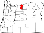
Sherman County, Oregon Basics:


Sherman County Oregon - Government Site

Population: 1,739
Area: 824 square miles
County seat: Moro
Area code(s) in use: 541
Time zone: PST
High school graduate or higher: 90.2%
Bachelor's degree or higher: 14.8%
Median household income: $44,583
Persons in poverty: 22.4%
Home ownership rate: 66.6%
Mean travel time to work: 21.4 minutes


Adjacent counties:
Gilliam  Klickitat (WA)  Wasco  Wheeler  

Find in Oregon

Map of the Sherman County area


Our detail map of Sherman County shows the Sherman County, Oregon boundary lines and other interesting items.

Places in Sherman County, Oregon

  Airports     show all on map

Compressor Station Number 10 Airstrip, Decker Ranch Airstrip, George Wilson Ranch Airstrip, Wasco State Airport

  Arches     show all on map

Biggs Arch

  Basins     show all on map

Minton Cove

  Bends     show all on map

Horseshoe Bend

  Bridges     show all on map

Cottonwood Bridge

  Buildings     show all on map

City of Moro Fire Department, Grass Valley City Hall, Grass Valley Public Works Department, Moro City Hall, Moro Public Works, Moro Rural Fire Protection District, North Sherman County Rural Fire Protection District, Rufus City Hall, Rufus Department of Public Works, Rufus Volunteer Fire Department and Ambulance Service, Sherman County Ambulance, Sherman County Historical Museum, Sherman County Justice Courthouse, Sherman County Public / School Library, Sherman County Sheriff's Office, South Sherman Fire Protection District Station 1, Wasco City / Community Library, Wasco City Hall, Wasco Public Works

  Cemeteries     show all on map

American Legion Cemetery, Daugherty Family Cemetery, De Moss Cemetery, Independent Order of Odd Fellows Cemetery, Kent IOOF Cemetery, Michigan Cemetery, Rose Hill Cemetery, Sunrise Cemetery, Wasco Methodist Cemetery, Wilcox Cemetery

  Census     show all on map

Biggs Junction Census Designated Place

  Channels     show all on map

Hells Gate Channel Range B, South Channel, South Channel Range C

  Dams     show all on map

Bibby Dam, Buether Dam, John Day Dam, Wilson Dam

  Falls     show all on map

Horseshoe Falls, Tumwater Falls

  Flats     show all on map

Lon Eakin Flat

  Harbors     show all on map

Le Paige Park Marina

  Islands     show all on map

Harris Island, Moody Island

  Locales     show all on map

Ainsworth (historical), Beavertail Campground Boat Ramp, Biggs, Biggs Service District Sewer System Facility, Bluffs (historical), Bourbon (historical), Buckhollow Boat Launch, Buckley (historical), Butlers Corner, Cooks Corner, Coxs Corner, Day (historical), De Moss (historical), Deschutes (historical), Eakin, Emigrant (historical), Fairview, Finnegans Corner, Free Bridge, Giles French Park Boat Ramp, Goff (historical), Grant (historical), Grebe (historical), Harmony, Harris (historical), Hay Canyon, Hodges Corner, John Day Dam Fish Ladder, John Day Substation, John Days (historical), Kent Compressor Station, Ketchum (historical), Le Page Park Boat Ramp, Liberty (historical), Macks Canyon Boat Launch, Maryhill Ferry (historical), Mays (historical), Michigan (historical), Miller (historical), Moro Sewage Lagoon, Nish (historical), Oregon Raceway Park, Pine Tree Boat Launch, Rickmans Corner, Rosebush, Rufus Sewer System, Sandon, Schillings Corner, Sherar Grade (historical), Sherman County Community Transit, Sherman County Fairgrounds, Sherman Experiment Station, Sink (historical), Spanish Hollow (historical), Summit (historical), Thornberry (historical), Tunnel (historical), Wasco Sewage Lagoon, Webfoot, Wilcox

  Parks     show all on map

Beavertail Recreation Site, De Moss County Park, Deschutes River State Park, Grass Valley City Park, John Day Scenic Waterway, Le Page Park, Moro City Park, Old Oregon Trail Monument, Rufus Community Center, Sherman County RV Park, Wasco City Park, Wasco Depot Park

  Pillars     show all on map

Lone Rock

  Populated Places     show all on map

Biggs Junction, Boardman (historical), De Moss Springs, Early (historical), Emigrant Springs (historical), Erskine, Fargher (historical), Grass Valley, Kent, Klondike, Locust Grove, McDonald, Monkland, Moro, Rufus, Rutledge, Sinks (historical), Wasco

  Post Offices     show all on map

Badger Post Office (historical), Biggs Post Office (historical), Biglow Post Office (historical), Croy Post Office (historical), De Moss Springs Post Office (historical), Dechutes Post Office (historical), Deschutes Bridge Post Office (historical), Early Post Office (historical), Emigrant Springs Post Office (historical), Erskineville Post Office (historical), Gordon Post Office (historical), Gorman Post Office (historical), Grant Post Office (historical), Grass Valley Post Office, Grover Post Office (historical), Kent Post Office, Klondike Post Office (historical), McDonald Post Office (historical), Miller Post Office (historical), Monkland Post Office (historical), Moro Post Office, Rufus Post Office, Rutledge Post Office (historical), Thornberry Post Office (historical), Villard Post Office (historical), Wasco Post Office

  Rapidss     show all on map

Lower John Day Rapids (historical), Preachers Eddy, Schofield Rapids (historical), Upper John Day Rapids (historical)

  Reserves     show all on map

Le Page Treaty Fishing Access Site, Preachers Eddy Treaty Fishing Access Site, Rufus Treaty Fishing Access Site

  Reservoirs     show all on map

Bibby Pond, Borstel Pond, Borstel Pond, Buether Reservoir, Powell Reservoir, Wilson Reservoir, Wilson Reservoir Number Two

  Ridges     show all on map

Adobe Point, Gordon Ridge, McInnes Norton Ridge, North Pole Ridge, Peddicord Point, Starvation Point

  Schools     show all on map

Fairview School (historical), Klondike School (historical), Locust Grove School (historical), North Sherman Elementary School, Rufus Elementary School (historical), Sherman Junior and Senior High School, South Sherman Elementary School

  Slopes     show all on map

Rattlesnake Grade, Ruggles Grade, Taylor Grade

  Springs     show all on map

Cottonwood Spring, Crocker Spring, Dipping Vat Spring, Emigrant Springs, Ferry Springs, Gooseberry Spring, Hatley Springs, Helm Springs, Hill Spring, Holman Spring, Horse Pasture Spring, Jackass Spring, Kenneth Spring, Kenny Spring, Lucy Payne Spring, Marlin Spring, McInnes Spring, Middle Spring, Norton Spring, Penny Spring, Pioneer Spring, Sand Spring, Schilling Spring, Sheep Springs, Smith Spring, South Spring, Stakely Spring, Warm Spring, Warren Spring, Willow Spring, Wingate Spring

  Streams     show all on map

China Hollow Creek, Deschutes River, Draw Creek, Elder Creek, Finnegan Creek, Kerr Creek, Long Hollow Creek, Rosebush Creek, Spring Creek

  Summits     show all on map

Beavertrail Butte, Gordon Butte, Matties Hump, Negro Ridge, Rose Hill, Sproul Point, Wilson Point, Wolf Mountain

  Trails     show all on map

Barlow Cutoff

  Valleys     show all on map

Allison Canyon, Armstrong Canyon, Barnet Canyon, Barnum Canyon, Bath Canyon, Big Gulch, Biglow Canyon, Box Canyon, Box Elder Canyon, Bronx Canyon, Brown Canyon, Bruckert Canyon, Bull Canyon, Bull Canyon, Burned Out Canyon, China Hollow, Chisholm Canyon, Combine Canyon, Cottonwood Canyon, Cottonwood Canyon, Cramer Canyon, Currie Canyon, Daugherty Canyon, De Moss Canyon, Deep Canyon, Dipping Vat Canyon, Dove Hollow, Draper Canyon, Dunlap Canyon, Eakin Canyon, Emigrant Canyon, Ferry Springs Canyon, Finnegan Canyon, Finster Canyon, Fox Canyon, Frank Fulton Canyon, French Canyon, Fulton Canyon, Gerking Canyon, Gert Canyon, Gordon Canyon, Gordon Hollow, Grass Valley Canyon, Grimes Canyon, Guyton Canyon, Hannafin Canyon, Harris Canyon, Hay Canyon, Hayes Canyon, Hellroaring Canyon, Helm Canyon, Holmes Canyon, Indian Cove, Jackass Canyon, Jackknife Canyon, Joes Camp Canyon, Jones Canyon, Kelsay Canyon, Kerr Canyon, King Canyon, Kuks Canyon, Little Ferry Canyon, Little Gulch, Locust Grove Canyon, Lucy Payne Canyon, Macks Canyon, Marlin Canyon, Mays Canyon, McLennan Canyon, Mud Hollow, Mule Canyon, Narrows, Nat Wheat Canyon, Neece Canyon, Negro Hollow, North Canyon, O'Leary Canyon, Perrault Canyon, Peterson Canyon, Pine Hollow, Pole Canyon, Porter Canyon, Pyburn Hollow, Rattlesnake Canyon, Remington Canyon, Rosebush Canyon, Rutledge Canyon, S A Canyon, Sand Canyon, Sand Hollow, Sayrs Canyon, Scott Canyon, Shotgun Canyon, Sixteen Canyon, Smith Canyon, Smith Canyon, Spanish Hollow, Spears Canyon, Sproul Canyon, Stanton Canyon, Station Canyon, Telephone Canyon, Turner Canyon, Vaughn Canyon, Wilcox Canyon, Willow Spring Canyon, Wingate Canyon, Zigzag Canyon,

Sherman County, Oregon Population By Race (2012 estimate)

RacePopulation
WhiteSherman County White population 1,6641,664  
American IndianSherman County American Indian population 4241
MixedSherman County Mixed population 2424
BlackSherman County Black population 55
AsianSherman County Asian population 33
Hawaiian & Pacific IslanderSherman County Hawaiian & Pacific Islander population 21

Additional population tables :
State population table
Oregon population by county