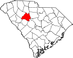
Newberry County, South Carolina Basics:


Newberry County South Carolina - Government Site

Population: 37,587
Area: 630 square miles
County seat: Newberry
Area code(s) in use: 864 803
Time zone: EST
High school graduate or higher: 76.0%
Bachelor's degree or higher: 19.0%
Median household income: $42,005
Persons in poverty: 16.7%
Home ownership rate: 72.3%
Mean travel time to work: 24.5 minutes


Adjacent counties:
Fairfield  Greenwood  Laurens  Lexington  Richland  Saluda  Union  

Find in South Carolina

Map of the Newberry County area


Our detail map of Newberry County shows the Newberry County, South Carolina boundary lines and other interesting items.

Places in Newberry County, South Carolina

  Airports     show all on map

Connelly Field, Newberry County Airport, Newberry County Memorial Hospital Heliport, Sexton Airport

  Bends     show all on map

Horseshoe Bend

  Bridges     show all on map

Blacks Bridge, Brazzlemans Bridge, Crofts Mill Bridge, Dysons Bridge, Hendersons Bridge (historical), Keitts Bridge, Kempsons Ferry Bridge, O'Neall Bridge, Sends Mill Bridge, Thorp Bridge

  Buildings     show all on map

Enoree Ranger District Office, Indian Creek Work Center, Keller Memorial Library, Newberry City Fire Department, Newberry City Fire Department, Newberry City Hall, Newberry County Courthouse, Newberry County Emergency Medical Services, Newberry County Rescue Squad, Newberry County Rural Fire Department Bush River, Newberry County Rural Fire Department Chappells, Newberry County Rural Fire Department Consolidated, Newberry County Rural Fire Department Fairview, Newberry County Rural Fire Department Friendly, Newberry County Rural Fire Department Little Mountain, Newberry County Rural Fire Department Maybinton, Newberry County Rural Fire Department O'Neal, Newberry County Rural Fire Department Peak, Newberry County Rural Fire Department Pomaria, Newberry County Rural Fire Department Prosperity, Newberry County Rural Fire Department Saint Phillips, Newberry County Rural Fire Department Silverstreet, Newberry County Rural Fire Department Stoney Hill, Newberry County Rural Fire Department Whitmire, Newberry-Saluda Regional Library, Prosperity Police Department, South Carolina Highway Patrol Troop 2 Post A, Whitmire Police Department, Whitmire Rescue Squad

  Capes     show all on map

Lominick Point

  Cemeteries     show all on map

Aveleigh Cemetery, Bachman Chapel Cemetery, Beth Eden Cemetery, Bethel Cemetery, Bethlehem Cemetery, Bozeman-Scurry Graveyard, Browns Chapel Cemetery, Bush River Meetinghouse Cemetery, Bush River Quaker Cemetery, Cannon Creek Cemetery, Cannons Creek Cemetery, Capers Chapel Cemetery, Clayton Memorial Cemetery, Colony Cemetery, Cross Roads Cemetery, Ebenezer Cemetery, Ebenezer Cemetery, Enoree Cemetery, Fairview Cemetery, Flinthill Cemetery, Hannah Cemetery, Holy Trinity Cemetery, Kings Creek Cemetery, Lebanon Cemetery, Little Beaver Dam Cemetery, Little River Cemetery, Macedonia Cemetery, Mount Bethel Cemetery, Mount Hebron Cemetery, Mount Moriah Cemetery, Mount Olivet Cemetery, Mount Pilgrim Cemetery, Mount Tabor Cemetery, Mount Tabor Cemetery, Mount Zion Cemetery, New Chapel Cemetery, New Hope Cemetery, Newberry Memorial Gardens, O'Neal Cemetery, Oak Grove Cemetery, Old Newberry Village Cemetery, Peak Cemetery, Pomaria Cemetery, Prosperity Cemetery, Queens Cemetery, Rosemont Cemetery, Saint James Cemetery, Saint Johns Cemetery, Saint Johns Cemetery, Saint Lukes Cemetery, Saint Matthews Cemetery, Saint Pauls Cemetery, Saint Phillips Cemetery, Seekwell Cemetery, Shady Grove Cemetery, Sharon Cemetery, Shiloh Cemetery, Smyrna Cemetery, Stone Cemetery, Tranquil Cemetery, Trinity Cemetery, Werts Cemetery, West End Cemetery, Whitmire Cemetery, Wicker Cemetery, Zion Cemetery, Zion Cemetery

  Churches     show all on map

Antioch Church, Aveleigh Presbyterian Church, Bachman Chapel Lutheran Church, Beth Eden Luthern Church, Bethany Lutheran Church, Bethel Church, Bethlehem Baptist Church, Bethlehem Lutheran Church, Big Beaverdam Church, Boozer Chapel, Brown Chapel (historical), Bush River Baptist Church, Bush River Meeting House (historical), Calvary Church, Calvary Presbyterian Church (historical), Cannons Creek Church (historical), Cannons Creek-Prosperity Church, Capers Chapel, Cedar Grove Church, Cedar Grove Church, Central Methodist Church, Clayton Memorial Church, Colony Lutheran Church, Cross Roads Church, Crossroads Church, East Side Baptist Church, Ebenezer Church, Ebenezer Church, Elisha Church, Enoree Church, Enoree Church, Fairview Church, Fairview Church, First Baptist Church, First Church of God, Flint Hill Church, Garmany Unity Church (historical), Hannah Church, Holy Trinity Evangelical Lutheran Church, Hopewell Church, Kings Creek Church, Lebanon Church, Lever Chapel, Lewis Memorial Church, Little Beaverdam Church, Little River Church, Little River Church, Lutheran Church of the Redeemer, Macedonia Lutheran Church, Masters Southern Baptist Church, Mayer Memorial Evangelical Lutheran Church, McCollough Church, Metropolitan Church, Mill Methodist Episcopal Church (historical), Miller Chapel African Methodist Episcopal Church, Morris Chapel, Mount Bethel Church, Mount Hebron Church, Mount Hermon Lutheran Church, Mount Moriah Church, Mount Nebo Church, Mount Olive Church, Mount Olive Church, Mount Olive Church, Mount Olivet Lutheran Church, Mount Pilgrim Lutheran Church, Mount Pleasant Church, Mount Tabor Church (historical), Mount Tabor Lutheran Church, Mount Zion Church, Mount Zion Church (historical), New Bush River Church, New Chapel, New Fellowship Church, New Hope Church, New Hope Church, Newberry Associate Reformed Presbyterian Church, Newberry Methodist Church, Oak Grove Church, Pentecostal Holiness Church, Pleasant Grove Church, Pomaria Lutheran Church, Queen Memorial Church, Renwick Grove Church, Saint James Church, Saint James Lutheran Church, Saint Johns Church (historical), Saint Johns Lutheran Church, Saint Johns Lutheran Church, Saint Lukes Episcopal Church, Saint Lukes Episcopal Mission, Saint Lukes Lutheran Church, Saint Marks Church, Saint Marys Church, Saint Mathews Church, Saint Mathews Church, Saint Matthews Lutheran Church, Saint Pauls Church, Saint Pauls Church (historical), Saint Pauls Lutheran Church, Saint Phillips Lutheran Church, Saint Simons Church, Saluda Church, Scurry-Spring Hill Church, Seekwell Church, Shady Grove Methodist Church (historical), Sharon Methodist Church, Shiloh Church, Silverstreet Lutheran Church, Smyrna Presbyterian Church, Sweet Springs Church, Tabernacle Church, Tabernacle Church (historical), Tranquil Church (historical), Trinity Church, Trinity Church, Trinity Church, Union Church, Victory Church, Welch Zion Church, Zion Church, Zion Church

  Crossings     show all on map

Ashford Ferry (historical), Bauknight Ferry (historical), Blairs Ferry (historical), Clayton Ferry (historical), Dawkins Ferry (historical), Henderson Ferry (historical), Hollys Ferry (historical), Interchange 66, Interchange 72, Interchange 74, Interchange 76, Interchange 82, Interchange 85, Kempsons Ferry (historical), Old Town Ferry (historical)

  Dams     show all on map

Adams Pond D-1467 Dam, Caldwells Pond D-1671 Dam, Eptings Pond D-1477 Dam, Greenslades Pond D-1670 Dam, Hendersons Pond D-1475 Dam, Johnstons Pond D-1472 Dam, Lake Greenwood Buzzard Roost Dam, Longshore Number One D-1468 Dam, Longshore Number Two D-1469 Dam, Martins Pond D-1471 Dam, Neels Pond D-1470 Dam, Parr Shoals Dam, Parr Shoals Dam, Parrs Pond Number One D-1669 Dam, Parrs Pond Number Two D-1473 Dam, Smiths Pond D-1668 Dam, South Carolina Noname 36001 D-1476 Dam, South Carolina Noname 36012 Dam, Waldrops Pond D-1474 Dam

  Hospitals     show all on map

Newberry County Memorial Hospital

  Islands     show all on map

Dreher Island, Henderson Island

  Locales     show all on map

Bakers Cross Roads, Brick House Campground, Bush River Community Center, By-Lo Shopping Center, Civilian Conservation Corps Camp F-6 (historical), Four County State Fish Hatchery, Harmons Mill (historical), Hope Station, Indian Creek Rifle Range, Iron's Poultry Farm, Jollystreet, Langfords Mill (historical), Long Lane, Long Lane Hunt Camp, Mayer Farms, Mollohon Mill (historical), Neel Poultry Farm, Newberry Country Club, Nichols Poultry Farm, Oakland Mill, Peisters Mill (historical), Price Poultry Farm, Scenic Area Hunt Camp, Schumpert Mill (historical), Willow Oak Hunt Camp

  Mines     show all on map

Holms Rock Quarry

  Parks     show all on map

Billy Dreher Island State Park, Boundary Street-Newberry Cotton Mills Historic District, Broad River Scenic Area, Caldwell Street Historic District, College Street Historic District, Harrington Street Historic District, Lynchs Woods Park, Main Street Historic District, Margaret Hunter Park, Marion Davis Park, Mollys Rock Recreation Area, Newberry College Historic District, Newberry Historic District, Vincent Street Historic District, Wells Park, West Boundary Street Historic District, Willowbrook Park

  Populated Places     show all on map

Bachman Chapel, Beth Eden, Boland Crossroads (historical), Boyd, Brickhouse Crossroads, Browns Crossroads, Bush River, Chappells, Cravenhill (historical), Cromer Crossroads, Deadfall Crossroads, Devils Cross Roads, Eison Crossroads, Fairview, Gary, Gilliam Spring (historical), Glymphville, Hayne (historical), Helena, Jalapa, Jug Hole, Keitts Crossroads, Kibler, Kinards, Lattakoo (historical), Little Mountain, Living Inn, Longshore, Lowmans Crossroads (historical), Macedonia, Maybinton, Mount Bethel (historical), Mudlick, Newberry, Oldtown (historical), Peak, Pomaria, Prosperity, Reuben (historical), Saint Phillips, Scurry, Silverstreet, Slighs, Smyrna, Sondleys (historical), Southeast Newberry, Spearman (historical), Stoney Hill, Taylors Crossroads, Trinity, Union, Vaughanville, Walton (historical), Wheeland, Whitmire

  Post Offices     show all on map

Newberry Post Office

  Reservoirs     show all on map

Caldwells Pond, Eptings Pond, Greenslades Pond, Parr Shoals Reservoir, Parrs Pond, Sandhill Farms Pond, Smiths Pond

  Schools     show all on map

Beaver Dam School (historical), Belmont School (historical), Beth Eden School (historical), Bethel Community School (historical), Big Creek School (historical), Boundary Street School, Broad River School (historical), Bush River School, Bush River School (historical), Carver School, Caughman School (historical), Cedar Grove School (historical), Colonel Brown School (historical), Cromer School (historical), Dan Watkins School (historical), Deadfall School (historical), Dominick School (historical), Drayton Street School, Elisha School (historical), Fairview High School (historical), Fairview School (historical), Flint Hill School (historical), Gallman Elementary School, Garmany School, Gilliam Chapel School (historical), Hannah School (historical), Hartford School (historical), Helena School (historical), Hillcrest School, Hope School (historical), Howard School (historical), Hunter Dewalt School (historical), Jalapa School (historical), Johnstone Academy (historical), Kinards School (historical), Kinards School (historical), Kings Creek School (historical), Laway School (historical), Leitzsey School (historical), Lever Chapel School (historical), Little Mountain Elementary School, Little Mountain School (historical), Long Lane Branch School (historical), Long Lane School (historical), McCullough School (historical), Mid Carolina High School, Mid-Carolina Junior High School, Mollyhorn School (historical), Monticello School (historical), Mount Bethel School (historical), Mount Hebron School (historical), Mount Moriah School (historical), Mount Olive School (historical), Mount Olive School (historical), Mount Olive School (historical), Mount Pleasant School (historical), Mount Table School (historical), Mount Zion School (historical), Mount Zion School (historical), Mudlick School (historical), New Hope School (historical), Newberry College, Newberry High School, Newberry Junior High School, Newberry Vocational Center, O'Neal High School (historical), Oak Grove School (historical), Oneal School (historical), Peak School (historical), Peak School (historical), Pleasant Hill School (historical), Pomaria Elementary School, Pomaria High School (historical), Presley School (historical), Prosperity Elementary School, Prosperity High School (historical), Reuben School, Ridge Spring School (historical), Rikard School, Rock Hill School (historical), Rose Spring School (historical), Saint Johns School (historical), Saint Lukes School (historical), Saint Phillips School (historical), Saluda Academy (historical), Seekwell School (historical), Shiloh School (historical), Silver Street School (historical), Speers Street School, Stoney Hill School (historical), Sunset Park School (historical), Tabernacle School (historical), Trinity School (historical), Trinity School (historical), Trinity School (historical), Union School (historical), Utopia School (historical), Vaughanville School (historical), Whitmire High School

  Springs     show all on map

Gilliam Spring

  Streams     show all on map

Asias Branch, Beaverdam Creek, Big Beavedam Creek, Big Creek, Big Dryer Creek, Buck Branch, Buffalo Creek, Buncombe Branch, Bush River, Camping Creek, Cannons Creek, Chapman Creek, Collins Branch, Crims Creek, Davenport Branch, David Branch, Drysacks Branch, Duckett Spring Branch, Duncan Creek, Enoree River, Fosters Branch, Garrison Creek, Georges Branch, Gilders Creek, Hawleek Creek, Headleys Creek, Hunting Creek, Indian Creek, Johns Mountain Branch, Joshuas Branch, Keitts River, Kellys Creek, Kerr Creek, Kinards Creek, Kings Creek, Little Creek, Little Kings Creek, Little River, Locust Branch, Loftons Branch, Long Branch, Mayer Creek, Means Branch, Mechanic Creek, Millers Branch, Mills Creek, Mud Creek, Mudlick Creek, Mulberry Branch, Pages Creek, Pattersons Creek, Peges Creek, Peters Creek, Quarters Branch, Reeder Branch, Reedy Creek, Rocky Branch, Rocky Branch, Rocky Branch, Rocky Creek, Rocky Creek, Sandy Branch, Sandy Run Creek, Scott Creek, Second Creek, Sharps Branch, Snap Branch, South Fork Kings Creek, Stephens Branch, Stevens Creek, Subers Creek, Sulphur Spring Branch, Summers Branch, Susannah Branch, Terrible Creek, Timothy Creek, Turners Branch, Welch Creek

  Summits     show all on map

Little Mountain

  Towers     show all on map

Long Lane Lookout Tower, Prosperity Lookout Tower, Silverstreet Lookout Tower, WKDK-AM (Newberry), WKMG-AM (Newberry), WNMX-FM (Newberry) (historical),

Newberry County, South Carolina Population By Race (2012 estimate)

RacePopulation
WhiteNewberry County White population 24,73224,732  
BlackNewberry County Black population 11,76511,764
MixedNewberry County Mixed population 489488
American IndianNewberry County American Indian population 301300
AsianNewberry County Asian population 188187
Hawaiian & Pacific IslanderNewberry County Hawaiian & Pacific Islander population 113112

Additional population tables :
State population table
South Carolina population by county