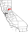
Nevada County, California Basics:


Nevada County California - Government Site

Population: 98,267
Area: 958 square miles
County seat: Nevada City
Area code(s) in use: 530
Time zone: PST
High school graduate or higher: 95.0%
Bachelor's degree or higher: 32.7%
Median household income: $57,382
Persons in poverty: 11.6%
Home ownership rate: 72.7%
Mean travel time to work: 24.2 minutes


Adjacent counties:
Placer  Sierra  Washoe (NV)  Yuba  

Find in California

Map of the Nevada County area


Our detail map of Nevada County shows the Nevada County, California boundary lines and other interesting items.

Places in Nevada County, California

  Airports     show all on map

Alta Sierra Airport, Grass Valley Service Center Heliport, Jackson Lake Heliport, Limberlost Ranch Airport, Milhous Ranch Airport, Nevada County Air Park, Shaws Hill Heliport, Tahoe Forest Hospital Heliport, Truckee-Tahoe Airport

  Bars     show all on map

Condemned Bar, French Bar, Jones Bar, Missouri Bar, Starvation Bar

  Basins     show all on map

Five Lakes Basin, Penn Valley, Pleasant Valley, Round Valley, Sunshine Valley, The Punchbowl

  Bays     show all on map

China Cove

  Beaches     show all on map

Pine Island Beach

  Bends     show all on map

Buttermilk Bend

  Bridges     show all on map

Bridgeport Covered Bridge, Donner Summit Bridge

  Buildings     show all on map

American Victorian Museum, Bicentennial Museum, Breen Cabin (historical), Brighton House (historical), Emigrant Trail Museum, Firehouse Number 1 Museum, Firehouse Number 2, Graniteville Volunteer Fire Company, Grass Valley Branch Nevada County Library, Grass Valley City Hall, Grass Valley Fire Department Station 1, Grass Valley Fire Department Station 2, Grass Valley Police Department, Graves Cabin, Higgins Area Fire Protection District, Nevada City City Hall, Nevada City Fire Department / Nevada County Consolidated Fire District Station 54, Nevada City Police Department, Nevada County Consolidated Fire District Administrative, Nevada County Consolidated Fire District Station 80, Nevada County Consolidated Fire District Station 81, Nevada County Consolidated Fire District Station 82, Nevada County Consolidated Fire District Station 83, Nevada County Consolidated Fire District Station 84, Nevada County Consolidated Fire District Station 86, Nevada County Consolidated Fire District Station 87, Nevada County Consolidated Fire District Station 88, Nevada County Consolidated Fire District Station 90, Nevada County Consolidated Fire District Station 92, Nevada County Courthouse, Nevada County Fire District 89, Nevada County Law Library, Nevada County Sheriff's Office, Nevada County Sheriff's Office Truckee Subdivision, Nevada Theatre, North San Juan Fire Protection District Station 1, North San Juan Fire Protection District Station 2, North San Juan Fire Protection District Station 3, North Star Museum, Ophir Hill Fire Protection District, Peardale - Chicago Park Fire Protection District, Peardale - Chicago Park Fire Protection District Station 257, Penn Valley Fire Protection District Station 43, Penn Valley Fire Protection District Station 44, Peter Grubb Hut, Red Castle, Rough and Ready Fire Protection District, Rough and Ready Grange Hall, Searls Historical Library, Stewart Mansion, Truckee Branch Nevada County Public Library, Truckee Fire Protection District Station 91 Downtown, Truckee Fire Protection District Station 92 Gateway, Truckee Fire Protection District Station 93 Donner Lake, Truckee Fire Protection District Station 94 Tahoe Donner, Truckee Fire Protection District Station 95 Glenshire, Truckee Fire Protection District Station 96, Truckee Fire Protection District Station 97, Veterans Memorial Building, Washington Fire Department, Washington Ridge California Youth Authority Camp, Woolsey Cabin (historical)

  Canals     show all on map

Allison Ranch Ditch, B Canal, Bald Hill Ditch, Bowman-Spaulding Conduit Flume, Cascade Canal, Chicago Park Ditch, China Ditch, Clear Creek Lateral, Cole Ditch, Cory Ditch, Cunningham Ditch, D-S Canal, Deer Creek Ditch, Excelsior Ditch, Forest Springs Lateral, Grass Valley Ditch, Idaho-Maryland Ditch, Kyler Ditch, Lafayette Ditch, Loma Rica Siphon, Lower Ditch, Lower Rough and Ready Ditch, Magnolia Ditch, Pet Hill Ditch, Rattlesnake Ditch, Redinger Ditch, Rex Ditch, Riffle Box Ditch, Rough and Ready Ditch, Smith-Gordon Ditch, Snow Mountain Ditch, South Yuba Canal, Stockton Hill Ditch, Stone Ditch, Tarr Ditch, Tunnel Ditch, Union Hill Ditch, Upper Rough and Ready Ditch, Viet Cameron Ditch, White Ditch, Wolf Ditch

  Capes     show all on map

Erie Point, Long Point, Peacock Point, Point Defiance

  Cemeteries     show all on map

Catholic Cemetery, Elm Ridge Cemetery, Greenwood Memorial Cemetery, Pioneer Cemetery, Pioneer Grove, Rough and Ready Cemetery, Saint Patricks Cemetery, Truckee Cemetery

  Census     show all on map

Alta Sierra Census Designated Place, Floriston Census Designated Place, Graniteville Census Designated Place, Kingvale Census Designated Place, Lake of the Pines Census Designated Place, Lake Wildwood Census Designated Place, North San Juan Census Designated Place, Penn Valley Census Designated Place, Rough and Ready Census Designated Place, Soda Springs Census Designated Place, Washington Census Designated Place

  Churches     show all on map

Bethel Assembly of God Church, Cedar Crest Church, Church of the Nazarene, Emmanuel Episcopal Church, First Baptist Church, First Baptist Church, First Church of Christ Scientist, First Congregational Church, First Methodist Church, Grace Lutheran Church, Saint Josephs Chapel, Saint Patricks Roman Catholic Church, Trinity Episcopal Church

  Cliffs     show all on map

Booth Point, Chalk Bluff, Excelsior, Frog Lake Cliff, Lupine Point, Pleasant Point, Ponderosa Palisades, Windy Point Cliffs

  Crossings     show all on map

Combie Crossing (historical), Edwards Crossing, Hoyt Crossing, Lang Crossing, Purdon Crossing, Rice Crossing, Steeplehollow Crossing

  Dams     show all on map

Anthony House 1300-002 Dam, Bellett 317 Dam, Big Downey Lake 1-024 Dam, Blue Lake 97-012 Dam, Boca Dam, Bowman Rockfill 61-002 Dam, Culbertson 97-017 Dam, Deer Creek Diversion 61-003 Dam, Donner Ever Valley 319 Dam, Donner Lake 301 Dam, Dutch Flat 2 Forebay 61-024 Dam, Dutch Flat Afterbay 61-023 Dam, Faucherie 61-022 Dam, French Lake 61-006 Dam, Fuller Lake 97-021 Dam, Jackson Lake 61-017 Dam, Jackson Meadows 61-020 Dam, Lake Angela 89-002 Dam, Lake Fordyce 97-028 Dam, Lake Spaulding 97-029 Dam, Lake Sterling 97-030 Dam, Lake Vera 303 Dam, Liberty Hill Dam, Loma Rica Airport 61-025 Dam, Lower Feeley Lake 97-035 Dam, Lower Lindsey 97-036 Dam, Magnolia 1302 Dam, Martis Creek Lake Dam, Meadow Lake 97-040 Dam, Mid Lindsey Lake 97-041 Dam, Milton Diversion 61-007 Dam, Nevada City Raw Water 2026 Dam, Our House Dam, Pine Grove 2003 Dam, Prosser Creek Dam, Rucker Lake 97-044 Dam, Sawmill Lake 61-010 Dam, Scotts Flat 61-018 Dam, Swan 1301 Dam, Upper Feeley Lake 97-045 Dam, Upper Rock Lake 97-048 Dam, Weaver Dam, White Rock Lake 97-049 Dam

  Flats     show all on map

Acid Flat, Austin Flat, Austin Meadow, Bennett Flat, Billy Mack Flat, Buck Meadows, Bull Flat, Burnt Flat, China Flat, Cox-Delaney Flat, Deadmans Flat, Deadmans Flat, English Meadow, Furnace Flat, Holbrook Flat, Indian Flat, Jackson Meadows (historical), Juniper Flat, La Mar Flat, Loney Meadow, McCarty Flat, Moscove Meadow, Murphy Flat, Pat Yore Flat, Pierce Meadow, Randolph Flat, Round Valley, Sailor Flat, Sailor Flat, Salt Flat, Scadden Flat, Scotts Flat (historical), Selby Flat, Skillman Flat, Walls Flat, Webster Flat, Woodchuck Flat

  Forests     show all on map

Tahoe National Forest

  Gaps     show all on map

Castle Pass, Euer Saddle, Magonigal Summit

  Hospitals     show all on map

Grass Valley Memorial Hospital, Sierra Nevada Memorial Hospital, Tahoe Forest Hospital District, W G Jones Memorial Hospital (historical)

  Lakes     show all on map

Azalea Lake, Baltimore Lake, Beyers Lakes, Blue Lake, Bullpen Lake, Buzzard Roost Lake, Catfish Lake, Catfish Lake, Chubb Lake, Crater Lake, Crooked Lakes, Derry Lake, Devils Oven Lake, Donner Lake, Downey Lake, Dry Lake, Eagle Lakes, Echo Lake, Faucherie Lake, Flora Lake, Frog Lake, Glacier Lake, Hidden Lake, Hole-In-Ground, Island Lake, Jerry Lake, Kilborn Lake, Lily Pond, Loney Lake, Long Lake, Lower Lola Montez Lake, Lytton Lake, McMurray Lake, Middle Lake, Milk Lake, Mossy Pond, Mud Lake, Paradise Lake, Penner Lake, Phoenix Lake, Round Lake, Sand Ridge Lake, Sanford Lake, Secret Lake, Shotgun Lake, Summit Lake, Tollhouse Lake, Tuttle Lake, Upper Lola Montez Lake, Wagon Wheel Lake, Warren Lake, Weil Lake, West Lakes

  Locales     show all on map

Allisons Ranch (historical), Alpine Meadow Campground, Annie McCloud Campground, B-Four Ranch, Backbone House (historical), Badger Hill Diggings, Banner Grange, Bent Monument, Black Camp, Boca Campground, Boca Rest Campground, Boreal Ridge Ski Area, Bowman House, Boyington Mill Campground, Brady Ranch, Buck Ranch, Buttes Area Camp, Camels Hump Lookout, Camp Lundeen, Camp Nineteen, Camp Pahatsi, Canyon Creek Campground, Carr-Feeley Campground, Casci Ranch, CCC Camp, Central House, Cherokee Diggings, Chicago Park, Churchs Camp, Chute Hill Campground, Circle E Ranch, Cold Springs Campground, Columbia Hill CDF Fire Station, Columbia Hill Ranger Station (historical), Creek Campground, CYA Camp, Dana Ranch, Deer Creek Forehay Recreation Site, Deer Creek Powerhouse, Deer Park Recreation Site, Donner Camp Picnic Area, Donner Summit, Donner Summit Recreation Site, Donner Summit Ski Area, English Mountain Ranch, Farad Powerhouse, Faucherie Campground, Findley Campground, Fir Top Campground, Fivemile House, Four H Club Camp, Four-T Ranch, Fuller Lake Campground, Glacier Trails Boy Scouts of America Camp, Golden Quartz Picnic Area, Greenhorn Campground, Greenhorn Picnic Area, Grouse Ridge Campground, Hagerty Ranch, Head Ranch, Hill Crest, Hilliard Ranch, Hilltop Ranch, Indian Springs, Indian Springs Campground, Jackson Creek Campground, Jackson Meadow Station, Jim McIvers Memorial Arena, Kennebec House (historical), Keystone Ranch, Kirkham Ranch, Lake Spaulding Campground, Lakeside Campground, Levey Ditch Camp, Lindsey Campground, Loma Rica Industrial Park, Lowell Hill, Magonigal Camp, Marin Sierra Boy Scout Camp, Marshall Ranch, Marten Ranch, McKittrick Ranch, McMurray Campground, Miller Ranch, Murphy Cabin, Murphy Ranch, Nevada County Golf Course, Nevada County Landfill, Nickerson Ranch, North Bloomfield Forest Service Station, Old Condon Mill, Omega Rest Area, Orchard Springs Campground, Peninsula Campground, Personeni Ranch, Pineaire Campground, Ponderosa Golf Course, Prosser Campground, Prosser Ranch Group Campground, Quinn Ranch, Rays Ranch, Reader Ranch, Ridge Campground, Rim Powerhouse, River Rest Campground, Robbins Ranch, Robinson Ranch, Rock Creek Trail Picnic Area, S P Lookout, Sagehen Campground, Sagehen Creek Campground, Schwartz Ranch, Scott-Flat Campground, Shady Creek Fire Camp, Shields Camp, Shonter Hill Campground, Silver Tip Campground, Skillman Campground, Soda Springs Ski Area, South Yuba Campground, South Yuba Primitive Campground, Spenceville, Splitrock Campground, State Foresty Guard Station, Sterling Lake Campground, Stockdale Ranch, Sweet Ranch (historical), Tahoe Donner Ski Area, Tahoe National Forest Supervisor Office, Towle Mill Site, Truckee Ranger Station, Truckee Work Center, Tull Ranch, University of California Wildlife Experiment Station, Upper Alder Creek Picnic Area, Van Norden Campground, Weaver lake Campground, White Cloud Campground, White Cloud Guard Station, White Cloud Picnic Area, Williams Ranch, Wolf Creek Ranch (historical), Woodcamp Campground, Woodcamp Picnic Area

  Mines     show all on map

Alpha Diggings, Alpha Mine, Alpha Mine, Ancho Erie Mine, Anderson Mine, Anderson Mine, Arctic Mine, Arrowhead Mine, Azalea Mine, Baltic Mine, Banner Mine, Banner Mountain Mine, Barren Mine, Birchville Mine, Black Bear Mine, Black Sand Mine, Blue Lead Mine, Buckeye Diggings, Canada Hill Mine, Celina Flat Mine, Centennial Mine, Champion Mine, Christmas Hill Diggings, Coe Mine, Cold Stream Pit, Comet Tunnel, Conlan Mine, Crown Point Mine, Crystal Hill Mine, Daisy Blue Mine, Daisy Hill Mine, Eagle Bird Mine, East Harmony Mine, Electric Mine, Empire Mine, Empress Mine, Excelsior Mine, Federal Loan Mine, Fountain Head Mine, Gaston Mine, Giant King Mine, Gold Bug Mine, Gold Hill Mine, Golden Treasure Mine, Gracie Mine, Granite Hill Mine, Greenhorn Creek Pit, Hartery Mine, Hermosa Mine, Hirschdale Cinder Quarry, Hirschdale Pit, Hoge Mine, Homeward Bound Mine, Hotwater Mine, Howie Mine, Hudson Bay Mine, Idaho-Maryland Mine, Jim Mine, Kentucky Ridge Mine, King Woolford Mill Site, Lake Combie Pit, Larimer Mine, Last Chance Mine, Last Chance Mine, Lava Cap Mine, Liberty Hill Diggings, Little York Diggings, Lone Jack Mine, Magenta Mine, Maid of Orleans Mine, Malakoff Diggings, Mammoth Spring Mine, Martis Valley Pit, Mary Jane Mine, Maslin Shaft, Meadow Lake Mine, Mistletoe Mine, Mountain View Mine, Murchie Mine, New Brunswick Mine, New Eureka Mine, New Hope Mine, New Rocky Bar Mine, New York Hill Mine, Niagara Mine, North Star Central Shaft, North Star Mine, Old Allison Ranch Mine, Old Brunswick Mine, Omaha Mine, Omega Diggings, Orleans Mine, Osborne Hill Mine, Peabody Mine, Pennsylvania Mine, Pine Hill Mine, Poore Mine, Rattlesnake Mine, Red Dog You Bet Diggings, Ridge Rock Quarry, Rose Mountain Mine, Sadie D Mine, Saint John Mine, Saint Louis Mine, San Juan Mine, Scotia Mine, Sleeping Beauty Mine, Snowflower Mine, South Star Mine, Spanish Mine, Spotswood Mine, Spring Hill Mine, Stockton Hill Mine, Swamp Angel Mine, Telegraph Mine, Texas Mine, Upper Spanish Mine, West Harmony Mine, Wisconsin Mine, WYOD Mine, Wyoming Mine, Yellow Metal Mine, Zeibright Mine, Zeibright Mine

  Parks     show all on map

Bugler Cove Park, Condon Park, Donner Memorial State Park, Donner Monument, Empire Mine State Historic Park, Forest Circle Park, Knight Monument, Malakoff Diggins State Historic Park, Malakoff Diggins-North Bloomfield Historic District, Meadow Park, Memorial Park, Miners Gulch Park, Nevada City Downtown Historic District, Nevada County Fairgrounds, Pioneer Park, Rock Creek Nature Study Area, South Yuba River State Park, Truckee River Regional Park, Vista Park, Watt Park, West End Beach Park, Western Gateway Regional Park

  Populated Places     show all on map

Alpha (historical), Alta Hill, Alta Sierra, Alta Sierra Estates, Alta Sierra Ranches, Alta Vista Park, Armstrong, Badger Hill (historical), Baltimore Town, Banner Crest, Bear River Pines, Bear Valley (historical), Bella Vista Park, Big Oak Valley, Birch Meadow Acres, Birchville, Bitney Corner, Blue Tent, Boca, Boston Ravine, Bridgeport, Bronco, Buena Vista (historical), Camp Spaulding, Cascade Shores, Casey Corner, Cedar Crest, Cedar Ridge, Champion (historical), Cherokee, Cherry Creek Acres, Coleman, Crystal Lake, Crystal Springs (historical), Cypress Hill, Deer Creek Park, Democrat (historical), Dew Drop, Dillon (historical), Donner Lake Village, Donner Pines Tract, Donner Woods, Eagle Bird (historical), Echo Ridge Estates, Echo Ridge Trails, Evergreen Estates, Floriston, Forest Knolls, Forest Spring (historical), French Corral, Gaston, Gateway, Gelatt, Glenbrook, Gold Flat, Graniteville, Grass Valley, Higgins Corner, Highland Park, Hills Flat, Hinton, Hirschdale, Hobart Mills, Hunts Hill (historical), Iceland, Jones Bar (historical), Junction House, Kenwood Estates, Kingvale, Kres, La Barr Meadows, Lake City, Lake of the Pines, Lake Wildwood, Lakeview, Langs (historical), Leduc Acres, Little York (historical), Malakoff (historical), Marsh Mill, Maybert (historical), Meadow Lake Park, Mooney Flat, Moores Flat, Mystic, Nevada City, Newtown, Norden, North Bloomfield, North Columbia, North San Juan, Olympia Glade, Olympic Heights, Omega, Ophir Hill Acres, Orleans Flat, Peardale, Penn Valley, Pinecrest, Polaris, Ponderosa Fairway Estates, Prosser (historical), Prosser Lake Heights, Prosser Lakeview Estates, Providence (historical), Quaker Hill (historical), Red Dog, Relief, Remington Hill (historical), Ridge View, Rough and Ready, Sahl Court, Scotts Flat, Sebastopol, Shands (historical), Shelby Flat (historical), Sherwood Forest, Sierra Knoll Estates, Sierra Vista Park, Snow Point (historical), Snow Tent (historical), Soda Springs, Spring Hill, Starbright Acres, Summit City (historical), Sunrise Heights, Sunset View, Sweetland, The Oaks, Timber Trails, Town Talk, Truckee, Tsekankan (historical), Union Hill, Union Mills, Ustoma (historical), Washington, Weeks Tract, White Spot, Willaura Estates, Willow Valley, Wokodot (historical), Wolf, Woolsey Flat, Yamako (historical), You Bet, Yuba Pass

  Post Offices     show all on map

Cedar Ridge Post Office, Gelatt Post Office (historical), Grass Valley Post Office, Nevada City Post Office, Norden Post Office, North San Juan Post Office, Soda Springs Post Office, Truckee Post Office

  Ranges     show all on map

Sagehen Hills

  Reservoirs     show all on map

Alta Hill Reservoir, Banner Reservoir, Blair Lake, Boca Reservoir, Bowman Lake, Carr Lake, Crystal Lake, Culbertson Lake, Deer Creek Reservoir, Diggins Pond, Feeley Lake, Fordyce Lake, French Lake, Fuller Lake, Grass Valley Reservoir, Harry L. Englebright Lake, Herring Reservoir, Hobart Reservoir, Idaho-Maryland Reservoir, Independence Lake, Jackson Lake, Jackson Meadows Reservoir, Lake Angela, Lake of the Pines, Lake Spaulding, Lake Sterling, Lake Vera, Lake Wildwood, Lava Cap Reservoir, Liberty Hill Reservoir, Lindsey Lakes, Lindsey Lakes, Lower Rock Lake, Martis Creek Lake, Meadow Lake, Milton Reservoir, Morris Reservoir, Pine Grove Reservoir, Prosser Creek Reservoir, Rex Reservoir, Rock Lake, Rock Lake, Rollins Reservoir, Rough and Ready Reservoir, Rucker Lake, Sawmill Lake, Scotts Flat Reservoir, Sunset View Reservoir, Weaver Lake, Weaver Reservoir, White Rock Lake, Yuba Reservoir

  Ridges     show all on map

Andesite Ridge, Boca Ridge, Boreal Ridge, Buck Ridge, Buckeye Ridge, Burlington Ridge, Carpenter Ridge, Celina Ridge, Cement Hill, Chalk Bluff Ridge, Donner Ridge, Gaston Ridge, Grouse Ridge, Harmony Ridge, Horton Ridge, Jones Ridge, Kentucky Ridge, Lowell Hill Ridge, Montezuma Ridge, Osceola Ridge, Pinoli Ridge, San Juan Ridge, San Juan Ridge, Sand Ridge, Washington Ridge

  Schools     show all on map

Alta Sierra Elementary School, Bear River High School, Bear River School, Ben Hill Elementary School, Blue Tent School, Central School (historical), Chicago Park Elementary School, Clear Creek Elementary School, Cottage Hill Elementary School, Deer Creek School, Donner Trail School, Forest Springs School, Grant Public School (historical), Grizzly Hill Elementary School, Hennessy Elementary School, Limekiln School, Lyman Gilmore Intermediate School, Malakoff Elementary School, Mount Saint Marys Academy, Nevada City School, Nevada Union High School, Oak Tree Elementary School, Pleasant Ridge Elementary School, Pleasant Valley Elementary School, Ready Springs Elementary School, Seven Hills Intermediate School, Sierra Mountain High School, Tahoe Truckee High School, Truckee Elementary School, Union Hill Elementary School, Washington Elementary School, Washington Public School (historical)

  Slopes     show all on map

Devils Slide, Horse Range

  Springs     show all on map

Bear Trap Spring, Big Lick Spring, Big Tunnel Spring, Black Oak Spring, Boca Spring, Buck Spring, Buckeye Spring, Coleman Spring, Damfine Spring, Demory Spring, Dempsey Spring, Derbec Spring, East Boca Spring, Fowler Spring, Holden Springs, Indian Spring, Jackies Orchard Spring, Juniper Ridge Spring, McKay Spring, Mills Spring, Mobley Spring, Mule Spring, Perkins Spring, Red Hill Spring, Rocky Canyon Spring, Sardine Spring, Snowtent Spring, Upper Derbec Spring, Upper Woolsey Spring, Willow Spring, Willow Spring, Woodchoppers Spring

  Streams     show all on map

Alder Creek, Alder Creek, Baltic Creek, Blind Shady Creek, Bloody Run, Bronco Creek, Brush Creek, Canyon Creek, Clear Creek, Clear Creek, Clipper Creek, Cold Stream, Critter Creek, Deadman Creek, Deer Creek, Diamond Creek, Donner Creek, Dry Creek, Ellens Creek, Fall Creek, Fish Creek, Fordyce Creek, French Corral Creek, French Creek, Gold Run, Granite Creek, Gray Creek, Greenhorn Creek, Grizzly Creek, Grub Creek, Hackett Creek, Humbug Creek, Indian Springs Creek, Jackson Creek, Jefferson Creek, Jordan Creek, Juniper Creek, Kenebec Creek, Lake Creek, Lindsey Creek, Little Brown Bear Creek, Little Canyon Creek, Little Clipper Creek, Little Deer Creek, Little Dry Creek, Little Greenhorn Creek, Little Shady Creek, Little Truckee River, Little Wolf Creek, Little Wolf Creek, Lower Castle Creek, Macklin Creek, Magnolia Creek, McKilligan Creek, Middle Yuba River, Million Dollar Creek, Money Creek, Moore Flat Creek, Mosquito Creek, Negro Creek, North Creek, North Fork Deer Creek, North Fork Gray Creek, North Fork Prosser Creek, North Fork Steephollow Creek, Owl Creek, Piper Creek, Poorman Creek, Poorman Creek, Prairie Creek, Prosser Creek, Purdon Creek, Ragsdale Creek, Rattlesnake Creek, Rattlesnake Creek, Rattlesnake Creek, Rock Creek, Rock Creek, Roscoe Creek, Rucker Creek, Rush Creek, Sagehen Creek, Salt Creek, Scotchman Creek, Shady Creek, Slate Creek, South Fork Canyon Creek, South Fork Deer Creek, South Fork Greenhorn Creek, South Fork Poorman Creek, South Fork Prosser Creek, South Fork Wolf Creek, South Wolf Creek, South Yuba River, Spring Creek, Squirrel Creek, Station Creek, Steephollow Creek, Subterranean Creek, Sweetland Creek, Texas Creek, Thimbleberry Creek, Toms Creek, Trap Creek, Trout Creek, Upper Castle Creek, Upper Independence Creek, Washington Creek, West Fork Gray Creek, West Juniper Creek, White Rock Creek, Willow Valley Creek, Wolf Creek, Woodcamp Creek

  Summits     show all on map

Alder Hill, Allenwood Hill, American Ranch Hill, Andesite Peak, Bald Mountain, Bald Mountain, Banner Mountain, Basin Peak, Billy Hill, Black Buttes, Boca Hill, Bowman Mountain, Brady Mountain, Buck Mountain, Buck Mountain, Bunker Hill, Burned Hill, Bushy Mountain, Buzzard Roost, Camel Hump, Castle Peak, Cherry Hill, Clyde Mountain, Cole Hill, Columbia Hill, Cottage Hill, Egbert Hill, English Mountain, Fall Creek Mountain, Fattebort Hill, Findley Peak, Fir Hill, Fordyce Summit, George R. Stewart Peak, George Washington Hill, Goat Rock, Gold Hill, Granite Hill, Haney Mountain, Hartley Butte, Haystack Mountain, Hog Hill, Iron Mountain, Iron Mountain, Juniper Hill, Lucas Hill, McGlashan Point, McGuire Mountain, Meadow Lake Hill, Montezuma Hill, Mount Lola, Mount Marliave, Mount Olive, Mount Stephens, Negro Jack Hill, Old Man Mountain, Ophir Hill, Osborne Hill, Peardon Hill, Pilot Peak, Pine Hill, Pine Hill, Pinoli Peak, Piper Hill, Prosser Hill, Pyramid Peak, Quaker Hill, Quartz Hill, Red Hill, Red Mountain, Red Mountain, Remington Hill, Rock Mountain, Round Mountain, Signal Peak, Sonntag Hill, Sugar Loaf Mountain, Sugarloaf Hill, Sugarloaf Mountain, Sugarloaf Peak, The Beartrap, Trailer Hill, Vandervere Mountain, Wolf Mountain, Zion Hill

  Towers     show all on map

KHTZ-AM (Truckee), KJFA-FM (Grass Valley), KJFA-FM (Grass Valley), KNCO-AM (Grass Valley), KNCO-FM (Grass Valley), KVMR-FM (Nevada City)

  Trails     show all on map

Baltimore Trail, Bayes Cabin Road, Beyers Lake Trail, Blue Lake Trail, Bowman Mountain Trail, Canyon Creek Trail, China Cove Trail, Crooked Lakes Trail, Diggins Loop Trail, Eagle Bird Trail, Fordyce Lake Trail, Glacier Lakes Trail, Glacier Lakes Trail, Grouse Ridge Trail, Humbug Trail, Linsey Lake Trail, Lola Montez Trail, Missouri Bar Trail, Mossy Pond East Trail, Mossy Pond West Trail, Mount Rose Trail, Probable Donner Trail, Round Lake Trail, South Yuba Trail, Spaulding Lake Trail, Warren Lake Trail, Woodcamp Creek Interpretive Trail

  Tunnels     show all on map

Bowman Tunnel, Clear Creek Tunnel, Milton-Bowman Tunnel, Zion Hill Tunnel

  Valleys     show all on map

Austin Ravine, Bathhouse Ravine, Bear Valley, Bear Valley, Billy Mack Canyon, Black Cut Ravine, Blue Ravine, Box Canyon Number Three, Canyon Twentyfour, Canyon Twentythree, Canyon Twentytwo, Canyon Two, Carpenter Valley, Casey Canyon, Castle Valley, Cedar Ravine, Coon Canyon, Crabtree Canyon, Devils Canyon, Eagle Ravine, East Boca Canyon, Eastern Canyon, Euer Valley, French Ravine, French Ravine, Gas Canyon, Golconda Ravine, Gold Canyon, Gonelson Canyon, Hawkins Canyon, Holley Ravine, Joe Miller Ravine, Jones Ravine, Jones Valley, Kentucky Ravine, Keystone Ravine, Logan Canyon, Long Hollow, Long Ravine, Meyer Ravine, Meyers Ravine, Missouri Canyon, Missouri Canyon, Mohawk Ravine, Mystic Canyon, National Gulch, Negro Canyon, New York Canyon, New York Ravine, North Canyon, Osceola Ravine, Pan Ravine, Paradise Valley, Perazzo Canyon, Poison Canyon, Puny Dip Canyon, Quinn Canyon, Rab Ravine, Rapp Ravine, Rhode Island Ravine, Riffle Box Ravine, Rocky Canyon, Rocky Glen, Russel Valley, Slacks Ravine, Slide Ravine, Stump Canyon, Tehama Ravine, Truckee Canyon, Uhlen Valley, Union Canyon, Union Valley, Upper Jones Valley, Willow Valley, Woodpecker Ravine,

Nevada County, California Population By Race (2012 estimate)

RacePopulation
WhiteNevada County White population 92,37192,370  
MixedNevada County Mixed population 2,8502,849
AsianNevada County Asian population 1,2771,277
American IndianNevada County American Indian population 1,1791,179
BlackNevada County Black population 491491
Hawaiian & Pacific IslanderNevada County Hawaiian & Pacific Islander population 9898

Additional population tables :
State population table
California population by county