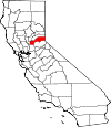
Placer County, California Basics:


Placer County California - Government Site

Population: 361,420
Area: 1407 square miles
County seat: Auburn
Area code(s) in use: 530 916
Time zone: PST
High school graduate or higher: 93.6%
Bachelor's degree or higher: 34.7%
Median household income: $73,356
Persons in poverty: 8.4%
Home ownership rate: 71.4%
Mean travel time to work: 26.7 minutes


Adjacent counties:
El Dorado  Nevada  Sacramento  Sutter  Washoe (NV)  Yuba  

Find in California

Map of the Placer County area


Our detail map of Placer County shows the Placer County, California boundary lines and other interesting items.

Places in Placer County, California

  Airports     show all on map

Auburn CDF Heliport, Auburn Municipal Airport, Blue Canyon - Nyack Airport, Fiddyment Field Airport, Holsclaws Stol Strip Stolport, Homewood Seaplane Base, Lincoln Regional Airport/Karl Harder Field, PG and E-Auburn Service Center Heliport, Pruett Airport

  Areas     show all on map

Royal Gorge, Thermalands

  Bars     show all on map

Alabama Bar, Big Bar, Buckeye Bar, Cherokee Bar, China Bar, Dotsons Bar (historical), Euchre Bar, Hoosier Bar, Horseshoe Bar (historical), Humbug Bar, Indian Bar, Italian Bar, Junction Bar, Kennebeck Bar, Louisiana Bar, Mammoth Bar, Mumford Bar, Murderers Bar, New York Bar, Oregon Bar, Parsley Bar, Pickering Bar, Poverty Bar, Rattlesnake Bar (historical), Stoney Bar, Stumps Bar, Tamaroo Bar, Willow Bar

  Basins     show all on map

Bear Wallow, Big Valley, Byrds Valley, Cothrin Cove, Devils Basin, Laddies Cove, Lake Valley, Picayune Valley, Shanks Cove, Sugar Bowl, Upper Hell Hole

  Bays     show all on map

Agate Bay, Beeks Bight, Carnelian Bay, Granite Bay, McKinney Bay

  Beaches     show all on map

Atagam Beach, Moondunes Beach, Patton Beach, Secline Beach

  Bends     show all on map

Big Bend, Bogus Thunder, Horseshoe Bend

  Bridges     show all on map

Dog Bar Bridge, Ellicott Bridge, Fanny Bridge, Foresthill Bridge, Gautier Bridge, Greenwood Bridge, McCourtney Crossing (historical), Sierra Vista Bridge

  Buildings     show all on map

Alta Volunteer Fire Protection District, American Medical Response, Applegate Branch Auburn-Placer County Library, Auburn City Fire Department Station 1 Martin Park, Auburn City Fire Department Station 2 Gietzen, Auburn City Fire Department Station 3 Maidu, Auburn City Hall, Auburn Police Department, Auburn-Placer County Library, California Army National Guard 233rd Firefighting Team, California Department of Forestry and Fire Protection Station 30 Colfax Fire Department, California Shock Trauma Air Rescue, Carnegie Library (historical), Carner Hall, Center For Sierra Nevada Studies, Central Community Hall, Colfax Branch Auburn-Placer County Library, Colfax Fire Department, Dietrich Theatre, Dry Creek Fire Department Placer County Fire District, Foresthill Fire Protection District Station 88, French Meadows Guard Station (historical), Fruitvale Community Hall, Gold Hill Grange Hall, Hope Village (historical), Iowa Hill Fire Department, Kings Beach Branch Auburn-Placer County Library, Lee Hall, Lincoln City Hall, Lincoln Police Department, Lincoln Public Library, Loomis Branch Auburn-Placer County Library, Lubeck Mansion, McRae Opera House (historical), Mount Pleasant Community Hall, Mount Vernon Community Hall, North Tahoe Fire Protection District Station 51 North Tahoe, North Tahoe Fire Protection District Station 52 North Tahoe, North Tahoe Fire Protection District Station 53 North Tahoe, North Tahoe Fire Protection District Station 54 North Tahoe, North Tahoe Fire Protection District Station 55 North Tahoe, North Tahoe Fire Protection District Station 56 Alpine Meadows, Placer County Courthouse, Placer County Fire Department Station 1 / City of Roseville Fire Department Station 1, Placer County Fire Department Station 15 / South Placer Fire Department Station 6, Placer County Fire Department Station 16 / South Placer Fire Department Station 4, Placer County Fire Department Station 17 / South Placer Fire Department Station 1, Placer County Fire Department Station 180 Atwood, Placer County Fire Department Station 182 / Ophir Fire Department, Placer County Fire Department Station 184 Lone Star, Placer County Fire Department Station 19 / South Placer Fire Department Station 3, Placer County Fire Department Station 2 / Roseville Fire Department Station 2, Placer County Fire Department Station 20 / South Placer Fire Department Station 5, Placer County Fire Department Station 23 / Rocklin City Fire Department Station 1, Placer County Fire Department Station 24 / Rocklin City Fire Department Station 2, Placer County Fire Department Station 25 / Rocklin City Fire Department Station 3, Placer County Fire Department Station 28 / Loomis Fire Protection District Station 1, Placer County Fire Department Station 29 / Loomis Fire Protection District Station 2, Placer County Fire Department Station 3 / Roseville Fire Department Station 3, Placer County Fire Department Station 31 / Northstar Fire Department, Placer County Fire Department Station 32 / Dutch Flat Volunteer Fire Department, Placer County Fire Department Station 33 / Lincoln City Fire Department Station 1, Placer County Fire Department Station 34 / Lincoln City Fire Department Station 2, Placer County Fire Department Station 35 / Lincoln City Fire Department Station 3, Placer County Fire Department Station 38 / Penryn Fire Protection District, Placer County Fire Department Station 4 / Roseville Fire Department Station 4, Placer County Fire Department Station 41 / Newcastle Fire Protection District, Placer County Fire Department Station 5 / Roseville Fire Department Station 5, Placer County Fire Department Station 6 / Roseville Fire Department Station 6, Placer County Fire Department Station 70 / Lincoln City Fire Department, Placer County Fire Department Station 73 Fowler, Placer County Fire Department Station 74 Thermalands, Placer County Fire Department Station 75 Paige, Placer County Fire Department Station 77 Sunset, Placer County Fire Department Station 78 Sheridan, Placer County Fire Department Station 8 / Roseville Fire Department Station 8, Placer County Fire Department Station 84 / Placer Hills Fire Department Station 1, Placer County Fire Department Station 85 / Placer Hills Fire Department Station 2, Placer County Fire Department Station 86 / Placer Hills Fire Department Station 3, Placer County Fire Department Station 88 / Forest Hill Fire Department Station 1, Placer County Fire Department Station 90 / Forest Hill Fire Department Station 3, Placer County Historical Museum, Placer County Jail, Placer County Sheriff Foresthill Substation, Placer County Sheriff's Office Auburn, Placer County Sheriff's Office Colfax Substation, Placer County Sheriff's Office Loomis Substation, Placer County Sheriff's Office Tahoe Substation, Placer Sheriff's Office Granite Bay Substation, Rocklin Branch Auburn-Placer County Library, Rocklin Police Department, Roseville Arts Center, Roseville City Hall, Roseville Police Department, Roseville Police Jail, Roseville Public Library, Roseville Telephone Museum, S P Cabin (historical), Sewell Hall, South Placer Fire Station, Squaw Valley Fire Department, Tahoe City Branch Auburn-Placer County Library, Telecare Placer County Psychiatric Health Facility, Truckee Fire Protection District Station 98 Serene Lakes, Veterans Memorial Building, Veterans Memorial Building, Veterans Memorial Hall, Walker Hall, Weaver Hall, Weimar Institute of Health & Education, Westshore Community Center, William M Winstead Memorial Library, Winstead Center

  Canals     show all on map

Antelope Canal, Barton Canal, Baughman Canal, Bear River Canal, Ben Franklin Canal, Boardman Canal, Bowman Canal, Bowman Feeder Canal, Breece and Wheeler Ditch, Camp Far West Ditch, Caperton Canal, China Wall Iowa Hill Ditch, Combie Ophir Canal, Doty Ravine North Canal, Drum Canal, Dudley Canal, Fiddler Green Canal, Gold Blossom Canal, Gold Hill Canal, Iowa Hill Ditch, Lincoln Canal, Lone Star Canal, Lower Fiddler Green Canal, Morgan Canal, Newcastle Canal, North Fork Ditch, Ophir Canal, Penryn Canal, Perry Canal, Pine Nut Ditch, Pulp Mill Ditch, Red Ravine Canal, Red Star Ditch, Red Star Mining Ditch (historical), Rose Spring Ditch, Shirland Canal, South Canal, South Canal, South Sutter Ditch, Sugarloaf Canal, Trap Line Ditch, Turner Canal, Upper Boardman Canal, Upper Boardmen Canal, Upper Bowman Canal, Valley View Canal, Whisky Diggins Canal, Wise Canal, Wise Penstock

  Capes     show all on map

Beals Point, Cape Horn, Dollar Point, Dotons Point, Flick Point, Ford Point, Iron Point

  Cemeteries     show all on map

Auburn District Cemetery, Colfax Cemetery, Dutch Flat Cemetery, Foresthill Cemetery, Iowa Hill Cemetery, Lone Star Cemetery, Manzanita Cemetery, New Auburn Cemetery, Newcastle Cemetery, Pioneer Grave, Roseville Cemetery, Sheridan Cemetery

  Census     show all on map

Alta Census Designated Place, Carnelian Bay Census Designated Place, Dollar Point Census Designated Place, Dutch Flat Census Designated Place, Foresthill Census Designated Place, Granite Bay Census Designated Place, Kings Beach Census Designated Place, Meadow Vista Census Designated Place, Newcastle Census Designated Place, North Auburn Census Designated Place, Penryn Census Designated Place, Sheridan Census Designated Place, Sunnyside-Tahoe City Census Designated Place, Tahoe Vista Census Designated Place, Tahoma Census Designated Place

  Channels     show all on map

Devils Gate

  Churches     show all on map

Bethel Lutheran Church, Christian Life Center, Church of God, Church of Jesus Christ of Latter Day Saints, Community Covenant Church, Faith Chapel Assembly of God Church, First Assembly of God Church, First Baptist Church of Roseville, First Church of Christ Scientist, First Presbyterian Church, First Southern Baptist Church, First United Methodist Church, First United Methodist Church, Full Gospel Tabernacle, Landmark Missionary Baptist Church, Lighthouse Christian Center, Mount Saint Joseph Seminary, Newcastle United Methodist Church, Placer Church, Rock of Roseville Church, Saint Josephs Catholic Church

  Cliffs     show all on map

Big Crater, Chalk Bluff, Little Crater, Long Point, Lovers Leap, Red Cliffs, Red Point, Sailor Point, Thunder Cliff, Twin Crags, Windy Point

  Crossings     show all on map

Diamond Crossing, Exit 102, Exit 103, Exit 105A, Exit 105B, Exit 106, Exit 108, Exit 109, Exit 110, Exit 112, Exit 115, Exit 116, Exit 118, Exit 119A, Exit 119B, Exit 119C, Exit 120, Exit 121, Exit 122, Exit 123, Exit 124, Exit 307, Exit 309, Exit 313, Hales Crossing, Parsley Bar Crossing, Plumtree Crossing, Taylor Crossing, Watson Crossing

  Dams     show all on map

Afterbay 1030-004 Dam, Boole 1320 Dam, Camp Far West 52-000 Dam, Camp Far West Diversion 52-002 Dam, Christian Valley 97-015 Dam, City of Lincoln 2008 Dam, Clover Valley 1030-005 Dam, Columbian 321 Dam, Combie 61-009 Dam, Dike Five, Dike Four, Dike Six, Drum Forebay 97-020 Dam, Folsom Dikes 1,2 and 3 Dam, Folsom Dikes 4,5 and 6 Dam, Halsey Forebay 97-023 Dam, Ice Lakes 1324 Dam, Interbay 1030-003 Dam, Kelly Lake 97-024 Dam, Kidd Lake 97-025 Dam, Kokila 320 Dam, L L Anderson 1030 Dam, L L Anderson Dam, Lake Alta 97-026 Dam, Lake Arthur 97-027 Dam, Lake Mary 311-003 Dam, Lake Tahoe Dam, Lake Theodore 97-031 Dam, Lake Valley 97-032 Dam, Lakewood 1322 Dam, Lower Hell Hole 1030-002 Dam, Lower Peak Lake 97-037 Dam, Mammoth Reservoir 1030-006 Dam, Morning Star Reservoir 325 Dam, New Drum Afterbay 97-128 Dam, North Fork Dam, Orr Creek Dam, Putts Lake 311-004 Dam, Quail Lake 326 Dam, Red Star Dam (historical), Reservoir A 1086 Dam, Rock Creek 97-043 Dam, Rock Creek Dam, Rollins 61-021 Dam, Sewer S Pond 5 1048 Dam, Snowflower 1323 Dam, Spring Valley Ranch 1321 Dam, Upper Peak Lake 97-047 Dam, Van Giesen Dam, Waste Water Storage 2022 Dam

  Falls     show all on map

Codfish Falls, Hidden Falls

  Flats     show all on map

Alpine Meadows, Antone Meadows, Barker Meadow, Big Meadow, Big Oak Flat, Blacksmith Flat, Buck Meadow, Buck Meadow (historical), Buckeye Flat, Bunker Meadow, Burnt Flat, Butcher Flat, Carpenter Flat, Cedar Flat, Deadman Flat, Dellar Meadow, Doty Flat, Drivers Flat, Elliot Meadow, French Meadows, Gooseneck Flat, Grizzly Flat, Hells Half Acre, Indian Flat, John Brown Flat, Klondike Meadow, Little McKinstry Meadow, Little Mountain Meadow, Little Oak Flat, Lower Hell Hole (historical), Lower Meadow, McKinstry Meadow, Mears Meadow, Miller Meadows, Monona Flat, Monte Carlo Meadows, Mountain Meadow, Murphy Meadows, Oak Flat, Page Meadows, Pelham Flat, Pug Ugly, Putnam Valley, Quartz Flat, Robinsons Flat, Sailor Flat, Sailor Meadow, Sawmill Flat, Squaw Flat, Squaw Flat, Strawberry Flat, Succor Flat, Wildcat Meadow

  Forests     show all on map

Onion Creek Experimental Forest

  Gaps     show all on map

Barker Pass, Donner Pass, Emigrant Gap, Giant Gap, Heavens Gate, Willmont Saddle, Yuba Gap

  Hospitals     show all on map

Dewitt General Hospital (historical), Dewitt State Hospital (historical), Highland General Hospital (historical), Kaiser Permanente Roseville Medical Center, Sutter Auburn Faith Hospital, Sutter Roseville Medical Center, Weimar Medical Center (historical)

  Lakes     show all on map

Averys Pond, Bear Lake, Buck Lake, Bunker Lake, Dulzura Lake, Ellis Lake, Fern Lake, Fisher Lake, Five Lakes, High Loch Leven Lake, Huntley Mill Lake, Huysink Lake, Ice Lakes, Kelly Lake, Lagoon Lake, Lake Alta, Lake Estelle, Lake Louise, Lily Lake, Little Needle Lake, Loch Leven Lakes, Long Lake, Long Lake, McKinney Lake, McKinstry Lake, Mildred Lakes, Miller Lake, Mountain Meadow Lake, Mud Lake, Nancy Lake, Natalie Lake, Needle Lake, Palisade Lake, Salmon Lake, Serena Lake, Shirley Lake, Swan Lake Junior, Twin Lakes, Warm Lake, Watson Lake

  Locales     show all on map

Ahart Campground, Alpine Meadows Ski Area, Alta Powerhouse, Angus Hills Golf Course, Auburn Waste Water Treatment Facility, Bake Oven, Baker Ranch, Beals Point Campground, Bear Creek Campground, Bear Trap Cabin, Bear Valley Campground, Bel Air Shopping Center, Big Bend Campground, Big Bend Forest Service Station, Big Gun Diggings, Big Meadow Campground, Big Meadows Campground, Big Tree Grove Campground, Big Tree Grove Picnic Area, Big Valley Bluff Lookout, Black Bear Campground, Black Oak Golf Course, Blue Canyon Guard Station, Blue Canyon Weather Station, Bonny Nook, Brock, Brockway Golf Club, Brockway Guard Station, Brockway Winter Sports Center, Brushy Spring Guard Station, Butcher Ranch, Camp Far West Ranch, Cedar Springs, Chamberlain Ranch, Chicken Hawk Campground, Coon Street Picnic Area, Coyote Group Campground, Cranston Ranch, Creekside Town Center Shopping Center, Damascus, Deadwood, Deer Park Ski Area, Dewey Campground (historical), DeWitt Government Center, Diamond Heart Ranch, Diamond K Ranch, Diamond Oaks Municipal Golf Course, Dinner Tree, Ditch Camp, Dobbas Cow Camp (historical), Dorer Ranch, Drum Powerhouse, Dry Creek Regional Wastewater Treatment Plant, Duncan Peak Forest Service Station, Duncan Peak Lookout Tower, Dutch Flat Powerhouse, Dutch Flat Station, Ebberts Ranch, Elliot Ranch, Emigrant Gap Scenic Viewpoint, Five Lakes Trailhead, Forbes Campground, Forbes Creek Group Campground, Foresthell Seed Orchard, Foresthill Ranger Station, Foresthill Work Center, Forks House, French House, French Meadows Boat Ramp and Picnic Area, French Meadows Boat Ramp and Picnic Recreation Site, French Meadows Forest Service Station, French Meadows Recreation Site, FS Water Treatment Plant, Galleria At Roseville Shopping Center, Garden Bar, Gasoline Alley, Gates Cabin, Gates Group Campground, Giant Gap Family Campground, Goggins (historical), Goose Meadows Campground, Gorman Ranch, Granite Bay Golf Course, Granite Flat Campground, Granlibakken Ski Area, Greek Store Guard Station (historical), Grizzly Bear House, Hampshire Rocks Campground, Handy Camp, Hell Hole-In Campground, Hidden Gold Camp, Hidden Valley Ranch, Homewood Ski Area, Hotaling, IDS Organization, Indian Creek Country Club, Joerger Ranch, Johnson Monument, Kaspian Picnic Area, Kelly Lake Campground, Kidd Lake Campgrond, Lake Forest Campground, Last Chance, Lewis Campground, Lincoln Koi Farm, Lincoln Rodeo Grounds, Lodgepole Campground, Long Ravine Campground, Maintop, Maxwell Sawmill, McGuire Boat Ramp, McGuire Campground (historical), McGuire Picnic and Beach Area, McGuire Picnic and Beach Recreation Site, Middle Meadows Campground, Miranda Cabin, Monzarita Day Use Campground, Mosquito Narrows, Mosquito Ridge Lookout, Mount Vernon Grange, Murry Camp, New England Mills, North Fork Campground, North Star Ski Area, Northstar-at-Tahoe, Northstar-at-Tahoe Ski Area, Old Joerger Ranch, Old Schaeffer Camp, Old Schaeffer Mill, Old Stanford Wood Camp, Old Sugar Pine Guard Station, Onion Creek Campground, ORV Staging Area, Placer Center Plaza Shopping Center, Poppy Campground, Powder Bowl Ski Area, R F Fiddyment Ranch, Ralston Campground, Ralston Picnic Area, Ridge Golf Course, Robinsons Flat Campground, Rolling Greens Golf Course, Roseville Shopping Center, Roseville Square Shopping Center, Secret House, Secret House Campground, Shirttail Creek Family Campground, Sierra View Country Club, Silver Creek Campground, Silver Tip Campground, Spring Valley Ranch, Squaw Valley Ski Area, Stallman Corners, Star Town, Stateline Lookout, Sugar Bowl Ski Area, Sugar Pine Beat Ramp, Sugar Pine Point, Sugarpine Mill (historical), Sunny South, Sunnybrook Farm, Sunset Oaks Country Club, Sunset Whitney Industrial Park, Tadpole Campground, Tahoe City Golf Course, Tahoe Nordic, Tahoe Ski Bowl Area, Tahoe Tavern, Talbot Campground, Tamarack Substation, The Balloon, Trail Spur (historical), Tunnel Mills Campground, W F Fiddyment Ranch, Watson Monument Emigrant Pass Marker, Western Regional Landfill, Whisky Creek Camp, William Kent Guard Station and Camp, Willowrock Plaza Shopping Center, Woodchuck Campground

  Military     show all on map

Lincoln Communication Annex

  Mines     show all on map

Adams Pit, Adams Pit, Alabama Mine, Alameda Tunnel, American Eagle Mine, American Hill Mine, Anderson Mine, Anderson Pit, Anna Sue Mine, Bachelor Pit, Baltimore Mine, Barney Pits, Basin Mine, Bauer Mine, Beaman Ledge Mine, Bear Wallow Tunnel, Bear's Elbow Quarry, Beauty Mine, Beehive Mine, Big Chief Mine, Big Dipper Mine, Black Oak Mine, Blackhawk Mine, Blue Devil Diggings, Boedner Mine, Bowen Mine, Bower Mine, Bowman Mine, Britt Mine, Buckeye Mine, Buckeye Pit, Bullion Mine, Burnham Pit, Burns Number One Mine, Burns Number Two Mine, Burroughs Pit, Burroughs Tunnel, Butte Mine, California, California Morning Star Mine, Cameron Mine, Campbell Mine, Cape Horn Tunnel, Carmac Mine, Centennial Mine, Central Mine, Clydesdale Mine, Comet Mine, Crosby Mine, Dairy Farm Mine, Daniel Webster Mine, Darling Mine, Deep Canyon Mine, Derby Mine, Dix Mine, Dixie Queen Mine, Dorer Mine, Double O Mine, Drummond Mine, Drummond Pit, Eastman Mine, El Dorado Hill Mine, Eldorado Mine, Elkhorn Mine, Eureka Tunnel, Fairview Number One Mine, Fairview Number Two Mine, Franklin Pit, Franklin Pit, Gas Hill Mine, Gleeson Diggings, Goggins Mine, Gold Dollar Mine, Golden Chief Mine, Golden Fleece Tunnel, Golden Gate Mine, Golden Gate Number One Mine, Golden Riffle Mine, Golden River Tunnel, Golden Streak Mine, Gorman Pit, Granite Mine, Green Mine, Grey Eagle Mine, Grizzly Mine, H and H Mine, Hard Climb Mine, Harkness Mine, Haymes Mine, Hazard Mine, Herman Mine, Hermit Mine, Herrington Quarry, Hidden Treasure Mine, Highway Forty Mine, Hinchy Mine, Hoffman Pits, Hogsback Tunnel, Home Ticket Mine, Homestake Mine, Honey Tunnel, Honor Camp Number Seven, Hornby Mine, Hungry Hollow Tunnel, Imperial Mine, Iowa Hill Mine, Jack Robinson Mine, Jarvis Tunnel, Keokuk Mine, Keystone Mine, Lebanon Mine, Lightfoot Pit, Lightfoot Tunnel, Lincoln Clay Mine, Lincoln Quarry (historical), Little Hope Mine, Lloyd Mine, Lost Camp Mine, Lost Emigrant Mine, Lower Glenn Mine, Lower Tunnel, Lynn Mine, Macedon Mine, Macedon Tunnel, Manhattan Mine, Marall Chrome Mine, Marrs Mine, Mary Anna Mine, Mary Len Mine, Mayflower Mine, McGuire Mine (historical), McKinley Mine, Merz Mine, Millers Defeat, Missouri Flat Mine, Mitchell Mine, Mountain Chief Mine, Mountain Chief Tunnel, Mountain Gate Tunnel, Muir Mine, Narry Red Mine, New Caledonia Mine, Newcastle Quarry, Nichols Diggings, Noonchester Mine, Occidental Mine, Old Vore Mine, Oro Mine, Ox Yoke Mine, Pacific Mine, Pacific Slab Mine, Paragon Mine, Pat Tuck Mine, Pay Day Number One Mine, Peters Mine, Pigeon Roost Mine, Pine Nut Mine, Pioneer Mine, Placer Queen Mine, Rainbow Land Mine, Rainbow Mine, Ralston Mine, Randall Mine, Rattlesnake Mine, Rawhide Mine, Red Star Mine, Rising Sun Mine, Root Hog Mine, Rublin Mine, Russel Mine, Sailor Canyon Mine, San Francisco Mine, Sauer Kraut Bite Mine, Savage Workings, Sharp Stick Mine, Shenanigan Mine, Sicily Mine, Sierra View Mines, Small Hope Mine, Snow Bird Mine, Sourdough Pit, Specimen Pit, Star Town Mine, Stewart Gravel Mine, Swiftshore Mine, Three Queens Mine, Tickell Mine, Trap Line Mine, Trinidad Mine, Turkey Hill Mine, Twenty One Placer Mine, Upper Glenn Mine, Victory Mine, Volcano Mine, Walker Mine, Washburn Mine, Washington Mine, Welcome Mine, White Mine, X-Ray Mine, Yellow Jacket Mine, Zuver Mine

  Parks     show all on map

Antelope Creek Park, Ashford Park, Auburn District Regional Park, Auburn Recreation Park, Auburn State Recreation Area, Burton Creek State Park, Christian Valley Park, Cirby Creek Park, Clover Valley Park, Cresthaven Park, Crestmont Park, Deer Park, Diamond Oaks Park, Eastwood Park, Emigrant Gap Historical Marker, Garbolino Park, Gold Country Fairgrounds, Griffith Quarry Historic Park, Hidden Falls Regional Park, Johnson-Springview Park, Kailua Park, Kasian Recreation Area, Kenwood Oaks Park, Kings Beach State Recreation Area, Leroy E Botts Memorial Park, Lincoln Estates Park, Loomis Basin Regional Park, Maidu Park, Mark White Park, McBean Memorial Park, McCann Stadium, North Tahoe Regional Park, North Tahoe Regional Park, Old Auburn Historic District, Old Timers Park, Placer County Fairgrounds, Placer County Grove Sierra Redwoods, Quarry Park, Royer Park, Saugstad Park, Sheridan Park, Sierra Gardens Park, Sierra Meadows Park, Spring Meadows Park, Squaw Valley State Reservation Area (historical), Tahoe City Public Beach, Tahoe Park, Tahoe State Recreation Area, Vista Grande Park, Ward Creek Project, Weber Park, William B Layton Park, Woodbridge Park, Woodside Park

  Pillars     show all on map

Devils Thumb, Fir Crags, Lime Rock, Stanford Rock

  Populated Places     show all on map

Alpine Meadows, Alta, Andover, Andover (historical), Applegate, Auburn, Auburn Hills Mobile Estates, Baltimore (historical), Bath (historical), Baxter, Big Bend, Blue Canyon, Bowman, Brockway, Brockway Vista, Cape Horn, Carnelian Bay, Carnelian Heights, Casa Loma, Chamberlands Estates, Chambers Lodge, Cisco, Cisco Grove, Clayton, Clipper Gap, Colfax, Comstock Acres, Dollar Point, Donner, Drum (historical), Dutch Flat, Eden Valley, Eder, Elders Corner, Emigrant Gap, Ewing, Flat Ravine (historical), Forebay, Foresthill, Four Acres, Gilberts, Goggins, Goggins (historical), Gold Hill, Gold Run, Golden Chain Mobile Home Park, Granite Bay, Greekstore (historical), Heather Glen, Hidden Valley, Homewood, Hughes Mill, Idlewild, Illinoistown (historical), Iowa Hill, Kilaga Springs, Kings Beach, Kingswood Estates, Kulkumish (historical), Lake Forest, Lakeshore, Lander Crossing, Last Chance, Lincoln, Loomis, Magra, Mayflower (historical), McCulloh, Meadow Vista, Michigan Bluff, Midas, Millertown (historical), Molma (historical), Monte Vista, Newcastle, Nielsburg, North Auburn, Ophir, Penryn, Pine Land, Pinecroft, Pitsokut (historical), Ponderosa Palisades, Rainbow, Ralston (historical), Rampart, Ramsey Crossing, Rawhide, Red Point (historical), Ridgewood, Riego, Rocklin, Roseville, Secret Canyon (historical), Secret Town, Shady Glen, Sheridan, Soda Springs, Southside Highlands, Spruce (historical), Stanford (historical), Sunnyside, Tahoe City, Tahoe Estates, Tahoe Marina Estates, Tahoe Park, Tahoe Pines, Tahoe Vista, Tahoe Woods, Tahoma, Tahoma Meadows, Talmont, Tamarack (historical), The Cedars, Timberland, Todd Valley, Towle, Troy, Twin Peaks Estates, Twin Pines, Virginiatown, Weimar, Westville, Whitney, Wood Vista, Yankee Jims, Zuver

  Post Offices     show all on map

Applegate Post Office, Auburn Post Office, Blue Canyon Post Office, Brockaway Post Office (historical), Carnelian Bay Post Office (historical), Chambers Lodge Post Office (historical), Colfax Post Office, Deerpark Post Office (historical), Foresthill Post Office, Homewood Post Office, Kings Beach Post Office, Lincoln Post Office, Loomis Post Office, McKinney Post Office (historical), Newcastle Post Office, Penryn Post Office, Rocklin Post Office, Roseville Post Office, Sheridan Post Office, Sqawk Creek Post Office (historical), Tahoe City Post Office, Tahoe Pines Post Office (historical), Tahoe Vista Post Office, Tahoe Vista Post Office (historical), Tahoma Post Office, Weimar Post Office, Westville Post Office (historical)

  Reserves     show all on map

Antone Meadows Natural Preserve, Burton Creek Natural Preserve, Granite Chief Wilderness

  Reservoirs     show all on map

Baldwin Reservoir, Big Reservoir, Caperton Reservoir, Cascade Lakes, Clover Valley Reservoir, Dollar Reservoir, Drum Forebay, French Meadows Reservoir, French Meadows Reservoir, Halsey Afterbay, Halsey Afterbay, Halsey Forebay, Hell Hole Reservoir, Hell Hole Reservoir, Hunkle Reservoir, Jerrys Pool, Kidd Lake, Lake Arthur, Lake Combie, Lake Mary, Lake Putt, Lake Putt, Lake Tahoe, Lake Theodore, Lake Valley Reservoir, Lake Van Norden, North Fork Lake, North Fork Reservoir (historical), Oxbow Reservoir, Quail Lake, Rock Creek Lake, Roseville Reservoir, S P Lakes, Sugar Pine Reservoir, Valley View Reservoir, Wise Forebay

  Ridges     show all on map

Baker Divide, Balloon Ridge, Barney Cavanah Ridge, Big John Ridge, Big Valley Bluff, Blackwood Ridge, Boulder Ridge, Chipmunk Ridge, Codfish Point, Cuckoo Ridge, Deadwood Ridge, End of the World, Forest Hill Divide, Giant Gap Ridge, Gillis Hill, Hammell Point, Hogback, Humbug Ridge, Iowa Hill Divide, Knee Ridge, Long Point, Macedon Ridge, Mildred Ridge, Mineral Point, Monumental Ridge, Moody Ridge, Mooney Ridge, Mosquito Ridge, Nevada Point, Nevada Point Ridge, Peavine Ridge, Portuguese Point, Prospect Hill, Ralston Ridge, Red Star Ridge, Sawtooth Ridge, Schallenberger Ridge, Smiths Point, Sore Finger Point, South Long Point

  Schools     show all on map

Adelante High School, Alpha School (historical), Alta Vista Elementary School, Alta-Dutch Flat Elementary School, Antelope Creek Elementary School, Bowman Elementary School, Carlin C Coppin Elementary School, Chana High School, Christian Valley School (historical), Cirby Elementary School, Colfax Elementary School, Colfax High School, College of Our Lady of Mercy, Columbia School, Crestmont Elementary School, Del Oro High School, Dry Creek Elementary School, E V Cain Elementary School, Edgemont School (historical), Emigrant Gap Elementary School, Eureka Union Elementary School, Fairoaks School (historical), Ferris Spanger Elementary School, Fleur Du Lac School, Foresthill Elementary School, Franklin Elementary School, Fruitvale School, Glen Edwards Elementary School, Glen Edwards Middle School, Gold Hill School (historical), Gold Run School, Greenhills Elementary School, Heald College - Roseville, Iowa Hill School, Japanese School (historical), Japanese School (historical), Kaseberg Elementary School, Kings Beach Elementary School, Lincoln High School, Lone Star School (historical), Loomis Elementary School, Monte Rio School (historical), Newcastle Elementary School, Oakmont High School, Ophir Elementary School, Parker Whitney Elementary School, Penryn Elementary School, Placer Elementary School, Placer High School, Placer Hills Elementary School, Pleasant Grove School (historical), Rideout Elementary School, Rock Creek Elementary School, Rocklin Elementary School, Roseville High School, Saint Albans Day School, Saint Josephs School, Saint Maria Goretti Academy, Saint Rose School, Sheridan Elementary School, Sierra College, Sierra Gardens Elementary School, Spring Garden School, Spring View Middle School, Tahoe Lake Elementary School, Valley View School, Vernon Street Elementary School (historical), Warren T Eich Intermediate School, Weimar Academy, Weimar College, Weimar Hills Junior High School, William Jessup University, Woodbridge Elementary School

  Springs     show all on map

Bear Spring, Bear Springs, Big Rock Spring, Big Spring, Brockway Spring, Brushy Spring, Corral Spring, Coyote Spring, Dad Youngs Spring, Dawson Spring, Deller Spring, Desert Cold Spring, Goat Spring, Government Spring, Heath Spring, Horse Spring, Hunters Spring, Joes Spring, McCulloh Spring, Meadow Spring, Nick Welch Spring, Onion Valley Spring Two, Pine Tree Spring, Sawpit Spring, Skunk Spring, Soda Springs, Tadpole Spring, Texas Hill Spring, Wallace Spring

  Streams     show all on map

Alderman Creek, Andrew Gray Creek, Antelope Creek, Barker Creek, Bear Creek, Bear Pen Creek, Bear Trap Creek, Big Granite Creek, Big Mosquito Creek, Blackwood Creek, Brimstone Creek, Brush Creek, Brushy Creek, Brushy Creek, Brushy Creek, Buckskin Creek, Burton Creek, Cabin Creek, Campbell Creek, Canyon Creek, Cedar Creek, Chief Creek, Chipmunk Creek, Cirby Creek, Clipper Creek, Clover Valley Creek, Codfish Creek, Cody Creek, Cold Creek, Cottage Home Creek, Cottonwood Creek, Coyote Creek, Dardanelles Creek, Deadman Creek, Deep Creek, Deer Creek, Dellar Creek, Dollar Creek, Dolly Creek, Doty Creek, Dry Creek, Duncan Creek, East Fork North Fork North Fork American River, East Martis Creek, Eldorado Creek, Ellis Creek, Five Lakes Creek, Forbes Creek, Frazier Creek, Fulda Creek, Grayhorse Creek, Griff Creek, Grouse Creek, Harvey Gray Creek, Humbug Creek, Indian Creek, Indian Creek, Indian Creek, Ingram Slough, Kaseberg Creek, Kent Creek, Linda Creek, Little Bear Creek, Little Codfish Creek, Little Duncan Creek, Little Granite Creek, Little Grizzly Creek, Little Indian Creek, Little Mosquito Creek, Little Powderhorn Creek, Long John Creek, Madden Creek, Martis Creek, McBride Creek, McKinney Creek, Middle Branch Owl Creek, Middle Fork American River, Middle Fork Blackwood Creek, Middle Martis Creek, Mile Hill Creek, Mill Creek, Miller Creek, Monte Carlo Creek, Monumental Creek, Mountain Chief Creek, North Branch Owl Creek, North Fork American River, North Fork Blackwood Creek, North Fork North Fork American River, North Fork of Middle Fork American River, North Miller Creek, Onion Creek, Orchard Creek, Orr Creek, Owl Creek, Pagge Creek, Palisade Creek, Peavine Creek, Pole Creek, Pond Creek, Powderhorn Creek, Rice Creek, Rock Creek, Rocky Wash, Royal Gorge River, Rubicon River, Sellier Creek, Serena Creek, Shady Grove Run, Shady Run, Silver Creek, South Branch Grouse Creek, South Branch Owl Creek, South Branch Pleasant Grove Creek, South Fork Cold Creek, Spruce Creek, Squaw Creek, Tadpole Creek, Talbot Creek, Temperance Creek, Todd Creek, Wabena Creek, Ward Creek, Watson Creek, West Martis Creek, West Meadow Creek, Whisky Creek, Whisky Run, Willow Creek, Wooley Creek, Yankee Slough, Yellow Jacket Creek

  Summits     show all on map

American Hill, Anderson Peak, Bald Hill, Bald Mountain, Bald Rock Mountain, Barker Peak, Big Chief, Big Hill, Big John Hill, Billys Peak, Black Mountain, Bogus Point, Brockway Summit, Bullshead, Bunker Hill, Camels Hump, Canada Hill, Cherry Point, Cisco Butte, Cold Spring Hill, Colfax Hill, Cottage Home Hill, Coyote Hill, Crows Nest, Devil Peak, Devils Peak, Devils Peak, Donner Peak, Duncan Hill, Duncan Peak, Eagle Rock, Ellis Peak, First Sugarloaf, Frost Hill, Gold Star Peak, Granite Chief, Guide Peak, Hayden Hill, Hayford Hill, Helester Point, Hotchkiss Hill, Howell Hill, Indian Knoll, Jackass Point, Jerrett Peak, Kings Hill, Kings Hill Point, KT-22, Little Bald Mountain, Little Chief, Little Sage Hill, Little Steamboat Mountain, Lookout Mountain, Lynchburg Hill, Lyon Peak, Martis Peak, McIntosh Hill, McKinstry Peak, Mount Disney, Mount Judah, Mount Lincoln, Mount Mildred, Mount Pluto, Mount Watson, Needle Peak, Painted Rock, Painted Rock, Pennsylvania Point, Poulsen Peak, Quartz Mountain, Race Track Hill, Rattlesnake Mountain, Red Hill, Red Star Point, Roach Hill, Robie Point, Sage Hill, Scott Hill, Scott Peak, Second Sugarloaf, Silver Peak, Snakehead Point, Snow Mountain, Spaulding Point, Squaw Peak, Steamboat Mountain, Stony Hill, Sugar Loaf, Sugar Pine Mountain, Sugar Pine Point, Sugarloaf, Sugarloaf, Sunflower Hill, Tanners Point, Telegraph Hill, Texas Hill, The Pinnacles, Tinker Knob, Twin Peaks, Volcano Hill, Wallace Peak, Ward Peak, Whisky Hill

  Towers     show all on map

KBCH-FM (Kings Beach), KEBR-AM (Rocklin), KFIA-AM (Carmichael), KHTZ-AM (Truckee), KPTO-AM (Citrus Heights), KRCX-AM (Roseville), KRXQ-FM (Roseville)

  Trails     show all on map

American Eagle Trail, American Eagle Trail, American River Trail, Bake Oven Trail, Baumann Trail, Beacroft Trail, Belix Trail, Big Granite Trail, Big Spring Trail, Big Tree Nature Trail, Big Valley Trail, Burnett Canyon Trail, Cherry Point Trail, Chipmunk Trail, Clydesdale Trail, Cockrin Trail, Dellar Trail, Euchre Bar Trail, Five Lakes Creek Trail, Forest View Trail, Forks House Trail, Forks House Trail, Gold Dollar Trail, Granite Chief Trail, Green Valley Trail, Grey Trail, Grizzly Canyon Trail, Grouse Creek Trail, Heath Falls Overlook Trail, Horse Spring Trail, Hunters Trail, Italian Bar Trail, Lagoon Trail, Last Chance Trail, Loch Leven Trail, Long Canyon Trail, Long Valley Trail, Lower Meadow Trail, McKinstry Trail, Mears Lake Valley Trail, Monumental Creek Trail, Mumford Bar Trail, Overland Emigrant Trail, Painted Rock Trail, Palisades Creek Trail, Parsley Bar Trail, Pigeon Roost Trail, Pioneer Express Trail, Sailor Flat Trail, Sailore Flat Trail, Salmon Lake Trail, Schlein Trail, Shanks Cove Trail, Slide Point Trail, Steamboat Trail, Sugar Pine Point Trail, Tanners Point Trail, Tevis Cup Trail, Wabena Trail, Wallace Trail

  Tunnels     show all on map

Blue Cut, Clara Tunnel, Clark Tunnel, Dutch Flat Tunnel, Osborne Tunnel, Union Tunnel

  Valleys     show all on map

Abrams Ravine, Antoine Canyon, Baltimore Ravine, Barts Valley, Bear Den Canyon, Bear Wallows, Big Grizzly Canyon, Big Snyder Gulch, Big Valley Canyon, Black Canyon, Blackhawk Canyon, Blind Canyon, Bloody Ravine, Blue Canyon, Blue Eyes Canyon, Brushy Canyon, Brushy Canyon, Brushy Mountain Canyon, Bunch Canyon, Burnett Canyon, Caps Ravine, Carnelian Canyon, Christian Valley, Cliff Canyon, Clover Valley, Coldstream Valley, Cub Canyon, Dark Canyon, De Krruse Canyon, Deadman Canyon, Deep Canyon, Devils Canyon, Doty Ravine, Duncan Canyon, Dutch Flat Canyon, Dutch Ravine, East Branch El Dorado Canyon, Eden Valley, El Dorado Canyon, Emigrant Canyon, Fenton Ravine, First Brushy Canyon, Flat Ravine, Gas Canyon, Georges Ravine, Giant Gap Gulch, Granite Canyon, Gray Eagle Canyon, Grayhorse Valley, Green Valley, Grizzly Canyon, Grouse Canyon, Grub Gulch, Hidden Valley, Homewood Canyon, Humbug Canyon, Indian Springs Ravine, Indiana Ravine, Jack Robinson Ravine, Jackass Gulch, Jamison Ravine, Jefferson Canyon, Jerry Canyon, Ladys Canyon, Lakeview Canyon, Little Duncan Canyon, Little Granite Canyon, Little Grizzly Canyon, Little Mad Canyon, Little Robinsons Valley, Little Secret Canyon, Little Wallace Canyon, Live Oak Ravine, Long Canyon, Long Valley, Lost Canyon, Macedon Canyon, Mad Canyon, Manila Canyon, Martis Valley, McIntyre Gulch, Mexican Gulch, Middle Branch Brushy Canyon, Middle Branch El Dorado Canyon, Miners Ravine, Mormon Ravine, Mount Pleasant Canyon, Murderers Gulch, New York Canyon, New York Canyon, North Branch Brushy Canyon, North Fork Long Canyon, North Ravine, North Shirttail Canyon, North Wallace Canyon, Onion Valley, Paradise Canyon, Peachstone Gulch, Pigeon Roost Canyon, Pine Nut Canyon, Poor Mans Canyon, Quail Trap Ravine, Refuge Canyon, Robbers Ravine, Sailor Canyon, Sailor Ravine, Sailors Ravine, Salvation Ravine, Screwauger Canyon, Second Brushy Canyon, Secret Canyon, Secret Ravine, Secret Ravine, Sharps Ravine, Sheldon Ravine, Shirttail Canyon, Sixmile Valley, Skunk Canyon, Slaughter Ravine, Sleepy Hollow, Slug Gulch, Smuthers Ravine, Snail Canyon, Snyder Canyon, South Branch Brushy Canyon, South Fork Long Canyon, South Wallace Canyon, Spanish Ravine, Specimen Gulch, Spring Canyon, Spring Garden Ravine, Spring Hollow, Squaw Gulch, Squaw Valley, Squires Canyon, Stampede Canyon, Starr Ravine, Steamboat Canyon, Stevens Ravine, Strap Ravine, Sugar Pine Canyon, Summit Valley, Third Brushy Canyon, Tommy Cain Ravine, United States Canyon, Volcano Canyon, Wallace Canyon, West Branch El Dorado Canyon, Wildcat Canyon, Willmont Canyon, Yellow Jacket Canyon, Young America Canyon,

Placer County, California Population By Race (2012 estimate)

RacePopulation
WhitePlacer County White population 313,351313,351  
AsianPlacer County Asian population 23,49223,492
MixedPlacer County Mixed population 13,73413,733
BlackPlacer County Black population 5,7835,782
American IndianPlacer County American Indian population 3,9763,975
Hawaiian & Pacific IslanderPlacer County Hawaiian & Pacific Islander population 1,0841,084

Additional population tables :
State population table
California population by county