Sutter County, California Basics:


Sutter County California - Government Site

Population: 94,659
Area: 602 square miles
County seat: Yuba City
Area code(s) in use: 530
Time zone: PST
High school graduate or higher: 77.9%
Bachelor's degree or higher: 18.4%
Median household income: $50,510
Persons in poverty: 17.0%
Home ownership rate: 60.5%
Mean travel time to work: 28.1 minutes

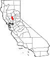
Adjacent counties:
Butte  Colusa  Placer  Sacramento  Yolo  Yuba  

Find in California

Map of the Sutter County area


Our detail map of Sutter County shows the Sutter County, California boundary lines and other interesting items.

Places in Sutter County, California

  Airports     show all on map

Bob's Flying Service Inc Airport, Bowles Airport, James Brothers Airport, James Brothers Airport, Lauppes Strip Airport, Lomo Airport, Moronis Airport, Riego Flight Strip Airport, Sanborn Airport, Scheidel Ranch Airport, Sopwith Farm Airport, Sunrise Dusters Airport, Sutter County Airport, Tenco Tractor Airport, Van Dyke Strip Airport, Vanderford Ranch Company Airport, Vestal Strip Airport, Wagner Aviation Airport

  Areas     show all on map

The Berry Patch

  Basins     show all on map

Sutter Basin

  Bends     show all on map

Boyers Bend, Eldorado Bend, Little Poker Bend, Missouri Bend, Poker Bend, Racetrack Bend, Star Bend, Wild Irishman Bend

  Bridges     show all on map

Long Bridge, Sutter Causeway, Twin Cities Memorial Bridge

  Buildings     show all on map

Barber Branch Sutter County Free Library, Bi - County Ambulance, East Nicolaus Fire Department, Live Oak Fire Department, Meridian Fire Department, North Valley Behavioral Health, Pleasant Grove Fire Department, Robbins Sutter Basin Fire Protection District, Sutter - Yuba Mental Health Services, Sutter Branch Sutter County Free Library, Sutter County Courthouse, Sutter County Fire Department, Sutter County Fire Department, Sutter County Free Library, Sutter County Jail, Sutter County Law Library, Sutter County Museum, Sutter County Office Building, Sutter County Sheriff's Office Live Oak Substation, Yuba City City Hall, Yuba City Farm Labor Center, Yuba City Fire Department Station 1, Yuba City Fire Department Station 2, Yuba City Fire Department Station 3, Yuba City Fire Department Station 4, Yuba City Fire Department Station 7, Yuba City Police Department, Yuba City Womens Club

  Canals     show all on map

Cross Canal, East Canal, East Interception Canal, East Side Canal, Farington Lateral, Humphrey Lateral, Live Oak Canal, Live Oak Canal, Main Canal, Main Chandon Lateral, North Drainage Canal, North Main Canal, Pleasant Grove Creek Canal, Sunset Avenue Lateral, Sutter Butte Canal, Sutter By-Pass, Sutter City Lateral, Sutter County Extension Canal, Tisdale By-Pass, Wadsworth Canal, West Interception Canal, West Side Canal

  Cemeteries     show all on map

Fairview Cemetery, Live Oak Cemetery, Meridian Cemetery, Nicolaus Cemetery, North Butte Cemetery, Pleasant Grove Cemetery, Pugh Cemetery, Stohlman Cemetery, Sutter Cemetery, Yuba City Cemetery

  Census     show all on map

East Nicolaus Census Designated Place, Meridian Census Designated Place, Nicolaus Census Designated Place, Rio Oso Census Designated Place, Robbins Census Designated Place, South Yuba City Census Designated Place (historical), Sutter Census Designated Place, Tierra Buena Census Designated Place (historical), Trowbridge Census Designated Place

  Churches     show all on map

Church of Christ, Church of the Nazarene, Cooper Avenue Baptist Church, Fairview Church, First Church of Christ Scientist, First Lutheran Church, First United Methodist Church, Franklin Home Site Church, Grace Church, Kingdom Hall of Jehovahs Witnesses, Pentecostal Holiness Church, Reorganized Church of Jesus Christ of Latter Day Saints, Saint Isidore Catholic Church, Sutter Assembly of God Church, Sutter Baptist Church, Sutter Church of Christ, Sutter United Methodist Church, Tabernacle De La Fe

  Crossings     show all on map

Dunns Ferry (historical), Moons Ferry (historical)

  Dams     show all on map

Tisdale Weir

  Falls     show all on map

The Falls

  Guts     show all on map

Bunkham Slough, Gilsizer Slough, Nelson Slough, Sacramento Slough, Snake Slough

  Hospitals     show all on map

Fremont Medical Center, Sutter Surgical Hospital North Valley

  Islands     show all on map

Willow Island

  Lakes     show all on map

Abbott Lake, Collins Eddy, Hiatt Lake, Hog Lake (historical), Horseshoe Lake, Horseshoe Lake, Lake of The Woods, Mary Lake, McGriff Lakes, Murphy Lake (historical), Mystic Lake, O'Connor Lakes, Sills Lake, Wood Lake

  Locales     show all on map

Barry Substation, Cranmore Landing, Eddys Ferry, Field and Tule Club, Hock Farm (historical), Joes Landing, Leo Chesney Correctional Center, Pleasant Grove, Pleasant Grove Station (historical), Rough and Ready Landing, Starrs Landing, Sunset Pumping Station, Sutter Butte Outing Club, Winchester Gun Club

  Mines     show all on map

Morehead Pit

  Parks     show all on map

Alta Park, Blackburn Talley Park, Gauche Park, Greenwood Park, Hillcrest Park, Kingwood Park, Live Oak Memorial Park, Lloyd Park, Maple Park, Meridian Park, Morley Park, Sam Brannan Park, Shanghai Bend Park, Southside Park, Sutter Buttes State Park, Sutter National Wildlife Refuge, Sutter Park, Veterans Park, Yuba-Sutter Fairgrounds

  Populated Places     show all on map

Abbott, Alemandra, Berg, Bihlman (historical), Bogue, Butte House (historical), Catlett, Chandler (historical), Colusa Junction, Cornelius (historical), Counsman, Cranmore, Cunard, Dean Place, East Nicolaus, Encinal, Ensley, Everglade, Hinsdale, Hoako (historical), Joes Landing, Joesphine, Karnak, Kirkville, Lira, Live Oak, Lomo, Marchant, Marcuse (historical), Mendoza (historical), Meridian, Mimal (historical), Mount Vernon, Nicolaus, Nuestro, Okpam (historical), Ola (historical), Oswald, Pease (historical), Pennington, Pleasant Grove, Poffenbergers Landing, Progress, Rio Oso, Riviera (historical), Robbins, Sanders, Sankey, Sesum (historical), South Yuba City, Stafford (historical), Striplin (historical), Subaco, Sullivan, Sunset, Sutter, Tarke, Tierra Buena, Tisdale, Tishum (historical), Tomcha (historical), Trowbridge, Tudor, Verona, Wilson, Yiikulme (historical), Yokulme (historical), Yuba City, Yupu (historical)

  Post Offices     show all on map

East Nicolaus Post Office, Live Oak Post Office, Meridian Post Office, Rio Oso Post Office, Robbins Post Office, Sutter Post Office, Yuba City Post Office

  Ranges     show all on map

Sutter Buttes

  Reservoirs     show all on map

Long Lake, Purdue Lake

  Ridges     show all on map

Cole Point

  Schools     show all on map

April Lane Elementary School, Barry Elementary School, Bridge Street Elementary School, Brittan Elementary School, Browns Elementary School, Butte View High School, Central School (historical), Central-Gaither Elementary School, Cottonwood School (historical), Eagle School (historical), East Nicolaus High School, Encinal Elementary School, Fairview School (historical), Faith Christian High School, Farmers School (historical), Franklin Elementary School, Grant School (historical), Gray Avenue Middle School, Hedger School, Holy Angel School, Illinois School (historical), King Avenue Elementary School, Knights School, Lee School (historical), Lincoln Elementary School, Lincrest Elementary School, Live Oak High School, Live Oak Middle School, Live Oak Unified Alternative Education Center, Luther Elementary School, Macum-Illinois Union Elementary School, Meridian Elementary School, Noyesburg School (historical), Nuestro Elementary School, O'Bannon School (historical), Park Avenue Elementary School, Pleasant Grove Elementary School, Robbins Elementary School, Slough School, Steindorf School, Sutter High School, Tierra Buena Elementary School, Union School (historical), Valley Oak Continuation High School, Washington School (historical), Wilson School, Winship Elementary School, Yuba City High School

  Streams     show all on map

Butte Creek, Coon Creek, Curry Creek, Feather River, King Slough, Little Blue Creek, Live Oak Slough, Morrison Slough, Ping Slough, Pleasant Grove Creek, Snake River

  Summits     show all on map

Barney Mound, North Butte, Old Craggy, South Butte, Twin Peaks, West Butte

  Swamps     show all on map

Butte Sink

  Towers     show all on map

KCEO-TV (Oroville), KFBK-AM (Sacramento), KKCY-FM (Colusa), KOBO-AM (Yuba City), KRFD-FM (Marysville), KUBA-AM (Yuba City), KXCL-FM (Yuba City)

  Valleys     show all on map

Auburn Ravine, Braggs Canyon, Brockman Canyon, Fig Tree, Huff Canyon, Kinch Canyon, Markham Ravine, Moore Canyon, Peace Valley,

Sutter County, California Population By Race (2012 estimate)

RacePopulation
WhiteSutter County White population 70,71070,710  
AsianSutter County Asian population 15,24015,240
MixedSutter County Mixed population 3,8813,881
BlackSutter County Black population 2,2722,271
American IndianSutter County American Indian population 2,1772,177
Hawaiian & Pacific IslanderSutter County Hawaiian & Pacific Islander population 379378

Additional population tables :
State population table
California population by county