Colusa County, California Basics:


Colusa County California - Government Site

Population: 21,355
Area: 1151 square miles
County seat: Colusa
Area code(s) in use: 530
Time zone: PST
High school graduate or higher: 69.5%
Bachelor's degree or higher: 13.5%
Median household income: $52,165
Persons in poverty: 15.2%
Home ownership rate: 63.8%
Mean travel time to work: 21.4 minutes

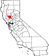
Adjacent counties:
Butte  Glenn  Lake  Sutter  Yolo  

Find in California

Map of the Colusa County area


Our detail map of Colusa County shows the Colusa County, California boundary lines and other interesting items.

Places in Colusa County, California

  Airports     show all on map

Antelope Valley Ranch Airport, Colusa County Airport, Davis Airport, Farnsworth Ranch Airstrip, Gunnersfield Ranch Airport, Indian Ranch Airport, Mc Cabe Ranch Airport, Moller Airport, Richter Airport, Thayer Aviation Airport, Williams Airport

  Areas     show all on map

Colusa By-Pass, Plum Orchard, The Redlands

  Bars     show all on map

Twentymile Bar

  Basins     show all on map

Colusa Basin, Corral Valley, Lower Letts Valley, Mill Valley, Mormon Basin, Munson Basin, Oat Valley, Star Valley, Summit Valley

  Bends     show all on map

Arnold Bend, Boggs Bend, Cobbs Bend, Girdner Bend, Gravel Point, Hamilton Bend, Moons Bend, Ogden Bend, Steiner Bend

  Bridges     show all on map

Hannum Bridge (historical), Mawson Bridge, Red Bridge

  Buildings     show all on map

Arbuckle College City Fire Protection District, Bear Valley - Indian Valley Fire Protection District, California Department of Forestry and Fire Protection Colusa County, California Department of Forestry and Fire Protection Leesville, California Highway Patrol Williams, Colusa Carnegie Library, Colusa County Sheriff's Office, Colusa Fire Department, Colusa Police Department, Enloe Ambulance Service Colusa, Enloe Ambulance Service Williams, Maxwell Fire Protection District, Princeton Fire Protection District, Sacramento River Fire Protection District Colusa Station, Sacramento River Fire Protection District Grand Island Station, Sacramento Valley Museum, United States Forest Service Mendocino National Forest Stonyford Work Center, Williams City Hall, Williams Fire Protection Authority, Williams Police Department

  Canals     show all on map

Central Drain, Cheney Slough Irrigation Canal, Clarks Ditch, Colusa Trough, Colusa Trough, East Drain, Main Drain, Northeast Drain, Provident Central Canal, Provident Eastern Canal, Provident Western Canal, Tehama-Colusa Canal, Wilkins Slough Main Irrigation Canal

  Cemeteries     show all on map

Grand Island Cemetery, Johns Cemetery, Maxwell Cemetery, Pryor Grave, Stonyford Cemetery

  Census     show all on map

Arbuckle Census Designated Place, College City Census Designated Place, Delevan Census Designated Place, Grimes Census Designated Place, Lodoga Census Designated Place, Maxwell Census Designated Place, Princeton Census Designated Place, Stonyford Census Designated Place

  Churches     show all on map

Arbuckle United Methodist Church, Church of the Annunciation, First Baptist Church, Maxwell Baptist Church, Maxwell United Methodist Church, Parkside Methodist Church, Pentecostal Church of God, Sacred Heart Catholic Church, Saint Mary of the Mountain Church, Saint Stephens Episcopal Church, Stonyford Community Church, Trinity United Methodist Church

  Cliffs     show all on map

Pine Needle Point, Windy Point

  Dams     show all on map

Coleman Dike Dam, Colusa Weir, East Park Dam, Funks Dam, Gordon Dike Dam, Letts Valley 1-039 Dam, Moulton Weir, Rees Jones 361 Dam, York Hill 360 Dam

  Flats     show all on map

Becker Flat, Buck Flat, Davis Flat, Davis Flat, Deadshot Flat, Deafy Glade, Deer Flat, Destanella Flat, Doe Flat, Grapevine Flat, Gravelly Flat, Hamilton Flat, Horse Hollow, Malaney Flat, Moon Glade, Rattlesnake Glade, Robbers Flat, Stag Flat, Tule Glade, Welton Glade, Widow Flats, Wolf Glade

  Gaps     show all on map

Golden Gate, Grapevine Pass, Leesville Gap, Sulphur Gap

  Guts     show all on map

Byers Slough, Dry Slough, Wilkins Slough

  Hospitals     show all on map

Colusa Regional Medical Center, Valley West Convalescent Hospital

  Lakes     show all on map

Cecil Lake, Lily Pond, Sabin Lake, Salt Lake, Tule Pond

  Levees     show all on map

Davis Levee, Old Davis Levee

  Locales     show all on map

Arbuckle Golf Club, Bell Outing Gun Club, Black Oak Campground, Boggs Landing, Butte Lodge Outing Club, Cachil Dehe Rancheria, California Division of Forestry Station, California Duck Club, Cedar Camp, Century Ranch, Colusa Golf and Country Club, Colusa Gun Club, Colusa Shooting Club, Commodore Gun Club, Compton Landing, Deafy Glade Trailhead Parking, Digger Pine Campground, Diversion Dam Campground, Fouts Camp, Fouts Recreation Site, Green Flat Camp, Green Mallard Duck Club, Happy Camp, House Mountain, Howells Landing, Huffmaster Ranch (historical), Keller Ranch, Kuhl Gun Club, Lake Land Gun Club, Letts Recreation Site, Limit Gun Club, Little Antelope Grade, Love Lady Ranch, McDaniel Recreation site, Mill Creek Recreation Site, Mill Valley Campground, Mummas Landing, North Fork Campground, North Fork Campground, Northern Gun Club, Old Mill Campground, Pacific Ridge Forest Service Station, Princeton Siding, Red Rock Cabin, Sanborn Cabin, Steel Trap Rock, Stonyford District Ranger Office, Stonyford Rodeo Grounds, Stonyford Work Center, Summit Springs Trailhead, Summit Springs Trailhead Parking, Swifts Stone Corral, Sycamore Siding, The Four Corners, Trout Creek Trailhead Parking, Wards Boat Landing, White Mallard Hunting Club, Wilbur Springs Station California Division (historical), Willow Creek Gun Club, Wilson Camp (historical), Wilson Recreation Site

  Mines     show all on map

Central Mine, Clyde Mine, Elgin Mine, Empire Mine, Manzanita Mine, Rathburn Mine, Ruby King Mine, Sites Quarry, Wide Awake Mine

  Parks     show all on map

Colusa County Fairgrounds, Colusa Levee Scenic Park, Colusa National Wildlife Refuge, Colusa Weir Recreation Area, Colusa-Sacramento River State Recreation Area, Delevan National Wildlife Refuge, Frenzel Creek Research Natural Area

  Pillars     show all on map

Eagle Rock, Horse Rock, Signal Rock

  Populated Places     show all on map

Arbee, Arbuckle, Bonnie View, Boyers Landing, College City, Colusa, Colusa Rancheria, Cortena, Delevan, Delphos, Devils Elbow, Fouts Springs, Fraziers Landing, Genevra, Graino, Grand Island, Grimes, Harrington, Leesville, Lodoga, Lurline (historical), Maxwell, Millers Landing, Mills Orchards, Princeton, Prize (historical), Sites, Stegeman, Stonyford, Sycamore, Waikosel (historical), West Butte, Wilbur Springs, Williams

  Post Offices     show all on map

Arbuckle Post Office, College City Post Office, Colusa Post Office, Grimes Post Office, Maxwell Post Office, Princeton Post Office, Stonyford Post Office, Williams Post Office

  Ranges     show all on map

Oat Hills

  Reservoirs     show all on map

East Park Reservoir, Funks Reservoir, Upper Letts Lake

  Ridges     show all on map

Blue Ridge, Board Camp Ridge, Clark Ridge, Cortina Ridge, County Line Ridge, Crackerbox Ridge, Gilmore Ridge, Hornet Nest Ridge, Howells Point Ridge, Letts Ridge, Little Sullivan Ridge, Logan Ridge, Lovelady Ridge, Miner Ridge, Pine Ridge, Schoolhouse Divide, Smelt Road Ridge, Soapstone Ridge, Sullivan Ridge, Telegraph Ridge, Trough Spring Ridge

  Schools     show all on map

Arbuckle Elementary School, Black Mountain School, Butte Creek School, Colusa High School, George T Egling Middle School, Grand Island Elementary School, Harmony School (historical), Indian Valley School, James M Burchfield Primary School, Johns District School, Little Stony School, Maxwell Elementary School, Maxwell High School, Our Lady of Lourdes School, Pierce Christian College (historical), Pierce High School, Pierce Joint Union High School (historical), Princeton Elementary School, Princeton Junior-Senior High School, Union High School, Union High School, Washington School (historical), Williams Elementary School, Williams High School, Williams Middle School, Yuba College-Colusa Center

  Springs     show all on map

Adobe Spring, Bear Wallow Spring, Blank Spring, Board Camp Spring, Box Spring, Britton Spring, Candy Bucket Spring, Champagne Spring, Cherry Spring, Cold Spring, Cold Spring, Cooks Springs, Cottonwood Spring, Dead Shot Spring, Deadshot Spring, Dunfield Spring, Eaton Springs, Ellen Spring, Ford Spring, Glascock Spring, Hog Spring, Hornet Nest Spring, Little Sulphur Spring, Parry Spring, Red Eye Spring, Scotties Spring, Skinnerville Spring, Stites Spring, Sulphur Spring, Summit Spring, Til Jones Spring, Trough Spring

  Streams     show all on map

Angel Slough, Antelope Creek, Bear Creek, Bounde Creek, Brush Creek, Butte Slough, Calvins Creek, Chamisal Creek, Cold Creek, Cortina Creek, Dead Shot Creek, Drumheller Slough, East Fork Sand Creek, East Fork Sulphur Creek, Elk Creek, Frenzel Creek, Freshwater Branch, Freshwater Creek, Funks Creek, Glenn Valley Slough, Hopkins Slough, Howard Creek, Hunters Creek, Hyphus Creek, Indian Creek, Letts Creek, Little Indian Creek, Little Sullivan Creek, Logan Creek, Lurline Creek, Manor Slough, Manzanita Creek, Middle Fork Mill Creek, Middle Fork Stony Creek, Mill Creek, Mill Creek, Miner Creek, North Branch Sand Creek, North Fork Elk Creek, North Fork Mill Creek, North Fork Stony Creek, Old Cortina Creek, Olgert Canyon, Onemile Creek, Paradise Creek, Perrington Creek, Powell Slough, Rich Creek, Salt Branch, Salt Creek, Salt Creek, Salt Creek, Sand Creek, South Branch Sand Creek, South Fork Cortina Creek, South Fork Mill Creek, South Fork Stony Creek, Spring Creek, Squaw Creek, Stone Corral Creek, Sullivan Creek, Sulphur Creek, Sycamore Slough, Trout Creek, Trout Creek, Trout Creek, Walters Creek, West Fork Sulphur Creek, Whisky Creek, Willow Creek, Wilson Creek

  Summits     show all on map

Anderson Mountain, Bald Hill, Bear Valley Buttes, Billys Hill, Black Mountain, Bunker Hill, Cooks Mountain, Coyote Peak, Gilmore Peak, Goat Mountain, Gravelly Buttes, Greasewood Mountain, Helmer Hill, High Rock, Hornet Nest Hill, Jackson Mountain, La Coma Tallac, Lambert Hill, Lodoga Peak, Lytle Mountain, Pacific Point, Pence Mountain, Potato Hill, Snow Mountain West, Sugarloaf, Sugarloaf, Three Sisters, Whiskey Hill

  Towers     show all on map

KKCY-FM (Colusa), KTMX-FM (Colusa)

  Trails     show all on map

Bathhouse Trail, Bonnie View Trail, Box Spring Loop, Milk Ranch Trail, Milk Ranch Trail, Trout Creek Trail

  Valleys     show all on map

Andys Canyon, Antelope Valley, Batiste Canyon, Bear Valley, Big Canyon, Blanchard Valley, Boulder Canyon, Boxer Valley, Brophy Canyon, Bullshead Canyon, Cain Valley, Carrier Canyon, Craig Canyon, Cultivator Canyon, Davis Canyon, Deadshot Canyon, Doyle Canyon, East Scotties Canyon, Eggman Canyon, Eula Canyon, Fox Canyon, Gaither Canyon, Glascock Canyon, Grassey Canyon, Hamilton Canyon, Hayes Canyon, High Valley, Holsten Canyon, Holsten Chimney Canyon, Jackson Canyon, John Cooper Canyon, Lawson Canyon, Little Sulphur Canyon, Little Valley, Long Canyon, Lynch Canyon, McDowell Canyon, Oak Cove, Palmer Canyon, Pocket Canyon, Rena Canyon, Salt Canyon, Schoolhouse Canyon, Scotties Canyon, Shale Spring Canyon, Shoemaker Valley, Shuckman Canyon, South Jackson Canyon, South Rail Canyon, Spring Valley, Stinchfield Canyon, Strode Canyon, Sullivan Valley, Thompson Canyon, Uncles Canyon, Warnick Canyon, Wilson Canyon,

Colusa County, California Population By Race (2012 estimate)

RacePopulation
WhiteColusa County White population 19,60419,603  
American IndianColusa County American Indian population 555555
MixedColusa County Mixed population 470469
AsianColusa County Asian population 363363
BlackColusa County Black population 256256
Hawaiian & Pacific IslanderColusa County Hawaiian & Pacific Islander population 128128

Additional population tables :
State population table
California population by county