Glenn County, California Basics:


Glenn County California - Government Site

Population: 27,957
Area: 1314 square miles
County seat: Willows
Area code(s) in use: 530
Time zone: PST
High school graduate or higher: 73.5%
Bachelor's degree or higher: 15.4%
Median household income: $42,641
Persons in poverty: 19.5%
Home ownership rate: 65.4%
Mean travel time to work: 20.9 minutes

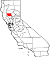
Adjacent counties:
Butte  Colusa  Lake  Mendocino  Tehama  

Find in California

Map of the Glenn County area


Our detail map of Glenn County shows the Glenn County, California boundary lines and other interesting items.

Places in Glenn County, California

  Airports     show all on map

Butler Landing Strip, Diamond M Ranch Airport, Haigh Field Airport, Kirkwood Airport, Noltas Airport, Willows-Glenn County Airport

  Bars     show all on map

The Pocket

  Basins     show all on map

Hubbard Valley, Rocky Basin, Salt Spring Valley, Snow Basin, The Basin

  Bends     show all on map

Beehive Bend, Jenny Lind Bend

  Bridges     show all on map

Gianella Bridge

  Buildings     show all on map

Alta Schmidt House Museum, Artois Fire Protection District, Bayliss Fire Protection District, Butte City Fire Department, California Highway Patrol Willows, Carnegie Community Center, Civic Memorial Building, Drew Cabin (historical), Elk Creek Fire Protection District - Elk Creek Volunteer Fire Department, Enloe Ambulance Service Willows, Glenn - Codora Fire Protection District / Glenn - Codora Fire Department, Glenn County Courthouse, Glenn County Jail, Glenn County Sheriff's Office, Glenn County Sheriff's Office, Hamilton City Fire Protection District / Hamilton City Fire Department, Kanawha Fire Protection District, Mendocino National Forest Fire Service United States Department of Agriculture, Ord Fire Protection District, Orland City Fire Department / Orland Rural Fire Protection District, Orland City Hall, Orland Free Library, Orland Police Department, Swift Point Warehouse, United States Forest Service Mendocino National Forest Alder Springs Work Center, Vanderford Cabin, Westside Ambulance Association, Willows City Hall, Willows City Police Department, Willows Fire Department, Willows Public Library, Willows Rural Fire Protection District

  Canals     show all on map

Glenn-Colusa Canal, Lemon Home Colony Canal, Provident Main Canal, Quint Canal, River Branch Canal, Stony Creek Irrigation Canal

  Cemeteries     show all on map

Artois Cemetery, Butte City Cemetery, Catholic Cemetery, Catholic Cemetery, Graves Cemetery, Grindstone Cemetery, Kirkwood Cemetery, Marvin Chapel Cemetery, Millsap Cemetery, Oddfellows Cemetery, Watson Grave

  Census     show all on map

Artois Census Designated Place, Elk Creek Census Designated Place, Hamilton City Census Designated Place

  Churches     show all on map

Bibleway Association Church, Capay Assembly of God Church, Church of Christ, Country Bible Church, Elk Creek Community Church, Evangelical Free Church, Evangelical Free Church of Hamilton City, Faith Baptist Church, Federated Church, First Apostolic Lighthouse of Jesus Christ Church, First Baptist Church, First Baptist Church, First Christian Church, First Church of Christ Scientist, First Lutheran Church, First Southern Baptist Church, First United Methodist Church, Foursquare Christian Fellowship, Holy Trinity Episcopal Church, Marvin Chapel (historical), Orland Southern Baptist Church, Pentecostal Church of God, Primera Mission Bautista, Saint Dominics Roman Catholic Church, Saint Monicas Roman Catholic Church, Saint Pauls Lutheran Church, Willows Christian Church

  Dams     show all on map

Circle C 375 Dam, E A Wright 371 Dam, Hamilton 374 Dam, James E Drew 373 Dam, Stony Creek Gravel 2005 Dam, Stony Gorge Dam, Stony Gorge Dam

  Flats     show all on map

Alder Flat, Black Diamond Glades, Cottonwood Glade, Euchre Glade, Grassy Patch, Gravelly Flat, Hamilton Glade, O'Neil Glade, Plaskett Meadows, Scotts Glade, Squaw Flat, Tar Flat, Yellow Jacket Glade

  Forests     show all on map

Mendocino National Forest

  Gaps     show all on map

Burrows Gap, Ivory Mill Saddle, Mendocino Pass

  Guts     show all on map

Dunning Slough, Perch Slough, Shannon Slough

  Hospitals     show all on map

Glenn Medical Center

  Islands     show all on map

Hanson Island, Hartley Island, Hoodoo Island, McIntosh Island, Oak Leaf Island, Packer Island, Phelan Island

  Lakes     show all on map

Indian Fishery, Keller Lake, Packer Lake

  Locales     show all on map

Alder Junction, Alder Springs Forest Service Facility, Amaral Farm, Atchison Campground, Bearwallow Trailhead Parking, Board Tree Campground, Brittan Ranch, Brownell Camp, Bunnell Ranch, Butler Camp, Butler Place, Camp Ellendale, Codora Four Corners, Commander Industrial Sawmill, Copper City Campground (historical), Cottonwood Glade Campground (historical), Del Harleson Camp, Dixon Orchard, El Manzano Rancho, Elk Creek Butte Lookout, French Ranch, Garnett Camp, Garrison Ranch (historical), Gillaspy Ranch, Glenn County Fairground, Glenn County Golf and Country Club, Hecks Camp, Ivory Mill Station, Jacinto Grange, Jolly Camp (historical), Keeran Camp, Lee Logan Camp, Lone Star Campground (historical), Long Point Lookout, Malton Field, Masterson Campground, McIntosh Landing, Meyers Cabin, Michael Ranch, Minor Farm, Newhard Landing, Ocean View, Ord Ferry, Peratis Duck Club, Plaskett Recreation Site, Plaskett Station, Powder House, Powell Cabin, Princeton Ferry, Reilly Landing, Riz Siding, Rowcroft Ranch, Saint John, Sidds Landing, Ski Hi, Smiley Camp, Smith Camp, Squaw Camp, Stone Valley Ranch, Stony Creek, Telephone Campground, Valley View Orchard, Valley View Orchard, Walker Cabin, Willows Wastewater Treatment Plant, Willows Westside Mall Shopping Center, Windy Point Trailhead Parking

  Mines     show all on map

Black Diamond Mine, Gray Eagle Mine, Hamilton City Pit, Hamilton Pit, Hydrick Pit

  Oilfields     show all on map

Kirkwood Gas Field, Rice Creek Gas Field

  Parks     show all on map

Ajax Field, Bidwell-Sacramento River State Park, Butte City Launch Facility, Central Park, Grizzly Flat Recreation Area, Irving Finch River Access, Jensen Park, Legion Memorial Park, Lely Aquatic Park, Library Park, Memorial Park, Ordbend County Park, Orland Buttes Recreation Area, Sacramento National Wildlife Refuge, Spence Park, Sycamore Park, Vinsonhaler Park

  Pillars     show all on map

Charlies Rock, Chimney Rock, Red Rock

  Populated Places     show all on map

Afton, Alder Springs, Artois, Bayliss, Bluegum, Butte City, Capay, Chrome, Codora, Copper City, Cory, Dogtown, Elk Creek, Fiddlers Green, Fruto, Glenn, Grapit, Greenwood, Hamilton City, Ideal Mobile Home Park, Jacinto, Jenks Place, Keller Place, Kirkwood, Kurand (historical), Logandale, Lone Star, Lyman (historical), Malton (historical), Meadowood Estates, Meyers Place, Mills Orchard, Millsholm (historical), Monroeville (historical), Newville, Norman, Ordbend, Orland, Reynolds Place (historical), Rotavele, Willow Glenn Mobile Home Park, Willows, Wilson Place, Wyo

  Post Offices     show all on map

Alder Springs Post Office (historical), Artois Post Office, Elk Creek Post Office, Glenn Post Office, Hamilton City Post Office, Oriental Post Office (historical), Orland Post Office, Willows Post Office

  Ranges     show all on map

Hoodoo Hills

  Reserves     show all on map

Snow Mountain Wilderness

  Reservoirs     show all on map

Dry Lake Reservoir, East Reservoir, Forks Reservoir, Stony Gorge Reservoir

  Ridges     show all on map

Auk Auk Ridge, Barb Ridge, Bear Wallow Ridge, Black Diamond Ridge, Bowman Ridge, Brushy Ridge, Buck Ridge, Cedar Ridge, Clifton Ridge, Daves Ridge, Digger Ridge, Elk Ridge, Felkner Ridge, Flowers Ridge, French Ridge, Gravelly Ridge, Happy Camp Ridge, Hardin Hole Ridge, Hardin Ridge, Harvey Spring Ridge, Heifer Ridge, Hokey Pokey Ridge, Hunter Ridge, Kern Ridge, Kilgore Ridge, Kill Dry Ridge, Lake Ridge, Log Spring Ridge, Long Point, Lost Camp Ridge, Markham Ridge, McGill Ridge, Middle Ridge, Middle Ridge, Noel Spring Ridge, Open Ridge, Pinto Ridge, Plaskett Ridge, Rattlesnake Ridge, Recer Ridge, Rockwell Ridge, Rocky Basin Ridge, Rocky Ridge, Rocky Ridge, Salt Log Ridge, Sanhedrin Ridge, Self Ridge, Seminary Ridge, Sheep Ridge, Shepherd Ridge, Skidmore Ridge, Spanish Ridge, Tool Cache Ridge

  Schools     show all on map

Aguas Frias School (historical), Calumet School, Capay Joint Union Elementary School, Carson School (historical), Cherokee School, Codora School, Elk Creek Elementary School, Elk Creek Junior-Senior High School, Fairview Elementary School, Hamilton Elementary School, Hamilton Union High School, Kanawha School, Lake Elementary School, Liberty School, McIntosh School, Mill Street Elementary School, Murdock Elementary School, Ord School, Orland High School, Plaza Elementary School, Price Intermediate School, Seventh-day Adventist School, Union School, Willows Community High School, Willows High School, Willows Intermediate School, Willows Union Grammar School (historical)

  Springs     show all on map

Bathtub Spring, Bearwallow Spring, Big Spring, Buck Spring, Cold Spring, Cold Spring, Cottonwood Spring, Daves Spring, Doe Spring, Foreman Spring, Frolic Spring, Glen Spring, Grouse Spring, Hard Spring, Hardin Hole Spring, Harmes Spring, Hummingbird Spring, Ice Spring, Jerusalem Spring, Jumbo Spring, Manzanita Spring, McGrew Spring, Noel Spring, Pepperwood Spring, Round Spring, Salt Spring, Seros Spring, Seven Troughs Spring, Sheetiron Spring, Slapjack Spring, Sulphur Spring, Summit Springs, Twin Springs, Valley View Spring, Watson Spring

  Streams     show all on map

Baker Slough, Basin Creek, Bear Wallow Creek, Bedford Creek, Black Diamond Creek, Briscoe Creek, Burris Creek, Campbell Slough, Chrome Creek, Clover Creek, Cottonwood Creek, Dark Hollow Creek, Dry Creek, Dutch Henry Creek, Dutch Oven Creek, Elk Creek, Estell Creek, Fillippi Creek, French Creek, French Creek, Freshwater Creek, Gay Creek, Gopher Creek, Goulding Creek, Grindstone Creek, Hambright Creek, Hamilton Creek, Harvey Spring Creek, Hayes Hollow Creek, Heifer Camp Creek, Howard Slough, Hunter Creek, Ida Creek, Kill Dry Creek, Little Butte Creek, Little Stony Creek, Mad Creek, McGill Creek, Mill Creek, Minton Creek, Montgomery Creek, Moore Creek, Negro Sam Slough, North Fork Briscoe Creek, North Fork Corbin Creek, North Fork Elk Creek, North Fork Logan Creek, North Fork Stony Creek, North Fork Walker Creek, Nye Creek, Panther Creek, Pigeon Creek, Plaskett Creek, Rattlesnake Creek, Salt Creek, Salt Creek, Salt Creek, Salt Gulch Creek, Scott Creek, Sheep Corral Creek, Sheep Creek, Shepard Slough, Shepherd Creek, Skidmore Creek, Snow Basin Creek, South Fork Elk Creek, South Fork Walker Creek, South Fork Willow Creek, Spanish Creek, Stony Creek, Tall Cabin Creek, Umbrella Creek, Walker Creek, Watson Creek, Wescott Creek, White Cabin Creek, White Horse Creek, Wilson Creek, Zumwalt Creek

  Summits     show all on map

Bald Hill, Bidwell Point, Black Butte, Briscoe Rocks, Brushy Mountain, Buck Point, Deer Mountain, Doe Peak, Dry Creek Hill, Elephant Hill, Felkner Hill, Ford Hill, Goat Rock, High Peak, Julian Rocks, Kern Point, Oak Knoll, Orland Buttes, Pelican Mound, Red Mountain, Saint John Mountain, Sugarloaf Hill, Summit Springs Hill, Triplet Butte, Valley View Mountain

  Swamps     show all on map

Rasnor Lakes

  Towers     show all on map

KIQS-AM (Willows), KIQS-FM (Willows), Valley View Lookout Tower

  Trails     show all on map

Bear Wallow Trail

  Valleys     show all on map

Bear Canyon, Bowman Canyon, Browns Canyon, Clark Valley, Green Valley, Green Valley, Indian Valley, Lake Canyon, Masterson Hollow, Mule Canyon, Pleasant Valley, Rail Canyon, Salt Gulch, Salt Gulch, Stone Valley, Water Canyon, Wildcat Canyon,

Glenn County, California Population By Race (2012 estimate)

RacePopulation
WhiteGlenn County White population 25,21725,217  
American IndianGlenn County American Indian population 839838
AsianGlenn County Asian population 811810
MixedGlenn County Mixed population 755754
BlackGlenn County Black population 308307
Hawaiian & Pacific IslanderGlenn County Hawaiian & Pacific Islander population 5655

Additional population tables :
State population table
California population by county