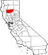
Tehama County, California Basics:


Tehama County California - Government Site

Population: 63,264
Area: 2950 square miles
County seat: Red Bluff
Area code(s) in use: 530
Time zone: PST
High school graduate or higher: 80.3%
Bachelor's degree or higher: 13.1%
Median household income: $40,307
Persons in poverty: 20.3%
Home ownership rate: 65.3%
Mean travel time to work: 23.4 minutes


Adjacent counties:
Butte  Glenn  Mendocino  Plumas  Shasta  Trinity  

Find in California

Map of the Tehama County area


Our detail map of Tehama County shows the Tehama County, California boundary lines and other interesting items.

Places in Tehama County, California

  Airports     show all on map

Big Bluff Ranch Airport, Corning Municipal Airport, Deer Creek Ranch Airport, Flying N Ranch Airport, Lake California Air Park, Meadow Airstrip, Ponderosa Sky Ranch Airport, Rancho Tehama Airport, Red Bluff Municipal Airport

  Areas     show all on map

Devils Half Acre, Devils Kitchen, Devils Parade Ground, Pentacola Field, Plum Garden, Potato Patch, Rouse Flat, The Burn, The Vineyard, Widow Wilson Field, Wilson Field

  Bars     show all on map

Copeland Bar, Moone Bar, Sacramento Bar

  Basins     show all on map

Barn Hollow, Bear Wallow, Bear Wallow, Bear Wallow, Beegum Basin, Cedar Basin, Deer Basin, Devils Basin, Devils Den, Devils Hole, Greasewood Basin, Hole in the Ground, Lake Hollow, Little Round Valley, Nevada Bottom, Three Prong Valley

  Bends     show all on map

Big Bend, Big Bend, Boots Bend, Jackstaff Bend

  Bridges     show all on map

Bend Bridge, High Trestle, Jellys Ferry Bridge, Oxbow Bridge, Woodson Bridge

  Buildings     show all on map

Apperson Cabin, Bell Cabin (historical), Brockman Cabin (historical), California Highway Patrol Red Bluff, Capay Fire Protection District, Carnegie Public Library (historical), Corning Branch Tehama County Library, Corning City Hall, Corning Police Department, Corning Volunteer Fire Department, Gerber Fire Department, Herbert Kraft Free Library, Lantz Cabin (historical), Lassen Volcanic National Park Fire Management, Magnuson Cabin, Maxim Cabin (historical), Rasmussen Cabin (historical), Red Bluff City Hall, Red Bluff Fire Department, Red Bluff Police Department, Ruffin Cabin, Tehama County Courthouse, Tehama County Fire Department Baker, Tehama County Fire Department Paskenta, Tehama County Fire Department Paynes Creek, Tehama County Fire Department Red Bank, Tehama County Fire Department Station 1 Red Bluff Headquarters, Tehama County Fire Department Station 10 Los Molinos, Tehama County Fire Department Station 11 Richfield, Tehama County Fire Department Station 12 Corning, Tehama County Fire Department Station 13 Rancho Tehama, Tehama County Fire Department Station 14 Dibble Creek, Tehama County Fire Department Station 16 Vina, Tehama County Fire Department Station 18 Manton, Tehama County Fire Department Station 2 Lake California, Tehama County Fire Department Station 20 Mineral, Tehama County Fire Department Station 21 Paynes Creek, Tehama County Fire Department Station 3 Bowman, Tehama County Fire Department Station 4 Ridgeway, Tehama County Fire Department Station 5 Bend, Tehama County Fire Department Station 9 El Camino, Tehama County Museum, Tehama County Sheriff's Office, Templeton Cabin (historical), Veterans Memorial Building, Veterans Memorial Hall

  Canals     show all on map

Cone Kimball Ditch, Corning Canal, Cross Country Ditch, Deer Creek Irrigation Ditch, Eagle Canyon Ditch, North Main Canal, South Ditch, South Main Canal, Tehama Colusa Canal, Union Canal, West North Main Canal, Wildcat Ditch

  Capes     show all on map

Boulder Point, Crowfoot Point, Juniper Point, Long Point, Monterey Point, Rattlesnake Point, Walker Point, Wildcat Point

  Cemeteries     show all on map

Carter Cemetery, Elmore Cemetery, Lowrey Cemetery, Oak Hill Cemetery, Paskenta Cemetery, Saint Marys Cemetery, Tehama Cemetery

  Census     show all on map

Bend Census Designated Place, Flournoy Census Designated Place, Gerber Census Designated Place, Gerber-Las Flores Census Designated Place (historical), Lake California Census Designated Place, Las Flores Census Designated Place, Los Molinos Census Designated Place, Manton Census Designated Place, Mineral Census Designated Place, Paskenta Census Designated Place, Paynes Creek Census Designated Place, Proberta Census Designated Place, Rancho Tehama Reserve Census Designated Place, Richfield Census Designated Place, Vina Census Designated Place

  Channels     show all on map

Hoodlum Chute, The Gorge

  Churches     show all on map

Bethel Pentecostal Holiness Church, Calvary Temple, Capay Community Friends Church, Church of Christ, Church of Christ, Church of God, Church of the Nazarene, Church of the Nazarene, Family Bible Church, First Baptist Church, First Baptist Church, First Christian Church, First Christian Church, First Church of Christ Scientist, First Methodist Church, First Methodist Church (historical), First Presbyterian Church, First Presbyterian Church, First United Methodist Church, First United Presbyterian Church, Four Square Gospel Church, Full Gospel Assembly Church (historical), Gospel Church, Immaculate Conception Roman Catholic Church, Maranatha Worship Center, Mount Olive Lutheran Church, Neighborhood Full Gospel Assembly of God Church, New Life Assembly of God Church, Sacred Heart Roman Catholic Church, Saint Andrews Episcopal Church, Saint Pauls Lutheran Church, Saint Peters Episcopal Church, Seventh Day Adventist Church, The Church of Jesus Christ of Latter Day Saints

  Cliffs     show all on map

Eagle Rock, Mill Creek Rim, Steamboat Point, Stony Point

  Crossings     show all on map

Blunkall Crossing, Cedar Crossing, Deadman Crossing, Deer Creek Crossing, Grapevine Crossing, Jellys Ferry (historical), P-38 Crossing, Six-Bit Crossing, Squaw Hill Ferry (historical), Twentymile Crossing

  Dams     show all on map

Black Butte Dam, Black Butte Lake Dam, Coleman Dam, Corral 265 Dam, Eagle Canyon Dam, Inskip Dam, Red Bluff Diversion Dam, Rye 265-002 Dam, South Log Pond 268 Dam, Sunflower 1261 Dam, Top Cat 1260 Dam

  Falls     show all on map

Bluff Falls, Deadhorse Falls, Deadhorse Falls, Deer Creek Falls, Lower Deer Creek Falls, Mill Creek Falls

  Flats     show all on map

Ant Flat, Appletree Glade, Attlebury Glade, Battle Creek Meadows, Beaver Creek Pinery, Beehive Flat, Belfast Meadows, Biscuit Flat, Black Flat, Bluedoor Flat, Brazell Meadows, Bucks Flat, Bull Flat, Carter Meadow, Childs Meadows, Cobb Flat, Cold Creek Meadows, Conard Meadows, Cooks Flat, Cox Glade, Dead Cow Flat, Deer Creek Flat, Deer Creek Meadows, Digger Pine Flat, Dipping Vat Flat, Durley Flat, Elk Flat, Eury Glade, Foreman Glade, Four Lantern Flat, Glassburner Meadows, Hamilton Glade, Hatch Flat, Hazen Flat, Henderson Glade, Hensley Glade, Hole in the Ground, Howard Meadows, Irish Glade, Juniper Flat, Kingsley Glade, Kingsley Glades, Last Feed Flat, Lewis Flat, Little Bucks Flat, Manzanita Flat, Maupin Flat, McMoran Flat, Minnie Glade, Morris Flat, Mose Genot Glade, Murphy Glades, Oak Flat, Oak Flat, Poison Glade, Poker Flat, Red Flat, Rouse Gardens, Saunders Flat, Schoolhouse Flat, Scofield Flat, Secret Flat, Shakecabin Flat, Slanes Flat, Slides Glade, Spencer Meadow, Story Flat, Sugarfoot Glade, Sugarpine Flat, Sunflower Flat, Syd Cabin Glade, Twin Meadows, Van Horn Flat, Vestal Flat, Wakefield Flat, Wilcox Flat, Wilson Flat, Wilson Meadow, Woodyard Flat, Woodyard Flat

  Gaps     show all on map

Deer Creek Pass, East Low Gap, Howell Gap, Morgan Summit, Pole Corral Gap, Rat Trap Gap, Rubberboot Gap, Salt Creek Saddle, Stuart Gap, Tedoc Gap, The Narrows, The Narrows, The Narrows, Whiskey Saddle

  Guts     show all on map

Vina Slough

  Hospitals     show all on map

Corning Memorial Hospital (historical), Saint Elizabeth Community Hospital, Tehama County Health Center

  Islands     show all on map

Blackberry Island, Blethen Island, Bloody Island, Foster Island, Island Number One (historical), Lower Foster Island, Mooney Island, Todd Island

  Lakes     show all on map

Conard Lake, Dales Lake, Dead Rabbit, Diamond Lake, Dry Lake, Elk Lake, Finley Lake, Forest Lake, Hog Lake, Horseshoe Pond, Huckleberry Lake, Kingsley Lake, Long Lake, McGowan Lake, Mountain Lake, North Yolla Bolly Lake, Norvell Pond, Patricia Lake, Pear Lake, Square Lake, Turner Lake, Wilson Lake

  Locales     show all on map

Alder Creek Campground, Apperson Cow Camp, Atkins Ranch, Baccala Cabin, Baker Fire Control Station, Baker Ranch, Ball Ranch, Balls Camp, Barker Camp, Battle Creek Ranch, Battle Creek Rod and Gun Club, Bear Wallow Campground, Bell Ranch, Benner Place, Big Bend Camp (historical), Big Stump Camp, Black Bear Camp, Black Butte Dam Project Headquarters, Black Oak Campground, Black Rock Campground, Blackjack Recreation Site, Blossom, Bluff Falls Campground, Bodkin Cabin, Braden Ranch, Braden Rock, Brewer Oak Recreation Site, Brokenshire Picnic Area, Browns Camp, Browns Camp, Browns Camp Trailhead, Brush Camp, Buck Camp, Burnt Camp, Burnt Camp, Burrill Homestead (historical), Cameron Place (historical), Camp Five, Camp Tehama, Cedar Basin Camp, Chase Place (historical), Childs Ranch, Circle S Ranch, Cline Ranch, Cold Springs Forest Service Facility, Conklin Orchard, Corning Sewage Disposal, Cowslip Campground, D Camp, Davies Orchard, Dead Mule Camp, Deep Hole Camp, Deer Creek Station, Delay Camp, Doll Camp, Dotys Camp, Drennan Camp, Dry Lake Campground, Eagle Rock Camp, Ekelund Ranch, El Camino Grange, El Rancho Rio Frio, Elam Campground, Ellis Place (historical), Facht Homestead, Fire Mountain, Forward Mill, Foss Ranch, Franks Cabin, Glassburger Place (historical), Glines Ranch, Goat Camp, Goat Camp, Government Flat, Grindstone Recreation Site, Griswold Ranch, Gurnsey Creek Campground, Haleakala Ranch, Handy Camp, Handy Camp, Hawk Camp, Hillhouse, Hobson Camp, Hole in the Ground Campground, Holiday Shopping Center, Horse Camp Recreation Site, Horsepacker Trailhead, Howell Camp, Ideas Cove Traihead, Ides Cove, Inks Creek Ranch, Inskip Powerhouse, Ishi Caves, Jeffers Rnach, Jelly Ranch, Johnson Cabin, Kopta Slough Boat-In Camp, Laniger Lakes, Lassen Lodge, Lassen Volcanic National Park Headquarters, Last Camp, Lazyman Camp, Lee Camp, Leininger Camp, Log Spring Station, Long Ranch, Los Molinos Grange, Lost Camp (historical), Lost Camp Ranger Station (historical), Lost Creek Maintenance Station, Manton Fire Control Station, Mason Camp, McKenzie Ranch, Mill Creek Campground, Miller Ranch, Mineral Ranger Station, Mineral Work Center, Moore Ranch, Mount Lassen Trout Farm, Mud Flat Campground, North Yolla Bolly Guard Station, Oak Creek Golf Course, One Bee Camp, Panther Spring Guard Station, Patton Mill, Payne Spring Cabin, Paynes Creek Rod and Gun Club, Poison Glade Recreation Site, Pole Corral, Pollard Corral, Ponderosa Sky Ranch, Post Creek Guard Station, Postpile Camp, Potato Patch Campground, Prine Cabin, Prine Cabin, Rancho Rio Alto, Raspberry Camp (historical), Rat Trap Gap Trailhead, Rat Trap Gap Trailhead Parking, Red Bluff Omni Radio Range Station, Riley Cabin, Rocky Cabin Recreation Site, Round Mountain Number One Camp, Round Mountain Number Two Camp, Round Valley Ranger Station (historical), Russell Cabin, Saddle Camp Campground, Saddle Camp Forest Service Station, Sanders Place, Saturday Camp, Saunders Place, Shackleford Place, Shake House, Sheep Pelt Camp (historical), Shelton Camp, Shiell Ranch, Shults Ranch, Side Rod Camp, Skeleton Camp, Smith Cabin, South Antelope Campground, South Powerhouse, Stephens Ranch, Stockton Cabin, Straight Arrow Camp, Stuart Gap Trailhead, Stuart Gap Trailhead Parking, Sugar Spring Campground, Sugarfoot Recreation Site, Sulphur Works Checking Station (historical), Tehama County Landfill, Telephone Camp, Tent Camp, Thomes Pocket, Thomes Pocket Recreation Site, Three Prong Campground, Thunder Camp, Tomhead Mountain Lookout, Tomhead Saddle Campground, Tomhead Saddle Trailhead, Toomes Camp, Toomes Camp, Transfer, Turner Mountain Lookout, Wells Cabin Campground, Wells Creek Campground, Weston Ranch, White Rock Campground, Whitlock Campground, Wilcox Oaks Golf Course, Wild Horse Corral, Willards Camp, Williams Camp, Willow Spring Campground, Wilson Ranch, Windy Cut Lookout (historical), Yellowjacket Ranger Station (historical)

  Military     show all on map

Red Bluff Air Force Station (historical)

  Mines     show all on map

Carmichael Rock Quarry, Cottonwood Creek Pit Number 3, Doyle Pit Number 17, Grau Mine, Kleinsorge Mine, South Elder Mine, Tomhead Mine

  Oilfields     show all on map

Corning Gas Field, South Corning Gas Field

  Parks     show all on map

Ayer Park, Buckhorn Recreation Area, Burris Creek Recreation Area, Diamond Park, Eagle Pass Recreation Area, Estil C Clark Park, Forward Park, Fry Field, Halbert Park, Lower Stony Creek Recreation Area, Mill Creek Park, Northside Park, Observation Point Recreation Area, Red Bluff City Park, Red Bluff Diverson Dam Recreation Area, Ridgeway Park, South Canal Recreation Area, Tehama County Fairgrounds, Tehama County River Park, Tehama State Wildlife Area, William B. Ide Adobe State Historic Park, Woodson Bridge State Recreation Area, Woodson Park, Yost Park

  Pillars     show all on map

Black Rock, Panther Rock, Steamboat Rock, White Rock

  Plains     show all on map

Abraham Plains, Devils Half Acre, Lost Creek Plateau, Mill Creek Plateau, Mud Springs Plains

  Populated Places     show all on map

Alford Place, Avery Place, Banfield Place, Bayles Place, Beegum, Bend, Black Forest, Blunt, Bollinger Place, Brown Place, Buena Vista, Campbellville, Childs Meadows, Cold Fork, Copeland, Copple Place, Corning, Dairyville, Dales, Dantuma Place, Dawson Place, Deer Creek, El Camino, Ensign (historical), Facht Place, Favinger Place, Finley Place, Flournoy, Fowler Place, Gerber, Gilliam Place, Griffin Place, Hammer Place, Hatfield Place (historical), Haven Place, Heitman Place (historical), Henleyville, Hercraff Place, Hooker, Houghton Place, Irish Place (historical), Kiska, Las Flores, Leonard Place (historical), Los Molinos, Lowrey, Lyman Springs, Lyonsville, Manton, Marian Place, Mary Ellen Place, McCartney Place, McClure Place, McKenzie Place, Meyers Place, Mill Creek, Mineral, Mitchell Place, Montgomery Place, Morgan Springs, Ninemile (historical), Pape Place, Paskenta, Payne Place, Paynes Creek, Peligreen Place, Pellow Place, Pete Hoff Place, Peterson Place, Pettyjohn Place, Polk Springs, Proberta, Rancho Tehama Reserve, Rawson, Red Bank, Red Bluff, Richfield, Roberts Place, Rosewood, Saint Bernard, Saunders Place, Savercool Place, Shackleford Place, Skinner Mill Place, Squaw Hill, Steuben Place, Summerville (historical), Sunnyside, Swain Place, Tehama, Tenmile (historical), Thompson Place, Vina, Wade Place, Walker Place (historical), Watson, Wells Place, Westend Galatin Place (historical), Whitlock Place, Wilder Place, Yellowjacket

  Post Offices     show all on map

Colyear Post Office (historical), Corning Post Office, Los Molinos Post Office, Mill Creek Post Office (historical), Mineral Post Office (historical), Red Bluff Post Office, Tehama Post Office, Tuscan Post Office (historical)

  Rapidss     show all on map

Captain Jones Rapids, Chinese Rapids, Plumas Rapids (historical)

  Reserves     show all on map

Ishi Wilderness, Nome Lackee Indian Reservation Monument, Woodson Bridge Natural Preserve

  Reservoirs     show all on map

Arts Pond, Black Butte Lake

  Ridges     show all on map

Allen Ridge, Berry Ridge, Blue Ridge, Board Ridge, Boswell Ridge, Brushy Ridge, Bryant Ridge, Campbell Ridge, Campo Seco Ridge, Cat Ridge, Cattle Ridge, Cold Spring Ridge, Cooks Ridges, Croney Ridge, Dead Horse Ridge, Deer Ridge, Derby Ridge, Doll Ridge, Elk Ridge, Elkhorn Ridge, Fish Ridge, Forks Ridge, Greer Ridge, Hall Ridge, Harvey Ridge, High Flat Ridge, Hogback Ridge, Hogs Back, Horse Trough Ridge, Horseback Ridge, Howell Ridge, Indian Ridge, Iron Spring Ridge, Iron Spring Ridge, Kenny Ridge, Lantz Ridge, Lazyman Ridge, Log Spring Ridge, Long Ridge, Long Ridge, Manzanita Ridge, McCarthy Point, Middle Ridge, Middle Ridge, Middle Ridge, Nuisance Ridge, Opium Glade Ridge, Plum Creek Ridge, Raglin Ridge, Rat Trap Ridge, Red Ridge, Riley Ridge, Rocky Ridge, Sanford Ridge, Sheep Trail Ridge, Shelton Ridge, Short Ridge, Short Ridge, Slanes Flat Ridge, Slides Ridge, Snake Ridge, South Ridge, Speegle Ridge, Syd Cabin Ridge, Syd Cabin Ridge, Tatham Ridge, Telephone Ridge, The Hogback, Thomes Pocket Ridge, Timber Ridge, Trough Ridge, Trough Spring Ridge, Valentine Ridge, Van Ridge, Whisky Ridge, Wild Horse Ridge, Willow Tree Ridge

  Schools     show all on map

Academy of Our Lady of Mercy, Antelope Elementary School, Bend Elementary School, Berrendos Elementary School, Bidwell Elementary School, Bowman School, Capay School, Centennial Continuation High School, Corning High School, Cottonwood School (historical), Elkins Elementary School, Evergreen School, Evergreen School, Farquhar School, Flournoy Elementary School, Gerber Elementary School, Hooker School (historical), Independent School, Jackson Heights Elementary School, Jelly School (historical), Kirkwood Elementary School, Lane Valley School (historical), Lassen View Elementary School, Lincoln School, Lincoln Street School, Live Oak School, Los Molinos Elementary School, Los Molinos High School, Lowrey School, Macam School (historical), Manton Elementary School, Marion School (historical), Maywood Intermediate School, Mercy High School, Merrill School, Metteer Elementary School, Mineral Elementary School, Moon School, Oat Creek School (historical), Olive View Elementary School, Orchard Park School, Plum Valley Elementary School, Red Bluff Union High School, Reeds Creek Elementary School, Richfield Elementary School, Sacred Heart School, Vina Elementary School, Vista Middle School, West Street Elementary School

  Springs     show all on map

Ballard Spring, Bear Wallow Spring, Bell Spring, Bennett Spring, Beverly Spring, Blackjack Spring, Blue Ridge Spring, Bluff Springs, Brushy Hollow Spring, Buck Spring, Buttermilk Spring, Cave Spring, Cedar Spring, Cold Spring, Cold Spring, Colyear Springs, Commissary Spring, Cottonwood Spring, Davison Spring, Dead Mule Spring, Doty Spring, Edge Cabin Spring, Emigrant Spring, Fern Springs, Government Spring, Grapevine Spring, Growler Hot Spring, Halley Spring, Harding Spring, Hensley Springs, Howard Spring, Iron Spring, Jackson Spring, Jungle Spring, Knass Spring, Lazyman Spring, Lightning Spring, Log Spring, Lone Pine Spring, Lone Pine Springs, Lost Creek Spring, Love Cabin Spring, Lyman Springs, Macon Springs, Maidenhair Spring, Miners Cabin Spring, Miners Spring, Morgan Hot Spring, Mud Spring, Negro Spring, North Yolla Bolly Spring, North Yolla Bolly Spring, Obe Fields Spring, Onion Springs, Panther Spring, Pepperwood Spring, Pine Spring, Pony Spring, Raspberry Camp Spring, Rattlesnake Spring, Rock Spring, Rocky Cabin Spring, Root Spring, Ross Gates Spring, Round Mountain Spring, Salt Lick, Salt Lick Spring, Sevenglass Spring, Sheep Camp Spring, Stinking Springs, Sugar Spring, Sugarpine Spring, Sulphur Lick, Sulphur Spring, Sulphur Spring, Sulphur Spring, Sulphur Spring, Sulphur Spring, Sulphur Spring, Sulphur Springs, Tail Holt Spring, Tamarack Spring, Tomhead Spring, Tuscan Springs, Twin Springs, Two-Barrel Spring, Uhl Spring, Valentine Spring, Van Spring, Weemasoul Spring, White Sulphur Spring, Wible Spring, Willow Spring, Willow Spring, Willow Springs

  Streams     show all on map

Alder Creek, Alder Creek, Alder Creek, Antelope Creek, Antelope Creek, Auger Creek, Avery Creek, Basin Creek, Battle Creek, Bear Creek, Beaver Creek, Bennett Creek, Berry Creek, Big Bear Creek, Big Crane Creek, Big Dry Creek, Big Salt Creek, Big Smoky Creek, Blue Tent Creek, Board Creek, Boat Gunwale Creek, Bowers Creek, Brannin Creek, Brewery Creek, Brickyard Creek, Brush Creek, Brush Creek, Brush Creek, Buck Creek, Buck Creek, Burch Creek, Burnt Creek, Butler Slough, Buttermilk Creek, Calf Creek, Calf Creek, Cameron Creek, Canyon Creek, Carter Creek, Cary Pasture Creek, Cascade Creek, Cedar Creek, Cement Creek, Champlin Slough, China Slough, Clover Creek, Cold Creek, Cold Fork, Cold Spring Creek, Cottonwood Creek, Cottonwood Creek, Coyote Creek, Coyote Creek, Craig Creek, Croney Creek, Cub Creek, Davis Flat Creek, Dead Horse Creek, Deadhorse Creek, Deer Creek, Deer Creek, Delaney Slough, Dibble Creek, Digger Creek, Digger Creek, Digger Creek, Digger Creek, Ditch Creek, Doll Creek, Dry Creek, Dry Creek, Dry Creek, Dye Creek, East Sand Slough, East Sulphur Creek, Elam Creek, Elder Creek, Elkhorn Creek, Elkhorn Creek, Elmore Creek, Etzler Creek, Fish Creek, Flood Creek, Flume Creek, Forked Creek, Frazier Creek, Griffin Creek, Grizzly Creek, Gunbarrel Creek, Gurnsey Creek, Guyre Creek, Hall Creek, Harvey Creek, Haypatch Creek, Hensley Creek, Hoag Slough, Hooker Creek, Hooper Creek, Horse Trough Creek, Houghton Creek, Howard Creek, Indian Creek, Inks Creek, Iron Creek, Jackson Spring Creek, Jewett Creek, Jones Camp Creek, Judd Creek, Kendrick Creek, Kingsley Creek, Kopta Slough, Last Chance Creek, Little Antelope Creek, Little Basin Creek, Little Bear Creek, Little Crane Creek, Little Dry Creek, Little Dry Creek, Little Grapevine Creek, Little Grizzly Creek, Little Mill Creek, Little North Fork North Fork Dye Creek, Little Pine Creek, Little Red Mountain Creek, Little Salt Creek, Little Salt Creek, Little Smoky Creek, Little Wildcat Creek, Liza Creek, Log Spring Creek, Lost Creek, Love Branch, Maple Creek, Martin Creek, McCarty Creek, McCarty Creek, McClure Creek, McClure Creek, Meeker Creek, Middle Fork Antelope Creek, Middle Fork Beegum Creek, Middle Fork Brush Creek, Middle Fork Elder Creek, Middle Fork Guyre Creek, Middle Fork Hall Creek, Mill Creek, Mill Creek, Mill Creek, Millrace Creek, Morgan Creek, Nanny Creek, Nelson Creek, Nevada Creek, New Creek, Ninemile Creek, North Fork Antelope Creek, North Fork Calf Creek, North Fork Dibble Creek, North Fork Dry Creek, North Fork Dye Creek, North Fork Elder Creek, North Fork Hall Creek, North Fork Hensley Creek, North Fork Little Mill Creek, North Fork Mill Creek, North Fork Patterson Creek, North Fork Plum Creek, North Fork Rattlesnake Creek, North Fork Red Bank Creek, North Fork Singer Creek, Oak Flat Creek, Oat Creek, Oat Creek, Old Man Springs Creek, Panther Creek, Panther Creek, Parker Creek, Patterson Creek, Paynes Creek, Paynes Creek Slough, Pigpen Creek, Pine Creek, Pine Creek, Plum Creek, Pole Corral Creek, Post Creek, Rancheria Creek, Rattlesnake Creek, Rattlesnake Creek, Red Bank Creek, Reeds Creek, Rice Creek, Ripley Creek, Rock Creek, Rock Gulch Creek, Rodeo Creek, Round Mountain Creek, Round Valley Creek, Rush Creek, Salt Creek, Salt Creek, Salt Creek, Samson Slough, Sehorn Creek, Sevenmile Creek, Shaw Creek, Slate Creek, Slate Creek, Slide Creek, Slides Creek, Snake Creek, Soap Creek, Sour Grass Creek, South Fork Antelope Creek, South Fork Battle Creek, South Fork Beegum Creek, South Fork Calf Creek, South Fork Cottonwood Creek, South Fork Dibble Creek, South Fork Dry Creek, South Fork Elder Creek, South Fork Guyre Creek, South Fork Hall Creek, South Fork Hensley Creek, South Fork Little Mill Creek, South Fork Patterson Creek, South Fork Rattlesnake Creek, South Fork Singer Creek, Spring Branch, Spring Branch, Spring Creek, Spring Creek, Squaw Hollow Creek, Stinking Creek, Sugarfoot Creek, Sulphur Creek, Sulphur Creek, Summit Creek, Swamp Creek, Switzel-Baum Creek, Thomes Creek, Toomes Creek, Truckee Creek, Weemasoul Creek, Wells Creek, West Fork Brush Creek, West Sulphur Creek, Wildcat Creek, Wildcat Creek, Willow Creek, Willow Creek, Willow Creek, Zimmershed Creek

  Summits     show all on map

All Top, Bald Hill, Bald Knob, Ball Mountain, Ball Rock, Barkley Mountain, Bear Den, Beegum Peak, Black Butte, Black Butte, Brush Mountain, Brushy Mountain, Butt Mountain, Campbell Mound, Christie Hill, Colby Mountain, Cold Creek Butte, Cold Spring Hill, Dewitt Peak, Digger Butte, Digger Pine Hill, Doe Mountain, Eagle Peak, Elkhorn Peak, Finley Butte, Flatiron Mountain, Franklin Point, Gleason Peak, Goat Hill, Grays Peak, Greasewood Hill, Gunsight, Hampton Butte, Harvey Peak, Humboldt Summit, Ice Cave Mountain, Inskip Hill, Iron Mountain, Jackass Butte, Lazyman Butte, Linn Mount, Little Inskip Hill, Little Red Mountain, Lookout Mountain, Lyons Peak, Mineral Summit, Morgan Mountain, Mount Conard, Mount Linn, North Star Mountain, Onion Butte, Onion Summit, Oven Lid, Owens Butte, Pattymocus Butte, Pinnacle Peak, Potato Hill, Promontory Point, Raney Peak, Red Mountain, Rocky Peak, Rocky Peak, Round Mountain, Round Mountain, Round Mountain, Round Mountain, Salt Creek Peak, Ski Hill, Soap Butte, South Yolla Bolly, South Yolla Bolly Mountains, Stevenson Peak, Sugarloaf, Sugarloaf Mountain, Sugarloaf Mountain, Table Mountain, Table Mountain, Table Mountain, Table Mountain, Tedoc Mountain, Tomhead Mountain, Turner Mountain, Tuscan Buttes, Twin Peaks, Vinegar Peak, Wells Creek Peak, Whitlock Butte, Williams Butte

  Swamps     show all on map

Spring Gardens

  Towers     show all on map

KALF-FM (Red Bluff), KBLF-AM (Red Bluff), KCEZ-FM (Corning), KCPM-TV (Chico), KFXS-FM (Red Bluff), KTCD-AM (Cottonwood), KXHM-FM (Orland)

  Trails     show all on map

Buena Vista Trail, Buttermilk Trail, Campbellville Trail, Carter Creek Trail, Carter Meadow Trail (historical), Childs Meadows Trail, Deer Creek Flat Trail, Graham Trail (historical), Growler Trail, Halley Grade, Hanna Trail, Heart Lake Twin Meadows Trail, Ides Cove National Recreation Trail, Lanyan Trail, Lassen Trail, Lazyman Butte Trail, Long Ridge Trail, Moak Trail (historical), Murphy Trail (historical), North Yolla Bolly Cold Fork Trail, Old Lassen Trail, Pettijohn Trail, Pine Creek Trail, South Fork Cottonwood Trail, Spencer Meadow Trail, Steamboat Trail, Sunflower Trail, Turner Mountain Trail

  Valleys     show all on map

Acorn Hollow, Baker Gulch, Basin Gulch, Bear Canyon, Bear Gulch, Bear Gulch, Bear Gulch, Beegum Gorge, Blue Canyon, Bone Gulch, Brown Gulch, Brushy Hollow, Buckhorn Gulch, Budden Canyon, Burnt Canyon, Burr Valley, Chapman Gulch, Chickatee Gulch, Chicken Hollow, China Gulch, China Gulch, Cooper Canyon, Corral Gulch, Cottonwood Spring Gulch, Coyote Gulch, Cracker Canyon, Crazy Canyon, Crow Gulch, Dark Canyon, De Haven Gulch, De Haven Gulch, Deadman Gulch, Dehaven Gulch, Devils Gulch, Devils Gulch, Devils Hole Gulch, Dewitt Gulch, Dexter Gulch, Dillion Cove, Dirty Gulch, Dry Gulch, Duncan Canyon, Dutchman Gulch, Eagle Canyon, Freshwater Gulch, Gordon Canyon, Government Gulch, Grapevine Canyon, Grapevine Gulch, Green Gulch, Hamilton Gulch, Handy Camp Gulch, Hart Gulch, Henderson Canyon, Hog Gulch, Hog Gulch, Horse Gulch, Horseshoe Gulch, Hubbard Gulch, Hull Canyon, Hungry Hollow, Initial Gulch, Iron Canyon, Iron Spring Gulch, Jackass Canyon, Jackass Gulch, Jones Valley, Juniper Gulch, Juniper Gulch, Juniper Gulch, Kelsey Gulch, Kingsley Cove, Kingsley Gulch, Lane Valley, Last Chance Gulch, Little Spring Gulch, Long Gulch, Long Gulch, Long Gulch, Long Gulch, Long Gulch, Long Hollow, McClendon Gulch, Meadow Gulch, Mitchell Gulch, Moak Cove, Moboy Gulch, Mud Valley, Mullen Gulch, Murphy Canyon, North Fork China Gulch, North Fork Devils Gulch, Oak Flat Gulch, Packer Gulch, Palmer Gulch, Panther Gulch, Peligreen Gulch, Pentacola Gulch, Plantation Gulch, Plumb Gulch, Quail Gulch, Raney Peak Gulch, Rattlesnake Valley, Red Bank Gulch, Round Valley, Round Valley, Salt Gulch, Sand Spring Canyon, Sheep Gulch, Sheep Trail Gulch, Smallwood Gulch, Snoqualmie Gulch, Solomon Gulch, Sour Grass Gulch, South Fork China Gulch, South Fork Devils Gulch, South Meadow Gulch, Spring Gulch, Spring Gulch, Squaw Hollow, Steep Hollow, Steep Hollow, Stone Corral Hollow, Sulphur Gulch, Sulphur Gulch, Sunflower Gulch, Supan Gulch, Surveyor Gulch, Tenmile Hollow, Tomhead Gulch, Toms Gulch, Trueblood Gulch, Turkey Mullen Gulch, Twentymile Hollow, Vale Gulch, Van Spring Gulch, Wagon Wheel Draw, Water Hollow, Whiteman Canyon, Wildcat Canyon, Wildcat Gulch, Wildhide Gulch, Wilson Cove, Yuka Gulch

  Woods     show all on map

Black Oak Grove, Burroughs Pinery, Graham Pinery,

Tehama County, California Population By Race (2012 estimate)

RacePopulation
WhiteTehama County White population 57,76057,760  
MixedTehama County Mixed population 2,0882,087
AsianTehama County Asian population 759759
BlackTehama County Black population 506506
Hawaiian & Pacific IslanderTehama County Hawaiian & Pacific Islander population 127126

Additional population tables :
State population table
California population by county