Plumas County, California Basics:


Plumas County California - Government Site

Population: 19,338
Area: 2553 square miles
County seat: Quincy
Area code(s) in use: 530
Time zone: PST
High school graduate or higher: 90.2%
Bachelor's degree or higher: 22.9%
Median household income: $45,358
Persons in poverty: 13.9%
Home ownership rate: 70.5%
Mean travel time to work: 21.0 minutes

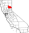
Adjacent counties:
Butte  Lassen  Shasta  Sierra  Tehama  Yuba  

Find in California

Map of the Plumas County area


Our detail map of Plumas County shows the Plumas County, California boundary lines and other interesting items.

Places in Plumas County, California

  Airports     show all on map

Chester Airport, Chester-US Forest Service Heliport, Gansner Field Airport, Indian Valley Hospital Heliport, Nervino Airport, Plumas District Hospital Heliport, Quincy Helitack Base Heliport, Rodgers Flat Heliport, Rogers Field Airport

  Areas     show all on map

Butterfly Valley Botanical Area, Elephants Playground, Happy Valley, Little Last Chance Canyon Special Interest Area, North Valley, Valley Creek Special Interest Area

  Bars     show all on map

Bill Bar, Butte Bar, Carpenter Bar, China Bar, Cleghorn Bar, English Bar, Hansons Bar, Hartman Bar, Indian Bar, Layman Bar, Meeker Bar, Minerva Bar, Missouri Bar, Morgan Bar, Pea Soup Bar, Poverty Bar, Rich Bar, Sherman Bar, Smiths Bar, Twelve Mile Bar, Workmans Bar

  Basins     show all on map

Bear Valley, Bear Wallow Basin, Cradle Valley, Deanes Valley, Fales Basin, Gilman Basin, Granite Basin, Lakes Basin, Little Grizzly Valley, Meadow Valley, Pecks Valley

  Bays     show all on map

Big Cove, Dan Blough Cove, Haskins Bay, Jenkins Cove

  Beaches     show all on map

Catfish Beach

  Bends     show all on map

Horseshoe Bend, McCarthy Bar, No Ear Bar, Oddie Bar

  Bridges     show all on map

Arlington Bridge, Drum Bridge, Flournoy Bridge, High Bridge, Notson Bridge

  Buildings     show all on map

Beckwourth Fire Department, Bucks Lake Fire Department, C Road Fire Department, California Highway Patrol Quincy, Chester Fire Department, Chester Fire Protection District, Crescent Mills Fire Protection District, Eastern Plumas Rural Fire Protection District Station 1, Eastern Plumas Rural Fire Protection District Station 2, Eastern Plumas Rural Fire Protection District Station 3, Graeagle Fire Protection District Station 1, Graeagle Fire Rescue White Hawk Ranch, Greenhorn Creek Volunteer Fire Department, Greenville Town Hall, Hamilton Branch Fire Protection District, Indian Valley Fire and Rescue, La Porte Fire Protection District, Long Valley Volunteer Fire Department, Meadow Valley Fire Protection District, Peninsula Fire Protection District Station 1, Peninsula Fire Protection District Station 2, Plumas County Courthouse, Plumas County Law Library, PLumas County Library, Plumas County Museum, Plumas County Sheriff's Office Chester Substation, Plumas County Sheriff's Office Greenville Substation, Plumas County Sheriff's Office Portola Substation, Plumas County Sheriff's Office Quincy Substation, Plumas Eureka Fire and Rescue, Portola Fire Department North Side Station, Portola Fire Department South Side Station, Portola Memorial Hall, Portola Railroad Museum, Prattville - Almanor Fire Department, Quincy Fire Protection District Station 1 Headquarters, Quincy Fire Protection District Station 2, Quincy Fire Protection District Station 3, Rhinehart Cabin (historical), Shake Cabin, Sierra Valley Fire Protection District, Taylorsville Fire Department, West Almanor Community Services District

  Capes     show all on map

Adams Neck, Almanor Peninsula, Bunnel Point, Dotta Neck, Forgay Point, Keddie Point, Lightning Tree Point, Long Point, Lunker Point, Quartz Point, Rainbow Point, Rocky Point, Smith Point, Stag Point, Turkey Point

  Cemeteries     show all on map

Big Flat Cemetery, Cromberg Cemetery, East Lawn Cemetery, Indian Cemetery, Johnsville Cemetery, Plumas County Cemetery, Qunicy Cemetery, Shady Grove Cemetery, Shim Flat Cemetery, Vinton Cemetery, Westside Cemetery, Whispering Pines Cemetery

  Census     show all on map

Almanor Census Designated Place, Beckwourth Census Designated Place, Belden Census Designated Place, Blairsden Census Designated Place, Bucks Lake Census Designated Place, C-Road Census Designated Place, Canyondam Census Designated Place, Caribou Census Designated Place, Chester Census Designated Place, Chilcoot-Vinton Census Designated Place, Clio Census Designated Place, Crescent Mills Census Designated Place, Cromberg Census Designated Place, Delleker Census Designated Place, East Quincy Census Designated Place, East Shore Census Designated Place, Gold Mountain Census Designated Place, Graeagle Census Designated Place, Greenhorn Census Designated Place, Greenville Census Designated Place, Hamilton Branch Census Designated Place, Indian Falls Census Designated Place, Iron Horse Census Designated Place, Johnsville Census Designated Place, Keddie Census Designated Place, La Porte Census Designated Place, Lake Almanor Country Club Census Designated Place, Lake Almanor Peninsula Census Designated Place, Lake Almanor West Census Designated Place, Lake Davis Census Designated Place, Little Grass Valley Census Designated Place, Mabie Census Designated Place, Meadow Valley Census Designated Place, Mohawk Vista Census Designated Place, Paxton Census Designated Place, Plumas Eureka Census Designated Place, Prattville Census Designated Place, Quincy Census Designated Place, Spring Garden Census Designated Place, Storrie Census Designated Place, Taylorsville Census Designated Place, Tobin Census Designated Place, Twain Census Designated Place, Valley Ranch Census Designated Place, Warner Valley Census Designated Place, Whitehawk Census Designated Place

  Channels     show all on map

Sierra Valley Channels

  Churches     show all on map

Assembly of God Church, Community United Methodist Church, First Baptist Church of Greenville, Greenville Community United Methodist Church, Indian Mission, Our Savior Lutheran Church, Portola Church of the Nazarene, Portola Station Baptist Church, Wesleyan Church

  Cliffs     show all on map

Elephant Butte, Limestone Point, Marble Cone, Mud Creek Rim, Rocky Point, Warner Valley Rim

  Crossings     show all on map

Babcock Crossing, Doyle Crossing, Murdock Crossing, Rock Creek Crossing, Rock Creek Crossing

  Dams     show all on map

Antelope 1-050 Dam, Antelope Valley Dam, Bidwell Lake 273 Dam, Bucks Diversion 94-000 Dam, Bucks Storage 94-002 Dam, Butt Valley 93 Dam, Caribou Afterbay 97-120 Dam, Chester Diversion Dam, Cresta Dam, Eureka Lake 1-042 Dam, Faggs Debris Dam, Frenchman 1-043 Dam, Frenchman Dam, Grizzly Creek 285 Dam, Grizzly Forebay 94-003 Dam, Grizzly Valley 1-052 Dam, Grizzly Valley Dam, Lake Almanor 93-003 Dam, Little Grass Valley 63-003 Dam, Long Lake 289 Dam, Lower Three Lakes 94-004 Dam, Rock Creek Dam, Silver Lake 274 Dam, Slate Creek Diversion 63-005 Dam, Smith Lake Dam, South Fork Diversion 63-004 Dam, Spring Valley Lake 1-073 Dam, Taylor Lake 288 Dam, Walker Mine Tailings Dam

  Falls     show all on map

Fern Falls, Indian Falls

  Flats     show all on map

American Valley, Babcock Meadows, Bellas Flat, Big Flat, Boulder Creek Meadow, Bull Flat, Burnham Meadow, Cedar Flat, Chummy Meadows, Claireville Flat, Cottonwood Meadow, Coyote Flat, Crocker Meadow, Cutter Meadow, Darby Meadow, Doctor Smith Flat, Dry Flat, Elizabethtown Flat, Fanani Meadow, Feather River Meadows, Fells Flat, Ferris Flat, Folchi Meadows, Grasshopper Flat, Grassy Flat, Green Flat, Greens Flat, Greens Flat, Grub Flat, Hallett Meadow, Hallsted Flat, Harrison Flat, Hauns Meadow, Henrys Flat, Johnson Fields, Jordan Flat, Last Chance Valley (historical), Lawton Meadow, Logue Meadows, Lowe Flat, Lynch Meadows, Maple Flat, McRae Meadow, Milkhouse Flat, Monitor Flat, Moody Meadows, Mosquito Flat, Murphy Flat, Myrtle Flat, Newtown Flat, Nye Meadows, Oak Flat, Oak Flat, Oats Meadow, Oliver Flat, Onion Flat, Peppard Flat, Reese Flat, Rhinehart Meadow, Rhodes Meadow, Ross Ranch Meadow, Sawmill Flat, Sawpit Flat, Skinner Flat, Soldier Meadows, Spanish Flat, Sunflower Flat, Sunflower Flat, Swain Meadow, Tamarack Flat, Tamarack Flat, Thompson Valley, Twin Meadows, Williams Valley, Zumwalt Flat

  Forests     show all on map

Feather River Experimental Forest, Plumas National Forest, Swain Mountain Experimental Forest, Swain Mountain Experimental Forest

  Gaps     show all on map

Bagley Pass, Beckwourth Pass, Camp Rodgers Saddle, Carman Saddle, Deadwood Saddle, Devils Gap, Dotta Saddle, Greenville Saddle, Lee Summit, McNair Saddle, Penman Saddle, Shores Gap

  Hospitals     show all on map

Eastern Plumas Hospital Portola Campus, Indian Valley Hospital District, Plumas District Hospital, Seneca Healthcare District Hospital

  Islands     show all on map

Dedication Island

  Lakes     show all on map

Bald Eagle Lake, Bear Lake, Big Bear Lake, Bloomer Lake, Blue Lake, Blue Lake, Blue Lake, Boiling Springs Lake, Campbell Lake, Cape Lake, Chips Lake, Crystal Lake, Cub Lake, Devils Punchbowl, Domingo Lake, Drake Lake, Dream Lake, Dry Lake, Duck Lake, Echo Lake, Elizabeth Lake, Fleischmann Lake, Fowler Lake, Frog Lake, Gold Lake, Grass Lake, Grass Lake, Grassy Lake, Grassy Lakes, Green Island Lake, Grizzly Lake, Hellgrammite Lake, Hidden Lake, Jacks Meadow Pond, Jamison Lake, Kellogg Lake, Kettle Rock Lake, Lily Lake, Little Bear Lake, Little Last Chance Lake, Little Summit Lake, Little Willow Lake, Long Lake, Lost Lake, Lost Lake, Lotts Lake, Lower Bucks Lake, Madora Lake, Morris Lake, Mud Lake, Mud Lake, Mud Lake, Mud Lake, Mud Lake, Mud Lake, Murphy Lake, Oliver Lake, Ridge Lake, Rock Lake, Rock Lake, Rock Lake, Rogers Lake, Round Lake, Saddle Lake, Saucer Lake, Silver Lake, Smith Lake, Snake Lake, Snow Lake, Spring Valley Lake, Star Lake, Taylor Lake, The Beaver Ponds, Thompson Lake, Upper Mud Lake, Wades Lake, Willow Lake

  Lava     show all on map

Lava Top

  Locales     show all on map

Abbey Bridge Guard Station (historical), Aknabir Canogriybd, Almanor, Almanor Campground, Almanor Ranger Station, American House, Antelope House (historical), Baccala Ranch, Barkers Cabin, Belden Campground, Benner Creek Campground, Big Cove Campground, Bills Cabin, Black Rock Campground, Boehme Ranch, Boulder Creek Campground, Boulder Creek Work Center, Bradys Camp, Browns Cabin, BSA Camp Timberwolf, Bucks Creek Powerhouse, Bucks Lake Guard Station, Bucks Lake Summer Home Tract, Bucks Lodge Campground, Camp Almanor, Camp Dixie, Camp Fourteen, Camp Rodgers, Camp Rodgers, Camp Thirteen, Camp Wallace Alexander, Campbell Cow Camp, Canyondam Picnic Area, Canyondam Work Center, Chilcoot Campground, Clear Creek Junction, Cleghorn Bar Campground, Clio Forest Service Facility, Clover Valley Ranch, Conklin Park Campground, Cool Springs Campground, Cottonwood Spring Campground, Crocker Guard Station, Crystal, Crystal Vista, Dan Beebe Campground, Daniel Zink Campground, Davis Roadside Rest, Deer Vally Golf Links, Domingo Spring Campground, Downing Cabin, Eagle Lake Ranger Station, Eastshore Picnic Area, Ebbe Stamp Mill, Elwell Lodge, Engel Mine Upper Camp, Faggs Ranch, Fant Gathering Corral (historical), Feather River, Feather River Inn Golf Course, Feather River Rod and Gun Club, Fleischmann Boy Scout Camp, Flemings Sheep Camp (historical), Four Trees, Fox Farm Campground, Frazier Cabin, Frazier Falls Scenic Viewpoint, French Bar, French Camp, Frenchman Campground, Frenchman Forest Service, Gansner Bar Campground, Gansner Bar Forest Service Facility, Gasner Park Picnic Area, Gold Lake Lodge, Graeagle Meadows Golf Course, Granes Cabin, Grasshopper Flat Campground, Gray Eagle Lodge, Greenville Campground, Greenville Ranger Station, Grigsby Camp, Grizzly Campground, Grizzly Creek Campground, Grizzly Forebay Campgsite, Grubbs Cow Camp, Hallsted Campground, Harwood Cabin, Heckle Ranch, High Bridge Campground, High Bridge Campground, Hutchins Group Campground, Injun Jim Campground, Jackson Creek Campground, Jackson Creek United States Forest Service Cabin (historical), James Lee Campground, Jenkins Sheep Camp, Keefer Ranch, Kelly Camp, Kennedy Cabin, Lake Almanor Country Club, Lake Center Lodge, Lake Center Lodge, Lakes Basin Campground, Lakes Basin Guard Station, Lakeshore Lodge, Lassen View, Last Chance, Last Chance Campground, Layman Camp, Lee Camp, Lemm Ranch, Letter Box, Lights Creek Guard Station (historical), Little Grizzly Campground, Little North Fork Campground, Lone Rock Campground, Long Point Campground, Lost Cove Picnic Area, Mammoth Mill, McKintosh Ranch, McLear Resort, Meadow View Forest Service Station, Middle Campsite, Midway House, Mill Creek Campground, Mohawk Boys Camp, Mohawk Ranger Station, Mohawk Valley Ranch, Mormon Trail Camp, Mountain Spring House, Mountain View Campground, Nelson Point, North Fork Campground, Oakland Recreation Camp, Onion Valley, Otis Ranch (historical), Paxton Siding, Perini Place, Peter Lassen Marker, PG and E Recreation Site, PG and E Summer Home Tract, Pioneer Cabin, Plumas Eureka Mill, Plumas Pines Golf Course, Ponderosa Flat Campground, Queen Lily Campground, Quincy District Ranger Office, Ramelli Ranch, Ramelli Ranch, Rice Creek Campground, Rich Bar, Ridenour Barn, Robbers Roost, Rock Creek Campground, Rock Creek Powerhouse, Rockwell Park Recreational Site, Rocky Point Campground, Ross Campground, Round Valley Campground, Ruffa Ranch, Ruffa Ranch (historical), Sanborn Mine, Sandy Point Campground, Sheep Camp, Sierra, Sierra Lodge, Silver Lake Campground, Soldier Meadows Campground, Spanish Creek, Spring Creek Campground, Spring Garden Ranch (historical), Stone Dairy Cabin, Stover Camp, Stover Mountain Ski Area, Sulphur Spring House (historical), Summit, Sundew Campground, Taylorsville Rancheria, Three Lakes Campground, Three Lakes Trailhead, Threemile Guard Station (historical), Trosi Canyon Ranch, Twain Siding, Twentymile House, United States Forest Service Outdoor Classroom, University of California Forestry Camp, Upper Jamison Campground, Upper Jamison Recreation Site, Walker Mine Compressor (historical), Warner Creek Campground, Warner Creek Campground, Warner Valley Campground, Wemple Cabin, Wheeler Sheep Campground, White Horse Administration Site, White Horse Campground, Williams Lodge, Willow Creek, Willow Creek Homesite, Yard House

  Mines     show all on map

Arcadia Mine, Barnards Diggings, Beardsley Mine, Belfrin Extension Mine, Belfrin Mine, Browns Hill Mine, Buckhorn Mine, Bunker Hill Mine, Carmack Mine, Cattle Spring Mine, Cherokee Mine, Chester Pit, Claybank Mine, Clear Creek Mine, Comeback Mine, Crescent Hill Mine, Davis Mine, Dejonah Creek Mine, Dutch Hill Mine, Dutch Hill Tunnel, Eagle Mine, Egbert Mines, Engel Mine, Feather Fork Mine, Five Bear Mine, Gallagher Mine, Glazier Mine, Gold Point Mine, Goldstripe Mine, Greenbower Mine, Grizzly Mine, H and G Mine, Hardquartz Mine, Hazard Mine, Hose Mine, Hungarian Placer Mine, Imperial Mine, Independence Mine, Independent Mine, Indian Valley Mine, Iron Dyke Mine, Jamison Mine, Johnson Mine, King Solomon Mine, Little California Mine, Little California Mine, Logan Tunnel, Lone Pine Mine Number 1, Long Valley Mine, Lott Mine, Lucky Chance Mine, Lucky Jack Mine, Lucky Laddie Mine, Lucky S Mine, Martin Mine, Mary Cameron Mine, Monitor Mine, Morris Mine, Mule Shoe Mine, New York Mine, Newtown Mine, Ontop Mine, Peerless Mine, Pilot Mine, Pineleaf Mine, Plinco Mine, Providence Hill Mine, Red Rock Mine, Robinson Mine, Ruby Mine, Secret Diggings, Shenandoah Mine, Squirrel Creek Mine, Standart Mine, Sugar Pine Mine, Sunnyside Mine, Swiss Mine, Taylor Diggings, Turkeytown Diggings, Upper Dutch Diggings, Virgilia Mine, Walker Consolidated Mine, Walker Mine, Walters Mine, Whiskey Diggings, White Horse Mine, White Pine Chrome Mine, Williams and Dorf Mine, Wilson-Gomez Mine, Woods Mine

  Parks     show all on map

Chester Park, Gansner Park, Lake Basin Recreation Area, Little Last Chance Canyon Scenic Area, Middle Fork Feather Wild and Scenic River, Mount Hough State Game Refuge, Pioneer Park, Plumas County Fairgrounds, Plumas-Eureka State Park, Portola City Park, State Game Refuge One-P, State Game Refuge One-P, State Game Refuge One-V

  Pillars     show all on map

Chucks Rock, Eagle Rock, Frog Rock, Lone Rock, Lookout Rock

  Plains     show all on map

Walker Plains

  Populated Places     show all on map

Almanor, Argentine (historical), Beckwourth, Belden, Bells Bar (historical), Blairsden, Bontes (historical), Buckeye, Bucks Lake, Bucks Lodge, Canyondam, Caribou, Cascade, Cedar Mill, Chases (historical), Chester, Chilcoot, China Gulch (historical), Clio, Crescent Mills, Cromberg, Crow (historical), Delaney (historical), Delleker, Dentens (historical), Drakesbad, East Quincy, East Shore, Edmanton (historical), English Bar (historical), Feather River Inn, Feather River Park, Five Points, Foxwood, Gate Place, Genesee, Graeagle, Grays Flat, Greenhorn, Greenville, Hamilton Branch, Haven, Hawley, Hopnomkoyo (historical), Hot Springs, Indian Falls, Iron Horse, Jamison (historical), Johnsville, Keddie, Kerby (historical), Kotasi (historical), La Porte, Lake Almanor Country Club, Lake Almanor Peninsula, Lake Almanor West, Lake Davis, Little Grass Valley, Little Jamison (historical), Longville, Lovejoy (historical), Mabie, Massack, Meadow Valley, Merlin, Moccasin, Mohawk, Mohawk Vista, Nakankoyo (historical), Palmetto, Paulson Place, Paxton, Peninsula Village, Plumas Eureka, Plumas Eureka (historical), Portola, Prattville, Quincy, Quincy Junction, Rock Creek, Rock Creek Camp, Rock Crest, Rodgers Flat, Round Valley (historical), Seneca, Silongkoyo (historical), Silver Creek (historical), Sloat, Spanish Ranch, Spring Garden, Squirrel Creek (historical), Storrie, Tasikoyo (historical), Taylorsville, Tobin, Twain, Two Rivers, Valley Ranch, Vinton, Virgilia, Walkermine (historical), Whitehawk

  Post Offices     show all on map

Almanor Post Office (historical), Box Post Office (historical), Camp Rogers Post Office (historical), Cedar Glen Post Office (historical), Chester Post Office, Chester Post Office (historical), Crescent Mills Post Office, Eclipse Post Office (historical), Greenville Post Office, Lassen View Post Office (historical), Longville Post Office (historical), Massack Post Office (historical), Mohawk Post Office (historical), Portola Post Office, Spanish Creek Post Office (historical), Tobin Post Office (historical), Wonderland Post Office (historical)

  Ranges     show all on map

Coyote Hills, Diamond Mountains

  Reserves     show all on map

Bucks Lake Wilderness

  Reservoirs     show all on map

Antelope Lake, Antelope Valley Reservoir, Belden Forebay, Bucks Lake, Butt Valley Reservoir, Dean Valley Reservoir (historical), Doyle Reservoir, Eureka Lake, Faggs Debris Pond, Faggs Reservoir, Frenchman Lake, Grizzly Forebay, Grizzly Ice Pond, Lake Almanor, Lake Davis, Little Grass Valley Reservoir, Long Lake, Lower Bucks Lake, Onion Valley Reservoir, Rock Creek Reservoir, Round Valley Reservoir, Silver Lake, Slate Creek Reservoir, Smith Lake, Three Lakes, Walker Mine Tailings Reservoir

  Ridges     show all on map

Bachs Creek Ridge, Blue Nose Ridge, Bonta Ridge, Browns Hill Ridge, Bunker Hill Ridge, Burton Ridge, Buzzard Roost Ridge, Eureka Ridge, Gibsonville Ridge, Gibsonville Ridge, Glazer Ridge, Grizzly Ridge, Harrison Ridge, Hartman Bar Ridge, Hartman Bar Ridge, Horton Ridge, Illinois Ridge, Indian Falls Ridge, Keddie Ridge, Little Glazer Ridge, Lumpkin Ridge, McRae Ridge, Mooreville Ridge, Mosquito Ridge, Oak Ridge, Peacock Point, Peel Ridge, Red Ridge, Rock Island Ridge, Ruffa Ridge, Soda Ridge, Stony Ridge, The Hogback, Tobin Ridge, Toland Ridge, Turner Ridge, Wildcat Ridge

  Schools     show all on map

Beckwourth School, C Roy Carmichael Elementary School, Chester Elementary School, Chester Junior-Senior High School, Feather River Community College District, Feather River Middle School, Feather River Prep School, Greenville Elementary School, Greenville Junior-Senior High School, Indian Jim Elementary School, Indian Valley High School, Island School (historical), La Porte School, Meadow Valley School, Pioneer Elementary School, Plumas Christian School, Portola Elementary School, Portola Junior-Senior High School, Quincy Elementary School, Quincy Junior-Senior High School, Summit School, Taylorsville Elementary School, Wolf Creek Middle School

  Slopes     show all on map

Mulligan Slide

  Springs     show all on map

Bell Spring, Benner Spring, Big Flat Spring, Big Pine Spring, Big Springs, Big Springs, Big Springs, Black Mountain Spring, Bottle Springs, Brush Spring, Buzzard Springs, Cedar Spring, Chipmunk Spring, Cinder Spring, Cold Spring, Cold Springs, Coldwater Spring, Cool Spring, Cow Camp Spring, Cromberg Spring, Deadman Spring, Devils Kitchen, Diamond Springs, Dinky Spring, Dixie Spring, Domingo Spring, Dooley Canyon Spring, Dotta Spring, Downing Cabin Spring, Drakes Springs, Granite Spring, Grigsby Spring, Horseshoe Spring, Indian Springs, Indian Valley Hot Springs, Jenkins Springs, Jennie Spring, Johnson Mill Spring, Juniper Spring, Juniper Spring, Kettle Rock Spring, Lava Spring, Little Spring, Lone Spring, Lost Cabin Spring, Louse Spring, Marble Hot Springs, Mosquito Springs, Murdock Crossing Spring, Otis Spring, Plinco Sheep Troughs Spring, Poison Creek Spring, Poison Spring, Red Rock Spring, Rock Spring, Rocky Point Spring, Round Mountain Spring, Schumacher Spring, Section Fifteen Spring, Snoring Spring, Soda Spring, Soda Spring, Soda Spring, Squaw Valley Peak Springs, Squaw Valley Spring, Stover Spring, Sulphur Springs, Terminal Geyser, Trosi Spring, Willow Spring

  Streams     show all on map

Antelope Creek, Artray Creek, Bachs Creek, Bailey Creek, Barry Creek, Bean Creek, Bear Creek, Bear Creek, Bear Creek, Bear Creek, Bear Valley Creek, Bell Bar Creek, Bellas Creek, Benner Creek, Benner Creek, Berry Creek, Berry Creek, Betterton Creek, Big Blackhawk Creek, Big Boulder Creek, Big Creek, Big Grizzly Creek, Bird Creek, Bird Creek, Black Rock Creek, Blakeless Creek, Bonta Creek, Bootsole Creek, Boulder Creek, Boulder Creek, Bray Creek, Buckeye Creek, Buckhorn Creek, Bucks Creek, Bull Run Creek, Bunchgrass Creek, Bunker Hill Creek, Butt Creek, Butterfly Creek, Calfpasture Creek, Camp Creek, Carpenter Creek, Cascade Creek, Cashman Creek, Catrell Creek, Cedar Creek, Cedar Creek, Chambers Creek, Chandler Creek, Charles Creek, Charles Valley Creek, China Creek, Chipmunk Creek, Chips Creek, Chris Creek, Claim Creek, Claremont Creek, Clarks Creek, Clear Creek, Clear Creek, Clear Creek, Clear Creek, Clear Creek, Clear Stream, Clearwater Creek, Cogswell Creek, Cold Brook Creek, Cold Stream, Cold Water Creek, Coldwater Creek, Coldwater Creek, Consignee Creek, Cooks Creek, Coquette Creek, Cottonwood Creek, Cottonwood Creek, Cottonwood Creek, Cow Creek, Cow Creek, Coyote Creek, Crocker Creek, Crystal Creek, Cub Creek, Dan Blough Creek, Daniels Creek, Davis Creek, Davis Creek, Davis Creek, Deadwood Creek, Deer Creek, Deer Creek, Deer Creek, Dejonah Creek, Denten Creek, Digger Creek, Dillon Creek, Dixie Creek, Dixie Creek, Dixon Creek, Dogwood Creek, Dolly Creek, Domingo Creek, Dooley Creek, Dry Creek, Dutch Creek, Dyson Slough, East Branch Big Creek, East Branch Hopkins Creek, East Branch Lights Creek, East Branch Mill Creek, East Branch North Fork Feather River, East Branch Rabbit Creek, East Branch Rock Creek, East Branch Schneider Creek, East Branch Soda Creek, East Channel Little Last Chance Creek, East Fork Carman Creek, East Nelson Creek, Emigrant Creek, Estray Creek, Eureka Creek, Fales Creek, Fant Creek, Ferris Creek, First Water Trough Creek, Firstwater Creek, Fish Creek, Fish Creek, Foreman Creek, Four Bits Creek, Fourth Water Creek, Fowler Creek, Frazier Creek, Frazier Creek, Freds Creek, Freeman Creek, French Creek, French Hotel Creek, Frenchman Creek, Frying Pan Creek, Galeppi Creek, Gansner Creek, Gilson Creek, Glazer Creek, Golden Creek, Granite Creek, Gravel Range Creek, Gray Eagle Creek, Greenhorn Creek, Grigsby Creek, Grizzly Creek, Grizzly Creek, Grizzly Creek, Grouse Hollow Creek, Hamilton Branch, Haskins Creek, Hauns Creek, Hopkins Creek, Hosselkus Creek, Hot Springs Creek, Hottentot Creek, Hough Creek, Humbug Creek, Humbug Creek, Hungry Creek, Ice Creek, Indian Creek, Indian Creek, Jackass Creek, Jacks Meadow Creek, Jackson Creek, Jamison Creek, Jenkins Creek, Jennie Creek, Johnson Creek, Jordan Creek, Joseph Creek, Kings Creek, L-T Creek, Last Chance Creek, Last Chance Creek, Last Chance Creek, Lava Creek, Lavassi Creek, Letterbox Creek, Lights Creek, Little Antelope Creek, Little Bear Creek, Little Blackhawk Creek, Little Dooley Creek, Little Grizzly Creek, Little Grizzly Creek, Little Jamison Creek, Little Last Chance Creek, Little Long Valley Creek, Little North Valley Creek, Little Schneider Creek, Little Stony Creek, Lone Rock Creek, Long Valley Creek, Lookout Creek, Lost Creek, Louse Creek, Lovejoy Creek, Marian Creek, Massack Creek, McCarthy Creek, Meadow Creek, Meadow Valley Creek, Middle Branch Mill Creek, Middle Branch Mosquito Creek, Middle Branch Ward Creek, Middle Creek, Middle Creek, Middle Fork Mill Creek, Milk Ranch Creek, Mill Creek, Mill Creek, Mill Creek, Mill Creek, Miller Creek, Miller Creek, Miller Fork, Moccasin Creek, Mohawk Creek, Montgomery Creek, Moonlight Creek, Morrow Creek, Morton Creek, Mosquito Creek, Mosquito Creek, Mount Ararat Creek, Mud Creek, Muggins Creek, Murphy Creek, Nelson Creek, North Branch Mosquito Creek, North Branch Ward Creek, North Channel Little Last Chance Creek, North Fork Ramelli Creek, North Valley Creek, Nye Creek, Ohio Creek, Oldhouse Creek, Oliver Creek, Oliver Creek, Onion Creek, Onion Valley Creek, Opapee Creek, Owl Creek, Oxford Creek, Palmetto Creek, Panhandle Creek, Panther Creek, Paradise Creek, Pauls Creek, Pecks Valley Creek, Peoria Creek, Peters Creek, Pidgeon Roost Creek, Pierce Creek, Pinchard Creek, Pine Creek, Pine Creek, Pineleaf Creek, Pliocene Creek, Poison Creek, Poorman Creek, Post Creek, Rabbit Creek, Ramelli Creek, Rattlesnake Creek, Red Clover Creek, Rice Creek, Right Hand Branch Mill Creek, Right Hand Salt Rock, Robinson Creek, Rock Creek, Rock Creek, Rock Creek, Rock Creek, Rock Creek, Rock Creek, Rock Creek, Rock Creek, Rocky Creek, Rogers Creek, Rowland Creek, Rush Creek, Sage Creek, Salmon Creek, Salt Creek, Saw Logs Creek, Sawmill Tom Creek, Sawmill Tom Creek, Schneider Creek, Scotch Creek, Second Water Trough Creek, Shanghai Creek, Sheepcamp Creek, Sherman Creek, Silver Creek, Silver Creek, Slate Creek, Slate Creek, Smith Creek, Smith Creek, Soapstone Creek, Sockum Creek, Soda Creek, Soda Creek, Soldier Creek, South Arm Rice Creek, South Branch Middle Fork Feather River, South Branch Mosquito Creek, South Branch Ward Creek, South Fork Haskins Creek, South Fork Long Valley Creek, South Fork Poorman Creek, South Fork Ramelli Creek, South Fork Rock Creek, Spanish Creek, Spring Creek, Squaw Queen Creek, Squirrel Creek, Squirrel Creek, Squirrel Creek, Stag Creek, Stony Creek, Swamp Creek, Taylor Creek, Taylor Creek, Taylors Creek, Third Water Creek, Thompson Creek, Thompson Creek, Toland Creek, Tollgate Creek, Tooms Creek, Union Creek, Valley Creek, Waggle Tail, Wallace Creek, Waller Creek, Wapaunsie Creek, Ward Creek, Warner Creek, Warren Creek, Washington Creek, Water Creek, West Branch Hopkins Creek, West Branch Humbug Creek, West Branch Lights Creek, West Branch Mill Creek, West Branch Nelson Creek, West Branch Soda Creek, West Fork Carman Creek, Whiskey Creek, White Creek, Whitehorse Creek, Wildcat Creek, Williams Creek, Willow Creek, Willow Creek, Willow Creek, Willow Creek, Willow Creek, Willow Creek, Willow Creek, Winters Creek, Wolf Creek, Yellow Creek, York Creek

  Summits     show all on map

Argentine Rock, Arlington Heights, Babcock Peak, Bald Eagle Mountain, Bald Rock, Bean Hill, Beckwourth Peak, Ben Lomond, Big Hill, Big Peak, Black Mountain, Blue Nose Mountain, Bonte Peak, Brush Hill, Bucks Mountain, Bucks Summit, Cairn Butte, Camel Peak, Castle Rocks, Chambers Peak, Chambers Peak, Cherry Hill, Chimney Rock, Claremont, Clarks Peak, Cold Spring Hill, Cottonwood Mountain, Crescent Hill, Crocker Mountain, Diamond Springs Hill, Dixie Mountain, Dogwood Peak, Duffey Dome, Eagle Rocks, East Claremont, Eisenheimer Peak, Eureka Peak, Evans Peak, Finger Board, Fowler Peak, Franklin Hill, Frenchman Hill, Glazer Point, Goat Mountain, Gopher Hill, Grass Valley Bald Mountain, Grizzly Dome, Grizzly Peak, Grizzly Summit, Humbug Summit, Hunodim Peak, Indicator Peak, Jennie Mountain, Johnson Hill, Johnson Hill, Keddie Peak, Kelly Mountain, Kennedy Butte, Kessler Peak, Kettle Rock, Kusim Hill, La Porte Bald Mountain, Lava Peak, Lexington Hill, Little Marble Cone, Little Peak, Little Volcano, Lone Spring Mountain, Lower Taylor, Manzanita Mountain, McElroy Hill, McKesick Peak, Moonlight Peak, Mount Ararat, Mount Elwell, Mount Harkness, Mount Hope, Mount Hough, Mount Ingalls, Mount Jackson, Mount Jura, Mount Pleasant, Mount Washington, Mud Creek Butte, North Stover Mountain, Old Ski Hill, Papoose Peak, Penman Peak, Pilot Peak, Radio Hill, Rattlesnake Hill, Rattlesnake Peak, Reconnaissance Peak, Red Hill, Red Mountain, Red Rock, Rocky Point, Round Mountain, Rush Creek Hill, Sifford Mountain, Ski Hill, Small Butte, Smith Peak, Soapstone Hill, Spanish Peak, Spring Valley Mountain, Squaw Peak, Squaw Valley Peak, Star Butte, Stover Mountain, Sugar Loaf, Sugar Loaf Mountain, Sugarloaf, Swain Mountain, Table Mountain, Table Rock, Tankusim Hill, Tanners Rock, Taylor Rock, The Big Hill, The Buttes, The Island, Thompson Peak, Threemile Rock, Tower Rock, Turn Table, Wapunbem Hill, Washington Hill, Wheeler Peak, Whiskey Hill, White Cap, Wild Cattle Mountain, Yankee Hill

  Swamps     show all on map

Cameron Meadows, Gould Swamp, Hay Meadow, Indian Meadow, Stump Ranch, Summit Marsh, The Hole

  Towers     show all on map

KNLF-FM (Quincy), KPCO-AM (Quincy), KQNC-FM (Quincy)

  Trails     show all on map

Bachs Ridge Trail, Bear Wallow Trail, Butte Bar Trail, Claremont Trail, Cleghorn Bar Trail, Eureka Peak Loop Trail, Finger Board Trail, Fowler Peak Trail, Galeppi Cattle Trail, Hansons Trail, Little Grass Valley Trail, Madora Lake Loop Trail, Mill Creek Trail, Sawmill Tom Trail, Three Lakes Trail, Willow Creek Trail, Yellow Creek Trail (historical)

  Tunnels     show all on map

Butt Valley Tunnel, Chilcoot Tunnel, Eureka Tunnel, Grizzly Dome Tunnel, Mammoth Tunnel, Spring Garden Tunnel, Tunnel 17, Tunnel Number 26, Tunnel Number 26, Tunnel Number 27, Tunnel Number 28, Tunnel Number 29, Tunnel Number 30, Tunnel Number 31, Tunnel Number 32, Tunnel Number 33, Tunnel Twenty Five, Tunnel Twenty Four, Tunnel Twenty Three

  Valleys     show all on map

American House Ravine, Antelope Valley, Arkansas Ravine, Axford Ravine, Barker Gulch, Bear Ravine, Belden Ravine, Big Peak Ravine, Big Ravine, Black Gulch, Blue Lead Gulch, Blue Nose Ravine, Bond Valley, Boring Mill Ravine, Boyle Ravine, Bullfrog Ravine, Burton Gulch, Butterfly Valley, Cantebury Gulch, Carman Valley, Charles Valley, Chicago Ravine, China Gulch, China Gulch, China Ravine, Clarks Ravine, Cogswell Ravine, Cold Spring Ravine, Continental Ravine, Correco Canyon, Crablouse Ravine, Creed Ravine, Cub Valley, Curtis Ravine, Dark Ravine, Dark Ravine, Deadman Gulch, Deadwood Canyon, Diamond Ravine, Digger Ravine, Dixie Valley, Dooley Canyon, Dotta Canyon, Dublin Jack Ravine, Eagle Gulch, Empire Ravine, Feney Ravine, Fern Canyon, Fitch Middle School, Florentine Canyon, Forman Ravine, Franklin Canyon, Franks Valley, French Ravine, Frenchman Cove, Frenchman Ravine, Garabini Ravine, Genesee Valley, Gray Eagle Valley, Grizzly Gulch, Grizzly Valley, Grouse Hollow, Hambly Ravine, Haskell Ravine, Haskins Valley, Hinchman Ravine, Horton Canyon, Hot Springs Ravine, Humbug Valley, Hunt Canyon, Hunters Ravine, Indian Valley, Johnson Ravine, Kellog Ravine, Kellogg Ravine, Kenzie Ravine, Kingsbury Ravine, Kirkham Ravine, Left Hand Canyon, Little Grass Valley, Locherman Canyon, Lone Rock Valley, Lonesome Canyon, Long Canyon, Long Ravine, Long Valley, Long Valley, Lower Lone Rock Valley, Mapes Canyon, Marion Ravine, Martin Neck Canyon, McClellan Canyon, McDermott Ravine, McFarland Ravine, McFarlane Ravine, McReynolds Valley, Middle Hollow, Middle Ravine, Miller Ravine, Missouri Gulch, Mohawk Valley, Moonlight Valley, Mudhole Hollow, Negro Run Ravine, North Arm, North Canyon, North Fork Forman Ravine, Oak Ravine, Ohio Ravine, Ohio Valley, Pancake Ravine, Pat Maloy Ravine, Pigtail Ravine, Pine Creek Valley, Poplar Valley, Porter Ravine, Rattlesnake Gulch, Rattlesnake Ravine, Red Clover Valley, Rich Gulch, Right Hand Canyon, Ross Canyon, Ross Canyon, Schneider Ravine, Serpentine Canyon, Shake Cabin Ravine, Sherwin Ravine, Siegfried Canyon, Sierra Valley, Silva Ravine, Slide Ravine, Snake Lake Valley, Soda Ravine, South Fork Forman Ravine, Spanish Ravine, Squaw Canyon, Squaw Valley, Steward Ravine, Superior Ravine, Taylor Gulch, Thompson Valley, Threemile Valley, Trosi Canyon, Truck Ravine, Twelvemile Ravine, Wallack Hollow, Warner Valley, Whiskey Canyon, Whitlock Ravine, Wilcox Valley, Williams Ravine, Wisconsin Ravine,

Plumas County, California Population By Race (2012 estimate)

RacePopulation
WhitePlumas County White population 17,65617,655  
MixedPlumas County Mixed population 696696
American IndianPlumas County American Indian population 580580
AsianPlumas County Asian population 193193
Hawaiian & Pacific IslanderPlumas County Hawaiian & Pacific Islander population 1919

Additional population tables :
State population table
California population by county