Butte County, California Basics:


Butte County California - Government Site

Population: 221,016
Area: 1636 square miles
County seat: Oroville
Area code(s) in use: 530
Time zone: PST
High school graduate or higher: 86.7%
Bachelor's degree or higher: 24.0%
Median household income: $43,339
Persons in poverty: 20.6%
Home ownership rate: 60.2%
Mean travel time to work: 20.9 minutes

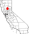
Adjacent counties:
Colusa  Glenn  Plumas  Sutter  Tehama  Yuba  

Find in California

Map of the Butte County area


Our detail map of Butte County shows the Butte County, California boundary lines and other interesting items.

Places in Butte County, California

  Airports     show all on map

Butte Creek Hog Ranch Airport, Chico Municipal Airport, Enloe Hospital Heliport, Johnsen Airport, Jones/Ag-Viation Airport, Lake Oroville Landing Area Seaplane Base, Oroville Municipal Airport, Paradise Skypark Airport, Ranchaero Airport, Richvale Airport, Siller Bros Inc Airport

  Bars     show all on map

American Bar, Bardees Bar, Bean Creek Bar, Beansoup Bar, Berry Creek Bar, Crooked Bar, Evans Bar, Fairfield Bar, Island Bar, Kanaka Bar, Merchants Bar, Miller Bar, Milsap Bar, Montgomery Bar, Rocky Bar, Stringtown Bar, Union Bar

  Basins     show all on map

Crane Valley, Flea Valley, Pleasant Valley, Wagners Valley

  Bends     show all on map

Hazel Bend, Missouri Bend

  Bridges     show all on map

Bidwell Bar Bridge, Canyon Creek Bridge, Enterprise Bridge, West Branch Bridge

  Buildings     show all on map

Berry Creek Rancheria Volunteer Fire Department, Bidwell Mansion, Biggs Branch Butte County Library, Biggs City Hall, Biggs Police Department, Butte County Behavioral Health and Inpatient Services, Butte County Courthouse, Butte County Fire Department Station 10, Butte County Fire Department Station 12, Butte County Fire Department Station 21, Butte County Fire Department Station 24, Butte County Fire Department Station 25, Butte County Fire Department Station 26, Butte County Fire Department Station 27, Butte County Fire Department Station 31, Butte County Fire Department Station 33, Butte County Fire Department Station 37, Butte County Fire Department Station 38, Butte County Fire Department Station 41, Butte County Fire Department Station 42, Butte County Fire Department Station 44, Butte County Fire Department Station 45, Butte County Fire Department Station 52, Butte County Fire Department Station 53, Butte County Fire Department Station 55, Butte County Fire Department Station 60, Butte County Fire Department Station 61, Butte County Fire Department Station 64, Butte County Fire Department Station 66, Butte County Fire Department Station 67, Butte County Fire Department Station 71, Butte County Fire Department Station 72, Butte County Fire Department Station 73, Butte County Fire Department Station 74, Butte County Fire Department Station 77, Butte County Library, Butte County Sheriff's Office, California Department of Forestry and Fire Protection Station 13 Stirling City, California Department of Forestry and Fire Protection Station 22 Cohasset, California Department of Forestry and Fire Protection Station 23 Forest Ranch, California Department of Forestry and Fire Protection Station 35 Paradise, California Department of Forestry and Fire Protection Station 36 Jarbo Gap, California Department of Forestry and Fire Protection Station 51 Feather Falls, California Department of Forestry and Fire Protection Station 54 Robinson Mill, California Department of Forestry and Fire Protection Station 62 Harts Mill, Central House, Chapman Neighborhood Center, Chico Branch Butte County Library, Chico City Hall, Chico Fire Department Station 1, Chico Fire Department Station 2, Chico Fire Department Station 3, Chico Fire Department Station 4, Chico Fire Department Station 5, Chico Fire Department Station 6, Chico Fire Department Training Center, Chico Museum, Chico Police Department, Cohasset Forest Fire Station, Craig Hall, De Sabla Powerhouse, Department of Forestry and Fire Protection Butte Unit / Butte County Fire Department Station 63, Department of Forestry and Fire Protection United States Forest Service Butte Meadows, Durham Branch Butte County Library, El Medio Fire Department, Enloe Rehabilitation Center, Feather River Ranger District Ambulance, First Responder Emergency Medical Services Station 11, First Responder Emergency Medical Services Station 12, First Responder Emergency Medical Services Station 14, First Responder Emergency Medical Services Station 21, First Responder Emergency Medical Services Station 22, First Responder Emergency Medical Services Station 23, First Responder Emergency Medical Services Station 31, First Responder Emergency Medical Services Station 32, First Responder Emergency Medical Services Station 33, Forest Ranch Forest Fire Station, Gridley Branch Butte County Library, Gridley City Hall, Gridley City Volunteer Fire Department Station 76, Gridley Police Department, Hurleton Fire Station, Kelly Ridge Fire Station, Lave Oroville Visitors Center, Manzanita Fire Station, Meriam Library, Oroville City Hall, Oroville Fire Department Station 1, Oroville Police Department, Oroville Public Library (historical), Paradise Branch Butte County Library, Paradise Fire Department Station 1, Paradise Fire Department Station 2, Paradise Fire Department Station 3, Paradise Police Department, Veterans Memorial Building, Veterans Memorial Building, Veterans Memorial Hall

  Canals     show all on map

Ashley Lateral, Baker Lateral, Bangor Ditch, Belding Lateral, Berry Creek Ditch, Biggs Extension, Bradford Lateral, Browning Lateral, Burns Government Lateral, Burns Lateral, Butler Canal, Butte Creek Diversion Channel, Center Ditch, Cherokee Canal, Cox Spillway, Crough Ditch, D D 100 Main Drain, Durham Mutual Ditch, Fleming Lateral, Gold Run Canal, Gravity Lateral, Green Lateral, Green Lateral, Henderson Ditch, High Gravity Lateral, High Lift Lateral, Lateral A, Lateral A-6, Lateral East, Lateral East-7, Lateral H, Lateral H-3, Lee Lateral, Low Gravity Wickman Lateral, Low Lift Lateral, Lower Miocene Canal, Main Canal, Main Ditch A, Main Ditch B, Main Drainage Canal, McKee Lateral, McQueen Lateral, Miners Ranch Canal, North Ditch, Odell Canal, Palermo Canal, Schwind Lateral, South Ditch, Stine Lateral, Thermalito Power Canal, Traynor Lateral, Upper Miocene Canal, Watt Lateral, Western Canal, Western Canal, Wilenor Ditch

  Capes     show all on map

Batchelor Point, Goat Point, Kimshew Point, Rattlesnake Point, Sugar Pine Point

  Cemeteries     show all on map

Centerville Cemetery, Chico Cemetery, Clear Creek Cemetery, Cohasset Cemetery, Coutolenc Cemetery, Durham Cemetery, Forest Ranch Cemetery, Glen Oaks Memorial Park Cemetery, Gridley-Biggs Cemetery, Honcut Cemetery, Indian Cemetery, Inskip Pioneer Cemetery, Memorial Park Cemetery, Nicholl Cemetery, Oak Grove Cemetery, Oroville Cemetery, Pine Creek Cemetery, Pioneer Cemetery, Thompson Flat Cemetery, Upham Cemetery

  Census     show all on map

Bangor Census Designated Place, Berry Creek Census Designated Place, Butte Creek Canyon Census Designated Place, Butte Meadows Census Designated Place, Butte Valley Census Designated Place, Cherokee Census Designated Place, Clipper Mills Census Designated Place, Cohasset Census Designated Place, Concow Census Designated Place, Durham Census Designated Place, Feather Falls Census Designated Place, Forbestown Census Designated Place, Forest Ranch Census Designated Place, Honcut Census Designated Place, Kelly Ridge Census Designated Place, Magalia Census Designated Place, Mechoopda Tribal Designated Statistical Area, Nord Census Designated Place, Oroville East Census Designated Place, Palermo Census Designated Place, Rackerby Census Designated Place, Richvale Census Designated Place, Robinson Mill Census Designated Place, South Oroville Census Designated Place, Stirling City Census Designated Place, Thermalito Census Designated Place, Yankee Hill Census Designated Place

  Churches     show all on map

Apostolic Church, Apostolic Gospel Temple, Bidwell Memorial Presbyterian Church, Biggs Assembly of God Church, Biggs United Methodist Church, Calvary Baptist Church, Calvary Baptist Church, Calvary Chapel of Gridley, Calvary Southern Baptist Church, Chico Gospel Hall, Christian Center, Church of Christ, Church of Christ, Church of God, Church of God in Christ, Church of the Brethren, Church of the Nazarene, Church of the Nazarene, Craig Memorial Congregational Church, Evangelical Free Church, First Assembly of God Church, First Assembly of God Church, First Baptist Church, First Baptist Church, First Baptist Church, First Christian Church, First Christian Church, First Church of Christ Scientist, First Congregational Church, First Methodist Church, First Presbyterian Church, Four Square Church, Foursquare Gospel Church, Free Methodist Church, Grace Baptist Church, Grace Brethren Church, Grace Lutheran Church, Gridley Christian Church, Historic Pioneer Church, Holy Church of God, I Am Temple, Iglesia Gentil De Cristo, Jubilee on the Ridge Church, Kingdom Hall of Jehovahs Witnesses, Kingdom Hall of Jehovahs Witnesses, Lighthouse Tabernacle, Magalia Community Church, New Life Apostolic Church, Oro Vista Baptist Church, Oroville Chinese Temple, Our Savior Lutheran Church, Paradise Christian Church, Paradise Church of Religious Science, Paradise Community Church of the Brethren, Paradise Holiness Church, Paradise Lutheran Church, Paradise Ridge Southern Baptist Church, Pentecostal Assembly of God Tabernacle, Pentecostal Church of God, Pentecostal Church of God, Pentecostal Church of God Faith Tabernacle, Reorganized Church of Jesus Christ of Latter Day Saints, Sacred Heart Catholic Church, Saint John the Baptist Roman Catholic Church, Saint Johns Episcopal Church, Saint Nicholas Episcopal Church, Saint Pauls Episcopal Church, Saint Thomas More Catholic Church, Saint Thomas the Apostle Catholic Church, Saint Timothys Episcopal Church, Seventh Day Adventist Church, Seventh Day Adventist Church, Seventh Day Adventist Church, Southside Foursquare Church, The Church of Jesus Christ of Latter Day Saints, The Church of Jesus Christ of Latter Day Saints, The Church of Jesus Christ of Latter Day Saints, The Church of Jesus Christ of Latter Day Saints, The Church of Jesus Christ of Latter Day Saints, The Esplanade Baptist Church, The Neighborhood Church, Thermalito Southern Baptist Church, Trinity Methodist Church, Truth Tabernacle

  Cliffs     show all on map

Cape Horn, Clarenback Point, East China Point

  Crossings     show all on map

Burts Ferry (historical), French Crossing, Golden Trout Crossing

  Dams     show all on map

A L Chaffin 346 Dam, Bidwell Bar Canyon Saddle Dam, Cannon Ranch 345 Dam, Concow 67 Dam, Dam 149, Dam 194, Desabla Forebay 97-005 Dam, Feather River Hatchery 1-047 Dam, Fish Barrier Dam, Forbestown Diversion 63-007 Dam, Forbestown Diversion Dam, Grizzly Creek 349 Dam, Grub Flat 344-002 Dam, Kunkle 97-007 Dam, Lake Madrone 1004 Dam, Lake Wyandotte 63 Dam, Littlefield 1341 Dam, Lost Creek 63-002 Dam, Magalia 73 Dam, Miners Ranch 63-009 Dam, Oroville 1-048 Dam, Oroville Dam, Paradise 73-002 Dam, Parish Camp Saddle Dam, Philbrook 97-008 Dam, Poe Dam, Ponderosa Diversion Dam, Round Valley 97-009 Dam, Sly Creek 63-006 Dam, Thermalito Afterbay 1-055 Dam, Thermalito Diversion 1-049 Dam, Thermalito Diversion Dam, Thermalito Forebay 1-054 Dam

  Falls     show all on map

Curtain Falls, Feather Falls

  Flats     show all on map

Box Hall Flat, Campbell Flat, Campbell Flat, Campbell Meadow, Chico Meadows, Cirby Meadow, Cuddleback Flat, Deer Park, Fish Camp Flat, Gold Flat, Jackass Flat, Jackass Flat, Jones Meadow, Lewis Flat, Millers Meadow, Schwartz Meadow, Snow Meadow, Sommey Flat, Swedes Flat, Thompson Flat, Whiskey Flat, Whiskey Flat

  Gaps     show all on map

Coyote Gap, Jarbo Gap, Lime Saddle, Sly Saddle, Stanwood Saddle, Sugar Pine Gap, The Narrows

  Guts     show all on map

Deadmans Reach, Hamilton Slough

  Hospitals     show all on map

Biggs Gridley Memorial Hospital, Curran Hospital, Enloe Children Health Center, Enloe Medical Center, Enloe Medical Center Cohasset Campus, Feather River Hospital, Oroville Hospital

  Islands     show all on map

Emery and Mitchell Island, Golden State Island, Ryan Island, Snaden Island, Wilson Island

  Lakes     show all on map

Bear Lake, Eddy Lake, Goose Lake (historical), Horseshoe Lake, Paradise Lake, Perkins Lake, Summit Lake, The Lagoon, Vandergrift Lake

  Locales     show all on map

Anderson Mill (historical), Andy Smith Ranch (historical), Bell Ranch, Berry Creek Station (historical), Bidwell Canyon Campground, Bidwell Canyon Marina, Bidwell Municipal Golf Course, Big Bald Rock Trailhead, Biggs Station (historical), Brush Creek Administrative Site, Buffalo Ranch, Butte County Center, Butte County Fairgrounds, Butte Creek Country Club, Butte Creek House, Butte Meadows Campground, Butte Meadows Recreation Site, Camp Creek Powerhouse, Camp Lassen, Camp One, Canyon Oaks Golf Course, Chaparral Guard Station, Cherry Hill Campground, Chico Landing, Coutolenc, Coyote Gap Forest Service Station, Coyote Gap Forest Service Station, Crain Mill, Cresta Powerhouse, Diamond Match Factory, Dome Trailhead, Doon Camp, Dresser Camp, Elks Retreat, Elliot Spring House, Ewalt Camp, Fall River Campground, Feather River Fish Hatchery, Five Corners, Forbestown Powerhouse, Forks of Butte, Four Corners, Fourteenmile House, Frenchmans Grave, Garden Ranch (historical), Goat Ranch Campground, Greek Ranch Camp, Grizzly Lodge, Hangtown Gun Club, Harts Mill (historical), Hawkins Camp, Heritage Oak Shopping Center, Hinton Ranch, Hooker Oak, Hutchins Mill (historical), Jackson Ranch, Jamison Ranch (historical), Johnson Cabin, Johnson Ranch, Kelly Ridge Golf Course, Lewis Flat Campsite, Lime Saddle Powerhouse, Loafer Creek Campground, Lodestar Farms, Lone Pine Lookout, Magalia Camp, Maynards Ranch, Mill Creek Cal-Transit, Mill Creek Cal-Transit Station, Miners Ranch, Mishop Bar Campground, Mountain House, Old Defiance Mill (historical), Old Spanish Corral, Onstott Ranch, Oroville Gun Club, Palermo Substation, Paradise Lake Recreation Site, Parish Camp, Park Village Shopping Center, Parrott Landing, Philbrook Lake Boat Ramp, Philbrook Lake Campground, Pine Cluster Ranch, Pine Creek Landing, Poe Powerhouse, Rag Dump, Ramsey Bar, Retson Camp, Rogers Cow Camp, Rose Ranch (historical), Saddle Creek Ranch, Sanborn Slough Gun Club, Schaefer Ranch, Schohr Ranch, Scottys Boat Landing, Seater Ranch, Shady Rest Area, Shady Rest Receration Area, Sly Creek Campground, Soda Springs Campground, Soda Springs Campground, Spencer Ranch, Spillway Boat Ramp, Strawberry Campground, Table Mountain Municipal Golf Course, Tenmile House, The Pines, Thermalito Forebay South Boat Ramp, Tule Goose Gun Club, Turners Mill (historical), United States Department of Agriculture Plant Introduction Garden, USDA Rice Experimental Station, Watson Cabin, West Branch Camp, Wild Goose Country Club, Wilson Landing, Wyandotte Substation, Zink Ranch

  Military     show all on map

Chico Army Air Field (historical), Oroville Army Air Field (historical)

  Mines     show all on map

Banner Mine, Big Bend Mine, Black Diamond Mine, Bloomingdale Mine, Blue Lead Mine, Buffalo Mine, Bumblebee Mine, Bunker Hill Mine, Carlysle Mine, Carr Mine, Central Pacific Mine, Cherokee Placer Mine, Cory Mine, Denver Mine, Dix Mine, Emma Mine, Evening Star Mine, Genil Mine, Hornet Mine, Horseshoe Mine, Indian Spring Mine, Madre de Oro Mine, Magalia Mine, Midas Mine, Monte de Oro Mine, Natomas 100 Pit, New Era Mine, Old Utah Mine, Orofino Mine, Pacific Heights Pit, Phoenix Mine, Rock River Mine, Royal Drift Mine, Silver Star Mine, Sky High Mine (historical), Snow Mine, Soapstone Mine, South Banner Mine, Southern Cross Mine, Standard Mine, Steifer Mine, Surcease Mine, Treasure Hill Mine, Triumph Mine

  Parks     show all on map

Bedrock Park, Bidwell Mansion State Historic Park, Bidwell Park, Bidwell Park, Bidwell River Park, Bidwell-Sacramento River State Park, Big Chico Creek Day Use Area, Bille Park, Bloomer Primitive Recreation Area, Clay Pit State Vehicular Recreation Area, Craig Recreation Area, Crain Memorial Park, Depot Park, Foreman Creek Recreation Area, Goat Ranch Recreation Area, Gray Lodge Waterfowl Management Area, Hewitt Park, Kelly Ridge Recreation Area, Lake Oroville State Recreation Area, Lime Saddle Memorial Park, Loafer Creek Recreation Area, Manuel Vierra Park, Mitchell Field, Nelson Park, Nick Daddow Plaza, Oak Way Park, Oroville Wildlife Area, Palermo Park, Paradise Memorial Park, Potters Ravine Recreation Area, Rotary Grove Park, Rotary Park, Sank Park, Silver Dollar Fairgrounds, Sycamore Creek Recreation Area, Thermalito Forebay North Picnic Area, Twentieth Street Park

  Pillars     show all on map

Arch Rock, Chimney Rock

  Populated Places     show all on map

Anita, Bangor, Barber, Bauka (historical), Bayu (historical), Berry Creek, Bidwell (historical), Bidwell Bar (historical), Big Bar, Big Bend, Big Ripples (historical), Biggs, Blavo, Blinzing (historical), Bloomer (historical), Brush (historical), Brush Creek, Butte Meadows, Camp Eighteen, Cana, Centerville, Chandon (historical), Chapmantown, Cherokee, Chico, Clipper Mills, Cohasset, Concow, Craig, Craig (historical), Cresta, David (historical), Dayton, De Sabla, Deadwood, DeSabla, Dodge Place, Dodgeland, Durham, East Biggs, East Gridley, Elsey, Enterprise (historical), Eskini (historical), Esquon, Fagan, Feather Falls, Flea Valley (historical), Forbestown, Forest Ranch, Gold Lake (historical), Gridley, Gridley Colony Number One (historical), Gridley Colony Number Two (historical), Haselbusch (historical), Hawk Ravine (historical), Helltown, Hokomo (historical), Holhoto (historical), Honcut, Hughes Place, Hume (historical), Hurleton, Inskip, Irish Town, Isaiah (historical), James, Jonesville, Junction House, Kalkalya (historical), Kister, Kramm, Kulaiapto (historical), Land (historical), Las Plumas (historical), Lava Beds (historical), Lomo, Lorraine (historical), Lovelock, Lumpkin, Magalia, Mayaro, Merrills Landing, Merrimac, Michopdo (historical), Mineral Slide, Moseley (historical), Nelson, Nelson Bar (historical), Nelsons Crossing, New Blinzing (historical), Nimshew, Nord, Oak Grove, Old Forbestown, Ololopa (historical), Oregon City, Oroleve, Oroville, Oroville Junction, Otaki (historical), Paki (historical), Palermo, Paradise, Paradise Pines, Parkhill, Peachton, Pentz, Pipers (historical), Poe, Powellton, Pulga, Quartz (historical), Ramada, Rancho Llano Seco, Riceton, Richardson Springs, Richland (historical), Richvale, Robinson Mills, Robinsons Corner, Roble, Rogerville, Shippee, Soto (historical), South Fork (historical), South Oroville, Stirling City, Stirling Junction, Sunnyslope, Sunusi (historical), Swedes Flat (historical), Tadoiko (historical), Taikus (historical), Thermalito, Toadtown, Totoma (historical), Tsuka (historical), Vista Robles, Wagners (historical), Wicks Corner, Wyandotte, Yankee Hill, Yauko (historical), Yuman (historical)

  Post Offices     show all on map

Biggs Post Office, Butte Meadows Post Office (historical), Chico Post Office, Gridley Post Office, Lovelock Post Office (historical), Magalia Post Office, Oroville Post Office, Paradise Post Office, Yankee Hill Post Office (historical)

  Ranges     show all on map

Campbell Hills

  Reservoirs     show all on map

Breedlove Reservoir, Cannon Reservoir, Concow Reservoir, Grub Flat Reservoir, Kunkle Reservoir, Lake De Sabla, Lake Oroville, Lake Wyandotte, Littlefield Reservoir, Lost Creek Reservoir, Madrone Lake, Magalia Reservoir, Miners Ranch Reservoir, Morgan Reservoir, Philbrook Reservoir, Ponderosa Reservoir, Sly Creek Reservoir, Snag Lake, Soto Lake, Spring Valley Reservoir, Sycamore Reservoir, Thermalito Afterbay, Thermalito Diversion Pool, Thermalito Forebay, Tom Jones Reservoir, Wilson Reservoir

  Ridges     show all on map

Big Ridge, Carpenter Ridge, Carpenter Ridge, Chino Ridge, Clements Ridge, Cleveland Hill, Cohasset Ridge, Cohasset Ridge, Cohasset Ridge, Coon Ridge, Doe Mill Ridge, Fields Ridge, Galen Ridge, Glover Ridge, Granite Ridge, Harrison Ridge, Keefer Ridge, Keefer Ridge, Kelly Ridge, Kenebeck Ridge, Lewis Ridge, Magee Ridge, McKay Ridge, Mooretown Ridge, Mooreville Ridge, Morgan Ridge, Mosquito Ridge, Mountain Spring House Ridge, Musty Buck Ridge, Perkins Ridge, Rocky Ridge, Stephens Ridge, Thatcher Ridge, Transfer Ridge, Watson Ridge, White Spring Ridge

  Schools     show all on map

Atkins School (historical), Aymer Jay Hamilton Elementary School, Bangor Elementary School, Berry Creek Elementary School, Bidwell Junior High School, Bidwell School, Biggs Elementary School, Biggs High-Middle School, Bird Street Elementary School, Burbank School, Butte College, California State University - Chico, Central Middle School, Central School (historical), Chapman Elementary School, Chico Army Flying School (historical), Chico Junior High School, Chico Senior High School, Citrus Avenue Elementary School, Clear Creek School, Clipper Mills School, Cohasset Elementary School, Concow Elementary School, Cottonwood School (historical), Durham High School, Durham Intermediate School, Eastside Elementary School, Fair View High School, Feather Falls Elementary School, Feather River School, Floral School, Forest Ranch Elementary School, Gridley High School, Helen M Wilcox Elementary School, Honcut School, Hooker Oak Elementary School, Horace Brakebill Elementary School, Jay E Partridge Elementary School, John A McManus Elementary School, Junior Academy, Kings School, Landlow School (historical), Las Plumas High School, Linden Public School (historical), Loma Vista School, Lone Tree School, Manzanita Elementary School, Marigold Elementary School, McKinley Elementary School, Messilla Valley School (historical), Morris Ravine School (historical), Neal Dow Elementary School, Nelson Avenue Elementary School, Nord Elementary School, Notre Dame School, Oakdale Heights Elementary School, Oroville High School, Palermo School, Paradise Christian School, Paradise Elementary School, Paradise High School, Paradise Intermediate School, Parkview Elementary School, Pines Elementary School, Pleasant Valley Senior High School, Ponderosa Elementary School, Poplar Avenue Elementary School, Richvale Elementary School, Ridgeview High School, Rio Seco School (historical), River District School (historical), Rockefeller School, Rose School, Rosedale Elementary School, Saint Thomas More School, Saint Thomas School, Seventh Day Adventist School, Shasta Union School, Sierra Avenue Elementary School, Sierra View Elementary School, Spring Valley Elementary School, Stanford Avenue Elementary School, Sycamore Elementary School, Union School (historical), West Liberty School, Wilson Elementary School, Wyandotte School

  Springs     show all on map

California Nutmeg Spring, Carson Spring, Cohasset Pioneers Spring, Cold Springs, Cornelia Lott Sank Memorial Spring, Deadman Spring, Durbin Spring, Dutch Pete Spring, Granite Spring, Hog Spring, Hospital Spring, Linden Spring, Preston Spring, Roadside Spring, Soda Springs, White Spring, Wyman Spring

  Streams     show all on map

Adams Creek, Anderson Fork, Baker Creek, Bean Creek, Bear Ranch Creek, Berry Creek, Bidwell Creek, Big Chico Creek, Big Kimshew Creek, Big Winters Creek, Bolt Creek, Boomer Creek, Bottle Creek, Brush Creek, Buckeye Creek, Bull Creek, Bush Creek, Camp Creek, Campbell Creek, Campbell Creek, Campbell Creek, Canyon Creek, Cascade Creek, Cave Creek, Cedar Creek, Cedar Creek, Channel Slough, Chino Creek, Cirby Creek, Clear Creek, Clear Creek, Clear Creek, Colby Creek, Cold Creek, Comanche Creek, Concow Creek, Coon Creek, Coon Creek, Cottonwood Creek, Dead Horse Slough, Deadwood Creek, Dicus Slough, Discovery Creek, Dogwood Creek, Dry Creek, Dubock Slough, Durham Slough, East Branch Mud Creek, East Fork Canyon Creek, East Fork Last Chance Creek, Empire Creek, Fall Creek, Fall River, Fallager Creek, Fish Creek, Flea Valley Creek, Foreman Creek, Foreman Creek, Fox Creek, Frazier Creek, French Creek, French Creek, Frey Creek, Galen Creek, Get Up and Get Creek, Gold Run, Grizzly Creek, Grizzly Creek, Grubbes Creek, Hamlin Slough, Haphazard Creek, Happy Hollow Creek, Harbean Slough, Haw Creek, Heinz Creek, Hibbard Creek, Hodapp Creek, Honcut Creek, Honey Run, Indian Creek, Inskip Creek, Jack Creek, Jones Creek, Jordan Creek, Kanaka Creek, Kanaka Creek, Keefer Slough, Kenebeck Creek, Keyser Creek, Know-nothing Creek, Kusal Slough, Last Chance Creek, Last Chance Creek, Lindo Channel, Little Buckeye Creek, Little Butte Creek, Little Chico Creek, Little Cottonwood Creek, Little Dry Creek, Little Frey Creek, Little Kimshew Creek, Little North Fork of Middle Fork Feather River, Little Ram Creek, Little Rock Creek, Little Rody Creek, Little Sucker Run, Little West Fork West Branch Feather River, Loafer Creek, Lockerman Creek, Lost Creek, Lower Rocky Honcut Creek, Maple Branch, Marble Creek, Martin Creek, McCabe Creek, Middle Branch Mud Creek, Middle Butte Creek, Middle Fork Feather River, Mill Creek, Minnie Creek, Mosquito Creek, Mosquito Creek, Mountain House Creek, Mud Creek, Murphy Slough, Natchez Creek, Negro Creek, Nolton Creek, North Fork Feather River, North Honcut Creek, Nutmeg Creek, Oroleve Creek, Owl Creek, Peavine Creek, Philbrook Creek, Pine Creek, Pinkard Creek, Pompys Creek, Powell Creek, Quartz Creek, Ram Creek, Rattlesnake Creek, Rock Creek, Rock Creek, Rock Creek, Rocky Honcut Creek, Rody Creek, Sanborn Slough, Scotts John Creek, Secret Creek, Singer Creek, Sly Creek, Sly Creek, Snaden Slough, South Branch Mill Creek, South Fork Berry Creek, South Fork Feather River, Stony Creek, Strawberry Valley Creek, Sucker Run, Sycamore Creek, Sycamore Creek, Sycamore Creek, Tigus Creek, Trickling Creek, Union Creek, Upper Rocky Honcut Creek, Varey Creek, Webb Creek, West Branch Butte Creek, West Branch Clear Creek, West Branch Feather River, West Branch Fish Creek, West Branch French Creek, West Branch Mud Creek, West Fork North Honcut Creek, West Fork Rock Creek, Wild Yankee Creek, Willow Creek, Willow Creek, Winters Creek, Woodleaf Creek, Wyandotte Creek

  Summits     show all on map

Bald Mountain, Bald Rock Dome, Bear Ranch Hill, Beauty Peak, Big Bald Rock, Big Bar Mountain, Big Bend Mountain, Bloomer Hill, Bottle Hill, Bull Hill, Cape Horn, Castle Rock, Cherry Hill, Crystal Hill, Deer Peak, East China Point, Flatiron, Flea Mountain, Gold Hill, Gold Hill, Humboldt Peak, Hump Hill, Hungary Hunt Peak, Ike Dye Hill, Island Bar Hill, Jordan Hill, Kanaka Peak, Katskill Hill, Little Bald Rock, Miller Hill, Monte de Oro, Mount Hope, Mount Ratchel, Nimshew Ridge, North Table Mountain, Oak Point, Parks Hill, Patton Peak, Phoenix Hill, Platte Mountain, Pompys Point, Portuguese Point, Quartz Hill, Red Hill, Robbers Roost, Robley Point, Rocky Peak, Rocky Point Peak, Sausage Mountain, Sawmill Peak, Serpentine Point, Shute Mountain, Sky High, Snow Mountain, Sorensen Hill, South Bidwell Hill, South Table Mountain, Steamboat Rock, Stringtown Mountain, Sugarloaf, Sugarloaf Peak, Sunset Hill, Swain Hill, Swain Hill, Swayne Hill, Sycamore Hill, Table Mountain, The High Rocks, Union Hill, West China Point, Wild Yankee Hill

  Towers     show all on map

KBCP-TV (Paradise), KCHH-FM (Paradise), KCHH-FM (Paradise), KCHO-FM (Chico), KEWE-FM (Oroville), KFMF-FM (Chico), KHAP-FM (Chico), KHSL-AM (Chico), KHSL-TV (Chico), KKXX-AM (Mulberry), KKXX-AM (Paradise), KNVR-FM (Paradise), KORV-AM (Oroville), KPAY-AM (Chico), KPAY-FM (Chico), KZFR-FM (Chico)

  Trails     show all on map

Big Bald Trail, Dome Trail, Mountain House Trail, Sky High Trail

  Tunnels     show all on map

Cresta Tunnel, Forbestown Tunnel, Kelly Ridge, Miners Ranch Tunnel, Poe Tunnel, Tunnel Number Eleven, Tunnel Number Nine, Tunnel Number Seven, Tunnel Number Ten, Tunnel Number Thirteen

  Valleys     show all on map

Bald Rock Canyon, Bear Gulch, Bear Gulch, Beatson Hollow, Berry Canyon, Bidwell Bar Canyon, Blair Ravine, Bloomer Ravine, Blowhard Ravine, Boucher Ravine, Breakneck Canyon, Brown Ravine, Brown Ravine, Bryant Ravine, Cabin Hollow, Carey Gulch, Cedar Ravine, China Gulch, Coal Canyon, Coon Hollow, Coon Hollow, Coon Ravine, Cory Canyon, Crouch Ravine, Cunningham Ravine, Dark Canyon, Dark Canyon, Deadman Ravine, Devil Canyon, Devils Gulch, Digger Ravine, Dixon Ravine, Dutch Ravine, Eagle Gulch, Fine Gold Gulch, Flag Canyon, Forbestown Ravine, Fortyniner Gulch, French Ravine, Griffin Gulch, Hamlin Canyon, Hawk Ravine, Hayes Canyon, High Rock Ravine, Horsethief Canyon, Irish Ravine, Iron Canyon, Jack Hill Ravine, Kennedy Ravine, Lanigan Gulch, Long Ravine, Long Ravine, Messilla Valley, Mineral Spring Ravine, Montgomery Bar Ravine, Morgan Ravine, Morris Ravine, Mosquito Gulch, Nance Canyon, Negro Gulch, Nelson Ravine, Nelson Ravine, Nugen Canyon, Oregon Gulch, Oregon Gulch, Owens Ravine, Pinkston Canyon, Platte Ravine, Potter Ravine, Rich Gulch, Robinson Ravine, Sandy Gulch, Sawmill Ravine, Schirmer Ravine, Shake Ravine, Sheep Hollow, Shields Gulch, Shirttail Canyon, Slaughterhouse Ravine, Sowell Ravine, Spoon Ravine, Spring Hollow, Spring Ravine, Spring Valley Gulch, Swain Ravine, Vinton Gulch, Web Hollow, West Branch Potter Ravine, Whitehall Ravine, Woodman Ravine, Wyman Ravine,

Butte County, California Population By Race (2012 estimate)

RacePopulation
WhiteButte County White population 192,284192,283  
AsianButte County Asian population 9,7259,724
MixedButte County Mixed population 9,0629,061
American IndianButte County American Indian population 5,3045,304
BlackButte County Black population 3,7573,757
Hawaiian & Pacific IslanderButte County Hawaiian & Pacific Islander population 663663

Additional population tables :
State population table
California population by county