Lamar County, Georgia Basics:


Lamar County Georgia - Government Site

Population: 18,048
Area: 184 square miles
County seat: Barnesville
Area code(s) in use: 770
Time zone: EST
High school graduate or higher: 80.0%
Bachelor's degree or higher: 12.7%
Median household income: $39,224
Persons in poverty: 19.8%
Home ownership rate: 69.5%
Mean travel time to work: 30.4 minutes

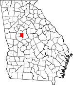
Adjacent counties:
Butts  Monroe  Pike  Spalding  Upson  

Find in Georgia

Map of the Lamar County area


Our detail map of Lamar County shows the Lamar County, Georgia boundary lines and other interesting items.

Places in Lamar County, Georgia

  Airports     show all on map

Antique Acres Airport, De De Airport, Flying H Ranch Inc Airport, Liberty Hill Airport, Little Tobesofkee Creek Ranch Airport, Toland Airport

  Buildings     show all on map

Barnesville City Hall, Barnesville Fire Department, Barnesville Police Department, Carnegie Library of Barnesville, Lamar County Courthouse, Lamar County Fire and Rescue Station 1 Grove Street, Lamar County Fire and Rescue Station 2 Redbone, Lamar County Fire and Rescue Station 3 South Milner, Lamar County Fire and Rescue Station 4 Johnstonville, Lamar County Fire and Rescue Station 5 Piedmont, Lamar County Jail, Lamar County Sheriff's Office, Lamar County Station 6 Chappell Mill, Lamar County Station 7, Lamar Pre-Release Center, Milner Police Department

  Cemeteries     show all on map

Blackman Cemetery, Cain Cemetery, Carden Cemetery, Confederate Cemetery, Crawley Cemetery, Ennis Cemetery, Fambrough Cemetery, Fleming Cemetery, Fredonia Cemetery, Harris Cemetery, Head Cemetery, Hill Cemetery, King Chapel Cemetery, Manry Cemetery, Martin Cemetery, Memorial Gardens, Moye Cemetery, New Crawley Cemetery, Pearson Cemetery, Person Cemetery, Pringle Cemetery, Ramah Cemetery, Reeves-Askin Cemetery, Rehobeth Cemetery, Sappington Cemetery, Sardis Cemetery, Seagraves Cemetery, Shattles Cemetery, Sheram Cemetery, Sheran-Horne-Smith Cemetery, Shiloh Cemetery, Stallings Cemetery, Taylor Cemetery, Wadesworth Cemetery, Wadsworth Cemetery, William F Johnston Cemetery

  Churches     show all on map

Bethel Church, Bethel Church, Calvary Church, Central Church, Ebenezer Church, Edie Creek Church, First Baptist Church, Fredonia Church, Good Hope Church, Green Mount Church, High Shoals Church, Holly Grove Church, Kingdom Hall, Kings Chapel Methodist Church (historical), Liberty Primitive Baptist Church, Lilla Church, Midway Church, Midway Church, Mount Calvary Church, Mount Pleasant Church, Mount Zion Church, Pleasant Hill Church, Prospect Church, Ramah Church, Rehoboth Church, Rock Springs Church, Rocky Mount Church, Sand Hill Church, Sardis Church, Shiloh Church, Shiloh Church, Sugar Hill Church, Union Church, Unionville Church

  Dams     show all on map

Akin Lake Dam, Arms Lake Dam, Barnesville Reservoir Dam, Camnaflax Lake Dam Number 3, Camnaflax Lake Dam Number 4, Childs Pond Dam, Davis Lake Dam, English Dam, English Lake Dam, Finny Lake Dam, Mangham Lake Dam, McCord Lake Dam, Pennington Lake Dam, Pippin Lake Dam, Potato Creek Structure Number 103 Dam, Potato Creek Structure Number 115 Dam, Potato Creek Structure Number 78 Dam, Sanders Dam, Smith Lake Dam, Spalamar Lake Dam, Tobesofkee Creek Structure Number 70 Dam, Upper Weldon Pond Dam, Weldon Lake Dam, Weldon Pond Dam, Wildlife Land Pond Dam

  Lakes     show all on map

Potts Pond

  Populated Places     show all on map

Aldora, Barnesville, Chappel, Five Points, Goggins, Graddick (historical), Horns Crossroads, Johnstonville, Lamont (historical), Liberty Hill, Middlebrooks (historical), Milner, Milner Crossroads, Patillo, Piedmont, Powell (historical), Redbone, Revere (historical), Unionville, Weldons Crossroads, Wilkinsons (historical), Woodfin Mill

  Post Offices     show all on map

Barnesville Post Office

  Reservoirs     show all on map

Akin Lake, Arms Lake, Barnesville Reservoir, Camnaflax Lake Number 3, Camnaflax Lake Number 4, Childs Pond, Davis Lake, English Lake, English Lake, Finny Lake, Hugh Steele Lake, Mangham Lake, McCord Lake, Pennington Lake, Pippin Lake, Potato Creek Structure Number 103 Lak, Potato Creek Structure Number 115 Lak, Potato Creek Structure Number 78 Lake, Sanders Lake, Smith Lake, Spalamar Lake, Tobesofkee Creek Structure Number 70, Upper Weldon Pond, Weldon Lake, Weldon Pond, Wildlife Land Pond, Woodfin Lake (historical)

  Schools     show all on map

Barksdale School (historical), Barnesville Academy, Bethel School (historical), Birch Street School, Central School (historical), Central School (historical), Edie Creek School (historical), Forsyth Road School, Gordon College, Graham Street School, Holly Grove School (historical), Lamar County Comprehensive High School, Lamar County Elementary School, Lamar County Middle School, Lamar County Primary School, Midway School (historical), Milner Cross Roads School (historical), Prospect School (historical), Rehoboth School (historical), Saint George's Episcopal School, Sand Hill School (historical), Sardis School (historical), Stroudsville School (historical), Sugar Hill School (historical)

  Springs     show all on map

Browns Mineral Spring

  Streams     show all on map

Ball Branch, Big Towaliga Creek, Buck Creek, Cole Creek, Edie Creek, Grape Creek, Grape Creek, Honey Bee Creek, Little Buck Creek, Little Potato Creek, Little Potato Creek, Parker Branch, Pepper Creek, Prairie Creek, Reeves Creek, Swan Creek, Turner Creek, Turnpike Creek, Wolf Creek, Wood Creek

  Summits     show all on map

Hog Mountain, Pine Mountain

  Towers     show all on map

WBAF-AM (Barnesville),

Lamar County, Georgia Population By Race (2012 estimate)

RacePopulation
WhiteLamar County White population 12,03812,038  
BlackLamar County Black population 5,5775,576
MixedLamar County Mixed population 289288
AsianLamar County Asian population 9090
American IndianLamar County American Indian population 5454
Hawaiian & Pacific IslanderLamar County Hawaiian & Pacific Islander population 00

Additional population tables :
State population table
Georgia population by county