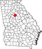
Newton County, Georgia Basics:


Newton County Georgia - Government Site

Population: 101,299
Area: 272 square miles
County seat: Covington
Area code(s) in use: 770
Time zone: EST
High school graduate or higher: 84.2%
Bachelor's degree or higher: 19.1%
Median household income: $51,336
Persons in poverty: 14.6%
Home ownership rate: 73.9%
Mean travel time to work: 32.5 minutes


Adjacent counties:
Butts  Henry  Jasper  Morgan  Rockdale  Walton  

Find in Georgia

Map of the Newton County area


Our detail map of Newton County shows the Newton County, Georgia boundary lines and other interesting items.

Places in Newton County, Georgia

  Airports     show all on map

Cline Ranch Strip, Covington Municipal Airport, Flanigan Airport, Morgan Farm Field, Neely Farms Airport, Newton General Hospital Heliport, Poole Farm Airport, Windy Hill Airport

  Bars     show all on map

Allen Shoals, Cedar Shoals, Factory Shoals, Island Shoals, Langston Shoals, Peachstone Shoals, White Shoals

  Bays     show all on map

Connally Cove, Kitchen Neck, Parker Neck, Plunkett Neck, Pope Neck

  Bridges     show all on map

Brown Bridge

  Buildings     show all on map

Andrew Hall, Candler-Hall Library, Central Newton Volunteer Fire Department Station 10, Covington City Hall, Covington Fire Department Station 1, Covington Fire Department Station 2, Covington Police Department, Dixie Manor, East Newton Volunteer Fire Station 4, Few Hall, Florida Hall, Georgia Forestry Commission Newton / Rockdale / Dekalb Office, Magnolia Terrace, Newton County Courthouse, Newton County Fire Service Station 1, Newton County Fire Service Station 14, Newton County Fire Service Station 15, Newton County Fire Service Station 3, Newton County Fire Service Station 6, Newton County Fire Service Station 7, Newton County Fire Service Station 9, Newton County Jail, Newton County Library, Newton County Sheriff's Office, North Newton Volunteer Fire Department Station 8, Orna Villa, Oxford City Hall, Oxford Police Department, Oxford Volunteer Fire / Rescue, Porterdale Police Department, Porterdale Volunteer Fire Department Station 11, Rocky Plains Volunteer Fire Department Station 2, Salem Volunteer Fire Department Station 5, Seney Hall, Swanscombe, Whitehall

  Cemeteries     show all on map

Adams Cemetery, Austin Chapel Cemetery, Bailey Cemetery, Bates Cemetery, Bethany Cemetery, Bethel Bara Cemetery, Biggers Cemetery, Brodnax Cemetery, Byrd Cemetery, Chapman Cemetery, Colley Cemetery, Confederate Soldiers Cemetery, Cook Cemetery, County Line Cemetery, Covington City Cemetery, Davis Cemetery, Dover Cemetery, Echols Cemetery, Ellington Cemetery, Fincher Cemetery, Gum Creek Cemetery, Harris Springs Cemetery, Hays Cemetery, Heard Cemetery, High Point Cemetery, Holly Springs Cemetery, Kitchen Cemetery, Lackey Cemetery, Lawnwood Memorial Park, Lovejoy Cemetery, Macedonia Cemetery, Middlebrook Cemetery, Middlebrooks Cemetery, Mount Moriah Cemetery, Mount Moriah Cemetery, Mount Pleasant Cemetery, Mount Zion Cemetery, Newborn City Cemetery, Newton Factory Cemetery, Oxford Town Cemetery, Parker Cemetery, Perry Family Cemetery, Pickett Cemetery, Pope Cemetery, Prospect Cemetery, Rakestraw Cemetery, Red Oak Cemetery, Sardis Cemetery, Scott Cemetery, Shiloh Cemetery, Starrsville Cemetery, Stewart Cemetery, Tabernacle Cemetery, Waters Cemetery, Zion Cemetery

  Churches     show all on map

Alcovy Church, Allen Memorial United Methodist Church, Almon Baptist Church, Austin Chapel, Bethany Church, Bethel Bara Baptist Church, Bethel Grove Baptist Church, Bethel Grove Church, Bethlehem Baptist Church, Canaan Baptist Church, Church of the Good Shepherd, County Line Church, Covington Christian Church, Crossway Mission Church, Early Hope Church, First Baptist Church, First Presbyterian Church, First United Methodist Church, Gaithers Church, Gaithers Church, Good Hope Baptist Church, Gospel Tabernacle United Pentecostal Church, Grace United Methodist Church, Graves Chapel, Gum Creek Church, Harmony Church, Harris Springs Church, High Point Baptist Church, Hopewell Church, Journey Baptist Church, Journey Baptist Church, Julia A Porter United Methodist Church, Little Bethel Church, Livingston Chapel Christian Methodist Episcopal Church, Love Joy Church, Luther Hayes Church, Macedonia Church, Macedonia Church, Mansfield Baptist Church, Mansfield United Methodist Church, Monastery of the Holy Ghost, Moses Methodist Church, Mount Carmel Church, Mount Olive Church, Mount Pleasant Church, Mount Zion Church, Mount Zion Church, Mount Zion Church, Murray Christian Methodist Episcopal Church, New Hope Baptist Church, Newborn United Methodist Church, North Covington United Methodist Church, Old Emory Church, Pascall Church, Pine Grove Church, Pleasant View Church, Poplar Grove Church, Porterdale Baptist Church, Porterdale Presbyterian Church, Prospect Church, Red Oak Church, Richards Chapel, Saint Augustines Catholic Church, Salem United Methodist Church, Sardis Church, Shiloh United Methodist Church, Shoal Creek Church, Simms Chapel, Snapping Shoals Church, Spring Hill Church, Springfield Church, Springfield Church, Starrsville Church, Stewart Baptist Church, Trinity United Methodist Church, Union Grove Church, Wesley Chapel, Zion Church

  Crossings     show all on map

Exit 44, Exit 45, Exit 45A, Exit 46, Exit 47, Exit 48

  Dams     show all on map

Bailey Lake Dam, Bert Adams Dam, Covington Reservoir Dam, Duvall Lake Dam, Greer Lake Dam, Hays Pond Dam, Lower Williams Lake Dam, Manning Lake Dam, Mores Pond Dam, Paradise Lake Dam, Silver Lake Dam, Stokes Lake Dam, Stone Lea Lake Dam, Stone Lea Lake Dam, Treadwell Lake Dam, Turner Lake Dam, Upper Williams Lake Dam, Wallace Lake Dam

  Hospitals     show all on map

Newton County Mental Health Center, Newton Medical Center

  Lakes     show all on map

Dials Millpond

  Locales     show all on map

Brick Store, Covington Corners Shopping Center, Covington Crossings Shopping Center, Covington Plaza Shopping Center, Covington-Newton County Industrial Park, Martins Crossing Shopping Center, Newton Crossroads Shopping Center, Newton Plaza Shopping Center, Pony Express, Salem Campground, Snapping Shoals

  Parks     show all on map

Baker Field Park, Floyd Street Historic District, Newton County Fairgrounds, Oxford Historic District, Springs Park

  Populated Places     show all on map

Abide Awhile, Airport Grove, Alcovy, Alcovy Mobile Home Park, Almon, Anderson Acres, Ashley Grove, Avalon, Barrington, Beacon Hill, Bear Creek Estates, Beaver Creek, Brandy Shoals, Brentwood, Briarpatch, Brookwood East, Brown Bridge Square, Buck Creek, Buckingham, Cambridge Forest, Cedar Creek, Cedar Ridge, Country Acres Mobile Home Park, Country Terrace, Country View, Country Wood, Covington, Creekwood Estates, Deer Track, Deerfield, Dialtown, Dixie, Dixie Acres, Dixie Village, East Wood, Elk Ridge, Essex Village, Fairfield, Fairview, Fairview Commons, Fieldstone, Fincher Farms, Flint Hill, Forest Lakes, Forest Mill, Fox Meadows, Glynn Isles, Greenwood Acres, Hayston, Hazelbrand Acres, Hidden Forest, Hidden Pines, Hidden Shoals, High Point, Highpoint Forest, Highpoint Mobile Home Park, Hightower Forest, Hollow Hills, Hollow Oaks, Horseshoe Springs, Hub Junction, Idlewood, Jamestown, Jerusalem, Kirkland Acres, Knights Landing, Lakeside, Lakeside Grove, Lassiter, Long Acres, Malcolm Woods, Mansfield, Mansfield Estates, Marble Valley, Meadow View, Meadowbrook Mobile Home Park, Meadowood Subdivision, Melody, Millers Glen, Murphy Hills, Newborn, Newton Chase, Newton Ridge, Newton Woods, North Conyers Farms, Oak Forest Mobile Home Park, Oak Grove, Oak Hill, Oak Hill Farms, Oakbrook, Oakwood, Oxford, Pace, Pine Grove, Pine Top Hill, Pine Valley Mobile Home Park, Plum Orchard, Porterdale, Quail Valley, Ridgeway, Rio Ranch, River Cove, River North, Riverbend, Riverbend Farms, Riverside Estates, Riverside Park, Riverwood, Rocky Plains, Rogers Heights, Saddle Acres, Salem Branch, Salem Cove, Salem Meadows, Salem Place, Salem Ridge, Salem Village, Settlers Grove, Sherwood Forest, Shoal Creek, Silver Lake, Skyline, Slades Mill, Spring Valley, Springfield, Springhill, Starrsville, Stewart, Stone Creek, Stone Lea, Surry Chase, Turkey Creek Estates, Twin Haynes Creek, Twin Oaks, Village Green, West Forest, Willow Woods, Woodfield, Woodland Acres

  Post Offices     show all on map

Covington Post Office, Oxford Post Office

  Reservoirs     show all on map

Bailey Lake, Cornish Creek Reservoir, Covington Reservoir, Duvall Lake, Ellis Lake, Greer Lake, Hays Pond, Lake Bulow Campbell, Lower Williams Lake, Manning Lake, Mores Pond, Paradise Lake, Silver Lake, Stokes Lake, Stone Lea Lake, Treadwell Lake, Turner Lake, Upper Williams Lake, Wallace Lake

  Schools     show all on map

Administer Tabernacle School, Alcovy High School, Challenge Charter Academy, Clements Middle School, Cousins Middle School, DeKalb Technical College Covington Campus, DeKalb Technical College Newton Center, East Newton Elementary School, Eastside High School, Emory Oxford College, Fairview Elementary School, Ficquett Elementary School, Georgia Perimeter College Newton Campus, Grace Christian Academy, Heard Mixon Elementary School, Indian Creek Middle School, Liberty Middle School, Live Oak Elementary School, Livingston Elementary School, Mainstay Academy, Mansfield Elementary School, Middle Ridge Elementary School, Montessori School of Covington, Newton High School, Oak Hill Elementary School, Palmer - Stone Elementary School, Porterdale Elementary School, Rocky Plains Elementary School, Sharp Learning Center, South Salem Elementary School, Troy University East Atlanta Covington Site, Veterans Memorial Middle School, Washington Street School, West Newton Elementary School, Woodlees Christian Academy

  Streams     show all on map

Bear Creek, Beaverdam Creek, Buck Branch, Caney Fork, Cornish Creek, Dennis Creek, Dog Branch, Dried Indian Creek, East Bear Creek, Freeman Creek, Gaithers Branch, Gibson Branch, Glass Creek, Gum Creek, Honey Creek, Honey Creek, Hurricane Creek, Little Gum Creek, Little Haynes Creek, Long Branch, McClane Creek, Nelson Creek, Parker Branch, Patrick Branch, Potts Creek, Sampson Creek, Shoal Creek, Snapping Shoals Creek, Strouds Creek, Tanyard Branch, West Bear Creek, Whitehead Creek, Wildcat Creek, Wrights Creek, Yellow River

  Summits     show all on map

Cornish Mountain

  Towers     show all on map

WGFS-AM (Covington), WGFS-AM (Covington),

Newton County, Georgia Population By Race (2012 estimate)

RacePopulation
WhiteNewton County White population 55,61355,613  
BlackNewton County Black population 42,34342,342
MixedNewton County Mixed population 1,8231,823
AsianNewton County Asian population 1,1141,114
American IndianNewton County American Indian population 304303
Hawaiian & Pacific IslanderNewton County Hawaiian & Pacific Islander population 101101

Additional population tables :
State population table
Georgia population by county