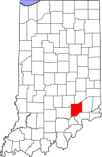
Jennings County, Indiana Basics:


Jennings County Indiana - Government Site

Population: 28,166
Area: 377 square miles
County seat: Vernon
Area code(s) in use: 812
Time zone: EST
High school graduate or higher: 85.2%
Bachelor's degree or higher: 8.9%
Median household income: $45,273
Persons in poverty: 13.5%
Home ownership rate: 75.7%
Mean travel time to work: 26.3 minutes


Adjacent counties:
Bartholomew  Decatur  Jackson  Jefferson  Ripley  Scott  

Find in Indiana

Map of the Jennings County area


Our detail map of Jennings County shows the Jennings County, Indiana boundary lines and other interesting items.

Places in Jennings County, Indiana

  Airports     show all on map

Aerobatic Practice Airport, Broomsage Ranch Airport, Brush Creek Airport, Miller and Sons Farm Supply Airport, North Vernon Airport

  Buildings     show all on map

Campbell Township Volunteer Fire Department, Jennings County Emergency Medical Services, Lovett Township Volunteer Fire Department, Montgomery Township Volunteer Fire Department, North Vernon Fire Department Station 1, North Vernon Fire Department Station 2, PHI Air Medical - North Vernon, Scipio - Geneva Township Fire Department, Spencer Township Volunteer Fire Department Station 1, Spencer Township Volunteer Fire Department Station 2, Vernon Volunteer Fire Department

  Canals     show all on map

Storm Creek Ditch

  Cemeteries     show all on map

Baldwin Cemetery, Barkman Cemetery, Bear Creek Cemetery, Bethel Cemetery, Butlerville Cemetery, Callicotte Cemetery, Cave Springs Cemetery, Cornell Cemetery, Coryell Cemetery, Day Cemetery, Ebenezer Cemetery, Fish Creek Cemetery, German Cemetery, Green Cemetery, Henry Cemetery, Hill Crest Cemetery, Hopewell Cemetery, Hopewell Cemetery, Hughes Cemetery, Hulse Cemetery, Hunt Cemetery, Keith Cemetery, Marsh Cemetery, Meek Cemetery, Myers Cemetery, Old Zenas Cemetery, Otter Creek Cemetery, Saint Bridget Cemetery, Saint Catherines Cemetery, Saint James Cemetery, Saint Marys Cemetery, Sixmile Cemetery, State School Cemetery, Stewart Cemetery, Sullivan Cemetery, Summerfield Cemetery, Vernon Cemetery, Weston Cemetery, Whitcomb Cemetery, Wohrer Cemetery, Zenas Cemetery

  Census     show all on map

Butlerville Census Designated Place, Country Squire Lakes Census Designated Place, Hayden Census Designated Place, Scipio Census Designated Place

  Churches     show all on map

Bear Creek Church, Browns Corner Church, Brush Creek Church, Cana Church, Centerville Community Church, Coffee Creek Church, Freedom Church, Graham Church, Graham Church, Ice Creek Church, Marion Church, Mount Zion Church, New Bethel Church, Oak Grove Church, Pleasant View Church, Rock Creek Church, Rush Branch Church, Saint Dennis Church, Saint Josephs Church, Tea Creek Church, Weston Church, Wilson Chapel, Zion Church

  Dams     show all on map

Broomsage Ranch Lake Dam, Country Squire Lake Dam, Crosley Lake Dam, Gaylord Stark Lake Dam, Hickory Lake Dam, Leatherwood Lake Dam, Van Voorhies Lake Dam, Whippoorwill Lake Dam

  Forests     show all on map

Selmier State Forest

  Hospitals     show all on map

Muscatatuck State Hospital and Training Center, Saint Vincent Jennings Hospital

  Locales     show all on map

Coffee Creek Conservation Club

  Mines     show all on map

Hayden Quarry, North Vernon Quarry, Putnamville Quarry

  Parks     show all on map

Brush Creek State Fish and Wildlife Area, Crosley State Fish and Wildlife Area, Muscatatuck County Park

  Populated Places     show all on map

Brewersville, Butlerville, Commiskey, Country Squire Lakes, Four Corners, Grayford, Hayden, Hilltown, Lovett, Nebraska, North Vernon, Oakdale, Paris, Paris Crossing, Queensville, San Jacinto, Scipio, Staples Ford, Tannersville, Vernon, Walnut Ridge, Zenas

  Post Offices     show all on map

Benville Post Office (historical), Cana Post Office (historical), Slate Post Office (historical)

  Reservoirs     show all on map

Broomsage Lake, Brush Creek Reservoir, Country Squire Lake, Crosley Lake, Gaylord Stark Lake, Hickory Lake, Kimberly Lake, Tanglewood Lake, Whippoorwill Lake

  Schools     show all on map

Hayden Elementary School, Muscatatuck State School, Paris School, Saint Anns School, Scipio Elementary School, Vernon Elementary School, Zenas Elementary School

  Streams     show all on map

Bear Creek, Bear Creek, Bear Creek, Bennetts Branch, Brushy Fork, Camp Creek, Coffee Creek, Crooked Creek, Crooked Creek, Davis Branch, Deer Creek, Duck Branch, Fish Creek, Fowler Branch, Goose Run, Grassy Creek, Gum Lick Creek, Huckleberry Branch, Ice Creek, Indian Creek, Little Bear Creek, Little Mutton Creek, Long Branch, Millstone Creek, Mutton Creek, Nettle Creek, Pleasant Run, Polly Branch, Poplar Root Creek, Powder Creek, Rattail Creek, Rock Creek, Rock Creek, Sixmile Creek, Slate Creek, Square Run, Storm Creek, Tea Creek, Turkey Run, Twomile Creek, Wolf Creek, Woods Branch, Wyaloosing Creek

  Towers     show all on map

WOCH-AM (North Vernon), WOCH-FM (North Vernon),

Jennings County, Indiana Population By Race (2012 estimate)

RacePopulation
WhiteJennings County White population 27,49027,490  
MixedJennings County Mixed population 310309
BlackJennings County Black population 253253
AsianJennings County Asian population 8484
American IndianJennings County American Indian population 2828
Hawaiian & Pacific IslanderJennings County Hawaiian & Pacific Islander population 00

Additional population tables :
State population table
Indiana population by county