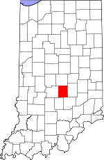
Johnson County, Indiana Basics:


Johnson County Indiana - Government Site

Population: 143,300
Area: 320 square miles
County seat: Franklin
Area code(s) in use: 317 812
Time zone: EST
High school graduate or higher: 90.9%
Bachelor's degree or higher: 25.9%
Median household income: $62,888
Persons in poverty: 9.3%
Home ownership rate: 74.2%
Mean travel time to work: 26.1 minutes


Adjacent counties:
Bartholomew  Brown  Marion  Morgan  Shelby  

Find in Indiana

Map of the Johnson County area


Our detail map of Johnson County shows the Johnson County, Indiana boundary lines and other interesting items.

Places in Johnson County, Indiana

  Airports     show all on map

Beck Airport, Berry Field Airport, Bronson Airport, Canary's Airport, Franklin Flying Field Airport, Greenwood Municipal Airport, Miles Field Airport, Plastics Park Airport, Robinson Field Airport, Thorn Field Airport, Woods Field Airport

  Buildings     show all on map

Amity Volunteer Fire Department, Bargersville Community Fire Department Station 1, Bargersville Community Fire Department Station 2, Bargersville Community Fire Station 1, Bargersville Community Fire Station 2, Barnes Science Hall, Cline Hall, Dietz Center, Edinburgh Fire and Rescue Station 1, Edinburgh Fire and Rescue Station 2, Elsey Hall, Franklin Fire Department Station 1, Franklin Fire Department Station 2, Franklin Fire Department Station 21, Franklin Fire Department Station 22, Greenwood City Building, Greenwood Community Center, Greenwood Fire Department Station 91, Greenwood Fire Department Station 91 Headquarters, Greenwood Fire Department Station 92, Greenwood Fire Department Station 93, Greenwood Fire Department Station 94, Greenwood Nursing Home, Greewood Public Library, Hamilton Library, Hoover Hall, Johnson Center for The Arts, Johnson County Courthouse, Johnson County Public Library, Johnson-Dietz Hall, Masonic Home, Napolitan Alumni House, Napolitan Student Center, Needham Community Volunteer Fire Department, Needham Community Volunteer Fire Department Station 82, Needham Volunteer Fire Department, New Whiteland City Hall, New Whiteland Volunteer Fire Department, Nineveh Township Volunteer Fire Department, Old Main, Shirk Hall, Spurlock Center, Trafalgar Volunteer Fire Department, Von Boll Welcome Center, White River Township Fire Department Station 51, White River Township Fire Department Station 52, White River Township Fire Department Station 53, Whiteland Volunteer Fire Department

  Canals     show all on map

Alexander Ditch, Amity Ditch, Brewer Ditch, Campbell Ditch, Canary Ditch, Cutsinger Ditch, Graham Ditch, Grubbs Ditch, Hazelett Ditch, Powell Ditch, Ransdell Ditch, Roberts Ditch, Scott Ditch, Shipp Ditch, Tracy Ditch, Vandivier Ditch

  Cemeteries     show all on map

Bargersville Cemetery, Boles Cemetery, Carmen Cemetery, Deer Cemetery, Dollings Cemetery, First Mount Pleasant Cemetery, Forest Lawn Cemetery, Freeman Cemetery, Gilmore Cemetery, Glade Cemetery, Greenlawn Cemetery, Greenwood Cemetery, Hamner Cemetery, Harris Cemetery, Henderson Cemetery, Hopewell Cemetery, Hurricane Cemetery, Lowe Cemetery, Mallow Cemetery, McColgin Cemetery, McGill Cemetery, Messersmith Cemetery, Miller Cemetery, Mount Auburn Cemetery, Mount Pleasant Cemetery, Mulligans Cemetery, Needham Cemetery, Nolan Cemetery, Pleasant Grove Cemetery, Prisoner of War Camp, Rest Haven Cemetery, Salem Cemetery, Shiloh Cemetery, Simpson Cemetery, Smiley Cemetery, Tucker Cemetery, Utterback Cemetery, Watts Cemetery, Wiles Cemetery, Williams Cemetery, Youngs Creek Cemetery

  Churches     show all on map

Amity Baptist Church, Bargersville Christian Church, Beech Grove Church, Bethel African Methodist Episcopal Church, Bethel Church, Bethlehem Church, Bluff Creek Christian Church, Christian Chapel, Church of God, Concordia Church, Fair Haven Church, First Baptist Church, First Baptist Church of Greenwood, First Presbyterian Church, First Separate Baptist Church, Franklin Assembly Church, Franklin Church of the Nazarene, Franklin Community Church, Franklin Memorial Christian Church, Friendship Church, Grace United Methodist Church, Greenwood Church of Christ, Greenwood Presbyterian Church, Honey Creek Church, Hopewell Presbyterian Church, Jollity Church, Journey Church of Franklin, Lick Spring Church, Mount Auburn United Methodist Church, Mount Carmel Church, Mount Olive Church, Mount Pleasant Christian Church, Mount Pleasant Church, Needham Church, New Whiteland Baptist Church, New Whiteland Christian Church, Northern Park Baptist Church, Our Lady of the Greenwood Church, Outreach Community Church of God, Pleasant Valley Church, Saint Andrew's Anglican Catholic Church, Saint Joseph Catholic Church, Saint Rose Church, Saint Thomas Episcopal Church, Salem Church, Second Baptist Church, Shiloh Community Church, Smith Valley Baptist Church, Solid Rock Church, Tabernacle Christian Church, Temple Baptist Church, Triumph Church, Union Christian Church, Victory Baptist Church, Vineyard Community Church, Walters Chapel, Whiteland United Methodist Church

  Crossings     show all on map

Interchange 80, Interchange 90, Interchange 95, Interchange 99

  Dams     show all on map

Atterbury Dam East, Bell Lake Dam, Doty Run Lake Dam, Earlham Lake Dam, Earth Dam West, Elmer C Summit Lake Dam, FFA Youth Center Dam Number 1, Hood Lake Dam, Lamb Lake Dam, Lamb Lake Estates Dam, Murray Lake Dam, Pease Lake Dam, Peoga Lake Dam, Princes Hants Lake Dam, Princes White Lake Dam, Ray Willoughby Dam Number 1, Ray Willoughby Dam Number 2 North, Roger Young Lake Dam, Saunders Lake Dam, Teeters Lake Dam

  Hospitals     show all on map

Johnson Memorial Hospital, Kindred Hospital Indianapolis South Campus, Masonic Hospital, Valle Vista Hospital

  Lakes     show all on map

Bell Lake, Dailey Lake, Donald Lake, H Lake, I Lake, Mullendore Pond

  Locales     show all on map

Canary Creek Outdoor Cinema, Copeland Hog Farm, Greenwood Mall, Hickory Stick Golf Club, Hillview Country Club, Johnson County Courthouse Square, Margate Plaza, Market Plaza Shopping Center, Meridian Meadows Shopping Center, Meridian Place Shopping Center, Mission Hills Office Center, Otte Golf Center, Park 800 Industrial Park, Precedent South Business Center, Red Roof Square Shopping Center, Royal Oak Country Club, Sierra Business Center, South Park Business Park, Stewart "Red" Faught Stadium, The Centre At Smith Valley Shopping Center, Valle Vista Golf Course, Walnut Ridge Golf Course, Wilgro Shopping Center

  Parks     show all on map

Allendale Camp, Atterbury State Fish and Wildlife Area, Childrens Garden Park, Craig Park, Dame Mall, East Park, Irwin Park, Old City Park, Pool Park, Province Park, Runkle Tennis Courts, Tot Park, West Park, Westside Park

  Populated Places     show all on map

Al-Mar, Amity, Anita, Auburn Trace, Bargersville, Bluff Acres, Bluff Creek, Brentridge, Brentwood, Brockton Manor, Bud, Cedar Hills, Clearview, Critchfield, Deerwood, Eagle Trace, Edinburgh, El Dorado, Foxberry Trace, Frances, Franklin, Golden Grove, Green Valley, Greenwood, Hendricks, Hopewell, Horizon Estates, Hunters Pointe, Imperial Hills, Kinder, McCarty, Mount Pleasant, Needham, New Whiteland, Nineveh, Old Bargersville, Pebble Hills, Pebble Run, Pennington Estates, Peoga, Princes Lakes, Providence, Reds Corner, Rocklane, Samaria, Smith Valley, Southwood Trailer Court, Spring Hill, Stones Crossing, Trafalgar, Tremont, Urmeyville, Waterloo, Waters Edge, West Whiteland, Whiteland, Willow Lakes, Woodland Stream

  Post Offices     show all on map

Whiteland Post Office

  Reservoirs     show all on map

Bell Lake, Brown Lake, Carolyn Lake, Dearmin Lake, Earlham Lake, FFA Youth Lake, Hants Lake, Hood Lake, Lamb Lake, Murray Lake, Peoga Lake, Pisgah Lake, Princes East Lake, Princes North Lake, Princes Northeast Lake, Princes White Lake, Ray Willoughby Lake, Riley Lake, Roger Young Lake, Saunders Lake, Stone Arch Lake, Teeters Lake, Woodridge Lake

  Ridges     show all on map

Pea Ridge

  Schools     show all on map

Break-O-Day Elementary School, Center Grove High School, Central Technical School, Clark Pleasant Junior High School, Franklin College of Indiana, Greenwood Middle School, Greenwood Northeast Elementary School, Greenwood Senior High School, Greenwood Southwest Elementary School, Ninevah Elementary School, Northwood Elementary School, Our Lady of the Greenwood School, Paynes School, Southside School, Union Elementary School, Whiteland Community High School

  Streams     show all on map

Auburn Branch, Barnes Creek, Big Blue River, Buckhart Creek, Center Creek, Crook Branch, Doty Run, Driftwood River, East Grassy Creek, Fair Brook, Fairview Creek, Frances Creek, Gilmore Creek, Goose Creek, Grassy Creek, Honey Creek, Hurricane Creek, Jolly Brook, Kinder Run, Lake Run, Lick Creek, Little Sugar Creek, Lowe Creek, Mallow Run, McColgin Creek, Messersmith Creek, Moores Creek, Nineveh Creek, Pleasant Creek, Ransdell Run, Ray Creek, Rocklane Creek, Salem Brook, Short Run, Smith Run, Travis Creek, Tucker Creek, Turkey Pen Creek, Utterback Branch, Waterloo Run, Youngs Creek

  Summits     show all on map

Donalds Knoll, Kelly Hill, Moore Hill, Polk Hill, Sally Doty Hill, Travis Hill, Turkey Hill

  Towers     show all on map

WGTC-FM (Bloomington), WTTV-TV (Bloomington)

  Valleys     show all on map

Blossom Hollow, Callon Hollow, Pitcher Hollow,

Johnson County, Indiana Population By Race (2012 estimate)

RacePopulation
WhiteJohnson County White population 135,562135,561  
AsianJohnson County Asian population 3,1533,152
BlackJohnson County Black population 2,1502,149
MixedJohnson County Mixed population 2,0062,006
American IndianJohnson County American Indian population 430429
Hawaiian & Pacific IslanderJohnson County Hawaiian & Pacific Islander population 00

Additional population tables :
State population table
Indiana population by county