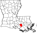
Assumption Parish, Louisiana Basics:


Assumption Parish Louisiana - Government Site

Population: 23,099
Area: 339 square miles
Parish seat: Napoleonville
Area code(s) in use: 225 985
Time zone: CST
High school graduate or higher: 69.9%
Bachelor's degree or higher: 9.0%
Median household income: $46,410
Persons in poverty: 18.8%
Home ownership rate: 82.6%
Mean travel time to work: 29.6 minutes


Adjacent counties:
Ascension  Iberia  Iberville  Lafourche  St. James  St. Martin  St. Mary  Terrebonne  

Find in Louisiana

Map of the Assumption Parish area


Our detail map of Assumption Parish shows the Assumption Parish, Louisiana boundary lines and other interesting items.

Places in Assumption Parish, Louisiana

  Airports     show all on map

Amelia Airport, Amelia Base Heliport, Assumption General Heliport, Belle Alliance Landing Strip, Cane-Air Airport, Dons Flying Service Airport

  Areas     show all on map

Coteau Frene

  Bays     show all on map

Bay Heron, Bay Marcalite, Bay Sherman, Bay Sylvester, Pierre Bay, Second Bay

  Bends     show all on map

Population Bend

  Buildings     show all on map

Assumption Area Chamber of Commerce, Assumption Parish Agricultural Building, Assumption Parish Courthouse, Assumption Parish Library, Assumption Parish Library Bayou L'Ourse Branch, Assumption Parish Library Labadieville Branch, Assumption Parish Library Pierre Part Branch, Assumption Parish Police Jury, Assumption Parish Sheriff's Office, Bayou L'Ourse Volunteer Fire Department, Heritage Manor of Napoleonville, Labadieville Volunteer Fire Department, Napoleonville Volunteer Fire Department, Napoleonville Volunteer Fire Department Station 1, Napoleonville Volunteer Fire Department Station 3, Paincourtville Volunteer Fire Department Main Station, Paincourtville Volunteer Fire Department Station 2, Paincourtville Volunteer Fire Department Station 3, Pierre Part Volunteer Fire and Rescue Station 1, Pierre Part Volunteer Fire Department

  Canals     show all on map

Armelise Canal, Baker Canal East, Baker Canal North, Baker Canal South, Cancienne Canal, Glenwood Canal, Godchaux Canal, Himalaya Canal, Ike Canal, Magnolia Canal, Norman Canal, SaintLouis Canal, Seatra Canal, Talbot Canal, Westfield Canal, Whitmel Canal, William Canal, William Canal

  Cemeteries     show all on map

Christ Cemetery, Christ Episcopal Cemetery, Evening Star Cemetery, Saint Augustine Cemetery, Saint Jules Cemetery, Saint Martins Cemetery, Saint Philomena Cemetery, Virginia Cemetery

  Census     show all on map

Bayou L'Ourse Census Designated Place, Belle Rose Census Designated Place, Labadieville Census Designated Place, Paincourtville Census Designated Place, Pierre Part Census Designated Place, Supreme Census Designated Place

  Channels     show all on map

Pierre Pass

  Churches     show all on map

Bayou L'Ourse Baptist Church, Beautiful Zion Baptist Church, Belle River Church, Bright Morning Star Baptist Church, Canne Church, Christ Baptist Church, Christ Episcopal Church, Church of the Assumption of the Blessed Virgin, Community Worship Center, First Baptist Church, First Pentecostal Church, Greater Israel Baptist Church, Kingdom Hall of Jehovahs Witnesses, Mount Carmel Church, Mount Pilgrim Church, Nelson Chapel African Methodist Episcopal Church, New Belmont Baptist Church, New Morning Star Baptist Church, New Mount Carmel Baptist Church, Pierre Part Christian Center, Precious Cornerstone Apostolic Church, Rose Hill Baptist Church, Sacred Heart Church, Saint Anns Catholic Church, Saint Augustine Church, Saint Benedict the Moor Catholic Church, Saint Elizabeth Catholic Church, Saint James United Methodist Church, Saint Joseph the Worker Church, Saint Jules Church, Saint Mark Baptist Church, Saint Martins Church, Saint Paul Baptist Church, Saint Phillip Baptist Church, Saint Philomena Catholic Church, Victory Baptist Church, Virginia Baptist Church, Wesley United Methodist Church, Woodlawn Church

  Dams     show all on map

Cedar Grove Plantation Pond Dam, Supreme Sugar Pond Dam

  Guts     show all on map

Bayou Choupique, Bayou Crouix

  Hospitals     show all on map

Assumption Community Hospital

  Lakes     show all on map

First Bay, Lake Verret, Willow Lake

  Locales     show all on map

Assumption Parish Waterworks, Bayou Side Golf Course, Belle Rose Plantation (historical), Belle Wood Plantation (historical), Delia Plantation, Hard Times Plantation, Locust Grove Plantation (historical), Louisiana State University Agricultural Complex, Napoleonville Wastewater Treatment Plant, No Problem Raceway Park

  Oilfields     show all on map

Amelia Gas Field, Bayou Saint Vincent Gas Field, Coteau Frene Oil and Gas Field, East Lake Palourde Oil and Gas Field, East Lake Verret Gas and Oil Field, Grand Bayou Oil and Gas Field, Graveyard Island Oil Field, Grosbec Bayou Gas Field, Napoleonville Oil and Gas Field, Natchez Bay Gas Field, Northwest Oakley Gas Field, Oakley Gas Field, Pierre Pass Gas Field, Ratcliff Oil and Gas Field, Sherman Bayou Gas Field

  Populated Places     show all on map

Albemarle, Amehe (historical), Attakapas Canal, Attakapas Landing, Bayou Corne, Bayou Crab, Belle Alliance, Belle River, Belle Rose, Belle Terre, Bellewood, Bertie, Boeuf, Brule, Brulie Maurin, Bruly Saint Martin, Brusle Saint Vincent, Burbank (historical), Cancienne, Cedar Grove Plantation, Chula, Church Spur, Dwight Fields, Elm Hall, Elm Hall Junction, Elmfield, Enola, Foley, Freetown, Freetown, Georgia, Glenwood, Grand Bayou, Himalaya, Ingleside, Kessler, Klotzville, Labadieville, Leche, Little Texas, Lower Texas, Lula, Madewood, Magnolia, Monty, Munsons, Napoleonville, Oakley, Paincourtville, Percle, Pierre Part, Plaincourtville, Plattenville, Ratliff, Rosedale, Saint Thomas, Star, Supreme, Sweet Home, Upper Texas, Ursa, Westfield, Wildwood, Woodlawn

  Post Offices     show all on map

Albemarle Post Office (historical), Avoca Post Office (historical), Belle Alliance Post Office (historical), Belle River Post Office (historical), Belle Rose Post Office, Bertie Post Office (historical), Honore Post Office (historical), Klotzville Post Office (historical), Labadieville Post Office, Laura Post Office (historical), Napoleonville Post Office, Paincourtville Post Office, Pierre Part Post Office, Plattenville Post Office, Riviere Post Office (historical), Supreme Post Office, Winklertown Post Office (historical)

  Reservoirs     show all on map

Cedar Grove Plantation Pond, Supreme Sugar Pond

  Schools     show all on map

Assumption High School, Assumption Middle Magnet School, Bayou L'Ourse Head Start School, Bayou L'Ourse Primary School, Belle Rose Head Start School, Belle Rose Middle School, Belle Rose Primary School, Community Worhsip Center School, Labadieville Head Start School, Labadieville Middle School, Labadieville Primary School, Les Petits Amis Childcare and Early Learning Center, Napoleonville Head Start School, Napoleonville Middle School, Napoleonville Primary School, New Belmont School, Pierre Part Elementary School, Pierre Part Head Start School, Pierre Part Middle School (historical), Saint Augustine School (historical), Saint Benedict School, Saint Elizabeth School, Saint Philomena Elementary School (historical)

  Streams     show all on map

Alligator Bayou, Bayou Alcide, Bayou Caroline, Bayou Corne, Bayou Crouix, Bayou Etienne, Bayou Felix, Bayou Gannevait, Bayou Grosbec, Bayou L'Ourse, Bayou Louis, Bayou Magazille, Bayou Morgan City, Bayou Natchez, Bayou Pierre Part, Bayou Saint Vincent, Bayou Sherman, Fourmile Bayou, Grand Bayou, Hothman Bayou, Little Bay, Little Bayou Long, Little Grand Bayou, Little Texas Bayou, Nerville Bayou, Ploton Bayou

  Valleys     show all on map

Bayou Sec,

Assumption Parish, Louisiana Population By Race (2012 estimate)

RacePopulation
WhiteAssumption Parish White population 15,73015,730  
BlackAssumption Parish Black population 6,9306,929
MixedAssumption Parish Mixed population 208207
American IndianAssumption Parish American Indian population 139138
AsianAssumption Parish Asian population 6969
Hawaiian & Pacific IslanderAssumption Parish Hawaiian & Pacific Islander population 2323

Additional population tables :
State population table
Louisiana population by county