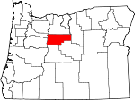
Jefferson County, Oregon Basics:


Jefferson County Oregon - Government Site

Population: 21,033
Area: 1781 square miles
County seat: Madras
Area code(s) in use: 541
Time zone: PST
High school graduate or higher: 83.7%
Bachelor's degree or higher: 15.5%
Median household income: $43,330
Persons in poverty: 19.2%
Home ownership rate: 64.5%
Mean travel time to work: 21.3 minutes


Adjacent counties:
Crook  Deschutes  Linn  Marion  Wasco  Wheeler  

Find in Oregon

Map of the Jefferson County area


Our detail map of Jefferson County shows the Jefferson County, Oregon boundary lines and other interesting items.

Places in Jefferson County, Oregon

  Airports     show all on map

3 Rivers Recreation Area Airport, Bombay Farms Airport, Brewer Airstrip, Compressor Station Number 11 Airstrip, Lake Billy Chinook State Airport, Madras Municipal Airport, Meuret Airstrip, Mountain View Hospital Heliport, Ochs Private Airport, Round Butte Heliport, Six Springs Ranch Airport

  Areas     show all on map

Hells Half Acre, Metolius Research Natural Area

  Basins     show all on map

Clarke Orchard, First Pines Hollow, Indian Arrows, Jory Basin, Paulina Basin

  Benches     show all on map

Canadian Bench, Metolius Bench, Tenino Bench

  Bridges     show all on map

Bridge 99

  Buildings     show all on map

Camp Creek Ranger Station (historical), Camp Sherman Fire Department, Crooked River National Grasslands Headquarters, Crooked River Ranch Fire District, Culver City Hall, Culver City Public Works, Culver Police Department, Deer Ridge Correctional Institution, Department of Motor Vehicles Madras, Haystack Grange, Jefferson County Circuit Court, Jefferson County Fire District 2, Jefferson County Library, Jefferson County Museum, Jefferson County Public Health Department Office, Jefferson County Public Works, Jefferson County Rural Fire Protection District 1, Jefferson County Sheriff's Office, Madras City Hall, Madras Municipal Court, Madras Police Department, Madras Public Works, Metolius City Hall, Metolius Municipal Court, Metolius Police Department, Oregon State Police Department Madras, The Museum at Warm Springs, Three Rivers Volunteer Fire Department, Warm Springs Fire and Safety, Warm Springs Library, Warm Springs Tribal Police Department

  Canals     show all on map

Cram Ditch

  Cemeteries     show all on map

Bruno Cemetery, Culver IOOF Cemetery, Dry Creek Cemetery, Geneva Cemetery, German Cemetery, Gray Butte Cemetery, Grizzly Cemetery, Hay Creek Cemetery, Maupin Cemetery, Milo Gard Cemetery, Mount Jefferson IOOF Cemetery, Round Butte Cemetery, Seekseequa Cemetery, Seekseequa Cemetery, Tenino Cemetery, Woods Cemetery

  Census     show all on map

Camp Sherman Census Designated Place, Warm Springs Census Designated Place

  Cliffs     show all on map

Big Canyon Rim, Coleman Point

  Dams     show all on map

Box Canyon Dam, Brewer Dam, Cherry Creek Dam, Haystack Dam, Jefferson Plywood Company Dam, Little Willow Creek Dam, Lyle Dam, Morrow Brothers Dam, Pelton Dam, Pelton Regulating Dam, Round Butte Dam

  Falls     show all on map

Steelhead Falls, Wizard Falls

  Flats     show all on map

Agency Plains, Bear Valley Lake, Boxcar Flats, Canyon Creek Meadows, Hole-in-the-Wall Park, Kuckup Park, Little Agency Plains, Peters Pasture, Reilly Flat, Seattle Flat, Tai Flat, Teller Flat

  Forests     show all on map

Crooked River National Grassland

  Gaps     show all on map

Biddle Pass, Lyle Gap, Red Gap, Red Rock Pass, The Gap, Tompkins Pass, Windy Gap

  Glaciers     show all on map

Waldo Glacier, Whitewater Glacier

  Harbors     show all on map

Cove Palisades Marina, Pelton Park Marina, Three Rivers Marina

  Hospitals     show all on map

Mountain View Hospital

  Lakes     show all on map

Blue Lake, Booth Lake, Boulder Lake, Cabot Lake, Cache Lake, Carl Lake, Catlin Lake, Cigar Lake, Circle Lake, Cyrus Hill Pond, Dark Lake, Dark Lake, Dollar Nine Lake, Dry Lake, Eloise Lake, Fly Lake, Francis Lake, Hand Lake, Harvey Lake, Head Lake, Horseshoe Lake, Island Lake, Island Lake, Jack Lake, Jefferson Lake, Junction Lake, Koko Lake, Lake Alice, Lake Hazel, Lake Hilda, Lake Marie, Lake Mary, Lake Sarah, Link Lake, Little Lake, Long Lake, Long Lake, Lost Lake, Mangriff Lake, Martin Lake, Minto Lake, Monon Lake, Nep-Te-Pa Lake, Olallie Lake, Patsy Lake, Rockpile Lake, Round Lake, Sand Camp Lake, Scout Lake, Shirley Lake, Spoon Lake, Square Lake, Summit Lake, Suttle Lake, Table Lake, Timber Lake, Top Lake, Trout Lake, Upper Lake, View Lake, Wasco Lake

  Locales     show all on map

Abbot Creek Recreation Site, Agency, Alder Spring Lookout, Allen Springs Recreation Site, Allingham Guard Station, Allingham Recreation Site, Black Butte Lookout Station, Black Place, Blue Bay Campground Boat Ramp, Blue Bay Recreation Site, Blue Lake Resort, Boyce Corral, Camp Sherman Recreation Site, Camp Tamarack, Camp Ten Recreation Site, Candle Creek Recreation Site, Canyon Creek Recreation Site, Cascades East Transit Madras Worksource Park and Ride, Cherry Creek Ranch, Cinder Beach Recreation Site, Circle M Ranch, Coleman (historical), Confederated Tribes of Warm Springs Wastewater Treatment Plant, Corbett Park, Corbett Sno-Park, Cove Palisades - Lower Deschutes Boat Ramp, Cove Palisades - Upper Deschutes Boat Ramp, Crooked River Campground Boat Ramp, Cross Keys (historical), Culver Sewage Treatment Facility, Cyrus Horse Camp, Dam Observatory, Drift Campground, Dry Creek Horse Camp, First Creek Camp, Fly Creek Ranch, Fly Lake Lookout, Fox Corral, Gates Ranch, Geneva Overlook, Gorge Recreation Site, Hay Creek Ranch, Haystack Campground Boat Ramp, Haystack Reservoir Recreation Site, Haystack West Boat Ramp, Haystack West Shore Recreation Site, Head of Jack Creek, Head of Metolius Recreation Site, Heisler Station, Horseshoe Lake Recreation Site, House on the Metolius Resort, Indian Park Boat Launch, Jack Creek Recreation Site, Jack Lake Recreation Site, Jefferson County Fairgrounds, Jumpoff Joe, Kaser Ranch, Lake Creek Lodge, Lake Simtustus Resort Boat Launch, Link Creek Campground Boat Ramp, Link Creek Recreation Site, Lower Bridge Recreation Site, Ludwick Cabin, Madras Southwest Base, Madras Speedway Dragstrip and Albany Sand Drags, Madras Station, McCoin Orchard, McCoin Orchard, Mecca, Mecca Flat Boat Ramp, Methodist Youth Camp, Metolius Sewage Treatment Plant, Monon Lake Recreation Site, Monty Recreation Site, Morrow Ranch, Norton Ranch, Olallie Butte Guard Station, Olallie Lake Campground Boat Ramp, Olallie Lake Recreation Site, Paul Dennis Recreation Site, Paxton, Pelton (historical), Pelton Park Boat Ramp, Peninsula Campground Boat Ramp, Peninsula Recreation Site, Perry South Campground, Perry South Campground Boat Ramp, Pine Rest Recreation Site, Pine Ridge Corral, Pioneer Ford Recreation Site, Prairie Farm Guard Station (historical), River Island Forest Camp (historical), Riverside Recreation Site, Rock Fort, Round Lake Christian Camp, Round Lake Recreation Site, Roundup Grounds, Scales Corral (historical), Scout Lake Group Camp, Seekseequa Junction, Sheep Spring Horse Camp, Shitike Butte Lookout Station, Singing Horse Ranch, Smiling River Recreation Site, South Shore Campground Boat Ramp, South Shore Recreation Site, South Waste Water Treatment Facility, Street Creek Boating Site and Campground, Sugar Pine Camp, Suttle Lake Forest Service Station, Suttle Lake Resort, Suttle Lake Resort Dock, Suttle Lake Water Ski, Suttle Lake Waterski Area Boat Ramp, The Cove Palisades Boat Ramp, Three Rivers Marina Boat Ramp, Trout Creek Campground Boat Ramp, Trout Creek Cow Camp, Trout Lake Campground, Truman (historical), Upper Cherry Creek Ranch, Vanora (historical), Warm Springs Agency Office, Warm Springs Boat Ramp, Warm Springs Forest Products 1 - 3 Biomass Facility, Willow Creek Corral, Wizard Falls Campground (historical), Wizard Falls State Fish Hatchery

  Military     show all on map

Madras Army Air Field (historical)

  Mines     show all on map

Axehandle Mine, Horse Heaven Mine, Oregon King Mine, Priday Agate Beds, Queen Oregon Mines, Ruby Mine

  Parks     show all on map

7th Street Park, Bean Park, Community Park, Cowden Park, Culver City Park, Elliot R Corbett II Memorial State Park, Friendship Park, Juniper Hill Park, Oak Street Park, Pelton Park, Rimrock Springs Wildlife Management Area, South Park, The Cove Palisades State Park, Totem Park, Warm Springs State Recreation Site (historical)

  Pillars     show all on map

Balanced Rocks, Balanced Rocks, Hat Rock, Hole in Wall Rock, Mays Rock, Sheep Rock

  Plains     show all on map

Lower Desert

  Populated Places     show all on map

Ashwood, Axehandle (historical), Camp Sherman, Crooked River Ranch, Culver, Donnybrook (historical), Gateway, Geneva, Grandview, Grizzly, Horseheaven, Kilts, Lamonta (historical), Madras, Metolius, Opal City, Warm Springs, Willowdale

  Post Offices     show all on map

Air Base Post Office (historical), Ashwood Post Office, Camp Sherman Post Office, Cherry Creek Post Office (historical), Cleek Post Office (historical), Crooked River Ranch Post Office, Cross Keys Post Office (historical), Culver Post Office, Desert Post Office (historical), Emery Post Office (historical), Gateway Post Office (historical), Geneva Post Office (historical), Grandview Post Office (historical), Grizzly Post Office (historical), Hay Creek Post Office (historical), Haystack Post Office (historical), Heisler Post Office (historical), Horse Heaven Post Office (historical), Kilts Post Office (historical), Lamonta Post Office (historical), Madras Post Office, Matoles Post Office (historical), Maud Post Office (historical), Mecca Post Office (historical), Metolius Post Office (historical), Opal City Post Office (historical), Trout Creek Post Office (historical), Vanora Post Office (historical), Warm Springs Post Office, Willoughby Post Office (historical), Willowdale Post Office (historical), Youngs Post Office (historical)

  Reservoirs     show all on map

Box Canyon Reservoir, Brewer Reservoir, Camp Creek Reservoir, Cotter Pond, Haystack Reservoir, Jefferson Plywood Company Mill Pond, Juniper Reservoir, Lake Billy Chinook, Lake Simtustus, Little Willow Creek Reservoir, Lyle Reservoir, Madras Water Tank, Mays Reservoir, Metolius Water Tank, Pelton Regulating Reservoir, Stephenson Lake, U P Water Tank (historical), Willow Creek Reservoir

  Ridges     show all on map

Akawa Butte, Axehandle Ridge, Blizzard Ridge, Domogalla Ridge, Green Ridge, Hensley Butte, Little Akawa Butte, Lyons Ridge, Maiers Butte, Pine Ridge, Pony Butte, Robinson Ridge, Sampson Mountain, Sugar Pine Ridge

  Schools     show all on map

Ashwood Elementary School, Black Butte Elementary School, Buff Elementary School, Culver Elementary School, Culver High School, Culver Middle School, Gibson Seventh Day Adventist Elementary School, Jefferson County Middle School, Madras Elementary School, Madras High School, Metolius Elementary School, Opal City School (historical), Warm Springs Elementary School, Westside Elementary School (historical)

  Slopes     show all on map

Hunter Grade, Mecca Grade

  Springs     show all on map

Abbot Butte Spring, Adams Spring, Alder Spring, Anderson Spring, Anderson Springs, Axehandle Spring, Beachkomb Spring, Bear Spring, Bills Spring, Bishop Spring, Bostick Spring, Box Springs, Broken Shovel Spring, Buttercup Spring, Canyon Spring, Carter Spring, Cherry Spring, Clarke Springs, Cold Spring, Cold Springs, Cottonwood Spring, Cottonwood Spring, Cottonwood Springs, Cougar Spring, County Trough Spring, Daisy Spring, Dave Ike Spring, Degner Spring, Douthit Spring, East Springer Spring, Eleven Spring, Hatfield Spring, Head of the Metolius, Hunter Spring, Juniper Spring, Keller Cabin Spring, Kings Gap Spring, Lake Camp Springs, Larson Spring, Lava Spring, Lee Woods Spring, Lithgow Spring, Log House Spring, Lower Bennett Spring, Lower Cyrus Spring, Lower Pine Ridge Spring, Lower Skull Hollow Spring, Lower Spring, Mackatie Spring, McCorkle Spring, McMeen Spring, Meralle Spring, Metolius Spring, Monner Spring, Newell Spring, Nichols Spring, North Combs Spring, Offatt Spring, Oler Spring, Opal Springs, Osborne Spring, Owl Spring, Parkey Springs, Peters Spring, Pine Spring, Pipp Spring, Prairie Farm Spring, Pump Spring, Rail Spring, Rainbow Trough Spring, Red Top Spring, Roaring Spring, Rodman Spring, Ryegrass Spring, Sampson Spring, Sand Spring, Sandrock Springs, Schmoker Spring, Seekseequa Spring, Seymore Springs, Six Creek Spring, Squeeksville Spring, Sugarpine Spring, Summit Spring, Sumner Spring, Symentire Spring, Thorn Spring, Tohet Spring, Tub Springs, Two Springs, Upper Bennett Spring, Upper Cyrus Spring, Upper Pine Ridge Spring, Whiskey Spring, Whisky Spring, White Rock Spring, Windy Brown Spring, Wizzard Falls Spring, Wright Spring

  Streams     show all on map

Abbot Creek, Alder Spring Creek, Amity Creek, Antelope Creek, Auger Creek, Awbrey Creek, Barber Creek, Bean Creek, Bear Valley Creek, Beaver Creek, Big Log Creek, Big Whetstone Creek, Brush Creek, Cabot Creek, Cache Creek, Camp Creek, Campbell Creek, Candle Creek, Canyon Creek, Cartwright Creek, Cherry Creek, Clover Creek, Code Creek, Coon Creek, Crooked River, Cultus Creek, Davis Creek, Dodds Creek, Drift Creek, Dry Creek, Dry Creek, Dry Creek, Dry Creek, First Creek, Fly Creek, Foley Creek, Gooseberry Creek, Gray Butte Creek, Hawley Creek, Hay Creek, Higgins Creek, Horse Creek, Horse Heaven Creek, Indian Creek, Jack Creek, Jefferson Creek, Jim Creek, Juniper Creek, Juniper Creek, Lake Creek, Link Creek, Lionshead Creek, Little Muddy Creek, Little Trout Creek, Little Whetstone Creek, Little Willow Creek, Mariel Creek, Martin Creek, McMeen Creek, Meadow Creek, Metolius River, Middle Fork Lake Creek, Middle Fork Street Creek, Milk Creek, Mud Springs Creek, Newbill Creek, North Fork Bean Creek, North Fork Boulder Creek, North Fork Lake Creek, North Fork Spring Creek, North Fork Street Creek, Opal Creek, Parker Creek, Pine Creek, Pine Creek, Pony Creek, Potlid Creek, Prairie Farm Creek, Racing Creek, Rainy Creek, Roaring Creek, Ross Creek, Sagebrush Creek, Seekseequa Creek, Sheep Creek, Shitike Creek, Six Creek, South Amity Creek, South Fork Bean Creek, South Fork Boulder Creek, South Fork Lake Creek, South Fork Seekseequa Creek, South Fork Spring Creek, South Fork Street Creek, Spring Creek, Spring Creek, Street Creek, Studhorse Creek, Teller Creek, Tenino Creek, Thompson Creek, Trout Creek, Turner Creek, Walker Creek, Whitewater River, Whychus Creek, Willow Creek, Wilson Creek, Wyman Creek

  Summits     show all on map

Abbot Butte, Arrastra Butte, Ash Butte, Awbrey Mountain, Axehandle Butte, Bald Peter, Baldwin Hills, Bear Butte, Black Butte, Black Rock, Black Rock, Box Springs Butte, Buck Butte, Camp Creek Butte, Castle Rocks, Cat Mountain, Coyote Butte, Coyote Mountain, Currant Peak, Cyrus Hill, Eagle Point, Elliot Heights, Forked Butte, Friends Peak, Gooseberry Mountain, Grater Butte, Gray Butte, Haystack Butte, Hinkle Butte, Horse Heaven Mountain, Hunt Butte, Indian Head Rock, Indian Rocks, Iron Mountain, Iron Mountain, Ironside Butte, Jackson Buttes, Juniper Butte, Kaser Butte, Lionshead, Lookout Butte, Middle Butte, Miller Heights, North Butte, Opal Mountain, Paulina Butte, Randle Butte, Red Rock, Roberts Butte, Rock Cone, Ross Butte, Round Butte, Sand Mountain, Sandrock Mountain, Sheep Rock, Sheep Rock, Shitike Butte, Stephenson Mountain, Sugarloaf Butte, Tee Wees Butte, Telfer Butte, Teller Butte, The Flatirons, The Island, The Peninsula, The Table, Thompson Peak, Three Fingered Jack, Tompkins Butte, Tracy Mountain, Twin Buttes, Wagner Mountain, West Hills

  Swamps     show all on map

Boulder Creek Meadows

  Towers     show all on map

Green Ridge Lookout Tower, Madras Control Tower

  Trails     show all on map

Brush Creek Trail, Cabot Lake Trail, Cache Lake Trail, Jefferson Creek Trail, Jefferson Lake Trail, Little Lake Trail, Reservation Trail, Round Lake Trail, Sugar Pine Ridge Trail, Summit Trail

  Valleys     show all on map

Akawa Gulch, Allen Canyon, Baker Canyon, Bear Valley, Big Canyon, Blind Canyon, Blind Gulch, Board Hollow, Boiler Draw, Box Canyon, Box Canyon, Buck Gulch, Calf Gulch, Carcass Canyon, Coleman Canyon, Crooked River Gorge, Degner Canyon, Deschutes Canyon, Devils Canyon, Dewies Canyon, Domogalla Canyon, Dry Canyon, Dry Hollow, Fir Tree Canyon, Flannery Gulch, Fly Creek Canyon, Fools Hollow, Forman Canyon, Fremont Canyon, Frog Springs Canyon, Hawley Canyon, Haystack Draw, Hubbards Draw, Hurbers Canyon, Jones Gulch, Juniper Canyon, Kinney Canyon, Kirkbride Canyon, Little Devils Canyon, Little Sandrock Gulch, Long Hollow, Long Hollow, Metolius Canyon, Mud Springs Valley, Muddy Canyon, Negro Brown Canyon, Old Maids Canyon, Osborne Canyon, Peg Gulch, Pine Spring Hollow, Poison Hollow, Post Hollow, Potter Canyon, Prineville Gulch, Quail Gulch, Red Shed Canyon, Rock Crusher Canyon, Root Gulch, Ross Canyon, Rutter Canyon, Ryegrass Hollow, Ryestack Gulch, Sand Hollow, Sandrock Gulch, Sheep Hollow, Sheep Hollow, Skull Hollow, Slaughterhouse Gulch, Stevens Canyon, Studhorse Canyon, Sugarloaf Canyon, Timber Culture Gulch, Tin Can Draw, Trahan Canyon, Trail Hollow, Trout Creek Valley, Tub Springs Canyon, Wagonblast Canyon, White Rock Gulch, Whychus Creek Canyon, Willow Creek Canyon, Wolford Canyon, Woods Hollow

  Wells     show all on map

Bennett Well, Blanchard Well, Boyce Pond Well, C W A Well, Cap Healy Well, Coburn Well, Dayton-Grant Well, Degner Well, Devine Well, Hardwick Well, Joe Weigand Well, Kutcher Well, Lone Pine Artesian Well, Morrow Well, Reichen Well, Reuter Well, Schmoker Well, Suicide Well, Weigand Well,

Jefferson County, Oregon Population By Race (2012 estimate)

RacePopulation
WhiteJefferson County White population 16,11116,111  
American IndianJefferson County American Indian population 3,8703,870
MixedJefferson County Mixed population 673673
BlackJefferson County Black population 210210
AsianJefferson County Asian population 105105
Hawaiian & Pacific IslanderJefferson County Hawaiian & Pacific Islander population 4242

Additional population tables :
State population table
Oregon population by county