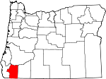
Josephine County, Oregon Basics:


Josephine County Oregon - Government Site

Population: 82,813
Area: 1640 square miles
County seat: Grants Pass
Area code(s) in use: 541
Time zone: PST
High school graduate or higher: 88.2%
Bachelor's degree or higher: 16.4%
Median household income: $36,699
Persons in poverty: 20.0%
Home ownership rate: 66.5%
Mean travel time to work: 19.4 minutes


Adjacent counties:
Curry  Del Norte (CA)  Douglas  Jackson  Siskiyou (CA)  

Find in Oregon

Map of the Josephine County area


Our detail map of Josephine County shows the Josephine County, Oregon boundary lines and other interesting items.

Places in Josephine County, Oregon

  Airports     show all on map

B Bar Ranch Airport, Backachers Ranch Airport, Grants Pass Airport, Hendershots Airstrip, Illinois Valley Airport, Inland Helicopters Heliport, Josephine Memorial Hospital Emergency Heliport, Roseburg Lumber Company Airstrip, Wonder Airport, Wonder Airstrip (historical)

  Areas     show all on map

Bald Mountain Prairie, Coonskin, Dasher Meadow, The Wild, York Creek Botanical Area

  Bars     show all on map

Almeda Bar, Black Bar, Brushy Bar, Collier Bar, Deadman Bar, Miami Bar, Oregon Bar, Panther Bar, Taylor Creek Bar, Tyee Bar

  Basins     show all on map

Swede Basin

  Bends     show all on map

Finley Bend, Horseshoe Bend

  Bridges     show all on map

Caveman Bridge, Grave Creek Bridge, Hellgate Bridge, Murphy Bridge, Robertson Bridge

  Buildings     show all on map

American Medical Response, Applegate Trail Interpretive Center Museum, Applegate Valley Rural Fire Protection District 9 Station 4, Applegate Valley Rural Fire Protection District 9 Station 6, Asante Health Three Rivers Community Hospital Blood Bank, Barnstormers Theatre, Bureau of Land Management Grants Pass Interagency Office, Cave Junction City Hall, Cave Junction Municipal Court, Cave Junction Public Works, Department of Motor Vehicles Cave Junction, Department of Motor Vehicles Grants Pass, Galice Ranger Station, Grants Pass City Hall, Grants Pass Department of Public Safety Police Department, Grants Pass Fire and Rescue Operations Division Station 1 Headquarters, Grants Pass Fire and Rescue Operations Division Station 2, Grants Pass Museum of Art, Grants Pass Performing Arts Center, Grants Pass Public Works, Historic Rogue Theatre, Illinois Valley Fire District Old Station 3, Illinois Valley Fire District Station 1, Illinois Valley Fire District Station 2, Illinois Valley Fire District Station 3, Illinois Valley Fire District Station 4, Illinois Valley Fire District Station 5, Illinois Valley Fire District Station 6, Illinois Valley Ranger Station, Josephine Community Library, Josephine County Adult Jail, Josephine County Community Corrections, Josephine County Juvenile Justice Center, Josephine County Public Health Department, Josephine County Public Works, Josephine County Sheriff's Office, Josphine County Circuit Courthouse, Kerbyville Museum, One Eleven Evelyn Theatre, Oregon State Police Department Grants Pass, Oregon Youth Authority - Rogue Valley Youth Correctional Facility, Pottsville Museum and Pioneer Town, Rogue Community College Rogue Theatre Building, Rogue River Siskiyou National Forest Law Enforcement Wild Rivers Ranger District, Rogue River Siskiyou National Forest Law Enforcement Wild Rivers Ranger District Cave Junction, Rural / Metro Fire Department Fleet Management Facility, Rural / Metro Fire Department Station 1, Rural / Metro Fire Department Station 2, Rural / Metro Fire Department Station 3, Rural / Metro Fire Department Station 4, Rural / Metro Fire Department Station 5, Rural / Metro Fire Department Station 6, Rural / Metro Fire Department Station 7, Schmidt House Museum, Siskiyou National Forest Headquarters, Williams Rural Fire Protection District, Wolf Creek Rural Fire Protection District

  Canals     show all on map

Baltimore Ditch, Blodgett Ditch, Highline Canal, Jerome Prairie Lateral, Kerby Ditch, Murphy Ditch, South Highline Canal, South Main Canal, The Drain, Tokay Canal, Watts and Topping Ditch

  Cemeteries     show all on map

Deer Creek Cemetery, Ferrydale Cemetery, Gotcher Cemetery, Granite Hill Cemetery, Hartley Cemetery, Hawthorne Memorial Gardens Cemetery, Hillcrest Memorial Park Cemetery, Laurel Cemetery, Lower Wolf Creek Cemetery, Placer Cemetery, Pleasant Valley Cemetery, Selma Cemetery, Sloan Cemetery, Sparlin Cemetery, Tokay Heights Cemetery, Wilderville Cemetery, Wolf Creek Cemetery

  Census     show all on map

Fruitdale Census Designated Place, Harbeck-Fruitdale Census Designated Place (historical), Kerby Census Designated Place, Merlin Census Designated Place, New Hope Census Designated Place, O'Brien Census Designated Place, Redwood Census Designated Place, Selma Census Designated Place, Takilma Census Designated Place, Williams Census Designated Place

  Cliffs     show all on map

Devils Slide, Green Wall

  Dams     show all on map

Bolan Lake Dam, Engler Huson Dike, Lake Selmac Dam, Lippert Dam Number Two, Miller Lake Dam, Pomeroy Dam, Seats Dam, Strong Dam, Tall Timber Dam, Werner Dam

  Falls     show all on map

Grave Creek Falls, Kelsey Falls (historical), Little Illinois River Falls, Lower Black Bar Falls, Rainie Falls, Silver Falls, Taylor Creek Falls, Upper Black Bar Falls

  Flats     show all on map

Bee Flat, Cedar Flat, Cherry Flat, Elkhorn Prairie, French Flat, Grayback Glades, Green Creek Meadow, Horse Flat, Indian Flat, Jerome Prairie, Kerby Flat, Little Bald Mountain Prairie, Lost Flat, Middle Bald Prairie, Missouri Flat, Oak Flat, Perkins Prairie, Pine Flat, Portuguese Flat, Red Flat, Sauers Flat, School Flat, Serpentine Flat, Silver Prairie, Star Flat

  Forests     show all on map

Siskiyou National Forest

  Gaps     show all on map

Free and Easy Pass, Freeland Saddle, Hansen Saddle, Hayes Hill Summit, Kings Saddle, Lone Tree Pass, Lookout Gap, Low Divide, Low Gap, Sawmill Gap, Sexton Mountain Pass, Smith Hill Summit, Stage Road Pass, Stringer Gap, Sucker Creek Gap, Sundown Gap, Tennessee Pass, Water Gap, Windy Gap

  Guts     show all on map

Howard Creek Chute, Schmitts Bayou

  Hospitals     show all on map

Merlin Sanitarium, Three Rivers Medical Center

  Islands     show all on map

Carpenters Island, Marks Island

  Lakes     show all on map

Bigelow Lakes, Bolan Lake, East Tanner Lake, Esterly Lakes, Fish Lake, Flanagan Slough, Frog Pond, Hinkle Lake, Little Miller Lake, Little Silver Creek Lake, Miller Lake, Rabbit Lake, Rough and Ready Lakes, Rough and Ready Mill Pond Dam, Tanner Lake, Tanner Lakes

  Locales     show all on map

All Hours (historical), Allen Creek (historical), Almeada Bar Boat Ramp, Almeda (historical), Anderson Station, Arden Craig (historical), Argo Boat Launch, Babcock Cabin, Baker Park Boat Ramp, Bald Mountain Camp, Big Pine Recreation Site, Big Slide Campground, Big Tree, Big Windy Creek Campground, Bigelow Cabins, Black Bar Lodge, Bolan Lake Recreation Site, Booth (historical), Briggs Cabin, Briggs Creek Recreation Site, Browns Mill, Brush Creek Camp, Buck Creek Recreation Site, Bulb (historical), Camp Grayback, Camp Howard, Camp Spencer (historical), Carson Cabin, Cave Creek Recreation Site, Cave Junction Wastewater Sewage Treatment, Cave Junction Water Treatment Plant, Caves Camp, Cedar Camp, Cedar Guard Station, China Garden, Chinook Park Boat Ramp, Chrome Camp, Copsey Camp, Deadhorse Corral, Denman Cabin, Dimmick (historical), Doe Creek Campground, Dulog Creek Recreation Area, Ennis Riffle Boat Ramp, Fantz Ranch, Ferry Hole Park Boat Ramp, Fleming Middle School Sewage Treatment Plant, Forest Queen, Forest Service Bolan Lake Non - Motorized Boat Launch, Fort Briggs (historical), Fort Hayes (historical), Fort Leland (historical), Fosters Temple, Fulk Cabin, Galice Boat Landing, Gold Center, Granite (historical), Granite Hill (historical), Grants Pass Country Club, Grants Pass Water Treatment Plant, Grants Pass Water Treatment Plant, Grave Creek Boat Ramp, Grayback Recreation Site, Grayback Shelter, Greyhound Station, Griffin Park Boat Ramp, Griffin Picnic Area, Grizzly Camp, Hall Cabin, Heffling (historical), Hog Creek Boat Ramp, Horse Range Camp (historical), Horse Spring Camp, Horseshoe Bend Campground, Indian Mary Park Boat Ramp, Jerome Prairie (historical), Josephine (historical), Josephine Community Transit, Josephine County Fairgrounds, Josephine County Fairgrounds Racetrack, Josephine County School District / Hidden Valley High School Sewage Treatment Plant, Josephine County School District Sewage Treatment Plant, Kelsy Creek Campground, Kendall Cabin, Kenny (historical), Kettering (historical), Krause Cabin, Lake Selmac Boat Dock, Lake Selmac Boat Dock, Lake Selmac Boat Dock, Lake Selmac McMullen Creek Boat Launch, Lake Selmac Reeves Creek Boat Launch, Lathrop Landing Boat Ramp, Little Windy Creek Campground, Love Station, Lucky Queen, Manzanita Safety Rest Area, Matson Park Boat Launch, McCaleb Ranch, Meadow Camp, Meadow Creek Campground, Miami Bar Boat Launch, Mountain Ranch, Myers Creek Recreation Site, North Jenny Creek Campground, Page Creek Guard Station, Page Mountain Sno-Park, Pearce Riffle Park Boat Ramp, Peavine Lookout, Pepper Camp, Pine Creek Shelter (historical), Pollard (historical), Prairie Creek (historical), Rand Access Boat Launch, Rand Ranger Station (historical), Rasmussen House, Riverside Park Boat Launch, Robertson Bridge Boat Ramp, Rogue Community College Outdoor Concert Bowl, Rough and Ready Lumber Biomass Production, Russian Creek Campground, Sam Brown Horse Camp, Sam Brown Recreation Site, Sand Creek (historical), Sanders (historical), Savage Rapids Crossing (historical), Schroeder Park Boat Ramp, Secret Creek Recreation Site, Shan Creek Recreation Site, Simmons (historical), Siskiyou Aerial Project Complex, Sixmile Recreation Site, Slate Slide Shelter (historical), Slaughterhouse, Soldier Camp, Sourgrass Camp, Spalding Pond Recreation Site, Spaulding Mill, Spring, Stites (historical), Store Gulch Guard Station, Store Gulch Recreation Site, Sucker Creek Shelter, Taylor Gorge Overlook, Thompson Creek Forest Camp, Tin Can Recreation Site, Trappers Camp, Tuff (historical), Tunnel 9, United Parcel Service Wastewater Treatment Facility, Valley of the Rogue Dairy, Villair Ranch, Waldo, Weaver Ranch (historical), West Ridge Camp, Wheeler City (historical), Whiskey Creek Campground, Whisky Creek Cabin, Whitehorse Park Boat Ramp, Wildcat Campground, Williams Forest Service Facility, Williams Guard Station, Winona (historical)

  Military     show all on map

Camp Spencer (historical), Fort Bailey (historical), Fort Vannoy (historical)

  Mines     show all on map

Ajax Mine, Alberg Mine, Albright Mine (historical), Almeda Mine, Aman Ranch Placer, Anaconda Mine, Anderson Mine, Arnold Mine, Baby Mine, Baker Mine, Bantam Mine, Barr Mine, Bear Mine, Benton Mine, Big Slide Lode, Black Bear Mine, Blanket Ledge Mine, Blue Channel Placer, Bolan Creek Mine, Bolan Mine, Bone of Contention Mine, Boswell Mine, Bristol Quarry, Brown Owl Mine, Buckeye Mine, Bunker Hill Mine, California Mine, Chrome King Mine, Columbia Mine, Columbia Placer, Copper Queen Mine, Cougar Mine, Courier Mine, Cox Mine (historical), Coyote Mine, Daisy Mine, Deep Gorge Mine, Dorothea Mine, Edmonds Mine, Elkhorn Mine, Esterly Mine, Eureka Mine, Fall Creek Copper Mine, Fandora Mine, Flanagan Mine, Florene Mine, Frog Pond Mine, Gem Quartz Mine, Glory Hole Placer, Goff Mine, Goff Placer, Gold Bug Mine, Gold Cup Placer, Gold Pan Placer Mine, Gold Plate Mine, Golden Ring Mine, Golden Wedge Mine, Gopher Mine, Granite Hill Mine, Greenback Mine, Grizzly Mine, Gypsy Queen Mine, Hammersly Mine, Hansen Mine, Horseshoe Lode, Howland Mine, Humdinger Mine, Ida Mine, J C L Mine, Jackpot Mine, Jewett Mine, Jim Blaine Mine, Jones Marble Quarry, Kester Mine, Little Jim Mine, Lucky Queen Mine, Lucky Strike Mine, Luethye Mine, MacAbee Mine, Martha Mine, Michigan Mine, Molly Hill Mine, Morning Mine, Mountain Lion Mine, Mountain View Mine, Murry Mine, Oak Mine, Old Channel Mine, Old Glory Mine, Oregon Bonanza Mine, Oriole Mine, Oro Grande Mine, Orofino Mine, Paradise Mine, Paradise Mine Number 1, Payne Placer, Pix Mine, Ponyshoe Mine, Rainbow Mine, Ramsey Mine, Ramsey Mine, Red Rose Mine, Redjacket Mine, Reed Mine, Reno Mine, Robertson Mine, Seven-Thirty Mine, Shot Mine, Silent Friend Mine, Silver Tip Mine, Sluter Mine, Snow Bird Mine, Speaker Placer, Spotted Fawn Mine, Star Mine, Steam Beer Placer, Sugar Pine Mine, Sunset Mine, Tip Top Mine, Twelve O'Clock Mine, Victor Mine, Victor Mine, Watts Mine, Windy Gap Mine, Yeager Mine, Yellowhorn Mine

  Parks     show all on map

Almeda County Park, Applegate County Park, Argo County Park, Carpenters Island Park, Cathedral Hills County Park, Chinook County Park, Croxton Pioneer Memorial Park, Ennis Riffle County Park, Ferry County Park, Fish Hatchery County Park, Gateway State Wayside (historical), George H Eckstein Park, Griffin County Park, Hog Creek County Park, Illinois River Forks State Park, Indian Mary County Park, Lake Selmac County Park, Lathrop County Park, Lawnridge Park, Matson County Park, Nobles House, Oregon Caves National Monument, Pierce Riffle County Park, Rand Recreation Area, Riverside Park, Robertson Bridge County Park, Rogue River Scenic Waterway, Rough and Ready State Park, Schroeder County Park, Stage Coach Forest State Park, Tom Pearce County Park, Tussing Park, Westholm Park, Whitehorse County Park, Wolf Creek County Park, Wolf Creek Inn State Park

  Pillars     show all on map

Castle Rock, Lime Rock

  Populated Places     show all on map

Allentown (historical), Althouse (historical), Bridgeview, Brown City (historical), Browntown, Browntown (historical), California Bar, Cave Junction, Dryden, Fruitdale, Galice, Golden, Grants Pass, Greenback (historical), Holland, Hugo, Kerby, Leland, Merlin, Murphy, New Hope, O'Brien, Placer, Pleasant Valley, Rand, Redwood, Selma, Speaker, Sunny Valley, Takilma, Three Pines, Wilderville, Williams, Williamsburg (historical), Wolf Creek, Wonder

  Post Offices     show all on map

Almeda Post Office (historical), Aloysius Post Office (historical), Altamont Post Office (historical), Althouse Post Office (historical), Anderson Post Office (historical), Booth Post Office (historical), Bour Post Office (historical), Browntown Post Office (historical), Cave Junction Post Office, Davidson Post Office (historical), Deering Post Office (historical), Dryden Post Office (historical), Galice Post Office (historical), Golden Post Office (historical), Granite Hill Post Office (historical), Grants Pass Post Office, Greenback Post Office (historical), Hammersley Post Office (historical), Holland Post Office (historical), Hugo Post Office (historical), Kerby Post Office, Leland Post Office (historical), Lucky Queen Post Office (historical), McAllister Post Office (historical), Merlin Post Office, Montezuma Post Office (historical), Mountain Post Office (historical), Murphy Post Office, O'Brien Post Office, Oak Grove Post Office (historical), Oakdale Post Office (historical), Oregon Caves Post Office (historical), Placer Post Office (historical), Selma Post Office, Speaker Post Office (historical), Sunny Valley Post Office, Takilma Post Office (historical), Threepines Post Office (historical), Vannoy Post Office (historical), Waldo Post Office (historical), Wilderville Post Office, Williams Post Office, Williamsburg Post Office (historical), Winona Post Office (historical), Wolf Creek Post Office, Wonder Post Office (historical)

  Ranges     show all on map

Horse Range

  Rapidss     show all on map

Argo Riffle, Armedio Riffle, Bedrock Riffle, Big Slide Riffle, Brushy Chutes, Chair Riffle, China Gulch Rapids, Dulog Riffle, Dunn Riffle, Ennis Riffle, Everton Riffle, Galice Riffle, Grave Creek Riffle, Little Windy Riffle, Lower Galice Riffle, Montgomery Rapids, Old Man Riffle, Plowshare Rapids, Rocky Riffle, Russian Rapids, Savage Rapids, Slate Slide Riffle, Slim Pickins Rapid, Submarine Hole, Telephone Hole Riffle, Tyee Rapids, Upper Galice Riffle, Washboard Rapids, Whitehorse Riffle, Wildcat Rapids, Windy Creek Chute, Winterbottom Riffle

  Reserves     show all on map

Kalmiopsis Wilderness, Red Buttes Wilderness

  Reservoirs     show all on map

Apple Rogue Reservoir, Aqua Fria Reservoir, Barker Reservoir, Brown Res, Cedar Pond, Cook Reservoir, Daily Reservoir, Dunlop Reservoir, Ehlig Reservoir, Ferber Reservoir, Fifer Reservoir, FS Reservoir, Graves Reservoir, Hartley Reservoir, Holzhauser Reservoir, House Reservoir, Katzenbach Reservoir, Kennison Reservoir, Kings Reservoir, Klose Pond, Lake Selmac, Lehman Reservoir, Lincoln Savage Reservoir, Lippert Reservoir Number Two, Mary K Reservoir, Miller Reservoir, Reinhardt Reservoir, Remey Reservoir, Rosenberg Reservoir, Rough and Ready Log Pond, Secesh Reservoir, Small Reservoir, Spalding Reservoir, Spaulding Reservoir, Steppe Reservoir, Strong Reservoir, Tall Timber Reservoir, Tobiason Reservoir, Trader Reservoir, Webb Reservoir, Wee Bonnie Loch Glen Reservoir, Werner Reservoir, Whittier Reservoir, Willson Reservoir, Wolf Creek Pools, Wood Reservoir, Woolfolk Reservoir

  Ridges     show all on map

Bearcamp Ridge, Buckhorn Ridge, Chrome Ridge, Lone Tree Ridge, Luther Divide, Squaw Ridge, Weston Ridge, Whisky Ridge

  Schools     show all on map

Allen Dale Elementary School, Applegate Elementary School, Brighton Academy, Dimmick School (historical), Evergreen Elementary School, Fleming Middle School, Fort Vannoy School, Fruitdale Elementary School, Grants Pass High School, Hidden Valley High School, Highland Elementary School, Illinois Valley High School, Jerome Prairie Elementary School, Lincoln Elementary School, Lincoln Savage Middle School, Lorna Byrne Middle School, Madrona Elementary School, Manzanita Elementary School, Mount Sexton Intermediate School, Murphy Elementary School (historical), New Hope Christian School, Newbridge High School, North Middle School, North Valley High School, Oak Grove School (historical), Parkside Elementary School, Redwood Elementary School, Riverside Elementary School, Rogue Community College, South Middle School, Vineyard Christian School, Wilderville School (historical), Wolf Creek School

  Springs     show all on map

Annie Spring, Azalea Spring, Azalea Spring, Big Spring, Bonham Spring, Browning Spring, Canteen Spring, Cedar Spring, Cold Spring, Cold Spring, Cool Spring, Cougar Spring, Dugout Spring, Fraser Spring, Friday Spring, Gaughan Spring, Gold Spring, Hope Spring, Horse Spring, Horse Spring, Huylers Spring, Jacobson Springs, Johnson Spring, Larkspur Spring, Mabel Spring, Maple Spring, Martin Spring, Miller Spring, Montana Spring, Mountain Spring, Mud Spring, Mud Springs, Olden Spring, One Doe Spring, Onion Spring, Pine Cone Spring, Poe Spring, Polar Spring, Rattlesnake Spring, Root Spring, Serpentine Spring, Sexton Spring, Siskiyou Springs, Tibbett Spring, Tiger Springs, Turner Spring, Whisky Creek Spring, Whisky Spring, Willow Spring

  Streams     show all on map

Alder Creek, Allen Creek, Althouse Creek, Althouse Slough, Anderson Creek, Anderson Creek, Angora Creek, Anna Creek, Antler Creek, Antler Creek, Applegate River, Argo Creek, Azalea Creek, Bacus Creek, Bailey Creek, Baker Creek, Baldy Creek, Banning Creek, Bannister Creek, Baum Slough, Bear Creek, Bear Creek, Bear Wallow Creek, Bear Wallow Creek, Big Windy Creek, Bigelow Creek, Bill Creek, Birch Creek, Black Canyon Creek, Black Rock Creek, Blodgett Creek, Bloody Run Creek, Blue Creek, Blue Jay Creek, Bluff Creek, Board Shanty Creek, Board Tree Creek, Bolan Creek, Booker Creek, Booze Creek, Boulder Creek, Breakdown Creek, Breezy Creek, Bricker Creek, Briggs Creek, Britton Creek, Brockhurst Creek, Bronco Creek, Brown Slough, Brush Creek, Brushy Creek, Buck Creek, Buckeye Creek, Bull Creek, Bummer Creek, Bunker Creek, Burned Timber Creek, Butcher Creek, Butcherknife Creek, Butte Creek, Calvert Slough, Camp Creek, Camp Meeting Creek, Canyon Creek, Carl Creek, Carter Creek, Case Creek, Cave Creek, Cedar Creek, Cedar Log Creek, Cedar Swamp Creek, Chance Creek, Chandler Creek, Chapin Creek, Chapman Creek, Cheney Creek, Cherry Creek, Chetco Pass Creek, Chief Creek, Chieftain Creek, China Creek, China Creek, China Creek, Choke Cherry Creek, Clark Creek, Clear Creek, Clear Creek, Cohen Creek, Cold Springs Creek, Copsey Creek, Corliss Creek, Corn Creek, Cove Creek, Cove Creek, Cowley Creek, Coyote Creek, Craggy Creek, Crooks Creek, Dailey Creek, Dales Bluff Creek, Davis Creek, Deadhorse Creek, Deep Creek, Deer Creek, Deer Creek, Deer Creek, Delta Creek, Dog Creek, Drain Creek, Draper Creek, Drier Creek, Dry Creek, Dry Creek, Dry Creek, Dulog Creek, Dunlap Creek, Dutcher Creek, Dutchy Creek, Dwight Creek, East Fork Big Windy Creek, East Fork Bolan Creek, East Fork Chapman Creek, East Fork Gilbert Creek, East Fork Howard Creek, East Fork Illinois River, East Fork Illinois River, East Fork Jones Creek, East Fork Kelsey Creek, East Fork Pine Creek, East Fork Rat Creek, East Fork Rum Creek, East Fork Squaw Creek, East Fork Whisky Creek, East Fork Williams Creek, East Gold Brook, East Tanner Creek, Eight Dollar Mountain Creek, Elder Creek, Elk Creek, Elk Creek, Elkhorn Creek, Elkhorn Creek, Elliott Creek, Ellis Creek, Ewe Creek, Fall Creek, Fall Creek, Fall Creek, Fall Creek, Fan Creek, Florence Creek, Forest Creek, Fourmile Creek, Fowlie Creek, Francis Creek, Free and Easy Creek, Fruitdale Creek, Galice Creek, George Creek, Gilbert Creek, Gilligan Creek, Glade Fork, Gold Dollar Creek, Goodwin Creek, Grade Creek, Granite Creek, Grannys Run, Grave Creek, Grayback Creek, Grays Creek, Greens Creek, Hansen Creek, Harmon Creek, Harris Creek, Harris Creek, Haven Creek, Haven Creek, Hawk Creek, Hayden Creek, Hegan Creek, Hog Creek, Hog Eye Creek, Holton Creek, Honeysuckle Creek, Horse Creek, Horse Creek, Horse Creek, Horsehead Creek, Horsetail Creek, Howard Creek, Indian Creek, Iron Creek, Jack Creek, Jackass Creek, Jackson Creek, Japanese Creek, Jenny Creek, Jenny Creek, Jewett Creek, Jimmy Creek, Johnston Creek, Jones Creek, Josephine Creek, Julie Creek, Jumpoff Joe Creek, Kelly Creek, Kelsey Creek, Kerby Slough, Keyte Creek, Khoeery Creek, Klondike Creek, Knight Creek, Labrador Creek, Lake Creek, Lake Creek, Lake Creek, Lake Creek, Lake Merritt, Lathrop Creek, Laundry Creek, Lazy Creek, Left Fork Sucker Creek, Left Hand Fork Brush Creek, Leuizenger Creek, Lewis Creek, Lightning Creek, Limestone Creek, Limpy Creek, Little Bear Creek, Little Cheney Creek, Little Craggy Creek, Little Creek, Little Elder Creek, Little Grayback Creek, Little Pickett Creek, Little Rock Creek, Little Silver Creek, Little Sixmile Creek, Little Stratton Creek, Little Todd Creek, Little Windy Creek, Little Zigzag Creek, Logan Cut, Lone Creek, Lone Tree Creek, Louse Creek, Love Creek, Low Gap Creek, Lozier Creek, Macks Creek, Madams Creek, Madronna Creek, Maple Creek, Maple Creek, Marsh Creek, Matz Draw, McCourtney Creek, McKnabe Creek, McMullin Creek, McNair Creek, Meadow Creek, Meehan Slough, Mendenhall Creek, Mill Creek, Mill Creek, Mill Creek, Mill Creek, Miller Creek, Miller Lake Creek, Minnie Creek, Minnow Creek, Montgomery Creek, Montgomery Creek, Moon Creek, Morris Creek, Mossback Creek, Mount Creek, Mouse Creek, Mule Creek, Munger Creek, Murphy Creek, Myers Creek, Myrtle Creek, Nelson Creek, No Name Creek, No Name Creek, Nogle Creek, Nome Creek, North Fork Deer Creek, North Fork Galice Creek, North Fork Louse Creek, North Fork Munger Creek, North Fork Rough and Ready Creek, North Fork Silver Creek, O'Brien Creek, O'Brien Creek, O'Connell Creek, O'Conner Creek, Oak Flat Creek, Onion Creek, Onion Creek, Oscar Creek, Owl Creek, Packers Creek, Page Creek, Paint Creek, Panther Creek, Panther Creek, Panther Creek, Parker Creek, Pass Creek, Payne Slough, Pearsoll Creek, Pennington Creek, Perdin Creek, Peterson Creek, Phillips Creek, Pickering Creek, Pickett Creek, Pine Creek, Pipe Fork, Pollard Creek, Poorman Creek, Powell Creek, Quartz Creek, Quartz Creek, Quedo Creek, Ramsey Creek, Rancherie Creek, Rat Creek, Rattlesnake Creek, Rattlesnake Creek, Rawhide Creek, Red Dog Creek, Reeves Creek, Reservoir Creek, Reservoir Creek, Reuben Creek, Rich Creek, Right Fork Rat Creek, Right Hand Fork Rock Creek, Right Hand Fork Steve Fork, Right Hand Fork West Fork Williams Creek, Robertson Creek, Rock Creek, Rock Creek, Rock Creek, Rock Creek, Rocky Creek, Rough and Ready Creek, Round Prairie Creek, Rum Creek, Russian Creek, Ryan Creek, Sailor Jack Creek, Salmon Creek, Salmon Creek, Salt Creek, Salt Lick Creek, Sand Creek, Sauers Creek, Sawyer Slough, Schoolhouse Creek, Schoolmarm Creek, Sebastopol Creek, Secret Creek, Shade Creek, Shady Creek, Shan Creek, Shanks Creek, Silver Creek, Sixmile Creek, Skag Creek, Skunk Creek, Skunk Creek, Slagle Creek, Slate Creek, Slate Creek, Slate Creek, Slick Rock Creek, Smith Creek, Snailback Creek, Soldier Creek, Soldier Creek, Sourgrass Creek, South Fork Argo Creek, South Fork Canyon Creek, South Fork Deer Creek, South Fork Galice Creek, South Fork Louse Creek, South Fork Rough and Ready Creek, South Fork Round Prairie Creek, South Fork Silver Creek, South Fork Taylor Creek, Sparrowhawk Creek, Spencer Creek, Spring Creek, Squaw Creek, Still Creek, Stratton Creek, Stringer Creek, Studhorse Creek, Sucker Creek, Sulphur Creek, Swamp Creek, Swanson Creek, Swede Creek, Tanner Creek, Taylor Creek, Telephone Creek, Thirteenmile Creek, Thompson Creek, Todd Creek, Tom East Creek, Tom East Creek, Tree Branch Creek, Tunnel Creek, Twin Cedars Creek, Tycer Creek, Valley Creek, Vannoy Creek, Walker Creek, Walker Creek, Wallow Creek, Water Branch, Water Gap Creek, Waterdog Creek, Waters Creek, Waterspout Creek, Welter Creek, West Fork Althouse Creek, West Fork Gilbert Creek, West Fork Illinois River, West Fork Jones Creek, West Fork Pine Creek, West Fork Rancherie Creek, West Fork Squaw Creek, West Fork Taylor Creek, West Fork Whisky Creek, West Fork Williams Creek, West Gold Brook, Whiskey Bottle Creek, Whiskey Creek, Whisky Creek, White Creek, White Rock Creek, Wildcat Creek, Wildcat Creek, Williams Creek, Windy Creek, Windy Creek, Wolf Creek, Wood Creek, Woodcock Creek, Yeager Creek, Yew Creek, Yew Wood Creek, York Creek, Yukon Creek, Zigzag Creek, Zigzag Creek

  Summits     show all on map

Althouse Mountain, Arnold Mountain, Bald Mountain, Bald Mountain, Beacon Hill, Big Sugarloaf Peak, Bolan Mountain, Bolt Mountain, Buck Peak, Buckhorn Mountain, Cedar Mountain, Chinaman Hat, Craggy Mountain, Dollar Mountain, Eagle Mountain, Eight Dollar Mountain, Elder Mountain, Elk Mountain, Fiddler Mountain, Flat Top, Freeland Mountain, French Peak, Gilligan Butte, Gold Basin Butte, Grants Pass Peak, Grayback Mountain, Grizzly Peak, Hayes Hill, Hobson Horn, Holcomb Peak, Horse Mountain, Horse Mountain, Hungry Hill, Hungry Hill, Indian Hill, Johnson Point, Josephine Mountain, Kerby Peak, King Mountain, Lake Mountain, Little Craggy Peak, Little Grayback Peak, Little Sugarloaf Peak, London Peak, Lone Mountain, Malone Peak, Marble Mountain, Mooney Mountain, Morgans Buckhorn, Mount Billingslea, Mount Elijah, Mount Hope, Mount Peavine, Mount Reuben, Mungers Butte, Murphy Mountain, Nome Peak, Number Eight Peak, Old Channel, Onion Mountain, Oregon Mountain, Our Mountain, Page Mountain, Pearsoll Peak, Peggler Butte, Pennington Butte, Pennington Mountain, Pickett Mountain, Pockett Knoll, Post Mountain, Red Mountain, Roberts Mountain, Roundtop Mountain, Saint Paul Mountain, Saint Peter Mountain, Serpentine Point, Sexton Mountain, Silver Peak, Sloan Mountain, South Bend Mountain, Squaw Mountain, Squaw Mountain, Steve Peak, Sugarloaf, Swan Mountain, Tanner Mountain, Taylor Mountain, Tennessee Mountain, Waldo Hill, Walker Mountain, Weston Mountain, Whetstone Butte, Whiskers Peak, Whisky Peak, Wonder Mountain, Woodcock Mountain, York Butte

  Towers     show all on map

KAGI-AM, KAJO-AM, KFMJ-FM, KIVR-AM, KSOR-FM, KSYS-TV

  Trails     show all on map

Althouse Trail, Bolan Lake Trail, Boundary Trail, Cliff Nature Trail, Coffee Pot Trail, Dutch Henry Trail (historical), East Fork Sucker Creek Trail, Gilmore Cutoff Trail, Grayback Clapboard Trail, Green Valley Trail, Illinois River Trail, Kerby Peak Trail, King Mountain Truck Trail, Lake Mountain Trail, Limestone Trail, Oregon Caves Trail, Steve Fork Trail, Sucker Creek Trail, Tannen Lakes Trail

  Tunnels     show all on map

Tunnel 8

  Valleys     show all on map

Ajax Gulch, Alder Gulch, Allen Gulch, Applegate Gulch, Ash Gulch, Avery Gulch, Baldwin Gulch, Bamboo Gulch, Bartley Gulch, Bear Gulch, Bear Gulch, Bear Gulch, Bear Gulch, Belknap Gulch, Benjamin Gulch, Benson Gulch, Berglund Gulch, Bills Gulch, Black Canyon, Blanchard Gulch, Blind Sam Gulch, Blue Canyon, Blue Gulch, Blue Gulch, Brass Nail Gulch, Briggs Valley, Brimston Gulch, Brockman Gulch, Brown Gulch, Browns Gulch, Browntown Gulch, Brushy Gulch, Brushy Gulch, Brushy Gulch, Buck Gulch, Bummer Gulch, Bummer Gulch, Burgess Gulch, Butcher Gulch, California Gulch, Canfield Gulch, Canyon Gulch, Carpenter Gulch, Carr Gulch, Cedar Gulch, Cedar Gulch, Centennial Creek, Cherry Gulch, China Gulch, China Gulch, Clapboard Gulch, Cochran Gulch, Colby Gulch, Cooksie Gulch, Coon Gulch, Davidson Gulch, Days Gulch, Deadman Gulch, Democrat Gulch, Dorr Canyon, Draper Valley, Dunbar Gulch, Eastman Gulch, Elder Gulch, Farmer Gulch, Fayes Gulch, Fehley Gulch, Fiddler Gulch, Fiddlers Gulch, Fisher Gulch, Five Finger Gulch, Flume Gulch, Foley Gulch, French Gulch, Frog Gulch, Frost Gulch, Frosty Canyon, Fry Gulch, Garradella Gulch, George Draw, Gillet Gulch, Gold Bug Gulch, Goldsby Gulch, Grandpa Gulch, Grantham Gulch, Green Gulch, Green Valley, Grizzly Gulch, Hades Gulch, Hamlin Gulch, Hansen Gulch, Hansford Gulch, Hare Gulch, Hellgate Canyon, Hole in the Ground, Hooks Gulch, Hoover Gulch, Horseshoe Gulch, Hughes Gulch, Hydraulic Gulch, Iron Gulch, Johnson Gulch, Johnson Gulch, Julian Gulch, Kennedy Gulch, King Gulch, KirKirs Canyon, Knapke Gulch, Knights Gulch, Layman Gulch, Levens Gulch, Lightning Gulch, Lime Gulch, Little Jim Gulch, Long Gulch, Long Gulch, Lost Canyon, Lucy Gulch, Lynholm Gulch, Mackin Gulch, Madison Gulch, Maple Gulch, Maple Gulch, Maple Springs Gulch, McGuire Gulch, Midnight Gulch, Mikes Gulch, Miller Gulch, Moore Gulch, Mule Gulch, Mulvaney Gulch, Newt Gulch, North Fork Rocky Gulch, North Marble Gulch, North Star Gulch, Number Eight Gulch, Number Seven Gulch, Onion Gulch, Orofino Gulch, Packers Gulch, Panning Gulch, Panther Gulch, Panther Gulch, Patrick Gulch, Peterson Gulch, Pigeon Gulch, Pine Gulch, Pine Gulch, Pollard Gulch, Post Gulch, Potter Gulch, Quail Gulch, Quartz Mill Gulch, Rail Canyon, Ramsey Gulch, Red Gulch, Rich Gulch, Rich Gulch, Robinson Gulch, Rocky Bar Gulch, Rocky Gulch, Run Gulch, Sailor Gulch, Sailor Gulch, Salt Gulch, Sanders Gulch, Scholey Gulch, Schoolhouse Gulch, Schoolhouse Gulch, Scofield Gulch, Scotch Gulch, Secesh Gulch, Secret Valley, Serpentine Gulch, Shorthorn Gulch, Silver Gulch, Singletree Gulch, Small Gulch, Smith Gulch, Snow Gulch, Sourdough Gulch, South Fork Fiddler Gulch, South Fork Rocky Gulch, South Marble Gulch, Spangler Gulch, Spring Gulch, Squaw Gulch, Stage Road Gulch, Store Gulch, Sugar Gulch, Sugarloaf Gulch, Sunflower Gulch, Swan Valley, Tartar Gulch, Taylor Creek Gorge, Taylor Gulch, Tennessee Gulch, Tennessee Gulch, The Canyon, Tin Canyon Gulch, Toinen Gulch, Toss Gulch, Trail Canyon, Trapper Gulch, Walker Gulch, Water Tank Gulch, Whiskey Gulch, Whiskey Gulch, Wildcat Gulch, Yew Wood Gulch,

Josephine County, Oregon Population By Race (2012 estimate)

RacePopulation
WhiteJosephine County White population 77,67977,678  
MixedJosephine County Mixed population 2,5672,567
American IndianJosephine County American Indian population 1,2421,242
AsianJosephine County Asian population 745745
BlackJosephine County Black population 414414
Hawaiian & Pacific IslanderJosephine County Hawaiian & Pacific Islander population 166165

Additional population tables :
State population table
Oregon population by county