Platte County, Wyoming Basics:


Platte County Wyoming - Government Site

Population: 8,751
Area: 2084 square miles
County seat: Wheatland
Area code(s) in use: 307
Time zone: MST
High school graduate or higher: 90.0%
Bachelor's degree or higher: 19.1%
Median household income: $44,917
Persons in poverty: 13.3%
Home ownership rate: 79.5%
Mean travel time to work: 17.9 minutes

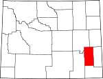
Adjacent counties:
Albany  Converse  Goshen  Laramie  Niobrara  

Find in Wyoming

Map of the Platte County area


Our detail map of Platte County shows the Platte County, Wyoming boundary lines and other interesting items.

Places in Platte County, Wyoming

  Airports     show all on map

Camp Guernsey Airport, Hagemeisters Twin Pine Ranch Airport, Phifer Airfield, Snell - North Laramie River Airport, Thomas Memorial Airport, Two Bar Ranch Airport

  Bays     show all on map

Davis Bay, Newell Bay

  Bends     show all on map

Bulls Bend

  Buildings     show all on map

Antelope Grange Hall, Camp Guernsey Fire Department, Chugwater Ambulance, Chugwater Fire Protection District, Eastern Wyoming Ambulance, Glendo Police Department, Glendo Volunteer Fire Department, Guernsey Police Department, Guernsey Rural Fire District, Guernsey Volunteer Fire Department, Hartville Fire Department, Platte County Firefighters - Glendo Rural Fire Zone 4, Platte County Rural Fire District 2F, Platte County Sheriff's Office, Sybille Volunteer Fire Department, Wheatland Fire Department, Wheatland Police Department

  Canals     show all on map

Bright and Southerland Ditch, City Ditch, Cramer Ditch, Ditch Number 1, Feeder Ditch Number 2, Highline Ditch, Home Ditch, Iowa Lateral, Laramie River Ditch Number 1, Lowica Ditch Number 2, Merkel Ditch Number 1, Mertz Ditch, Mitchell Ditch, Mitchell Ditch Number 1, Mullen Ditch, North Laramie Canal, North Laramie Ditch Number 3, Number 2 Canal, Old Muleshoe Drain Ditch, Pine Ditch, Ramsey Ditch, Uva Ditch, Wyoming Development Company Canal

  Cemeteries     show all on map

Dwyer Cemetery, Horseshoe Cemetery, Lucindy Rollins Grave, Wheatland Cemetery

  Census     show all on map

Chugcreek Census Designated Place, Lakeview North Census Designated Place, Slater Census Designated Place, Westview Circle Census Designated Place, Whiting Census Designated Place, Y-O Ranch Census Designated Place

  Churches     show all on map

Iowa Center Flats Church

  Cliffs     show all on map

Brimmer Point, Goshen Hole Rim, Register Cliff

  Dams     show all on map

Bagley Brothers Dam, Black Reservoir Number 2 Dam, Bohnke Dam, Broom Creek Dam, Buck Dam, Cedar Ridge Number 1 Dam, Christiansen Number 2 Dam, Chug Springs Dam, Clay Number 1 Dam, Clearwater Dam, Crandall Dam, Cundall Dam, Double L Dam, Eshom Dam, Gilbert Number 1 Dam, Glendo Dam, Glendo Dam, Glendo Dike Number 1 Dam, Glendo Dike Number 2 Dam, Glendo Dike Number 3 Dam, Grant Dam, Grayrocks Dam, Guernsey Dam, Guernsey Fish Pond Dam, Hal Dam, Hal Number 2 Dam, Hugh McDonald Dam, J N Mertz Dam, Ken Number 1 Dam, Loren Ramsey Fish Dam, Mbpp Raw Water Storage Dam, MBPP Storm Runoff Retention Dam, McComb Dam, Mertz Number 2 Dam, Miller Number 1 Dam, Miller Number 2 Dam, Miller Number 2 Reservoir Dam, Moran Dam, Morrison Number 2 Dam, Muddy Number 1 Dam, N Laramie Land Company Number 1 Dam, N Laramie Land Company Number 3 Dam, Naffziger Dam, O Bar O Number 3 Dam, Phelps Dam, Phelps Number 2 Dam, Pump Dam, Richard Reservoir Number 1 Dam, Roath Dam, Robert Grant Dam, Rock Lake Dam, Ryff and Klassert Dam, Spring Creek Number 1 Dam, Twiford Dam, Utter Dam, Wheatland Number 1 Dam, Wyatt Number 2 Dam

  Falls     show all on map

Cottonwood Falls

  Flats     show all on map

Bettelyoun Flats, Chugwater Flats, Gyp Flat, Lewis Flat

  Gaps     show all on map

Antelope Gap, Johnson Canyon, Rocky Pass, Seward Pass

  Hospitals     show all on map

Meadowlark Maison Hospital, Platte County Memorial Hospital, Platte County Memorial Nursing Home

  Lakes     show all on map

Festo Lake, Jones Lake, Wheeler Lake

  Locales     show all on map

Adams Ranch, Allison Ranch, Anderson Ranch, Antelope School, Ayers (historical), Bard Ranch, Beacon Number 8, Boner Ranch, Bowman Ranch, Brownrigg Ranch, Butner Ranch, C S Ranch, Call Ranch, Canyon View School, Chase Ranch, Clair Milton Ranch, Cold Spring Campground, Cottonwood Community Hall, Crane, Cundall Ranch, Delano Ranch, Devils Washtub, Diamond Ranch, Don Cundall Ranch, Donaldson Ranch, Double L Ranch, Elkhorn Ranch, Ferguson Ranch, Fitzhugh Ranch, Fletcher Ranch, Foss Ranch, Frederick Ranch, G Mitchell Ranch, Grant Ranch, Graves Ranch, H B Coleman Ranch, Hagemeister Ranch, Harry Coleman Ranch, Haushar Ranch, Herman Ranch, Hightower, Hill Ranch, Horseshoe Pony Express Station, Johnson Ranch, Johnson Ranch, Lauk-stein Ruins, Lewis Ranch, Lewis Ranch, Lewis Ranch, M L Coleman Ranch, Macfarlane Ranch, Martin Ranch, McNutt Ranch, Milton Ranch, Moody Community Club, Morrison Ranch, Mountain View Community Hall, Muthart Place, Mylet Ranch, Old 4 J Ranch, Old Guernsey Ranch, Old Mitchell Home Ranch, Osborn Ranch, Patten Creek School, Patterson Ranch, Paul Cundall Ranch, Pepper Ranch, Phifer Ranch, Red Cloud Picnic Ground, Ross Ranch, Russel Ranch, Schreyer Ranch, Slate Creek School, Smith Ranch, Sommers Ranch, Spotted Tail Picnic Ground, Stephenson Ranch, Stirrup Ranch, Stokes Siding, Sudbury Ranch, Swan, Tatman Ranch, Upper McDougal Ranch, Vermilyea Ranch, Voight Ranch, Weaver Ranch, Wedemeyer Ranch, Wendover Bend Ranch, West Ranch, Whitcomb Ranch, Wilkinson School, Willadsen Ranch, Wilson Ranch

  Military     show all on map

Camp Guernsey

  Mines     show all on map

Big Mac Claim, Black Powder Mines, Chicago Mine, Cooney Hill Prospect, Emerald Group Mine, Friday Number Two Prospect, George Creek Mine, Good Fortune Mine, Groves and Collins Deposit, Guernsey Stone Quarry, Ingleside Quarries, JBC Deposit Mine, Jehosophat Prospect, LT Sisson Dolomite Deposit, Lucky Gus Prospect, May Number One Quarry, McDougal Deposit, Pete Kiewit and Sons Mine, Plaga-Judd Deposit, Precious Honor Mine Number 1, Precious Honor Mine Number 2, Rabbit Creek Mine, Roff Deposit Mine, Romsa Dolomite Deposit, Texan Lode, Whipporwill Mine

  Parks     show all on map

Glendo State Park, Register Cliff Monument, State Park

  Pillars     show all on map

Chimney Rock, Horse Tooth

  Populated Places     show all on map

Bordeaux, Brinton, Cassa, Chugcreek, Chugwater, Curtis, Diamond, Dwyer, Dwyer Junction, Ferguson Corner, Gibson, Glendo, Guernsey, Hartville, Irvine Home Trust Retirement Homes, Meadowdale, Natwick, Sibylee, Slater, Sunrise, Uva, Wendover, Westview Circle, Wheatland, Whiting, Y-O Ranch

  Ranges     show all on map

Richeau Hills

  Reservoirs     show all on map

Attebury Reservoir, Bagley Brothers Reservoir, Black Reservoir Number 2, Bohke Reservoir, Broom Creek Reservoir, Buck Reservoir, Cedar Ridge Number 1 Reservoir, Christiansen Number 2 Reservoir, Chug Springs Reservoir, Clay Number 1 Reservoir, Clearwater Reservoir, Cundall Reservoir, Double L Reservoir, Downey Reservoir Number 1, Eshom Reservoir, Gilbert Reservoir, Glendo Reservoir, Grant Reservoir, Grayrocks Reservoir, Guernsey Fish Pond, Guernsey Reservoir, Hal Number 2 Reservoir, Hal Reservoir, Hooley Reservoir, Hugh McDonald Reservoir, J N Metz Reservoir, Ken Number 1 Reservoir, Loren Ramsey Fish Reservoir, Lowica Reservoir, Mbpp Raw Water Storage Reservoir, MBPP Storm Runoff Retention Reservoir, McComb Reservoir, Mertz Reservoir, Mertz Reservoir Number 2, Miller Number 1 Reservoir, Miller Number 2 Reservoir, Miller Number 2 Reservoir, Moran Reservoir, Morrison Number 2 Reservoir, Muddy Reservoir Number 1, N Laramie Land Company Number 1 Reservoir, N Laramie Land Company Number 3 Reservoir, Naffziger Reservoir, O Bar O Number 3 Reservoir, Phelps Number 2 Reservoir, Phelps Reservoir, Pump Reservoir, Reservoir Number 1, Reservoir Number 1, Reservoir Number 1, Reservoir Number 2, Reservoir Number 3, Richard Reservoir Number 1, Roath Reservoir, Robert Grant Reservoir, Rock Lake, Ryff and Klassert Reservoir, Spring Creek Number 1 Reservoir, Twiford Reservoir, Utter Reservoir, Wheatland Number 1 Reservoir, Wyatt Reservoir Number 2

  Ridges     show all on map

Cooney Hills, Pine Ridge, Rattlesnake Ridge, South Cooney Hills, The Hogback

  Schools     show all on map

Chugwater High School, Chugwater Junior High School, Chugwater School, Cottonwood School, Fish Creek School, Glendo High School, Glendo Junior High School, Glendo School, Guernsey-Sunrise High School, Guernsey-Sunrise Junior High School, Guernsey-Sunrise School, Lewis School, Libbey School, Rosentreter School, Sibylee School, Sommers-Shockley School, Sybille School, Timber Canyon Ranch School, Wedemeyer School, West School, Wheatland High School, Wheatland Junior High School

  Slopes     show all on map

Dickinson Hill, Emigrant Hill, Sunrise Hill

  Springs     show all on map

Bear Spring, Box Springs, Box Springs, Broom Creek Spring, Buck Camp Spring, Buffalo Springs, Cold Spring, Cold Spring, Cottonwood Falls Spring, Eagles Nest Spring, Home Ranch Spring, Jewel Springs, Latham Spring, Lower State Spring, Mud Springs, Patten Creek Spring, Richeau Spring, Spouting Spring, Twin Springs, Upper State Spring, Warm Springs, Willow Spring

  Streams     show all on map

Bear Track Creek, Bluegrass Creek, Boxelder Creek, Broom Creek, Cabin Creek, Camp Creek, Canyon Creek, Chugwater Creek, Coffee Creek, Collins Cutoff Creek, Cottonwood Creek, Cottonwood Creek, Coyote Creek, Crow Creek, Dagley Creek, Deadhead Creek, Dearcorn Draw, Dry Creek, Dry Laramie River, Dugout Creek, East Fork Deadhead Creek, Elkhorn Creek, Fish Creek, George Creek, Held Creek, Hobbs Creek, Horseshoe Creek, Landis Creek, Little Cottonwood Creek, Little Indian Creek, Lone Tree Creek, Luman Creek, Marble Quarry Creek, Matilda Creek, Maxwell Creek, McMurray Creek, Middle Bear Creek, Mud Springs Branch, Muddy Creek, Mule Creek, North Bear Creek, North Chugwater Creek, North Elkhorn Creek, North Horseshoe Creek, North Laramie River, North Richeau Creek, Paradise Creek, Patten Creek, Pollard Creek, Rabbit Creek, Rabbit Creek, Reed Creek, Rock Creek, Scotch Creek, Sheep Camp Creek, Slate Creek, South Bear Creek, South Fish Creek, South Fork Sybille Creek, South Hunton Creek, South Richeau Creek, Spanish Creek, Spring Creek, Spring Creek, Spring Creek, Spring Creek, Spring Creek, Spring Creek, Sybille Creek, Tepee Ring Creek, Transfer Creek, Wagonhound Creek, Watergap Creek, Wheatland Creek, Willow Creek

  Summits     show all on map

Anvil Peak, Baldy, Baldy Mountain, Cedar Hill, Cedar Top, Chicago Mine Hill, Chimney Rock, Coleman Butte, Deer Hill, Degans Butte, Eagles Nest, Johnson Mountain, Pin Top, Porter Rock, Powell Mountain, Reeder Hill, Sentinel Rock, Sheep Mountain, Sheep Mountain, Sibley Peak, Sommers Hill, Squaw Hill, Squaw Mountain, Squaw Rock, Stroda Point, Table Mountain

  Towers     show all on map

KYCN-AM (Wheatland), KYCN-FM (Wheatland)

  Tunnels     show all on map

Burlington Northern Tunnel Number 1, Burlington Northern Tunnel Number 2, Burlinton Northern Tunnel Number 3

  Valleys     show all on map

Ayers Draw, Big Draw, Big Sand Draw, Black Canyon, Bobcat Canyon, Buckshot Draw, Cottonwood Draw, County Line Draw, Deadhorse Canyon, Deadmans Gulch, Duval Draw, Eagles Nest Canyon, East Canyon, Fish Canyon, Grant Agnew Draw, Hartville Canyon, Horse Draw, Jacobs Draw, Klutz Canyon, L L Draw, Little Cottonwood Draw, Long Canyon, Mendenhal Draw, Miller Draw, Morris Canyon, North Fork Draw, North Steer Draw, Palmer Canyon, Parson Draw, Ragan Draw, Red Canyon, Reeder Draw, River Canyon, Sam Draw, Sand Draw, Sand Draw, Sawmill Canyon, Shapley Draw, Sommers Draw, South Fork Sand Draw, South Steer Draw, Sparks Canyon, Steer Draw, Stewart Draw, Stroda Draw, Vincent Draw, Walker Draw, Warm Springs Canyon, Webb Canyon, Wendover Canyon, Whalen Canyon, Whiskey Gulch, Willow Draw,

Platte County, Wyoming Population By Race (2012 estimate)

RacePopulation
WhitePlatte County White population 8,4718,470  
MixedPlatte County Mixed population 114113
American IndianPlatte County American Indian population 7070
BlackPlatte County Black population 5352
AsianPlatte County Asian population 4443
Hawaiian & Pacific IslanderPlatte County Hawaiian & Pacific Islander population 98

Additional population tables :
State population table
Wyoming population by county