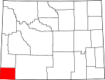
Uinta County, Wyoming Basics:


Uinta County Wyoming - Government Site

Population: 21,047
Area: 2081 square miles
County seat: Evanston
Area code(s) in use: 307
Time zone: MST
High school graduate or higher: 88.3%
Bachelor's degree or higher: 18.3%
Median household income: $59,714
Persons in poverty: 12.4%
Home ownership rate: 74.5%
Mean travel time to work: 21.6 minutes


Adjacent counties:
Daggett (UT)  Lincoln  Rich (UT)  Summit (UT)  Sweetwater  

Find in Wyoming

Map of the Uinta County area


Our detail map of Uinta County shows the Uinta County, Wyoming boundary lines and other interesting items.

Places in Uinta County, Wyoming

  Airports     show all on map

Evanston-Uinta County Airport - Burns Field, Evanston-Uinta County Airport - Burns Field, Fort Bridger Airport

  Areas     show all on map

Pine Grove, Twentyone Grove

  Basins     show all on map

Cedar Basin, Chalk Creek Basin, Cow Pit Number 3, Leavitt Basin, Standard Pit

  Benches     show all on map

Bigelow Bench, Cottonwood Bench, Tipperary Bench

  Bends     show all on map

Bessie Bottom, Horseshoe Bend

  Buildings     show all on map

Evanston Police Department, Lyman Police Department, Mountain View Fire Department, Mountain View Police Department, Uinta County Emergency Medical Services Lyman, Uinta County Fire Protection Bear River, Uinta County Fire Protection Evanston Headquarters, Uinta County Fire Protection Evanston Station 2, Uinta County Fire Protection Evanston Station 3, Uinta County Fire Protection Fort Bridger, Uinta County Fire Protection Lyman, Uinta County Sheriff's Office Evanston, Uinta County Sheriff's Office Mountain View

  Canals     show all on map

Adin Brown Ditch, Austin Canal, Bear Canal, Bear Canal, Bear River Canal, Bigelow Ditch, Bigelow Ditch, Blacks Fork Canal, Botero Ditch, Botero Ditch, Bridger Butte Canal, Byrne Ditch Number 2, Byrne Number 2 Ditch, Cedar Basin Ditch, Cedar Basin Ditch, Center Ditch, Chapman Canal, Christensen Ditch, City Ditch, Crompton Ditch, Crown Ditch, Davis and Company Ditch, Fort Bridger Canal, Grimsley Ditch, Hilliard East Fork Canal, Hilliard Westside Canal, J E Ditch, Kidman Well Canal, Lambs Supply Ditch, Lannon Ditch, Lee Ditch, Luckey Ditch, Milich Ditch, Morris Ditch, Murray Ditch, Nielsen Ditch, Oasis Ditch, Old City Ditch, Outlet Cross Ditch, Pate Ditch, Pine Grove Canal, Pine Grove Canal, Pine Grove Canal, Stag Hollow Ditch, Tunnel Ditch, Twin Buttes Canal, Urie Ditch, Wash Supply Ditch

  Cemeteries     show all on map

Almy Cemetery, City Cemetery, Evanston Cemetery, Fort Bridger Cemetery, Johnson Cemetery, Lonetree Cemetery, Millburne Cemetery, Spring Valley Cemetery

  Census     show all on map

Carter Census Designated Place, Fort Bridger Census Designated Place, Lonetree Census Designated Place, Robertson Census Designated Place, Urie Census Designated Place

  Churches     show all on map

Williard Ward Church

  Cliffs     show all on map

Rocky Point, The Needles

  Dams     show all on map

Beaver Lake Dam, Blake Dam, Broadbent Number 2 Dam, Byrne Dam, Byrne Dam, Chesney Dam, Church Buttes Dam, Clifford F Graham Dam, Cottonwood Dam, Crompton Dam, Davis Number 2 Dam, East Dam, Erickson Dam and Reservoir, Graham Dam, Guild and Dean Dam, Guild Dam, Heber Dam, Little Peidmont Dam, Martin Dam, Massae Dam, Meeks Cabin Dam, Meeks Cabin Dam, Moslander Dam, Myers Dam, Painter Dam, Painter Number 1 Dam, Paterson Lake Dam, Piedmont Dam, Powers Stock Dam, Reed Dam, Sulphur Creek Dam, Tipperary Dam, Vacher Dam, Van Tassel Lake Dam, Wall Reservoir Dam, Woodruff Narrows Dam

  Flats     show all on map

Cumberland Flats, Gourley Meadows, Hamblin Park, Hilliard Flat, Lambs Meadow, Nebraska Flat, Poverty Flats, Sage Creek Park

  Gaps     show all on map

Bridger Gap, Session Pass, Spring Gap, Woodruff Lower Narrows, Woodruff Upper Narrows

  Hospitals     show all on map

Evanston Regional Hospital, Pioneer Counseling Resource Services Hospital, Rocky Mountain Care Hospital of Evanston, Wyoming State Hospital

  Lakes     show all on map

Archie Pond, Lake Louise

  Locales     show all on map

Bear River Mall, Church Butte Camp, Church Buttes Siding, Company Ranch, Deadhorse State Hospital Camp, Eakin Pumping Station, Evanston Pumping Station, Front Street Mall, Hickey Ranch, Meeks Cabin (historical), Meeks Cabin Campground, Millersville (historical), Moss Agate Cut, Perry Ranch, Ragan, Rock Cut, Scullys Gap, Slagowski Ranch, Smith Ranch, Spring Valley, The Boilers, Uinta County Youth Camp, Yellow Creek Shopping Mall

  Mines     show all on map

Almy Number Five Mine, Almy Number Forty-one Mine, Almy Number Four Mine, Almy Number One Mine, Almy Number Seven Mine, Almy Number Six Mine, Almy Number Thirty-one Mine, Almy Number Three Mine, Almy Number Two Mine, Bertagonilli Mine, Brilliant Number Eight Mine, Carter Mine, Cumberland Gap Mine, Cumberland Number One Mine, Cumberland Number Three Mine, Cumberland Number Twenty-five Mine, Davis Mine, Diamond Alkali Company Number One Mine, Isaac Kampman Mine, Jager Oil Prospect, Jakes Mine, Jamison Claim, Junction Mine, Kendall Mine, Lazeart Mine, Lee Mine, Lezear Opening Mine, Oyster Ridge Mine, R.L. Connelly Mine, Richardson Mine, Spring Valley Mine

  Parks     show all on map

Cowboy Cabin Park, Deadhorse Park, Jacks Park, Slab Park

  Populated Places     show all on map

Almy, Altamont, Antelope, Aspen, Bear River, Beartown, Bridger, Byrnes Crossing, Carter, Carter Cedars, Elkhurst, Evanston, Fort Bridger, Hampton, Hilliard, Lonetree, Lyman, Millburne, Mountain View, Piedmont, Robertson, Three Forks, Urie, Verne

  Ranges     show all on map

Bald Range, Session Mountains

  Reservoirs     show all on map

Austin Reservoir, Austin Reservoir, Balsam Root Reservoir, Beaver Lake, Behunin Reservoir, Bigelow Bench Reservoir, Blake Reservoir, Broadbent Number 2 Reservoir, Buck Basin Reservoir, Byrne Reservoir, Byrne Reservoir, Byrne Reservoir, Byrne Reservoir, Cedar Brake Reservoir Number 1, Cedar Mountain Reservoir Number 7, Chesney Reservoir, Church Buttes Reservoir, Clematis Reservoir, Cliff Graham Reservoir Number 3, Clifford F Graham Reservoir, Cottonwood Reservoir, Cottonwood Reservoir, Cow Reservoir Number 1, Crompton Reservoir, Crompton Reservoir, Davis Number 2 Reservoir, Dobie Reservoir, Dry Creek Reservoir, East Reservoir, Erickson Reservoir, Graham Reservoir, Graham Reservoir Number 1, Guild and Dean Reservoir, Guild Reservoir, Guild Reservoir, Heber Reservoir, Hickey Mountain Reservoir, High Mesa Reservoir Number 2, Little Peidmont Reservoir, Little Piedmont Reservoir, Martin Reservoir, Massae Reservoir, Meeks Cabin Reservoir, Meeks Cabin Reservoir, Moslander Reservoir, Moslander Reservoir, Murray Reservoir, Myers Reservoir, Myers Reservoir, Painter Number 1 Reservoir, Painter Reservoir, Piedmont Reservoir, Powers Stock Reservoir, Reed Reservoir, Sage Mountain Reservoir, Standard Reservoir, Sulphur Creek Reservoir, Sulphur Creek Reservoir, Thirtythree Pond, Tipperary Reservoir, Vacher Reservoir, Van Tassel Lake, Wall Development Company Reservoir, Wall Reservoir, Well Reservoir, Whisky Reservoir, Woodruff Narrows Reservoir

  Ridges     show all on map

Buck Fever Ridge, Cap White Ridge, Knight Ridge, Little Hogsback, Meyers Ridge, Moslander Ridge, Mumford Ridge, Murphy Ridge, Oyster Shell Ridge, Pine Ridge, Sandy Ridge, The Hogsback

  Schools     show all on map

Aspen School, Clark School, Davis Middle School, Evanston High School, Evanston Middle School, Fort Bridger School, Lyman High School, Lyman Middle School, Lyman School, Mountain View High School, Mountain View Middle School, Mountain View School, North Evanston School, Uinta Meadows School, Urie School

  Springs     show all on map

Barrel Springs, Big Spring, Bigelow Springs, Butcher Knife Spring, Carter Spring, Cold Spring, Cold Spring, Cold Spring, Cold Springs, Corral Spring, Crompton Spring, Dog Spring, Eight Spring, Foote Spring, Grove Spring, Mine Spring, Mineral Springs, Mulkay Spring, Musselman Springs, Nielsen Spring, Pitcher Spring, Roadside Spring, Rocky Springs, School Section Spring, Section 2 Spring, Seventeen Spring, Shurtliff Spring, Webb Spring, Whiskey Spring

  Streams     show all on map

Albert Creek, Alkali Creek, Antelope Creek, Antone Creek, Archie Creek, Aspen Creek, Basin Creek, Bazoo Hollow Creek, Beaver Creek, Bell Creek, Bugas Spring Creek, Bull Creek, Byrne Creek, Carter Spring Creek, Cellar Creek, Chicken Creek, Clear Creek, Clear Creek, Cold Springs Creek, Cottonwood Creek, Cottonwood Creek, Cottonwood Creek, Cottonwood Creek, Coyote Creek, Drown Creek, Dry Creek, East Branch Little Creek, East Branch Silver Springs Creek, East Fork Smiths Fork, East Muddy Creek, Evans Creek, Evans Creek, Felter Creek, Fish Creek, Fowkes Canyon Creek, Gilbert Creek, Groshon Creek, Hague Creek, Hill Creek, Hinshaw Creek, Honey Creek, Horse Creek, Jones Creek, LaChapelle Creek, Lamb Creek, Leavitt Creek, Little Blacks Fork, Little Byrne Creek, Little Creek, Little Dee Creek, Little Dry Creek, Little Gilbert Creek, Little Muddy Creek, Little Sage Creek, Little West Fork Blacks Fork, Little Yellow Creek, Lonetree Creek, Louse Creek, Meeks Creek, Middle Fork Beaver Creek, Middle Fork Fowkes Canyon Creek, Middle Fork Sheep Creek, Mill Creek, Moss Creek, Muddy Creek, Mussleman Creek, North Creek, North Fork Fowkes Canyon Creek, Piedmont Creek, Pleasant Valley Creek, Quarry Creek, Red Canyon Creek, Red Rock Fork Salt Creek, Rock Creek, Ryckman Creek, Sage Creek, Salt Creek, Shurtleff Creek, Silver Springs Creek, Sixmile Creek, Sixmile Creek, Smiths Fork, Smiths Fork, South Creek, South Fork Fowkes Canyon Creek, South Fork Sheep Creek, Spring Creek, Spring Creek, Spring Creek, Stoney Run, Stowe Creek, Sulphur Creek, Thief Creek, Threemile Creek, Van Tassel Creek, Wasatch Creek, West Fork Beaver Creek, West Fork Smiths Fork, West Muddy Creek, Whitney Canyon Creek, Whitney Creek, Willow Creek, Willow Creek, Willow Creek, Willow Creek, Yellow Creek, Yellow Hollow Creek

  Summits     show all on map

Aspen Mountain, Bald Knoll, Bell Butte, Bridger Butte, Burnt Hill, Chapman Butte, Church Butte, Cottonwood Mountain, Dans Nipple, Hanks Hill, Haystack Butte, Hickey Mountain, Leavitt Bench, Medicine Butte, North Sheep Mountain, Pine Knoll, Round Mountain, Sage Creek Mountain, South Sheep Mountain, Sugarloaf Butte, Table Mountain, The Butte, The Hogback, The Nipple, The Pinnacle, The Pinnacle, Thunderbolt Mountain, Turtle Hill, Twenty Knoll, Wells Flat, Wildcat Butte

  Towers     show all on map

KBVZ-FM (Fort Bridger), KEVA-AM (Evanston), KOTB-FM (Evanston)

  Trails     show all on map

Emigrant Trail, Emigrant Trail, Emigrant Trail, Emigrant Trail, Emigrant Trail

  Tunnels     show all on map

Altamont Tunnel, Aspen Tunnel

  Valleys     show all on map

Acocks Canyon, Alma Holt Draw, Anna Holt Draw, Austin Wash, Balsam Draw, Bartlett Hollow, Beaver Dam Hollow, Bernard Hollow, Berry Draw, Big Draw, Big Hollow, Blake Hollow, Blumel Draw, Bog Draw, Brewster Draw, Bruff Draw, Bugas Draw, Burton Hollow, Butcher Knife Draw, Byrnes Draw, Caterpillar Draw, Choppy Draw, Christensen Hollow, Clifton Hollow, Coal Hollow, Coal Mine Draw, Cook Draw, Cottonwood Hollow, Cove Draw, Crooked Canyon, Dog Spring Wash, Dry Canyon, Dry Hollow, Dry Wash, Duel Hollow, Duncomb Hollow, Fowkes Canyon, Glasscock Hollow, Grassy Draw, Grassy Hollow, Guild Hollow, Guild Hollow, Hank Hollow, Harding Hollow, Haystack Draw, Haystack Draw, Ingersoll Wash, Jack Hollow, Jackknife Draw, Knight Hollow, Limekiln Gulch, Long Hollow, Long Hollow, Long Hollow, Lost Draw, Lyman Draw, Meadow Draw, Meadow Draw, Mud Spring Hollow, Musselman Draw, Perry Draw, Picnic Hollow, Randall Draw, Red Canyon, Richardson Draw, Robinson Hollow, Rock Hollow, Rocky Hollow, Section Six Draw, Section Three Draw, Sheep Draw, Sheep Draw, Shell Hollow, Short Draw, Sims Canyon, Soda Hollow, South Draw, Spring Hollow, Stagecoach Hollow, Steves Draw, Sulphur Hollow, Taylor Draw, Thistle Hollow, Thomas Canyon, Toms Draw, Triangulation Point Draw, Twomile Draw, Twomile Hollow, Urie Draw, Wasmer Draw, West Musselman Draw, Whitney Canyon, Young Hollow,

Uinta County, Wyoming Population By Race (2012 estimate)

RacePopulation
WhiteUinta County White population 20,20520,205  
MixedUinta County Mixed population 337336
American IndianUinta County American Indian population 253252
BlackUinta County Black population 126126
AsianUinta County Asian population 8484
Hawaiian & Pacific IslanderUinta County Hawaiian & Pacific Islander population 4242

Additional population tables :
State population table
Wyoming population by county