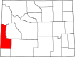
Lincoln County, Wyoming Basics:


Lincoln County Wyoming - Government Site

Population: 17,960
Area: 4076 square miles
County seat: Kemmerer
Area code(s) in use: 307
Time zone: MST
High school graduate or higher: 93.0%
Bachelor's degree or higher: 23.2%
Median household income: $62,542
Persons in poverty: 7.1%
Home ownership rate: 83.2%
Mean travel time to work: 27.5 minutes


Adjacent counties:
Bear Lake (ID)  Bonneville (ID)  Caribou (ID)  Rich (UT)  Sublette  Sweetwater  Teton  Uinta  

Find in Wyoming

Map of the Lincoln County area


Our detail map of Lincoln County shows the Lincoln County, Wyoming boundary lines and other interesting items.

Places in Lincoln County, Wyoming

  Airports     show all on map

Afton Municipal Airport, Alpine Airport, Cokeville Municipal Airport, Freedom Air Ranch Airport, Heiner Airport, Kemmerer Municipal Airport, Lone Pine Flying Ranch Airport, South Lincon Medical Center Heliport, Star Valley Ranch Airport

  Areas     show all on map

Big Bend, Hams Fork Plateau, Red Castles

  Bars     show all on map

Pine Bar

  Basins     show all on map

Bridger Basin, Colorado River Divide Great Basin, Dempsey Basin, Fontenelle Basin, Forest Dell, Grizzly Basin, Lake Basin, Long Spring Basin, Pomeroy Basin, Pomeroy Basin, Raymond Basin, Red Eye Basin, Salt Basin, Schuster Basin

  Benches     show all on map

Chrisman Bench, Opal Bench

  Bends     show all on map

Oregon Trail Lander Cutoff, The Elbow

  Bridges     show all on map

Greys River Bridge, Squaw Creek Bridge

  Buildings     show all on map

Afton Volunteer Fire Department, Alpine Fire Department, Bear River Fire District / Cokeville Fire Department, Bridger - Teton National Forest Greys River Ranger District Fire Engine Crew, Bridger - Teton National Forest Kemmerer Ranger District Fire Engine Crew, Cokeville Police Department, Diamondville Police Department, Kemmerer Police Department, Kemmerer Volunteer Fire Department, La Barge Volunteer Fire Department, Lincoln County Sheriff's Office, South Lincoln County Emergency Medical Services, South Lincoln County Emergency Medical Services, Star Valley Medical Center Emergency Medical Services, Thayne Ambulance, Thayne and Rural Volunteer Fire Department

  Canals     show all on map

Anderson Ditch, Anderson Howard Canal, Ardie Ditch, Baker Ditch, Beckwith and Quinn Canal, Beckwith and Quinn Ditch, Bedford Canal, Beta Ditch, Bryan Ditch, Chrisman Ditch Number 1, Cottonwood Canal, Covey Canal, D C P Ditch, Delaney Ditch, East Side Canal, East Stock Ditch, Emelle Ditch, Fabian and Tyler Ditch, Fabian Ditch, Fairview Canal, Francis Ditch, Graham Ditch, Green River Supply Canal Lateral Number 1, Guyette Ditch Number 1, Hardman Ditch, Hyrum Smith Ditch, Jigger Ditch, Johnson Ditch, Johnson Spencer Ditch, Jones North Ditch, Jones South Ditch, King Ditch, Mau Ditch, McFarland Ditch, Moxa Ditch, Noblitt Ditch, Nutria Ditch, Old Mexican Ditch, Park Ditch Number 1, Perry and Partridge Ditch, Philbrick and Johnson Ditch, Phillips and Reel Ditch, Pixley Ditch, Ranchero Ditch, River Ditch, Roberson Ditch, Rocky Point Ditch, Rowe Ditch, Shafer Ditch, Sights Ditch, Smith Ditch, Smith Ditch Number 1, South Fork Ditch, South Side Ditch, State Line Ditch, Steed Ditch, Stoner Nelson Wheelock Ditch, Sublet Ditch, Tanner Hunt Garrett, Taylor Canal, Twin Creek Ditch, Valley Ditch, Vermillion Ditch, W L Smith Ditch, West Side Ditch, White Water Ditch, Winslow Hallock and Capen Ditch, Wright Ditch, Ziegler Ditch

  Cemeteries     show all on map

Afton Cemetery, Auburn Cemetery, Ball Cemetery, Bedford Cemetery, Cokeville Cemetery, Cumberland Cemetery, Elizabeth Paul Grave, Estella Brown Grave, Etna Cemetery, Fairview Cemetery, Grover Cemetery, Hamstork Cemetery, Holden Cemetery, Nancy Hill Grave, Smoot Cemetery, Thayne Cemetery

  Census     show all on map

Alpine Northeast Census Designated Place, Alpine Northwest Census Designated Place, Auburn Census Designated Place, Bedford Census Designated Place, Etna Census Designated Place, Fairview Census Designated Place, Fontenelle Census Designated Place, Freedom Census Designated Place, Grover Census Designated Place, Nordic Census Designated Place, Oakley Census Designated Place, Osmond Census Designated Place, Smoot Census Designated Place, Taylor Census Designated Place, Turnerville Census Designated Place

  Cliffs     show all on map

Crockers Point, Names Hill, Pow Wow Point, Skull Point, Windy Point

  Dams     show all on map

Afton Electric Dam, Aimo Dam, B-Q Dam, C H Smith Dam, Colletti Number 2 Dam, Cottonwood Lake Dam, Elias P Dam, Fmc Dam, Fontenelle Dam, Fontenelle Dam, Franklin Dam, Graham Number 2 Dam, Holland Dam, Kemmerer Number 1 Dam, Lake Viva Naughton Dam, Landslide Dam, Molinar Dam, Naughton Ash Pond Number 2 Dam, Philip Lake Dam, Pixley Dam, Poison Creek Dam, Q P Dam, Rich Dam, Richey Dam, Thoman Dam, Willey Number 1 Dam

  Falls     show all on map

Lewis Falls, Spring Creek Falls, Wohelo Falls

  Flats     show all on map

Allred Flat, Big Park, Burnt Bend, Button Flat, Collett Flat, Craven Creek Meadows, Horse Heaven Meadows, Indian Grave Flat, Japanese Park, LaBarge Meadows, Little Park, Lunch Creek Meadows, Mammoth Hollow, Moose Flat, Mud Springs Flats, Mule Meadow, Poison Meadows, Red Park, Roosevelt Meadows, Salt Flat, Squaw Flat, Sublette Flat

  Forests     show all on map

Bridger National Forest

  Gaps     show all on map

Blazon Gap, Box Canyon Pass, Cheese Pass, Cliff Creek Pass, Cumberland Gap, Fontenelle Gap, Gunsight Pass, McDougal Pass, North Indian Creek Pass, Pickle Pass, Red Pass, Rocky Gap, Salt River Pass, Sheep Pass, Telephone Pass, The Narrows, The Narrows, Wagner Pass, White Saddle, Windy Gap, Wright Divide

  Guts     show all on map

Forgen Slough, The Slough

  Hospitals     show all on map

South Lincoln Medical Center, Star Valley Latter Day Saints Hospital (historical), Star Valley Medical Center

  Islands     show all on map

Ball Island

  Lakes     show all on map

Bailey Lake, Blind Bull Lake, Corral Creek Lake, Cottonwood Lake, Crow Creek Lakes, Crystal Lake, Crystal Lake, Devils Hole Lakes, Dry Creek Lake, Fontenelle Lakes, Huff Lake, Lake Alice, Lake Bastow, Little Jenny Lake, Lost Lake, Mud Lakes, Mud Springs Lake, Murphy Lakes, Quarter Corner Pond, Roaring Fork Lakes, Rock Lake, Shute Creek Lake, Slide Lake, South Three Forks Lakes, Spring Lake, Stump Lake, Swift Creek Lake, Travis Lake, Twin Creek Lakes, Wagner Lake, Waterdog Lake

  Locales     show all on map

Afton Rest Area, Allred Flat Recreation Site, Alpine Campground, Alpine Summer Home Area, Beckwith, Big Spring Recreation Site, Box Y Ranch, Bridge Campground, Corral Creek Guard Station, Cottonwood Lake Campground, Crystal Lake Recreation Site, Deer Creek Guard Station, East Elbow Campground, East Table Creek Campground, Elbow Campground (historical), Elk Creek Forest Service Station, Facenelli Ranch, Forest Park Campground, Forest Park Elk Wintering Area, Forks Campground, Glencoe Junction, Grand Canyon Boat Landing, Greys River District Ranger Office, Hams Fork Campground, Hayward Place (historical), Herschler Ranch, Hobble Creek Recreation Site, Jamison Ranch, Kelley Guard Station, Kemmerer Field Club Golf Course, KOA Campground, LaBarge Guard Station, Larsen Ranch, Lincoln County Fair Grounds, Lynx Creek Campground, Marse, McCain Guard Station, Meadow Creek Guard Station, Meadows Forest Service Facility, Moose Flat Campground, Moxa, Moyer, Murphy Creek Campground, Nutria, Old Dutch John Ranch, Peroidic Spring Recreation Site, Pixley, Rainbow Camp, Rimrock Ranch, Salt River Pass Recreation Site, Scaler Guard Station, Sheep Gulch Boat Ramp, Smiths Fork Guard Station, Station Creek Campground, Storm Shelter Cabin Number 2, Swift Creek Campground, The Rock Slide, Turnerville Community, Water Tank Number 8, Waterfall, Waterfall, West Table Creek Boat Ramp, Wolf Creek Campground, Wyoming Game and Fish Administrative Site, Ziller Ranch

  Mines     show all on map

Adaville Mine, Afton Creek Mine, Alpine Mine, Alpine Mine, Beaver Creek Mine, Biazon Mine, Blazon Mine, Blind Bull Mine, Brilliant Number Eight Mine, Budd Prospect Mine, Coantag Prospect, Cokeville Mine, Conroy Mine, Cottonwood Mine, Cumberland Number Three Mine, Deadman Gulch Mine, Diamondville Number 1 Mine, Dry Canyon Mine, Elkol Strip Mine, Fitzpatrick Mine, Five-South Mine, Fossil Fish Quarries, Frontier Number 1 Mine, Frontier Number 3 Mine, Glencoe Mine, Gomer Mine, Government Mine, Griggs Mine, Haddenham Mine, Kemmerer Mine, Kemmerer Number 5 Mine, Kemmerer Number Four Mine, Kemmerer Number One Mine, Leefe Mine, Lincoln Star Mine, McDouglas Pass Mine, New Twin Creek Mine, North Forty Pit, Oakley Mine, Old Blind Bull Mine, Pacific Coal Company Mine, PIKL Coal Mine, Pine Bar Diggings, Poison Creek Mine, Radiant Mine, San Francisco Chemical Company Number Five Mine, San Francisco Chemical Company Number Four Mine, San Francisco Chemical Company Number One Mine, San Francisco Chemical Company Number Three Mine, San Francisco Chemical Company Number Two Mine, Sayley Mine, Sheep Creek Canyon Mine, Sheep Creek Divide Mine, Smith Mine, Smiths Fork Mine, Spencer Call Sand and Gravel Pit, Spring Lake Creek Prospect, State Line Pit, Stauffer Chemical Company Rocky Point Mine, Sudden Number One Mine, Susie Mine, Swift Creek Area Mine, Top of the World Mine, Tunp Range Number One Mine, Tunp Range Number Three Mine, Twin Creek Mine, Twin Creek Number Two Mine, Vail Mine, Viola Area Mine, West Branch Hams Fork Creek Mine, West Mine

  Parks     show all on map

Fontenelle Recreation Area, Fossil Butte National Monument, Grover Park, Nugent Park

  Populated Places     show all on map

Afton, Alpine, Alpine Junction, Auburn, Bedford, Blazon Junction, Border Junction, Carlson, Cokeville, Diamondville, Elkol, Etna, Fairview, Fontenelle, Fossil, Frontier, Grover, Kemmerer, La Barge, Leefe, Opal, Osmond, Rocky Crossing, Sage, Smoot, Star Valley Ranch, Thayne, Turnerville, Viola, Willow Addition

  Post Offices     show all on map

Alpine Post Office (historical)

  Ranges     show all on map

Gannett Hills, Red Hills, Salt River Range, Sublette Range, Tunp Range, Wyoming Range

  Reservoirs     show all on map

Afton Electric Reservoir, Aimo Reservoir, Billy Canyon Reservoir Number 1, C H Smith Reservoir, Cercocapia Reservoir, Colletti Number 2 Reservoir, Conroy Lake, Cottonwood Lake, Craven Creek Reservoir, Elias P Reservoir, Fmc Reservoir, Fontenelle Reservoir, Fourth Creek Reservoir, Franklin Reservoir, Graham Number 2 Reservoir, Graham Reservoir, Holland Reservoir, Kemmer Number 1 Reservoir, Kemmerer Reservoir, Lag Reservoir, Lake Viva Naughton, Larson Reservoir, Molinar Reservoir, Naughton Ash Pond Number 2, Philip Reservoir, Pocket Reservoir, Poison Creek Reservoir, Q P Reservoir, Quealy Reservoir, Question Mark Reservoir, Rich Reservoir, Richey Reservoir, Skull Point Reservoir, Swift Creek Lake, Thomas Reservoir, Utah Power and Light Company Hams Fork Reservoir, White Rock Pit Reservoir, Willey Number 1 Reservoir

  Ridges     show all on map

Absaroka Ridge, Bear River Divide, Boulder Ridge, Buckskin Knoll, Commissary Ridge, Dempsey Ridge, Fontenelle Hogbacks, Fossil Ridge, Grayback Ridge, Hams Fork Ridge, Indian Ridge, Mahogany Ridge, Middle Ridge, Mormon Knolls, Muddy Ridge, Oyster Ridge, Pine Knoll, Pine Ridge, Porcupine Ridge, Rock Creek Ridge, Rubey Point, Sillem Ridge, Slate Creek Ridge, Star Peaks, Stoffer Ridge, Tri Basin Divide, Tygee Ridge, Witherspoon Ridge

  Schools     show all on map

Afton Elementary School, Burgoon School, Cokeville High School, Cokeville Junior High School, Cokeville School, Holdaway Elementary School, Holdaway School, Kemmerer High School, Kemmerer Middle School, Kemmerer School, Metcalf School, Osmond School, Star Valley Elementary School, Star Valley High School, Star Valley High School, Star Valley Junior High School, Star Valley Junior High School, Thoman Ranch School

  Springs     show all on map

Alkali Spring, Big Spring, Cedar Spring, Coyote Spring, Curtis Spring, Drubby Spring, Emigrant Spring, Emigrant Spring, Gil Smith Spring, Gooseberry Spring, Hogsback Spring Number 2, Indian Spring, Jenkins Springs, Little Round Mountain Spring, Mud Spring, Mud Springs, OE Spring, Ollie Spring, Opal Springs, Periodic Spring, Roberson Spring, Shot Hole Spring, Stirrup Spring, Sucker Spring, Van Gilder Spring, Warfield Springs, Wild Horse Spring, Willow Springs, Wyman Spring, Young Spring

  Streams     show all on map

Adams Creek, Alice Creek, Alkali Creek, Allen Creek, Anderson Creek, Anderson Creek, Antelope Creek, Apperson Creek, Aspen Creek, Aspen Creek, Astle Creek, Bailey Creek, Bald Hornet Creek, Bartlett Creek, Basin Creek, Beachler Creek, Bear Creek, Bear Trap Creek, Bearhole Creek, Beaver Creek, Beaver Dam Creek, Big Fall Creek, Birch Creek, Birch Creek, Birch Creek, Bird Creek, Blind Bull Creek, Blind Trail Creek, Blue Bell Creek, Bluejay Creek, Boco Creek, Bourne Creek, Box Canyon Creek, Bridger Creek, Bridger Fork, Bruner Creek, Buck Creek, Bug Creek, Bull Creek, Bullpen Creek, Burdick Creek, Burke Creek, Cabin Creek, Cabin Creek, Cabin Creek, Call Creek, Camp Creek, Camp Creek, Camp Creek, Camp Creek, Campfire Creek, Carl Creek, Carl Creek, Carter Creek, Cedar Creek, Cedar Creek, Chalk Creek, Chapel Creek, Chappel Creek, Chappell Creek, Chicken Creek, Chicken Creek, Child Creek, Christopherson Creek, Claudia Creek, Clear Creek, Clear Creek, Clear Creek, Clear Creek, Cliff Creek, Coal Branch, Coal Creek, Coal Creek, Coal Creek, Coal Creek, Coantag Creek, Collett Creek, Corlos Creek, Corral Creek, Corral Creek, Corral Creek, Cottonwood Creek, Cottonwood Creek, Cow Camp Creek, Cow Hollow Creek, Coyote Park Creek, Craven Creek, Crow Creek, Crow Creek, Crow Creek, Crystal Creek, Dead Dog Creek, Deadhorse Creek, Deadman Creek, Deer Creek, Deer Creek, Delaney Creek, Dempsey Creek, Devils Hole Creek, Dick Creek, Dip Creek, Dipper Creek, Dixon Slough, Dock Creek, Driveway Creek, Dry Canyon Creek, Dry Creek, Dry Creek, Dry Creek, Dry Fork, Dry Fork Smiths Fork, Dry Muddy Creek, Dutch George Creek, East Branch Willow Creek, East Fork Beaver Creek, East Fork Greys River, East Fork Hams Fork, East Fork Pole Creek, East Fork Salt Creek, East Fork Twin Creek, East Fork Willow Creek, East Table Creek, Edwards Creek, Elbow Creek, Electric Creek, Elk Creek, Elk Creek, Elk Hollow Creek, Emigrant Creek, Erwine Creek, Everly Creek, Fawn Creek, Fawn Creek, Fenn Creek, Fifth Creek, Fire Box Creek, Fire Trail Creek, First Creek, First Creek, First Creek, Fish Creek, Fish Creek, Fisher Creek, Flat Creek, Flat Creek, Florey Creek, Fontenelle Creek, Forked Creek, Fourth Creek, Fourth Creek, Fourth Creek, Fullturn Creek, Garrett Creek, Giraffe Creek, Gomm Creek, Grade Canyon Creek, Grassy Hollow Creek, Greys River, Grindstone Creek, Grover Creek, Halfturn Creek, Hams Fork Creek, Harmony Creek, Hawkins Creek, Heard Hollow Creek, Henderson Creek, Higby Creek, Hobble Creek, Hock Creek, Horse Creek, Horse Creek, Hot Foot Creek, Huff Creek, Hunter Creek, Indian Creek, Indian Creek, Iron Rim Creek, Isabel Creek, Jackknife Creek, Jackson Creek, Jensen Creek, Kelley Creek, Keyser Creek, King Creek, Kinney Creek, Krall Spring Creek, La Barge Creek, Lake Creek, Lake Creek, Lake Creek, Lake Creek, Lake Mountain Creek, Lander Creek, Lee Creek, Leeds Creek, Limekiln Creek, Little Bear Creek, Little Beaver Creek, Little Blind Bull Creek, Little Clear Creek, Little Coal Creek, Little Corral Creek, Little Cottonwood Creek, Little Elk Creek, Little Fall Creek, Little Greys River, Little Hornet Creek, Little Indian Creek, Little Indian Creek, Little Jo Creek, Little Muddy Creek, Little Muddy Creek, Little Park Creek, Little Red Creek, Little White Creek, Lookout Creek, Lost Creek, Lost Creek, Lost Creek, Lost Creek, Lost Horse Creek, Lower Cabin Creek, Lunch Creek, Lynx Creek, Mack Creek, Mahogany Creek, Man Creek, Marten Creek, Martha Creek, Mayfield Creek, McCain Creek, McNeel Creek, Meadow Creek, Meadow Creek, Middle Creek, Middle Fork Beaver Creek, Middle Fork Slate Creek, Middle Three Forks Creek, Mikes Hole Creek, Mill Creek, Mill Creek, Mill Creek, Miller Creek, Miller Creek, Miller Creek, Mink Creek, Minnehaha Creek, Minnie Holden Creek, Mistum Creek, Moffat Creek, Moore Creek, Moose Creek, Mud Creek, Muddy Creek, Muddy Creek, Muddy Creek, Mumford Creek, Murdock Creek, Murphy Creek, Nameless Creek, North Bartlett Creek, North Branch Cedar Creek, North Bridger Creek, North Chappel Creek, North Clear Creek, North Corral Creek, North Crow Creek, North Fork Alkali Creek, North Fork Cottonwood Creek, North Fork Deadman Creek, North Fork Dempsey Creek, North Fork Elk Creek, North Fork Fish Creek, North Fork Lander Creek, North Fork Leeds Creek, North Fork Little Muddy Creek, North Fork Murphy Creek, North Fork Pine Hollow Creek, North Fork Roney Creek, North Fork Sheep Creek, North Fork Sheep Creek, North Fork Slate Creek, North Fork Smiths Fork, North Fork Stoner Creek, North Fork Strawberry Creek, North Fork Swift Creek, North Fork Twin Creek, North Fork Willow Creek, North Muddy Creek, North Three Forks Creek, North Twin Creek, North Willow Creek, North Willow Creek, Olsen Creek, Packsaddle Creek, Packstring Creek, Park Creek, Park Creek, Pearson Creek, Perkins Creek, Peternal Draw, Phillips Creek, Phosphate Creek, Pickett Creek, Pine Creek, Pine Creek, Pine Hollow Creek, Pine Tree Creek, Pipper Creek, Placer Creek, Poison Creek, Poison Creek, Poker Creek, Pole Creek, Pomeroy Creek, Porcupine Creek, Porcupine Creek, Porcupine Creek, Potato Creek, Rabbit Creek, Red Creek, Red Creek, Red Eye Creek, Red Top Creek, Richardson Creek, Ridge Creek, Road Creek, Roaring Creek, Roaring Fork, Roberson Creek, Robinson Creek, Robinson Creek, Rock Creek, Rock Creek, Rock Creek, Rock Creek, Rock Creek, Roney Creek, Roos Creek, Rough Creek, Ryan Creek, Ryan Creek, Salt Creek, Salt Creek, Salt River, Sams Creek, Sawmill Creek, Sawmill Creek, Scotty Creek, Second Creek, Second Creek, Second Creek, Shafer Creek, Shale Creek, Shale Creek, Sheep Creek, Sheep Creek, Sheep Creek, Sheep Creek, Sheep Creek, Sheep Dip Creek, Shepard Creek, Shingle Mill Creek, Sixth Creek, Skull Creek, Slate Creek, Slide Creek, Sliderock Creek, Smallpox Creek, Smiths Fork, South Coantag Creek, South Crow Creek, South Doe Creek, South Fork Dempsey Creek, South Fork Elk Creek, South Fork Fontenelle Creek, South Fork Hams Fork, South Fork Leeds Creek, South Fork Little Greys River, South Fork Meadow Creek, South Fork Mill Creek, South Fork North Horse Creek, South Fork Pine Hollow Creek, South Fork Raymond Creek, South Fork Slate Creek, South Fork Smiths Fork, South Fork Stoner Creek, South Fork Sublette Creek, South Fork Twin Creek, South Indian Creek, South La Barge Creek, South Three Forks Creek, South Twin Creek, South Willow Creek, Sprague Creek, Spring Branch, Spring Creek, Spring Creek, Spring Creek, Spring Creek, Spring Creek, Spring Creek, Spring Creek, Spring Creek, Spring Creek, Spring Creek, Spring Creek, Spring Creek, Spring Creek, Spring Lake Creek, Spruce Creek, Squaw Creek, Squirrel Creek, Squirrel Creek, Station Creek, Steer Creek, Stepp Creek, Stewart Creek, Stewart Creek, Stewart Creek, Stoner Creek, Strawberry Creek, Stump Creek, Sublette Creek, Swab Creek, Swift Creek, Taylor Creek, Third Creek, Third Creek, Third Creek, Timber Creek, Tincup Creek, Toms Creek, Trail Creek, Trail Creek, Trail Creek, Trail Creek, Trail Creek, Trail Creek, Trail Fork, Travis Creek, Trespass Creek, Tuffield Creek, Turkey Creek, Twin Creek, Twin Creek, Upper Cabin Creek, Wagner Creek, Warfield Creek, Water Creek, Way Creek, Weiner Creek, West Bailey Creek, West Beaver Creek, West Fork Beaver Creek, West Fork Dempsey Creek, West Fork Greys River, West Fork Hams Fork, West Fork Smiths Fork, West Table Creek, West Willow Creek, Wheat Creek, Whiskey Creek, Whiskey Creek, White Creek, White Pine Creek, Wilkinson Creek, Willow Creek, Willow Creek, Willow Creek, Willow Creek, Willow Creek, Witherspoon Creek, Wolf Creek, Wyman Creek, Wyman Spring Branch, Zieglers Wash

  Summits     show all on map

Bald Mountain, Big Hill, Bradley Mountain, Bridger Hill, Bull Mountain, Cabin Creek Peak, Cavanaugh Peak, Clause Peak, Coke Mountain, Deadhorse Peak, Deadman Mountain, Desertion Point, Electric Peak, Eli Hill, Elk Mountain, Elk Mountain, Five Slash Fifty-Three Knoll, Fontennelle Mountain, Fort Hill, Fossil Butte, Graham Peak, Granny Peak, Green Knoll, Haderlie Knoll, Haystack Peak, High Top, Holden Hill, Indian Peak, Johnson Knoll, Lake Mountain, Larsen Knoll, Little Round Mountain, Man Peak, Miller Mountain, Miller Mountain, Mount Coffin, Mount Fitzpatrick, Mount Isabel, Mount McDougal, Mount Thompson, Mount Wagner, Observation Peak, Pine Knoll, Pink Hill, Prater Mountain, Quealy Peak, Red Mountain, Red Peak, Red Top Mountain, Rock Lake Peak, Rocky Point, Round Hill, Round Mountain, Sand Knoll, Sawtooth Mountain, Sherman Peak, Slate Creek Butte, South Fork Mountain, Star Hill, Stewart Peak, Stratton Knoll, Sublette Mountain, The Big Knob, The Pinnacle, The Spur, Virginia Peak, Visser Peak, Wickiup Knoll, Wolf Mountain, Wyoming Peak

  Towers     show all on map

Cabin Creek Peak Lookout Tower, KCGL-FM (Diamondville), KMER-AM (Kemmerer), KRGA-FM (Kemmerer), KRSV-AM (Afton), KRSV-FM (Afton), Landmark Star Tower

  Trails     show all on map

Emigrant Trail, Oregon Trail - Lander Cutoff, Pine Creek Trail, Smiths Fork Greys River Stock Driveway, Stewart Trail, Wyoming Range Trail

  Valleys     show all on map

Alcohol Draw, Allred Canyon, Anderson Canyon, Anderson Canyon, Aspen Hollow, Bear Canyon, Bear Gulch, Bear Trap Gulch, Beard Canyon, Beaver Dam Canyon, Big Basin Canyon, Billy Canyon, Birch Gulch, Black Canyon, Blaney Canyon, Blind Canyon, Bloom Hollow, Boney Canyon, Boyd Hollow, Boyd Hollow, Bradshaw Canyon, Broad Canyon, Broad Hollow, Broad Hollow, Buck Canyon, Buckman Hollow, Bull Gulch, Bull Hollow, Bulldog Hollow, Burnt Hollow, Burnt Timber Canyon, Case Knife Canyon, Cemetery Gulch, Christy Canyon, Churchhouse Hollow, Cook Canyon, Corral Canyon, Deadhorse Canyon, Delaney Canyon, Driveway Canyon, Dry Canyon, Dry Gulch, Dry Hollow, Dry Hollow, Dry Wash, Dutson Canyon, Elbow Canyon, Ferney Gulch, Garden Canyon, Goblin Gulch, Gomm Hollow, Grade Canyon, Grand Canyon, Graveyard Canyon, Green Canyon, Groo Canyon, Hale Canyon, Hardmans Hollow, Hawthorn Hollow, Hay Hollow, Hemmert Canyon, Herman Canyon, Holden Hollow, Horse Trap Draw, Jensen Canyon, Jordan Canyon, Lake Gulch, Layland Canyon, Lily Hollow, Long Draw, Long Spring Canyon, Lund Draw, Marthas Canyon, Matthews Draw, Mill Hollow, Millet Canyon, Morgan Canyon, Mud Gulch, Mud Hollow, Newswander Canyon, North Lake Canyon, Nugget Canyon, Oakley Draw, Oat Canyon, Open Canyon, Poison Hollow, Poison Hollow, Poker Hollow, Pole Canyon, Pole Canyon, Pomeroy Draw, Prater Canyon, Preacher Hollow, Quakenasp Canyon, Quaking Aspen Hollow, Raymond Canyon, Red Canyon, Red Hollow, Road Hollow, Rose Canyon, Salt Canyon, Scout Canyon, Shale Hollow, Shearing Corral Hollow, Sheep Gulch, Slide Canyon, Smith Canyon, Snow Hollow, South Branch Cedar Creek, South Fork Hemmert Canyon, South Lake Canyon, Spring Gulch, Spruce Hollow, Spur Canyon, Squaw Fork Canyon, Star Valley, Steed Canyon, Steves Canyon, Suter Canyon, Telephone Hollow, Toms Creek Canyon, Trough Hollow, Twin Hollow, Twiss Hollow, Underwood Canyon, Warner Hollow, Water Canyon, Water Canyon, Watercress Canyon, West Fork Water Canyon, Windmill Draw, Wolfley Canyon, Wood Hollow, Y Canyon, Young Canyon

  Wells     show all on map

The Old Water Well,

Lincoln County, Wyoming Population By Race (2012 estimate)

RacePopulation
WhiteLincoln County White population 17,34917,349  
MixedLincoln County Mixed population 180179
BlackLincoln County Black population 144143
AsianLincoln County Asian population 9089
Hawaiian & Pacific IslanderLincoln County Hawaiian & Pacific Islander population 1817

Additional population tables :
State population table
Wyoming population by county