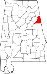
Cleburne County, Alabama Basics:


Cleburne County Alabama - Government Site

Population: 14,885
Area: 560 square miles
County seat: Heflin
Area code(s) in use: 256
Time zone: CST
High school graduate or higher: 74.2%
Bachelor's degree or higher: 9.5%
Median household income: $37,244
Persons in poverty: 18.0%
Home ownership rate: 78.7%
Mean travel time to work: 30.6 minutes


Adjacent counties:
Calhoun  Carroll (GA)  Cherokee  Clay  Haralson (GA)  Polk (GA)  Randolph  Talladega  

Find in Alabama

Map of the Cleburne County area


Our detail map of Cleburne County shows the Cleburne County, Alabama boundary lines and other interesting items.

Places in Cleburne County, Alabama

  Bridges     show all on map

Denman Bridge, Evans Bridge, Riddles Bridge, Ross Bridge

  Buildings     show all on map

Abernathy Volunteer Fire Department, Cleburne County Courthouse, Cleburne County Sheriff's Office, Fruithurst Volunteer Fire Department, Heflin City Hall, Heflin Fire Department, Heflin Police Department, Hollis Crossroads Volunteer Fire Department, Micaville Volunteer Fire Department, Muscadine Volunteer Fire Department, Piney Woods - Oak Level Volunteer Fire Department, Ranburne Fire and Rescue, Ranburne Town Police Department, Shoal Creek Ranger District Office, Turkey Heaven Volunteer Fire Department, Turkey Heaven Volunteer Fire Department Substation

  Cemeteries     show all on map

Ai Cemetery, Antioch Cemetery, Beason Grove Cemetery, Bethel Cemetery, Bethlehem Cemetery, Black Cemetery, Cherry Grove Cemetery, Cherry Grove Cemetery, Cleburne Memorial Garden, Cole Cemetery, Crumbleys Chapel Cemetery, Dunn Cemetery, Edwardsville Cemetery, Evans Cemetery, Evans Chapel Cemetery, Fordham Cemetery, Grimes Cemetery, Happy Hill Cemetery, Harmony Grove Cemetery, Heflin Cemetery, Hepsabah Cemetery, Macedonia Cemetery, Mars Hill Cemetery, Mount Olive Cemetery, Mount Perry Cemetery, New Harmony Cemetery, Old Liberty Cemetery, Payne Cemetery, Roe Cemetery, Stead Cemetery, Union Hill Cemetery, Upper Cane Creek Cemetery, Williams Cemetery, Wise Chapel Cemetery

  Census     show all on map

Hollis Crossroads Census Designated Place

  Churches     show all on map

Abel Bethsadia Church, Advents Church (historical), Ai Baptist Church, Antioch Church, Beason Grove Baptist Church, Bethel Church, Bethlehem Church, Beulah Church, Camp Creek Baptist Church, Campground Church, Canaan Church, Cane Creek Church, Cedar Creek Church, Central Church (historical), Cherry Grove Church (historical), Christian Church, Chulafinnee Church, Concord Church, Corinth Church, Corinth Church (historical), Cove Church (historical), Crossroads Church, Crumbleys Chapel Church of God, Evans Chapel, Fairview Church (historical), Five Points Church, Friendship Church, Grantley Church, Greens Chapel, Happy Hill Baptist Church, Harmony Grove Baptist Church, Heaven Bound Church, Heflin African Methodist Episcopal Church, Hepsabah Church, Hopewell Church, Howles Grove Church (historical), Hurricane United Methodist Church, Lebanon Church, Lecta Church, Liberty Hill Church, Lighthouse Church, Macedonia Baptist Church, Macedonia Church, Macedonia Church (historical), Mars Hill Church, Micaville Church (historical), Mount Olive Baptist Church, Mount Olive Church, Mount Paran Church, Mount Pleasant Church (historical), Mountain Creek Church, Mountain Grove Church, Mountain View Church, Muscadine Church, Muscadine Church, New Bethel Church, New Coldwater Church, New Harmony Church, New Hope Church, New Hopewell Baptist Church, Oak Grove Church, Oak Hill Church, Oak Level Church, Old Harmony Church, Old Salem Church (historical), Pilgrims Rest Church, Pine Grove Church, Pine Tuckey Church, Piney Woods Church, Pleasant Grove Church, Pleasant Hill Church, Pleasant Ridge Church, Rock Springs Church, Saint Michaels Church, Salem Grove Church, Shady Grove Church (historical), Shoal Creek Church, State Line Church, Union Hill Baptist Church, Upper Cane Creek Church, Verdin Chapel, Vise Grove Church, Wise Chapel Church, Wise Chapel United Methodist Church

  Cliffs     show all on map

Goat Bluff, Pulpit Rock

  Crossings     show all on map

Interchange 199, Interchange 205, Interchange 210, Smith Ford

  Dams     show all on map

Abel Dam, Aderhold Dam, Allen and Phillips Dam, Bell Dam, Bonner Dam, Boy Scout Dam, Cahulga Creek Watershed Dam Number 1, Carter Dam, Coleman Dam, Coleman Dam, Creighton Number 1 Dam, Creighton Number 2 Dam, Edmonds Lake Dam, Esterling and Burns Dam, Heflin Dam, Huston Dam, Lake Cleburne Dam, Laminack Dam, Lost Creek Watershed Dam Number 1, Lost Creek Watershed Dam Number 2, Lost Creek Watershed Dam Number 3, Lost Creek Watershed Dam Number 4, Nelson Dam, Owens Dam, Robinson Dam, Robinson Number 2 Dam, Snows Dam, Stricklin Dam, Terrapin Creek Watershed Dam Number 14, Terrapin Creek Watershed Dam Number 15, Terrapin Creek Watershed Dam Number 21, Terrapin Creek Watershed Dam Number 22, Terrapin Creek Watershed Dam Number 31, Terrapin Creek Watershed Dam Number 33, White Number 1 Dam, White Number 2 Dam

  Forests     show all on map

Talladega National Forest

  Gaps     show all on map

Abel Gap, Emory Gap, Mains Gap, Maxwell Gap

  Islands     show all on map

Rock Garden

  Lakes     show all on map

Beecham Lake, Morgan Lake

  Locales     show all on map

Andersons Store (historical), Barnes Mill (historical), Beason Mill, Bentons Mill (historical), Camp Hollis, Camp Sequoyah, Choccolocco Ranger Station, Cicero (historical), Cooks Mill (historical), Corn Grove (historical), Duck Nest Hunten Camp, Duck Nest Springs, Endora (historical), Fowlers Store (historical), Gibbs Store (historical), Honeycutt (historical), Laurel Shelter-Forest Service Facility, Lower Shoal Shelter, Mayfields Store (historical), McLeroys Store (historical), Northgutts Store (historical), Oakfuskee (historical), Oswalt (historical), Pine Glen Camping Area, Pound Mill (historical), Roberts Mill (historical), Robinsons Store (historical), Rosewood (historical), Shoal Creek (historical), Skinners Store (historical), Solomon (historical), Stone Hill (historical), Teagues Mill (historical), Vaughn Mill (historical)

  Mines     show all on map

Arbacoochee Lode and Placer Mine, Augusta Mine, Caver Mine, Flemming Mine, Jordan Mine, Morris Mine, Mulkey Prospect, Woodstock Mine

  Parks     show all on map

Bulldog Stadium, Cheaha State Park, Coleman Lake Campground and Picnic Area, Shoal Creek Picnic Area, Tiger Stadium

  Populated Places     show all on map

Abel, Abernathy, Ai, Arbacoochee (historical), Bell Mills, Belltown, Bethel, Borden Springs, Borden Wheeler Springs, Chulafinnee, Cleburne, Coldwater, Edwardsville, Five Points, Fruithurst, Gold Hill, Grantley, Heflin, Hightower, Hollis Crossroads, Hopewell, Lebanon, Lecta, Liberty Hill, Macedonia, Mars Hill, Micaville, Mount Pleasant, Muscadine, Oak Level, Palestine, Piney Woods, Plainview, Ranburne, Trickem, Union Hill

  Post Offices     show all on map

Fair Play Post Office (historical), Kemps Post Office (historical), Oakfuskee Post Office (historical), Winston Post Office (historical)

  Reserves     show all on map

Dugger Mountain Wilderness

  Reservoirs     show all on map

Abel Lake, Bonner Lake, Boy Scout Lake, Cahulga Creek Lake Number 1, Carters Lake, Cheaha Lake, Choccolocco Creek Lake Number 7, Coleman Lake, Coleman Lake, Creighton Lake Number 1, Creighton Number 2 Lake, Esterlings Lake, Gold Mine Lakes, Highrock Lake, Lake Charles, Lake Cleburne, Lake Edmond, Lake Heflin, Laminack Lake, Lost Creek Lake Number 1, Lost Creek Lake Number 2, Lost Creek Lake Number 3, Lost Creek Lake Number 4, Mineral Spring Pond, Mountain Brook Lake, Nelsons Lake, Owens Lake, Robinson Lake, Robinson Lake Number 2, Snows Lake, Stricklins Lake, Terrapin Creek Lake Number 15, Terrapin Creek Lake Number 21, Terrapin Creek Lake Number 22, Terrapin Creek Lake Number 31, Terrapin Creek Lake Number 33, Thomas Lake, Trudy Lake, Twin Lakes, White Lake Number 1, White Lake Number 2

  Ridges     show all on map

Augusta Mine Ridge, Bald Mountain, Big Tank Ridge, Blake Mountain, Brymer Mountain, Horseblock Mountain, Kemp Mountain, Little Tank Ridge, Wilson Ridge

  Schools     show all on map

Bethel School (historical), Chulafinnee School (historical), Cleburne County High School, Cleburne County Vocational School, Crossroads School (historical), Edwardsville Academy (historical), Fortner School (historical), Fruithurst Elementary School, Hale School (historical), Harmony Grove School (historical), Harris School (historical), Heflin Grammar School (historical), Heflin Training School, Hensen School (historical), Howells Grove School (historical), Liberty Hill School (historical), Macedonia School (historical), Oak Level Academy (historical), Overton School (historical), Piney Woods School (historical), Pleasant Grove Junior High School, Pleasant Hill School (historical), Pound School (historical), Ranburne High School, Slate Hill School (historical), Sunnyside School (historical), Union Hill School (historical), Wise School (historical), Woodrow School (historical)

  Springs     show all on map

Little Sulfer Springs, Murry Springs

  Streams     show all on map

Albright Creek, Bacchus Branch, Bennett Creek, Bobo Branch, Burton Creek, Cahulga Creek, Camp Creek, Cane Creek, Carr Creek, Cedar Creek, Chulafinnee Creek, Clear Creek, Dry Creek, Dynne Creek, Hales Fork, Henry Creek, Hog Creek, Holland Creek, Johnywady Creek, Kelley Creek, Kemp Creek, Ligon Creek, Little Lost Creek, Little Terrapin Creek, Little Terrapin Creek, Lockchelooge Creek, Lost Creek, Macola Creek, Marys Creek, Mathis Branch, Mountain Creek, Muscadine Creek, Newsome Branch, Nixon Branch, Norman Creek, Norman Creek, Owen Creek, Rocky Branch, Sheep Creek, Silas Creek, Snake Creek, South Fork Terrapin Creek, Swan Branch, Town Creek, Town Creek, Tumlin Creek, Tumlin Creek, Turner Creek, Verdin Creek, Wallace Creek, Williams Creek

  Summits     show all on map

Bald Rock, Bee Hill, Blue Mountain, Cheaha Mountain, Cottaquilla Mountain, Flag Mountain, Hitching Beech, Ivory Mountain, Johns Mountain, Mercer Mountain, Oak Hill, Oakey Mountain, Pine Mountain, Potter Mountain, Rattlesnake Mountain, Ross Mountain, Turkey Heaven Mountain, Wheeler Hill, Wilkinson Mountain

  Swamps     show all on map

Warner Swamp

  Towers     show all on map

Abel Horseblock Lookout Tower, Bankhead Lookout Tower, Dugger Mountain Lookout Tower, Oak Grove Lookout Tower, Turkey Heaven Mountain Lookout Tower, WCIQ-TV (Mount Cheaha),

Cleburne County, Alabama Population By Race (2012 estimate)

RacePopulation
WhiteCleburne County White population 14,08114,081  
BlackCleburne County Black population 551550
MixedCleburne County Mixed population 164163
American IndianCleburne County American Indian population 6059
AsianCleburne County Asian population 3029
Hawaiian & Pacific IslanderCleburne County Hawaiian & Pacific Islander population 1514

Additional population tables :
State population table
Alabama population by county