Peach County, Georgia Basics:


Peach County Georgia - Government Site

Population: 27,571
Area: 150 square miles
County seat: Fort Valley
Area code(s) in use: 478
Time zone: EST
High school graduate or higher: 80.6%
Bachelor's degree or higher: 18.4%
Median household income: $41,488
Persons in poverty: 26.6%
Home ownership rate: 66.8%
Mean travel time to work: 22.6 minutes

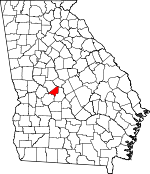
Adjacent counties:
Bibb  Crawford  Houston  Macon  Taylor  

Find in Georgia

Map of the Peach County area


Our detail map of Peach County shows the Peach County, Georgia boundary lines and other interesting items.

Places in Peach County, Georgia

  Airports     show all on map

Cameron Field Airport, Duke Airport, Miami Valley Farm Airport, Peachtree Landings Airport, Perry-Fort Valley Airport, Perry-Houston County, Smith Field Airport, Webb and Shepard Farm Airport

  Buildings     show all on map

Byron Police Department, Byron Public Library, Byron Volunteer Fire Department, Fort Valley City Hall, Fort Valley Fire Department Station 1, Fort Valley Fire Department Station 2, Fort Valley Police Department, Fort Valley State University Police, Peach County Courthouse, Peach County Fire Department Station 1, Peach County Fire Department Station 2, Peach County Fire Department Station 3, Peach County Fire Department Station 5, Peach County Fire Department Station 6, Peach County Jail, Peach County Sheriff's Office, Thomas Public Library

  Cemeteries     show all on map

Cliett Cemetery, Diamond Cemetery, Lisenby Cemetery, Miami Cemetery, Oak Lawn Cemetery, Scattergood Cemetery, Williams Cemetery, Willow Lake Cemetery

  Churches     show all on map

Allen Chapel, Allen Temple, Bethel Church, Byron Baptist Church, Chamlee Church, Church of Christ, Church of God, Congregational Methodist Church (historical), Fairview Church, Fellowship Primitive Baptist Church, First Baptist Church of Fort Valley, First Methodist Church, Fort Valley Church, Friendship Church, Full Gospel Lighthouse Church, Kingdom Hall Church, Little Bethel Church, Lizzie Chapel, Macedonia Church, Midway Church, Mount Olive Methodist Episcopal Church, Mount Pleasant Church, New Faith Church, Oak Lawn Church, Powersville Church, Richland Church, Rose Chapel (historical), Saint Andrews Episcopal Church, Saint John Church, Saint Juliana Church, Smyrna Church, Trinity Baptist Church, Union Baptist Church, Union Church, Ushers Temple

  Crossings     show all on map

Exit 44, Exit 45, Interchange 46

  Dams     show all on map

Cleveland Dam, Frances Fountain Dam, Howard North Dam, John Schofeld Dam, Lake Blue Bird Dam, Lake Clopine Dam, Louis Newberry Dam, Lucy Giles Dam, South Lake Dam, Whipple Dam

  Hospitals     show all on map

Peach Regional Medical Center

  Lakes     show all on map

Lake Clopine, Taylors Pond

  Locales     show all on map

Camp Benjamin Hawkins, Camp Care, Fort Valley Shopping Center, Middle Georgia Raceway (historical), North Peach Industrial Park, Peach Festival Outlet Center, Pineola Farms, South Peach Industrial Park

  Military     show all on map

Nike Site R-88C (historical), Nike Site R-88L (historical)

  Populated Places     show all on map

Albaugh, Alice Ingram Subdivision, Alpine Heights, Biss, Bryn Mawr, Byron, Clopine, Echeconnee, Edgewood, Fagan, Fort Valley, Grogan, Hartley, Hidden Forest, Indian Oaks, Kewanee Farms, Lakeview, Miami Valley, Myrtle, Oak Grove, Ohio, Peach Valley, Ponderosa Lake, Powersville, Stallworth Trailer Park, State College, Taylors Mill, Valley Pines, Washington Square, Willow Lake

  Post Offices     show all on map

Byron Post Office, Echeconnee Post Office (historical), Fort Valley Post Office, Powersville Post Office

  Reservoirs     show all on map

Blue Bird Lake, Cleveland Lake, Frances Fountain Lake, Housers Millpond, Howard North Lake, John Schofeld Lake, Lake Blue Bird, Lake Clopine, Louis Newberry Lake, Lucy Giles Lake, Scout Lake, Twin Lakes, Whipple Lake

  Schools     show all on map

Byron Elementary School, Byron School, Fort Valley Female College (historical), Fort Valley Female Seminary (historical), Fort Valley High School (historical), Fort Valley Male Academy (historical), Fort Valley Middle School, Fort Valley Primary School, Fort Valley State University, Friendship School (historical), Grady Institute (historical), Hunt Elementary School, Hunt School, Matthews School (historical), Peach County High School, Peach County Training School (historical), Royal C Peabody Trade School, Smyrna School (historical)

  Streams     show all on map

Dry Run Creek, Hickorynut Branch, Mule Creek

  Towers     show all on map

WKXK-FM (Fort Valley), WKXK-FM (Fort Valley), WPGA-FM (Perry), WQBZ-FM (Fort Valley), WXKO-AM (Fort Valley),

Peach County, Georgia Population By Race (2012 estimate)

RacePopulation
WhitePeach County White population 14,17114,171  
BlackPeach County Black population 12,60012,599
MixedPeach County Mixed population 414413
AsianPeach County Asian population 221220
American IndianPeach County American Indian population 138137
Hawaiian & Pacific IslanderPeach County Hawaiian & Pacific Islander population 2827

Additional population tables :
State population table
Georgia population by county