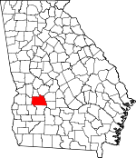
Sumter County, Georgia Basics:


Sumter County Georgia - Government Site

Population: 31,595
Area: 483 square miles
County seat: Americus
Area code(s) in use: 229
Time zone: EST
High school graduate or higher: 77.5%
Bachelor's degree or higher: 19.8%
Median household income: $33,528
Persons in poverty: 30.7%
Home ownership rate: 59.5%
Mean travel time to work: 18.7 minutes


Adjacent counties:
Crisp  Dooly  Lee  Macon  Marion  Schley  Terrell  Webster  

Find in Georgia

Map of the Sumter County area


Our detail map of Sumter County shows the Sumter County, Georgia boundary lines and other interesting items.

Places in Sumter County, Georgia

  Airports     show all on map

Carlan Airport, Jimmy Carter Regional Airport, Lowell Field Airport, Peterson Field Airport

  Buildings     show all on map

Americus City Hall, Americus Fire and Emergency Services Station 1, Americus Fire and Emergency Services Station 2, Americus Fire and Emergency Services Station 3, Americus Police Department, Andersonville Fire Department, Carnegie Library, Desoto Volunteer Fire Department, Georgia Southwestern State University Police Department, Georgia State Patrol Troop G Post 10 Americus, James Earl Carter Library, Lake Blackshear Fire Department, Leslie Fire Department, Leslie Police Department, Peanut Museum (historical), Plains Depot, Plains Police Department, Plains Volunteer Fire Department, South Georiga Home for the Aged, Southwest Sumter Volunteer Fire Department, Sumter County Correctional Institution, Sumter County Courthouse, Sumter County Jail

  Cemeteries     show all on map

Andersonville Cemetery, Anthony Cemetery, Antioch Cemetery, Benevolence Cemetery, Blackshire Cemetery, Bradley Cemetery, Daniel Cemetery, DeSoto Cemetery, East Forsyth Street Cemetery, East View Cemetery, Friendship Cemetery, Friendship Cemetery, Hebron Cemetery, Hodges Cemetery, Kelley Cemetery, Lebanon Cemetery, Leslie City Cemetery, Liberty Cemetery, Magnolia Springs Cemetery, Mount Olive Cemetery, Mount Zion Cemetery, Oak Grove Cemetery, Pleasant Grove Cemetery, Providence Cemetery, Rylander Cemetery, Saint James-Pennington Cemetery, Saint Marks Cemetery, Salem Cemetery, Shiloh Cemetery, Staley Memorial Gardens, Sunset Memorial Gardens, Tabernacle Cemetery, Williams Cemetery

  Churches     show all on map

Anthony Chapel Methodist Church (historical), Antioch Church, Benevolence Church, Bethel Church, Bethel Church, Bethesda Baptist Church, Bethlehem Church, Big Bethel Baptist Church, Blooming Rose Church, Calvary Church, Calvary Episcopal Church, Campbell Chapel African Methodist Episcopal Church, Cedar Springs Church, Central Church, Cheek Memorial Church, Christ Church, Church of the Nazarene, Concord Church, Corinth Church, County Line Church, Daniel Grove Church, Davis Grove Church, DeSoto Methodist Church, Eastside Church, Ebenezer Church, First Baptist Church, First Christian Church, First Methodist Church, First Presbyterian Church, First United Methodist Church, Friendship Baptist Church, Friendship Baptist Church, Hebron Church, House of God Church, Jackson Grove Church, Jerusalem Church, Lee Street Baptist Church, Liberty Church, Longbranch Church (historical), Midway Church (historical), Mitchell Grove Church, Mount Hope Church, Mount Moriah Church, Mount Olivet Baptist Church, Mount Pleasant Church (historical), Mount Salem Church, Mount Tabor Church, Mount Zion Church, Mount Zion Church (historical), Mountain Creek Church, New Corinth Church, New Kovent Church, New Lebanon Church, New Zion Church, Open Door Church, Perry Grove Church, Pilgrim Holiness Church, Plains Baptist Church, Pleasant Grove Church, Pleasant Grove Church, Pleasant Grove Church (historical), Providence Church (historical), Rylander Church, Saint Andrews Lutheran Church, Saint John African Methodist Episcopal Church (historical), Saint Luke Church, Saint Marks Church, Saint Marys Church, Saint Pauls Church, Saint Pauls Church, Salem Church, Sanctified Church, Shady Grove Church, Shady Grove Church, Shiloh Baptist Church, Shiloh Church, Shipp Chapel, Spring Creek Church, Spring Hill Church, Tabernacle Church, Triedstone Baptist Church, Union Grove Church, Union Oak Grove Church, Union Tabernacle, Union Whitely Church, Welcome Church, Whitlen Grove Church (historical), Zion Hope Church, Zion Hope Church

  Cliffs     show all on map

Danville Bluff

  Crossings     show all on map

Murrys Ferry (historical)

  Dams     show all on map

Able Acres Dam, Argo Lake Dam, Browns Millpond Dam, Charles Reeves Lake Dam, David Gwest Lake Dam, Edgemon Lake Dam, Esperanza Farms Lake Dam, Floyd Frazier Lake Dam, Gill Pace Lake Dam, Hagerson Lake Dam, Hancock Lake Dam, Hoke Smith Lake Dam East, Hoke Smith Lake Dam West, Jimmy Green Lake Dam, Jimmy Green Lake Dam East, John James Lake Dam, Koinonia Community Lake Dam, Lake Collins Dam, Lake Jennifer Dam, Lake Philema Dam, McMath Millpond Dam, Pat Crumpton Lake Dam, Powell Dairy Farm Dam, Russell Thomas Lake Dam, Shipp Lake Dam, Statham Lake Dam, Taylor Lake Dam, Taylor Lake Dam North, Thomas Millpond Dam, Ttharpe Lake Dam, Virgil Holmen Lake Dam, Wells Millpond Dam, Wilson Lake Dam, Youngs Millpond Dam

  Guts     show all on map

Parkers Slough

  Hospitals     show all on map

Sumter Regional Hospital, Wise Sanitarium Number 1 (historical)

  Lakes     show all on map

Barren Lake, Browns Millpond, Cypress Pond, Lake Sawdust

  Locales     show all on map

Acme Mill (historical), Americas Village Shopping Center, Americus Country Club, Andrews Mill (historical), Belair Plaza Shopping Center, Browns Mill (historical), Chamblis Mill, Davison Mill, Eastgate Shopping Center, Hodges Mill (historical), Kidds Mill (historical), McMath Mill (historical), Perlis Plaza Shopping Center, Pine Pointe Shopping Center, Seals Mill (historical), Southwest Georgia Agricultural Branch Station, Wells Mill (historical), Wheatley Plaza Shopping Center

  Parks     show all on map

Americus Historic District, Jimmy Carter National Historic Site, Logan Park, Plains City Park, Plains Historic District, Reese Park

  Populated Places     show all on map

Americus, Andersonville, Arles, Bottsford, Cobb, Concord, Corinth (historical), Croxton Crossroads, Danville (historical), DeSoto, Flintside, Friendship, Gatewood, Huntington, Lamar, Lebanon (historical), Leslie, Maddox, Magnolia Springs (historical), Methvins, Myrtle Springs (historical), New Era, New Point, Northside Homes, Parkers (historical), Pennington, Plains, Shiloh, Sumter, Sumter Homes, Thalean

  Post Offices     show all on map

Americus Post Office, Leslie Post Office, Plains Post Office

  Reservoirs     show all on map

Able Acres Lake, Argo Lake, Charles Reeves Lake, David Gwest Lake, Edgemon Lake, Esperanza Lake, Floyd Frazier Lake, Gill Pace Lake, Hagerson Lake, Hancock Lake, Hoke Smith Lake East, Hoke Smith Lake West, Jimmy Green Lake East, Jimmy Greene Lake, John James Lake, Koinonia Community Lake, Lake Collins, Lake Jennifer, Lake Philema, McMath Millpond, Murphys Mill Pond, Pat Crumpton Lake, Powell Dairy Farm Lake, Russell Thomas Lake, Shipp Lake, Statham Lake, Taylor Lake, Taylor Lake North, Tharpe Lake, Thomas Millpond, Virgil Holmen Lake, Well Millpond, Wells Millpond, Wilson Lake, Youngs Millpond

  Schools     show all on map

Americus High School, Anthony School (historical), Chambliss School (historical), Cherokee School, Cobb School, Davis Grove School (historical), East View School, Eurlow School, Friendship School (historical), Gamage School (historical), Gatewood School (historical), Georgia Southwestern State University, Howell School (historical), Jerusalem School (historical), Magnolia Male and Female Institute (historical), Mossydell School (historical), Mount Salem School (historical), New Era School (historical), Northeast School, Nunn Industrial School (historical), Pennyton School (historical), Plains High School, Providence School (historical), Reese Park Grammar School (historical), Rosenwald School (historical), Shiloh School (historical), South Georiga Technical School, Southeast School, Southland Academy, Staley Middle School, Sumter School, Thalean School (historical), Thomson School (historical), Tropic School (historical), Union High School, West Side School, Zion Hope School (historical)

  Springs     show all on map

Magnolia Spring, Sweetwater Mineral Springs

  Streams     show all on map

Angelica Creek, Bailey Branch, Bear Branch, Boggy Branch, Collins Branch, Deer Creek, Dominy Branch, Dry Branch Creek, Fivemile Branch, Gleaton-Johnson Slough, Hurricane Branch, Lime Creek, Little Lime Creek, Little Muckaloochee Creek, Mill Creek, Mountain Creek, Murray Branch, Ninemile Branch, Parkers Mill Creek, Pessell Creek, Philema Creek, Po Joe Branch, Prison Branch, Spring Creek, Town Creek, Ty Ty Creek, Wolf Creek

  Towers     show all on map

De Soto Lookout Tower, Sumter Lookout Tower, WDEC-AM (Americus), WDEC-FM (Americus), WISK-AM (Americus), WPUR-FM (Americus),

Sumter County, Georgia Population By Race (2012 estimate)

RacePopulation
BlackSumter County Black population 16,52416,524  
WhiteSumter County White population 14,06014,059
AsianSumter County Asian population 442442
MixedSumter County Mixed population 316315
American IndianSumter County American Indian population 158157
Hawaiian & Pacific IslanderSumter County Hawaiian & Pacific Islander population 6363

Additional population tables :
State population table
Georgia population by county