White County, Georgia Basics:


White County Georgia - Government Site

Population: 27,601
Area: 241 square miles
County seat: Cleveland
Area code(s) in use: 706
Time zone: EST
High school graduate or higher: 85.1%
Bachelor's degree or higher: 20.0%
Median household income: $40,720
Persons in poverty: 17.2%
Home ownership rate: 74.4%
Mean travel time to work: 32.4 minutes

Adjacent counties:
Habersham  Hall  Lumpkin  Towns  Union  

Find in Georgia

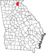
Map of the White County area


Our detail map of White County shows the White County, Georgia boundary lines and other interesting items.

Places in White County, Georgia

  Airports     show all on map

Deer Crossing Airport, Mountain Airpark, White County Landing Field

  Bridges     show all on map

Earl Nix Bridge, Roy Head Bridge, Sidney Lanier Bridge

  Buildings     show all on map

Barnes Greenhouse, Cleveland City Hall, Cleveland Police Department, Cleveland Volunteer Fire Department, Helen Fire Department, Helen Police Department, White County Courthouse, White County Fire Department Station 1, White County Fire Department Station 2, White County Fire Department Station 3, White County Fire Department Station 4, White County Fire Department Station 5, White County Fire Department Station 6, White County Fire Department Station 7, White County Fire Department Station 8, White County Jail, White County Library, White County Sheriff's Department

  Cemeteries     show all on map

Antioch Cemetery, Antioch Cemetery, Bean Creek Cemetery, Bethel Cemetery, Bethel Cemetery, Center Grove Cemetery, Chattahoochee Cemetery, Chattahoochee Cemetery Number One, Chattahoochee Cemetery Number Two, Cleveland Cemetery, County Line Cemetery, Crescent Hill Cemetery, Dean Cemetery, Dukes Creek Cemetery, Friendship Cemetery, Hood Cemetery, Lawrence Cemetery, Loudsville Cemetery, Macedonia Cemetery, Mossy Creek Cemetery, Mount Pleasant Cemetery, Mount View Cemetery, Mount Yonah Cemetery, Nacoochee Cemetery, Nacoochee Cemetery, New Blue Creek Cemetery, New Bridge Cemetery, Old Blue Creek Cemetery, Shoal Creek Cemetery, Smiths Chapel Cemetery, Tesnatee Cemetery, Town Creek Cemetery, Union Cemetery, Union Grove Cemetery, White Creek Cemetery, Zion Cemetery

  Census     show all on map

Nacoochee Census Designated Place (historical), Sautee Census Designated Place (historical), Sautee Nacoochee Census Designated Place, Yonah Census Designated Place

  Churches     show all on map

Antioch Baptist Church, Asbestos Church, Bean Creek Church, Bethel Church, Bethel Church, Bible Memory Church, Blue Creek Church, Center Church, Center Grove Church, Chattahoochee Church, Chattahoochee Methodist Church, Community Church, County Line Church, Cresecent Hill Church, Dukes Creek Church, Emmanuel Gospel Church, Friendship Church, Full Gospel Church, Little Mission, Loudsville Church, Macedonia Church, Mossy Creek Church, Mount Pleasant Church, Mount View Church, Nacoochee Baptist Church, Nacoochee Church, New Bridge Church, Resurrection Episcopal Church, Sal Mountain Chapel, Shoal Creek Church, Smiths Chapel, Tesnattee Church, Town Creek Church, Union Church, Union Grove Chapel, Union Grove Church, White Church, White Creek Church, Woodlawn Church, Zion Church, Zion Church

  Cliffs     show all on map

Grimes Nose

  Dams     show all on map

Allen Lake Dam, Black Lake Dam, Bolton Lake Dam, Camp Coleman Lake Dam, Chambers Lake Dam, Clear Lake Dam, Dorsey Lake Dam, Frank Lake Dam, Gooch Lake Dam, Hills Lake Dam, Jellystone Dam, Knight Lake Dam, Lake Pless Dam, Mays Lake Dam, Pless Pond Dam, Royal Lake Dam, Sautee Creek Watershed Number 12 Dam, Sautee Creek Watershed Number 13 Dam, Sautee Watershed Number 10 Dam, Sims Lake Dam, Sky Lake Dam, Smith Lake Dam, Tallhurst Lake Dam, Twin Lakes East Dam, Twin Lakes West Dam, Unicoi State Park Lake Dam, Warwick Lake Dam, Webster Lake Dam

  Falls     show all on map

Anna Ruby Falls, Dukes Creek Falls

  Gaps     show all on map

Big Gap, Carr Gap, Cool Springs Gap, Double Gap, High Gap, Hogpen Gap, Jasper Gap, Little Low Gap, Locust Log Gap, Low Gap, Morris Gap, Pheasant Branch Gap, Piney Gap, Red Hill Gap, Saddle Gap, Sapling Gap, Slayton Gap, Tesnatee Gap, Walnut Gap, White Oak Gap, White Oak Stamp Gap, Whitly Gap, Wide Gap, Windy Gap, Wolfpen Gap

  Lakes     show all on map

Glass Pond, Lake Qualatchee

  Locales     show all on map

Andrews Cove Campground, Anna Ruby Campground, Anna Ruby Falls Scenic Area, Camp Barney Medintz, Coleman Camp, Colonial Shopping Center, Dodd Creek Vista Campground, Dukes Creek Falls Campground, Gateway Shopping Center, Loudsville Camp Ground, Mossy Creek Campground, Raven Cliffs Scenic Area, Skitt Mountain Golf Course, Union Grove Campground, Village Shopping Center

  Mines     show all on map

Childs Mine, Lot Ten Mine, White County Mine

  Parks     show all on map

Sautee Valley Historic District, Unicoi State Park, White County Park

  Populated Places     show all on map

Benefit, Centerside, Cleveland, Eastburn (historical), Helen, Kinseytown, Leaf, Leo, Lynch (historical), Mossy Creek, Nacoochee, Naguchee (historical), Oculus (historical), Pink, Pleasant Retreat (historical), Robertstown, Rogers Mill, Sautee, Stovall Mill, Tesnatee, Yonah

  Post Offices     show all on map

Cleveland Post Office, Helen Post Office, Sautee Post Office

  Ranges     show all on map

Long Mountain

  Rapidss     show all on map

Raven Cliff Falls

  Reserves     show all on map

Camp Appalachian Wilderness, Raven Cliffs Wilderness

  Reservoirs     show all on map

Alexander Pond, Allen Lake, Ash Pond, Black Lake, Blalock Ponds, Bolton Lake, Camp Coleman Lake, Chambers Lake, Clear Lake, Dorsey Lake, Dorsey Pond, Frank Lake, Garner Pond, Gooch Lake, Hills Lake, Hood Pond, Knight Lake, Lake Pless, Lewis Lake, Lothridge Lake, Mays Lake, Patton Lake, Pilgrim Pond, Pless Pond, Royal Lake, Sautee Creek Watershed Number 12 Lake, Sautee Creek Watershed Number 13 Lake, Sautee Watershed Number 10 Lake, Seabolt Pond, Sims Lake, Sky Lake, Smith Lake, Tallhurst Lake, Twin Lakes, Twin Lakes East, Twin Lakes West, Unicoi Lake, Unicoi State Park Lake, Warner Pond, Warwick Lake, Webster Lake, Willeford Pond

  Ridges     show all on map

Allison Ridge, Ash Ridge, Hargret Ridge, Hickorynut Lead, Hickorynut Ridge, Horse Range Mountain, Locust Log Ridge, Long Ridge, Murdock Ridge, Piney Ridge, Trail Ridge, York Ridge

  Schools     show all on map

Blue Ridge School (historical), Helen School, Jack P Nix Primary School, Mossy Creek Elementary School, Mount Yonah Elementary School, Robertstown School, Shoal Creek School, Truett McConnell College, White County High School, White County Intermediate School, White County Middle School, White County Ninth Grade Academy, White Creek Christian Academy, White Creek School

  Streams     show all on map

Andrews Creek, Ash Creek, Bean Creek, Bear Den Creek, Ben Creek, Blue Creek, Blue Knob Branch, Brasstown Creek, Bruner Branch, Car Creek, Cathey Creek, Chateen Creek, Chickamauga Branch, Chickamauga Creek, Chinquapin Branch, Church Branch, Cool Springs Branch, Cox Creek, Craig Creek, Crumley Creek, Davis Creek, Dean Creek, Devils Den Branch, Dodd Creek, Double Culvert Branch, Double Gap Branch, Dover Creek, Dukes Creek, East Fork Smith Creek, England Camp Branch, Flat Creek, Freeman Creek, Glade Branch, Hickory Branch, Horton Creek, Indian Camp Creek, Jasus Creek, Jenny Creek, Joes Branch, Ledford Branch, Little Flat Camp Branch, Little Low Gap Branch, Lost House Branch, Low Gap Creek, Martin Branch, Mauldin Mill Creek, McClure Creek, Nester Branch, Pheasant Branch, Rice Cabin Creek, Sautee Creek, Shoal Creek, Smith Creek, Snake Branch, Spoilcane Creek, Steep Creek, Tesnatee Creek, Thurmond Creek, Tom White Branch, Town Creek, Turkeypen Branch, Turner Creek, Turner Creek, Vandiver Branch, West Fork Smith Creek, West Place Branch, White Branch, White Creek, White Creek, Wilks Creek, Winkley Branch, Winn Branch, York Creek

  Summits     show all on map

Adams Bald, Ash Mountain, Blue Knob, Chimney Mountain, Crumbly Knob, Crumbly Mountain, Dean Mountain, Double Head, Gerrell Mountain, Hickory Knob, Hickorynut Mountain, Leadpole Mountain, Little Andy Mountain, Little Blue Knob, Little Crumbly Knob, Little Hickorynut Mountain, Lynch Mountain, Macks Mountain, Nacoochee Indian Mound, Piney Mountain, Piney Mountain, Piney Mountain, Pink Mountain, Pinnacle Mountain, Poe Knob, Polly Knob, Poor Mountain, Rocky Mountain, Sal Mountain, Skitt Mountain, Smith Mountain, Stony Knob, Tatum Mountain, Wauka Mountain, White Oak Mountain, Wildcat Mountain, Yonah Mountain

  Towers     show all on map

WCON-FM (Cornelia), WGGA-FM (Cleveland), WMJE-FM (Clarkesville), WRWH-AM (Cleveland), Yonah Mountain Lookout Tower

  Trails     show all on map

Raven Cliff Falls Trail, Whitly Gap Trail

  Valleys     show all on map

Nacoochee Valley, Sautee Valley, Sautee-Nacoochee Valley, Scorpion Hollow,

White County, Georgia Population By Race (2012 estimate)

RacePopulation
WhiteWhite County White population 26,35926,358  
BlackWhite County Black population 552552
MixedWhite County Mixed population 386386
American IndianWhite County American Indian population 138138
Hawaiian & Pacific IslanderWhite County Hawaiian & Pacific Islander population 00

Additional population tables :
State population table
Georgia population by county