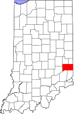
Franklin County, Indiana Basics:


Franklin County Indiana - Government Site

Population: 23,003
Area: 384 square miles
County seat: Brookville
Area code(s) in use: 765 812
Time zone: EST
High school graduate or higher: 85.7%
Bachelor's degree or higher: 17.7%
Median household income: $50,271
Persons in poverty: 13.9%
Home ownership rate: 79.8%
Mean travel time to work: 29.8 minutes


Adjacent counties:
Butler (OH)  Dearborn  Decatur  Fayette  Hamilton (OH)  Preble (OH)  Ripley  Rush  Union  

Find in Indiana

Map of the Franklin County area


Our detail map of Franklin County shows the Franklin County, Indiana boundary lines and other interesting items.

Places in Franklin County, Indiana

  Airports     show all on map

Hillenbrand Industries Airport

  Buildings     show all on map

Blooming Grove Volunteer Fire Department, Brookville Volunteer Fire Department, Cedar Grove Volunteer Fire Department, Drewersburg Volunteer Fire Department Station 1, Drewersburg Volunteer Fire Department Station 2, Eagle Fire Company of Oldenburg Indiana, Franklin County Emergency Medical Services Station 1, Franklin County Emergency Medical Services Station 2, Franklin County Emergency Medical Services Station 3, Franklin County Emergency Medical Services Station 4, Laurel City Fire Department, Metamora Volunteer Fire Department, New Trenton Volunteer Fire Department

  Canals     show all on map

Whitewater Canal

  Cemeteries     show all on map

Asbury Cemetery, Barnes Cemetery, Bethlehem Cemetery, Bowman Cemetery, Conn Cemetery, Ebenezer Cemetery, Gobel Cemetery, Holy Family Cemetery, James Cemetery, Jenks Cemetery, Maple Grove Cemetery, Marlin Cemetery, McKenzie Cemetery, Mount Carmel Cemetery, North Cemetery, Old Brick Cemetery, Old Brick Cemetery, Otwell Cemetery, Saint Annes Cemetery, Saint Michaels Cemetery, Saint Nicholas Cemetery, Snow Cemetery, South Gate Cemetery, Springfield Cemetery, Stipps Hill Cemetery, Usher Cemetery, Wolf Creek Cemetery

  Census     show all on map

Metamora Census Designated Place, New Trenton Census Designated Place

  Churches     show all on map

Big Cedar Church, Chapel Church, Cupp Church, Drewersburg Church, Duck Creek Stone Chapel, Elm Grove Church, Harmony Church, Little Cedar Grove Church, Little Children Home Church, Oak Forest Church, Old Franklin Church, Philadephia Church (historical), Pilgrim Holiness Church, Plum Grove Church, Saint Jacobs Church, Saint Peters Church, Saint Philomenas Church, Smyrna Church, Sorrowful Mother Shrine, Springfield Church, Stips Hill Church (historical), Trinity Church, Wesley Chapel, Yung Church (historical)

  Dams     show all on map

Bartmess Lake Dam, Brookville Lake Dam, Champion Acre Lake Dam, Gemco Lake Dam, Laurel Feeder Dam, Wayne Kopp Lake Dam, Whitewater Canal Memorial Lock, Woodland Retreat Dam

  Falls     show all on map

Derbyshire Falls

  Lakes     show all on map

Shady Lake, Triple Lakes

  Locales     show all on map

Fairfield Causeway, Orschell Overlook

  Mines     show all on map

Booher Stone Quarry, Harrison Sand and Gravel Pit, Holzhause Stone Quarry, Ogle Stone Quarry, Turner Stone Quarry

  Parks     show all on map

Camp Lenmary, Flood Victims Memorial, Mounds State Recreation Area, Whitewater Canal Memorial

  Populated Places     show all on map

Andersonville, Ashby (historical), Bath, Blooming Grove, Brookville, Buena Vista, Cedar Grove, Drewersburg, Enochsburg, Fairfield, Hamburg, Highland Center, Huntersville, Klemmes Corner, Lake View, Laurel, Metamora, Midway, Millville, Mixersville, Mound Haven, Mount Auburn, Mount Carmel, New Fairfield, New Trenton, Oak Forest, Oak Tree Crossroads, Old Bath, Oldenburg, Palestine, Peoria, Peppertown, Pinhook, Raymond, Rockdale, Saint Marys, Saint Peter, Scipio, Sharptown, South Gate, Stavetown, Whitcomb, Yellow Bank, Youngs Corner

  Post Offices     show all on map

Springfield Post Office (historical)

  Reservoirs     show all on map

Bartmess Lake, Brookville Lake, Canal Lakes, Champion Acre Lake, Gemco Lake, Wayne Kopp Lake, Woodland Retreat Lake

  Ridges     show all on map

McGuire Ridge

  Schools     show all on map

Brookville Elementary School, Brookville High School, Brookville Junior High School, Chapel School, Collett School (historical), Duck Creek School (historical), Elm Grove School (historical), Gap School (historical), Glasselly School (historical), Holland School (historical), Kirschbaum School (historical), Laurel Elementary and High School, Little Cedar Creek School (historical), Minneman School (historical), Mount Carmel School, Oldenburg Elementary School, Peterson School (historical), Plum Grove School (historical), Pritog School (historical), Ray School (historical), Rocket School (historical), Saint Michael School, Springfield School (historical), Stips Hill School (historical), Strausburg School (historical), Swartz School (historical), Tracy School (historical), Usher School (historical), Whitewater School (historical)

  Streams     show all on map

Bachelors Run, Baker Branch, Bath Creek, Big Cedar Creek, Blackburn Creek, Blue Creek, Blue Lick, Brown Branch, Butlers Run, Cranes Run, Deer Creek, Dodson Branch, Dry Branch, Duck Creek, East Fork Big Cedar Creek, East Fork Blue Creek, Elkhorn Creek, Fremont Branch, Garrison Creek, Gates Creek, Gobbles Creek, Goose Creek, Hamburg Branch, Harvey Branch, Indian Creek, Jim Run, Johnson Fork, Kroeger Branch, Laurence Branch, Lee Creek, Little Cedar Creek, Little Duck Creek, Little Sanes Creek, Little Walnut Fork, Logan Creek, Long Acres Branch, Long Branch, Marlin Branch, McCartys Run, Phillips Creek, Ramsey Creek, Richland Creek, Righthand Fork Salt Creek, Russell Branch, Salt Creek, Salt Well Creek, Sater Run, Sayres Branch, Shingle Creek, Sillimans Creek, Silver Creek, Snail Creek, Sours Run, Squaw Run, Sugar Creek, Tent Brook, Trace Branch, Walnut Fork, Whistle Creek, Whistle Creek, Wolf Creek, Wolf Creek, Yellow Bank Creek

  Summits     show all on map

Battle Point, Bon Well Hill, Boundary Hill, Cobbs Hill, Elkhorn Hill, English Hill, Garr Hill, Gobblers Knob Hill, Jackson Hill, Long Hollow Hill, New Trenton Hill, Snow Hill, South Gate Hill, The Mounds, Wee Wee Hill, Wiley Indian Mound, Yellow Bank Hill

  Valleys     show all on map

Buzzard Hollow, Coalpit Hollow, Halls Hollow, Owl Hollow, Possum Hollow, Sleepy Hollow,

Franklin County, Indiana Population By Race (2012 estimate)

RacePopulation
WhiteFranklin County White population 22,65822,657  
MixedFranklin County Mixed population 184184
BlackFranklin County Black population 6969
American IndianFranklin County American Indian population 4646
Hawaiian & Pacific IslanderFranklin County Hawaiian & Pacific Islander population 00

Additional population tables :
State population table
Indiana population by county